Barndominium Builders in Grayson County, KY
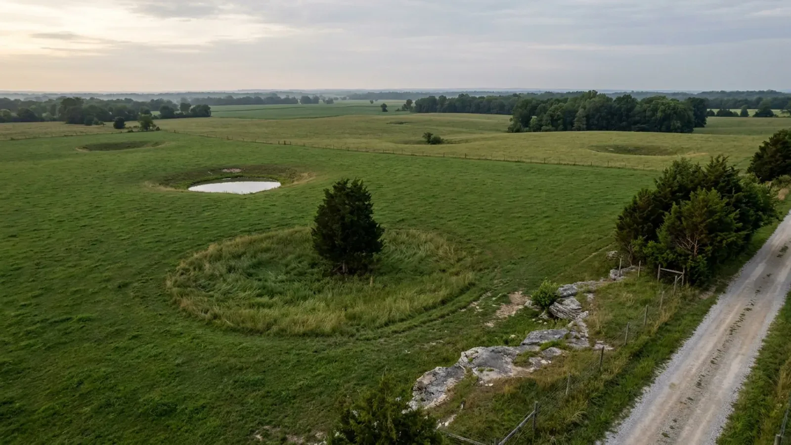
Grayson County is Leitchfield, Clarkson, Caneyville and Millwood, 500 square miles of west-central Kentucky between Rough River Lake and Nolin Lake — and it is not the city of Grayson, which is 150 miles east in Carter County. That distinction has to be made first because almost every search for a Grayson building permit lands on the wrong one. This page is about the county whose seat is Leitchfield, whose phone numbers begin 270, and whose clocks run on Central time. What makes it a serious place to build is the land. USDA's 2022 Census of Agriculture counts 1,283 farms here across 232,159 acres — the fifth-highest farm count of any Kentucky county, and roughly seventy per cent of the county's land area — and land in farms rose nine per cent between 2017 and 2022 while most of the Commonwealth's went the other way. The regulatory picture matches. Kentucky's planning statute, KRS Chapter 100, is optional, and the only KRS 100 planning unit inside Grayson County is the City of Leitchfield, which zones and permits inside its own limits and has no jurisdiction outside them. So on unincorporated Grayson County land there is no rural minimum lot size to satisfy, no setback schedule, no accessory-structure floor-area cap and no height limit — which for a shop-first, shop-bigger-than-the-house barndominium is the single most useful thing about the county. The Kentucky Geological Survey puts Grayson on the eastern edge of the Western Kentucky Coal Field, west of the Dripping Springs Escarpment, on flat-topped sandstone-capped ridges with valleys cut 150 to 200 feet into them and karst — sinking streams, sinkholes and springs — present locally in the eastern part of the county. Two Corps of Engineers reservoirs touch it, and the flowage easements around them prohibit habitable structures outright. Between the deed, the septic evaluation and the Corps line, the constraints here are about the ground and the water, not about the permit counter.
Grayson County at a glance
- County
- Grayson
- Population
- 27,633
- ZIP codes
- 42754, 42726, 42721, 42762, 42712, 40119, 42349, 42361
- Site visits
- Same week
Building conditions in Grayson County
The building code is the same in every Kentucky county, and no local government may adopt or enforce a different one on a house — the Kentucky Residential Code says so in its own text. The design criteria are settled by the state too: the code prints a filled-in table covering all 120 counties, so your county's ground snow load, frost depth and seismic design category are published figures rather than something a local office decides. Ultimate design wind speed is 115 mph for every county in the state.
What changes from one county to the next is whether anyone checks. Kentucky makes permits, inspections and certificates of occupancy optional for a single-family home unless the local government has passed an ordinance requiring them, and it forbids the state from stepping in where none has. Twenty-five counties tell the state outright that they have no local building inspector, and in much of the rest the answer depends on an ordinance the county either passed or never did. Zoning is a separate, equally local choice — most Kentucky counties have never adopted any. What is below covers this county specifically: who issues the permit if anyone does, what the state's tables assign it, and what the ground does to a slab.
https://dhbc.ky.gov/Documents/Grayson%20County.pdf (sheet updated 5/5/2026) and https://dhbc.ky.gov/Documents/Carter%20County.pdf — both extracted with pdftotext in raw and layout modes and compared line by line, 6 Sep 2026 · https://codelibrary.amlegal.com/codes/grayson/latest/grayson_ky/0-0-0-22669 (CITY OF GRAYSON code of ordinances, Chapter 70 — the Carter County city, labelled here so it is not mistaken for a county document) · FEMA CRS Eligible Communities, effective 1 April 2026, https://www.fema.gov/sites/default/files/documents/fema_crs_eligible-communities_042026.pdf — the Kentucky block is 42 rows and was read with pdftotext -raw after the -layout pass returned a different class for the same row; -raw is authoritative · https://kydlgweb.ky.gov/Counties/16_CountyView.cfm?County=Grayson
https://kydlgweb.ky.gov/Counties/16_CountyView.cfm?County=Grayson (Commonwealth's own county officials listing, read 6 Sep 2026 — the county's own site at graysoncountyky.gov was returning a hosting configuration error rather than a page that day, and the Internet Archive was itself offline, so this is the primary listing that could be read) · City of Leitchfield Zoning Ordinance, Article 1 §1.1 Enacting Clause, https://leitchfield.ky.gov/wp-content/uploads/2023/05/Zoning-Ordinance-2023.pdf (PDF text extracted and read 6 Sep 2026) · City of Leitchfield Comprehensive Plan 2015, https://leitchfield.ky.gov/wp-content/uploads/2023/06/Comprehensive-Plan-2015.pdf (the phrase City of Leitchfield Planning Unit, extracted and read 6 Sep 2026) · https://kadisonline.org/planning-zoning/
https://dhbc.ky.gov/Documents/Grayson%20County.pdf (sheet updated 5/5/2026; extracted with pdftotext in both -raw and -layout and reconciled row by row, 6 Sep 2026 — the two passes agree that the Local Building Inspector row carries only a name and a phone, and that the Leitchfield health-department address belongs to the environmentalist and plumbing block) · https://apps.legislature.ky.gov/law/statutes/statute.aspx?id=52659 (KRS 198B.060) · https://kydlgweb.ky.gov/Counties/16_CountyView.cfm?County=Grayson
https://dhbc.ky.gov/Documents/2018%20Kentucky%20Residential%20Code%203d%20Ed.pdf — Table R301.2(1) Design Snow, Climatic and Geometric Design Criteria for Kentucky Counties; Table R301.2.2.1 Seismic Design Categories–Site Class D; Table R403.1.4 Minimum Frost Protection Depth for Kentucky and the §R403.1.4 exception text. All three county tables are transcribed in research/statewide/design-criteria-and-climate.md from a raw content-stream extraction of the DHBC PDF and were read there rather than re-fetched; the Grayson row was checked against each of the three published lists individually
U.S. Army Corps of Engineers, Louisville District, Shoreline Management Plan — Barren River Lake, Nolin River Lake, Rough River Lake (2015), §5 Development, §6 Shoreline Allocation, §7.1 Approved Zoning and §10 Flowage Easements: https://usace.contentdm.oclc.org/utils/getfile/collection/p16021coll7/id/27441 (PDF text extracted with pdftotext and read 6 Sep 2026; the Louisville District's own www.lrl.usace.army.mil pages refuse automated access, so the plan was read from the Corps' document collection host) · https://www.fema.gov/cis/KY.html (Kentucky Community Status Book, Grayson County rows read 6 Sep 2026 — this host refuses plain automated requests, so the table was read through a rendering fetch) · https://www.uky.edu/KGS/water/library/gwatlas/Grayson/Topography.htm (KGS, lake pool elevations) · https://www.lrl.usace.army.mil/Missions/Civil-Works/Recreation/Lake-Master-Plan-Updates/Rough-River-Lake-Master-Plan-Update/
https://www.nass.usda.gov/Publications/AgCensus/2022/Online_Resources/County_Profiles/Kentucky/cp21085.pdf (2022 Census of Agriculture, Grayson County profile, FIPS 21085 — extracted with pdftotext both -raw and -layout and reconciled row by row; the -layout pass misaligns both the overview and the farms-by-size table by one row, so the figures above are taken from the -raw pass, whose size bands sum to the published 1,283 total) · land area and internal point from the U.S. Census Bureau 2024 Gazetteer county file, https://www2.census.gov/geo/docs/maps-data/data/gazetteer/2024_Gazetteer/2024_Gaz_counties_national.zip (Grayson County KY: 499.536 sq mi land, 11.493 sq mi water) · population from research/statewide/geography-and-population.md
Also worth knowing before you build in Grayson County
- Inside Leitchfield: five acres in the Agricultural zone, permits priced by the square foot — and no height limit at all in Agricultural
- The City of Leitchfield publishes its zoning ordinance in full, and the numbers are specific. Agricultural zone (A), §3.8.1d and §3.8.1e: minimum lot area 217,800 square feet — exactly five acres — minimum lot width 250 feet, 50-foot front yard, 50-foot rear yard, 35-foot side yards on both sides, maximum lot coverage 35 per cent. Rural Residential (RR), §3.8.2d and §3.8.2e: minimum lot 87,120 square feet, two acres, width 200 feet, front 45 feet, rear 25 feet, sides 25 feet, coverage 35 per cent. The height rule is §4.1.5, and its last sentence is the one to read twice: no building shall exceed two storeys or 34 feet unless each side yard is increased by five feet for every additional five feet of height, with an absolute ceiling of 50 feet — except that there shall be no height restrictions in Agricultural districts, other than FAA limits near an airport. There is no accessory-building floor-area cap anywhere in the ordinance, which puts Leitchfield alongside Madison, Scott, Jessamine, Lincoln, Grant and Clark rather than with the counties that cap them, and unlike Clark it imposes no one-storey limit on an accessory building either. Three provisions do reach one: §4.1.9 allows only one principal building and its accessory structures per lot, §4.26 bars accessory buildings from any front yard, and §4.1.6 prohibits a building in the rear of a main building on the same lot being erected for residential purposes — which is worth raising early if the plan is a shop with living quarters set behind the house. Permit fees under §6.31a are charged by area: $0.12 per square foot of living space including garage, $0.03 per square foot of basement, $0.08 per square foot of auxiliary structure with a $25 minimum, and $0.10 per square foot of addition. A rezoning is $125 up to 5.99 acres and $125 plus $2 an acre above that, capped at $500; a conditional use permit is $75, a variance $35, and Planning Commission or Board of Adjustment requests carry a $20 County Clerk filing fee. A permit goes void six months from issuance unless substantial progress has been made.
- Karst is local here, not county-wide — and Leitchfield writes its own 50-foot sinkhole rule
- Grayson County is not inside any of the five karst regions the Kentucky Geological Survey names — the Western Pennyroyal arc runs south and west of it, through Bowling Green and Hopkinsville — and KGS publishes no county roster for those regions, so an honest answer here is that the county has karst without sitting in a named karst area. What KGS does say about this county specifically is precise: Grayson occupies an upland including parts of the Mississippian Plateaus Region west of the Dripping Springs Escarpment and the eastern edge of the Western Kentucky Coal Field, and karst features such as sinking streams, sinkholes and springs are present locally in the eastern part of the county. The geology behind that is the St. Louis and Ste. Genevieve Limestones, the oldest rocks at the surface here, under the sandstones and shales of the Caseyville and Tradewater Formations. Two rules follow, and they are the ones that decide where a slab goes. The state septic regulation, 902 KAR 10:085, rules an area unsuitable if it is closer than seventy feet to an open sinkhole throat, downslope from the sinkhole sideslope midpoint, or subject to flooding damage — and the downslope test is not a fixed radius, so a single large sinkhole can take a wide band of a parcel out of play. Inside Leitchfield the city adds its own, in §4.1.10: sinkholes and similar depressions, and the area within fifty feet horizontally of the rim or the area subject to periodic flooding, whichever is greater, shall be preserved in its natural state for drainage, and no building, street or other improvement shall be made within it — with the Planning Commission empowered to increase that area if drainage conditions warrant. KGS's own warning about the classic trap is worth repeating: homes built over filled sinkholes may be damaged as the fill is transported out of the sinkhole and the soil cover collapses, and structures built in sinkholes are often vulnerable to flood damage. The flattest, cheapest-looking spot on a karst parcel is frequently the one to avoid. KGS's Karst Potential Index viewer is pannable to a parcel and classes bedrock as Intense, Prone or Nonkarst, though it maps rock type rather than what lies under any particular 3,000 square feet.
- Coal-measure rock, and no mine subsidence insurance fund — Grayson is not one of the 37 counties
- This one is counter-intuitive and worth getting exactly right, because the geology and the insurance point in opposite directions. KGS places Grayson County on the eastern edge of the Western Kentucky Coal Field and lists the Tradewater Formation — coals, sandstones and shales — among the county's mapped units, alongside the Caseyville sandstones. Coal-bearing Pennsylvanian rock is genuinely here. But Kentucky's Mine Subsidence Insurance Fund covers only the 37 counties whose fiscal courts voted the coverage in, and Grayson is not one of them; neither are its neighbours Hardin, Meade or Breckinridge. The fund's western-coalfield membership picks up Butler, Edmonson, Ohio, Hancock, Daviess, Muhlenberg, McLean, Henderson, Hopkins, Union and Webster instead, so the boundary runs west and south of this county. In a participating county KRS 304.44-030 puts the endorsement on every property policy automatically unless the insured waives it in writing; in Grayson County there is no such automatic endorsement, and the ordinary homeowner's earth-movement exclusion — which the Department of Insurance quotes in its own brochure as excluding damage originating from earth movement, settling, shrinking, bulging or expansion of soil — stands unrelieved. So the practical instruction is to check the ground rather than rely on the policy. The Kentucky Mine Mapping Information System at minemaps.ky.gov is parcel-checkable, and the cabinet publishes its own limits on it: the mapping is stated to be accurate to about ±40 feet and should not be considered complete. Two more things a buyer should know. The fund's statutory definition covers the collapse of underground coal mines only — not earthquake, landslide, water seepage, strip-mine effects or blasting. And Kentucky's seller disclosure, KREC Form 402, asks about soil stability, drainage and erosion but carries no question at all about mines, sinkholes, caves or undermining, so a silent form is not an assurance.
- The septic permit is a standalone county health department here — and the site evaluation and the permit are $300 each
- Do not assume Grayson shares its neighbours' health district. Hardin and Meade are served by the six-county Lincoln Trail District Health Department out of Elizabethtown; Grayson is not. The Grayson County Health Department is its own agency at 124 East White Oak Street, Leitchfield KY 42754, 270-259-3141, with environmental services on 270-259-8046 and DHBC naming Jerry Brackett as the environmentalist. Its published environmental fee schedule, effective 1 February 2022 and revised 23 August 2024, prices the on-site sewage programme item by item: a Basic Site Evaluation is $300, a Repair Site Evaluation $150, and preliminary site evaluations run $115 for 2 to 10 lots, $230 for 11 to 20 and $345 above 20. The Permit to Install is a separate $300 for a new system, with a holding tank at $100, a Type 1 alteration at $175, a Type 2 or experimental system at $265 and a cluster system at $600; verification of an existing system is $100 and the certified installer testing fee is $25, which does not apply to master plumbers. So getting a new conventional system approved and permitted is $600 in health department fees before anyone digs. The department describes its own sequence plainly — it performs a soil evaluation of the property to determine the system size needed for a new installation, and works with certified installers in the county. Two planning consequences follow. Under 902 KAR 10:085 the site must have room for the system and a full replacement area, so the septic layout constrains the building envelope rather than the other way round, and the evaluation should come before the pad is sited. And inside Leitchfield the health officer's review is not optional paperwork: §4.1.8 of the city ordinance makes it unlawful to construct any building for human occupancy without sewage disposal facilities approved by the county health department, and requires the Grayson County Health Officer's review to accompany the zoning permit application.
- A well is not a given away from the valleys, and where the faults run it can be very good
- The Kentucky Geological Survey's Groundwater Resources of Grayson County draws an unusually sharp line across the county, and it is a line a buyer should price. In the lowlands along the Rough River and the valleys draining into Caney Creek, and in the belt extending about ten miles east and west from Leitchfield, most drilled wells are adequate for a domestic supply, with depths of adequate wells running 100 to 300 feet — and yields as high as 100 gallons per minute have been reported from wells penetrating the fault zones that are prominent in parts of the county. In the remaining areas of the county, only a few wells yield enough water for a domestic supply, except in the lowland areas bordering streams where yields are sometimes sufficient. Alluvium along the Rough River can give up to 100 gallons per minute from sand and gravel, but most wells in thin alluvium furnish less than 100 gallons a day, which is not a domestic supply at all; the Tradewater Formation on the dissected uplands and ridgetops generally yields only small quantities and needs a good thickness of sandstone to serve a modern house. The underlying study is McGrain and Currens (1978), so this is the regional picture rather than a prediction for one parcel. The instruction it supports is simple and worth following: before you make an offer on a ridge tract with no public water main, find out whether a rural water district line reaches the property, and if it does not, price a well as a contingency rather than a certainty.
- The 2012 flood maps, a sanctioned city, and the state permit that stacks on top of the local one
- FEMA's Community Status Book lists four Grayson County communities and they do not all have the same answer. Unincorporated Grayson County, CID 210330, participates in the National Flood Insurance Program in the Regular Program, with an initial Flood Hazard Boundary Map of 25 November 1977, an initial FIRM of 15 February 1991 and a current effective map of 19 September 2012. Leitchfield, CID 210085, participates with an initial FHBM of 10 May 1974, an initial FIRM of 15 September 2001 and the same 19 September 2012 map. Caneyville, CID 210084, participates, initial FHBM 10 May 1974, initial FIRM 27 September 1985, same map date. The City of Clarkson, CID 210363, is listed as non-participating with a sanction date of 19 September 2013 — which means federally backed flood insurance is not available inside those city limits, and that is a material fact for a lender as well as a buyer. No Grayson County community holds a Community Rating System class, so there is no CRS premium discount anywhere in the county; Kentucky has 42 communities on FEMA's CRS list and 33 of those hold a class better than 10, and none of them is here. Whichever community your parcel is in, Kentucky adds a second permit on top of the local one: a state Division of Water Individual permit is required for construction in the base floodplain under KRS 151.250 and 401 KAR 4:060 §2, applied for on form DOW 7116, and state jurisdiction reaches the whole base floodplain rather than only the regulatory floodway. The county's own flood damage prevention ordinance exists — the Leitchfield zoning ordinance's §4.1.11 directs its administrative official to uphold the Grayson County or Leitchfield Flood Damage Prevention Ordinance — and the county's floodplain administrator sits at the Fiscal Court address, 130 East Market Street in Leitchfield.
- EPA radon Zone 2, and a code that requires nothing about radon anywhere in Kentucky
- EPA maps Grayson County in radon Zone 2, moderate potential — defined on EPA's own Kentucky sheet as a predicted average indoor screening level of at least 2 and not more than 4 picocuries per litre. That places it with Hardin and Breckinridge and apart from Hart and Warren to the south, both of which are Zone 1; Kentucky has 30 Zone 1 counties, 82 in Zone 2 and 8 in Zone 3. EPA prints its own caution on the same sheet: the map was developed in 1993, it should not be used to decide whether an individual home needs testing, and all homes should be tested regardless of zone. What matters for a new build is that the Kentucky Residential Code adopts appendices K, R and S and does not adopt Appendix F, Radon Control Methods, so radon-resistant construction is required nowhere in Kentucky. A passive sub-slab depressurisation rough-in is inexpensive while the slab is open and expensive to retrofit afterwards, and KRS 309.436(9) expressly exempts a building contractor installing vent pipes during construction of a home from the state radon licensing regime — so it is a decision to make deliberately at slab stage rather than a service that needs a separate registration. One more code number belongs beside it. Table R401.4.1 publishes presumptive load-bearing values in lieu of a complete geotechnical evaluation — 12,000 psf for crystalline bedrock, 4,000 for sedimentary and foliated rock, 3,000 for sandy gravel, 2,000 for sands and silty or clayey gravels, and 1,500 psf for clay, sandy clay, silty clay, clayey silt, silt and sandy silt — and its footnote b provides that where the building official determines in-place soils below 1,500 psf are likely, a soils investigation determines the capacity. On a wide, shallow, rigid slab on a filled or colluvial pad, that threshold is the one to know about before the pour, not after.
City of Leitchfield Zoning Ordinance (Ordinance #99-6, effective 1 January 2000, with amendments through a revision dated 10/2022), Articles 2, 3, 4 and 6 — https://leitchfield.ky.gov/wp-content/uploads/2023/05/Zoning-Ordinance-2023.pdf (PDF text extracted with pdftotext in both -raw and -layout and reconciled, 6 Sep 2026) · https://leitchfield.ky.gov/planning-and-zoning/ (office, administrator and hours) · the same code is separately published through a municipal code publisher as Chapters 150 and 153; the city's own PDF was used
https://www.uky.edu/KGS/water/library/gwatlas/Grayson/Topography.htm and https://www.uky.edu/KGS/water/library/gwatlas/Grayson/Geology.htm (KGS Groundwater Resources of Grayson County, quoting McGrain and Currens 1978; read 6 Sep 2026) · https://www.uky.edu/KGS/water/library/gwatlas/wprkarst.html (KGS's five named karst regions — Grayson County is named in none of them, and KGS publishes no county roster) · https://www.uky.edu/KGS/water/library/gwatlas/Grayson/Karst.htm · City of Leitchfield Zoning Ordinance §4.1.10, https://leitchfield.ky.gov/wp-content/uploads/2023/05/Zoning-Ordinance-2023.pdf · https://apps.legislature.ky.gov/law/kar/titles/902/010/085/ · https://kgs.uky.edu/kygeode/geomap?gkarst=true
https://www.uky.edu/KGS/water/library/gwatlas/Grayson/Topography.htm and https://www.uky.edu/KGS/water/library/gwatlas/Grayson/Geology.htm (KGS: eastern edge of the Western Kentucky Coal Field; Tradewater and Caseyville Formations mapped in the county) · https://insurance.ky.gov/PPC/Documents/JAN%202025_Revised%20Mine%20Subsidence%20Insurance%20Fund%20080124.pdf (KDOI brochure rev. 08/24 effective 1/1/25 — the 37-county participating list, the statutory definition and the earth-movement exclusion; Grayson does not appear on the list) · https://insurance.ky.gov/ppc/Documents/bulletin0904minesubs092109.pdf · https://minemaps.ky.gov/ and https://eppcgis.ky.gov/minemapping/ · KREC Form 402 as established in research/statewide/soils-karst-and-slopes.md
https://www.graysoncountyhealth.org/environmental (Grayson County Health Department environmental services, read 6 Sep 2026) · Grayson County Health Department Environmental Fee Schedule, effective 1 February 2022, revision 23 August 2024, https://www.graysoncountyhealth.org/_files/ugd/be0748_619fa3c31f3142299db8194319b61297.pdf (extracted with pdftotext in both -raw and -layout; the 680 Onsite Sewage Program block reconciles line for line in both passes) · https://dhbc.ky.gov/Documents/Grayson%20County.pdf (health department environmentalist block) · City of Leitchfield Zoning Ordinance §4.1.8, https://leitchfield.ky.gov/wp-content/uploads/2023/05/Zoning-Ordinance-2023.pdf · https://apps.legislature.ky.gov/law/kar/titles/902/010/085/
Kentucky Geological Survey, Groundwater Resources of Grayson County, Kentucky — Overview: https://www.uky.edu/KGS/water/library/gwatlas/Grayson/Overview.htm and Groundwater Availability: https://www.uky.edu/KGS/water/library/gwatlas/Grayson/GWavailability.htm (both read 6 Sep 2026; the atlas attributes the underlying discussion to McGrain and Currens, 1978) · https://kgs.uky.edu/kgsmap/KGSWater/viewer.asp
https://www.fema.gov/cis/KY.html (Kentucky Community Status Book, Grayson County rows read 6 Sep 2026 — the host refuses plain automated requests, so the table was read through a rendering fetch) · FEMA CRS Eligible Communities effective 1 April 2026, https://www.fema.gov/sites/default/files/documents/fema_crs_eligible-communities_042026.pdf (the 42-row Kentucky block was extracted with pdftotext -raw and contains no Grayson County entry) · City of Leitchfield Zoning Ordinance §4.1.11, https://leitchfield.ky.gov/wp-content/uploads/2023/05/Zoning-Ordinance-2023.pdf · https://apps.legislature.ky.gov/law/statutes/statute.aspx?id=54097 · https://eec.ky.gov/Environmental-Protection/Water/FloodDrought/Pages/default.aspx — the Kentucky Local Floodplain Coordinators Contact List at https://eec.ky.gov/Environmental-Protection/Water/FloodDrought/Documents/FloodplainCoordinatorsList.pdf no longer resolves and the Internet Archive was offline on 6 Sep 2026, so the coordinator contact should be confirmed with the Fiscal Court on 270-259-3159
https://www.epa.gov/sites/default/files/2014-08/documents/kentucky.pdf (EPA Map of Radon Zones for Kentucky — zone definitions and EPA's printed cautions) · https://radonlevels.org/state/ky (county-to-zone assignment for Grayson, read 6 Sep 2026; posture: this is a third-party rendering of the EPA map, corroborated against the statewide 30/82/8 distribution and the Zone 1 county list transcribed in research/statewide/soils-karst-and-slopes.md, rather than a primary EPA county table) · https://kgs.uky.edu/radon and https://kygs.uky.edu/geology/radon (KGS's geology-based indoor radon potential map, finer-grained than the EPA county zone) · https://dhbc.ky.gov/Documents/2018%20Kentucky%20Residential%20Code%203d%20Ed.pdf — Table R401.4.1 and footnote b, and the appendices section

The expensive surprises are in the ground, not the building
What moves a Kentucky budget is usually below grade, and more often than not it is what the ground is sitting on rather than the ground itself. The Kentucky Geological Survey says 92 of the state's 120 counties contain karst — limestone that dissolves — across four named areas: the Western Pennyroyal around Bowling Green and Hopkinsville, the Inner Bluegrass around Lexington, the Eastern Pennyroyal through Somerset and Monticello, and Pine Mountain in the south-east. On karst, KGS's own model ordinance for local governments lists the structures that should not be sited in sinkhole areas, and the list is buildings with soil-bearing foundations and buildings that cover thousands of square feet with impermeable surface. A post-frame or steel building on a monolithic slab is both of those at once. KGS is equally clear that nearly all karst parcels still have buildable ground on them — so karst does not stop the build, it removes the option of siting the pad by eye. A filled and graded-over sinkhole is the classic trap, because the pad looks perfect.
In the two coal fields the question is undermining instead, and Kentucky treats it differently from everything else: mine subsidence coverage is added automatically to property policies in the counties whose fiscal court voted the fund in, with a written opt-out — thirty-seven of them — while karst collapse gets no fund at all and falls under the ordinary earth-movement exclusion. On slopes the surprise is geographic: KGS's landslide inventory puts Kenton, Campbell, Boone and Gallatin — the northern Kentucky counties opposite Cincinnati — near the very top, above most Appalachian counties, on Ordovician shale. Three of those four — Boone, Campbell and Kenton — are the only counties in the state with a line of their own in the residential code's bearing table, which raises the presumptive value for two named clay groups there and nowhere else. Everywhere else the table gives clay and silt a single presumptive figure, and a soils investigation becomes mandatory once the building official determines the real capacity is likely to be lower than it.
The same ground then sizes the septic system, and Kentucky does that from soil morphology — a certified inspector reading the profile in a backhoe pit — rather than from a percolation test, at 110 gallons a day per bedroom against an application rate taken from soil texture and structure. On a mound or other alternative design a measured permeability test can still be required. And on karst the septic regulation is blunter than the building code ever gets: it declares the ground within seventy feet of an open sinkhole throat unsuitable outright. The soil that needs a foundation engineer is usually the soil that complicates the drainfield, so the site work, the foundation and the septic get resolved together rather than one at a time. We price the dirt before we price the building.
What we build in Grayson County
All seven services are available in Grayson County. What a build costs depends far more on the parcel than on square footage, so we price against your land rather than publishing a rate card.
Barndominium Kits
We check barndominium kit packages against the wind, snow, frost and seismic criteria the Kentucky Residential Code publishes for your county.
Pole Barn Homes
Pole barn homes across Kentucky. KRC §R327 covers accessory barns, not houses — so a pole barn home is engineered by the code's own terms.
Custom Barndominium Plans
Barndominium plans drawn to Kentucky's published county design criteria — snow, wind, seismic, frost — with engineering where the code calls for it.
What a build looks like
Three stages every Grayson County project passes through, from a raw parcel to a finished home. Site work first, because that is where the budget is decided.

The parcel
Karst and mine maps, the flood question, zoning where the county has any, and utility access — all checked before anything is drawn.
Pad and permit
Clearing, grading and a compacted pad, while the submittal works through whichever office issues the permit — and where no office does, through the approvals that still apply.

Frame to finish
Shell erected and dried in, then systems and interior finish — and the certified electrical inspection your utility needs before it will set a meter.
Those are the rules where you are building in Grayson County. Tell us what you want to build and we will draw it to them.
Where we build around Grayson County
Grayson and the rural land around it. The buildable acreage for a project this size usually sits outside the city limits, and in Kentucky that line frequently decides whether anyone issues a permit at all, not merely who issues it.
Keep reading
The questions that usually come next once you know what Grayson County allows.
Barndominium Cost Guide
Why the published spread runs from one end of the scale to the other, and which of it is the building rather than the ground.
Read itIs It Legal in Kentucky?
Whether your county inspects a house at all, what the farm-dwelling exemption really requires, and the approvals that reach you anyway.
Read itWhat a Pole Barn Home Costs
Post-frame against stick-built, and what the prescriptive post-frame section of the state code does and does not cover.
Read itNearby areas we build in
Others we cover nearby. They share the same statewide code and the same state-published design tables — but whether a house is permitted and inspected at all, whether the county zones, what the health department will accept for septic, and what the ground does to a foundation can all differ from one card to the next. Two counties that touch are not two versions of the same answer.
Building in Grayson County: common questions
10 questions we get asked most often about building in Grayson County. If yours is not on the list, ask it directly.
Do I need a building permit to put up a barndominium in Grayson County?
Is this the same Grayson I keep finding online?
Can I build a shop bigger than the house, and can I build it first?
I am looking at a parcel on Rough River Lake. What should I know before I offer?
Who issues the septic permit, and what does it cost to get started?
Does Grayson County need a deeper footing or a stiffer frame than its neighbours?
Is there really buildable land in Grayson County?
Is mine subsidence something I need to worry about here?
Nobody may inspect the frame outside Leitchfield. So does anything actually get checked?
What about sinkholes — is this karst country?
Building in Grayson County?
Start with the plan. Tell us what you want to build and we will draw it, then confirm whether any office permits and inspects a house where your parcel is, what it will let you put there, and which line of the state's snow, frost and seismic tables your county falls on. That conversation costs nothing.