Barndominium Builders in Hardin County, KY
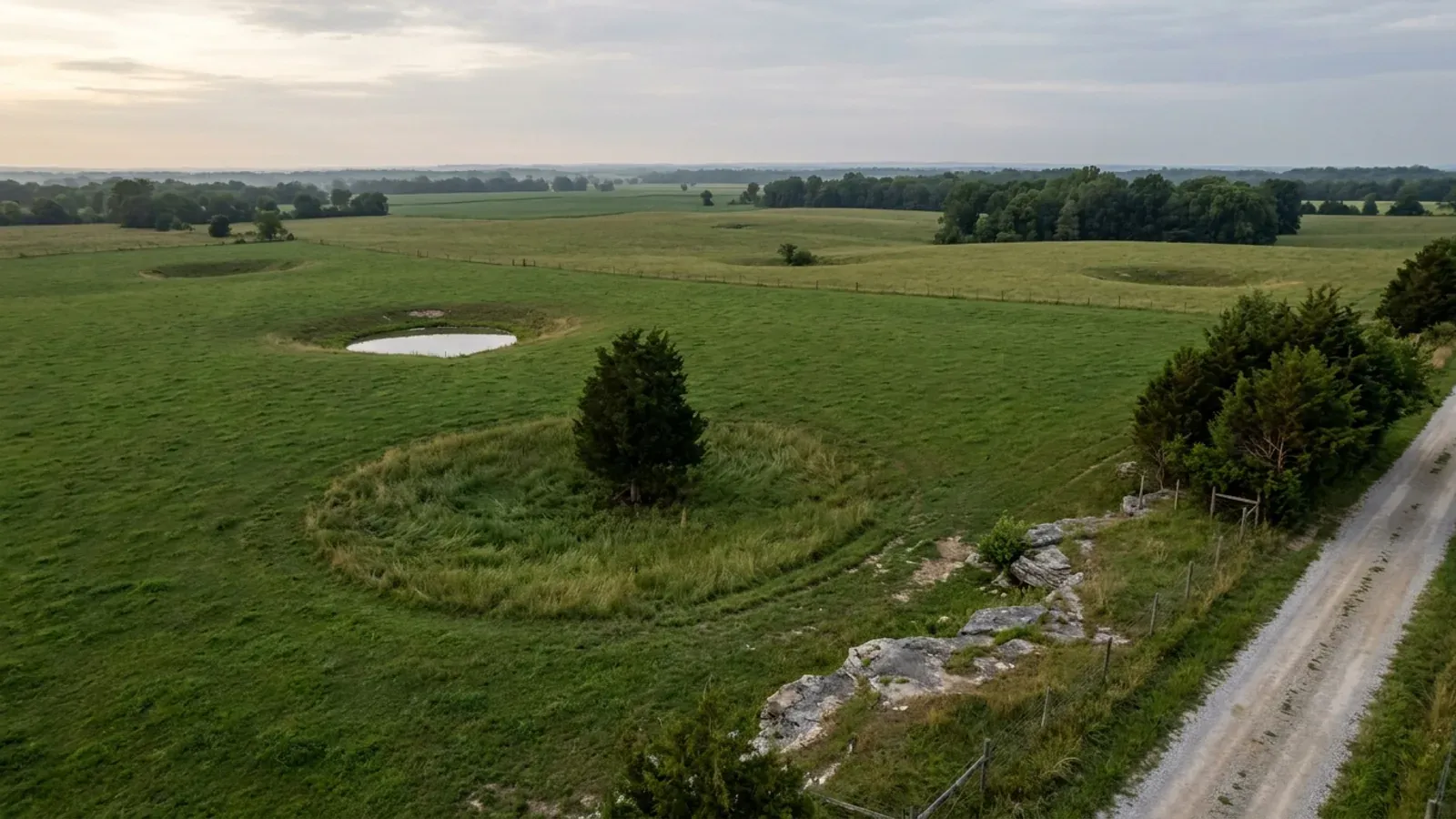
Hardin County is the exception that a Kentucky reader should not assume. Most of the Commonwealth's counties have no zoning and require no residential building permit; Hardin has both. The Hardin County Fiscal Court adopted the Development Guidance System Zoning Ordinance in 2009 and it is still the governing document for unincorporated Hardin County — sixteen zones, a Zoning Permit for a single-family dwelling and for an accessory structure, a building and electrical permit before work starts, and a Certificate of Occupancy issued by the Planning and Development Commission that no one gets until the electrical, plumbing and septic are signed off. Three cities inside the county — Elizabethtown, Radcliff and Vine Grove — run their own building departments on top of that, so the answer to who inspects your house is a four-way question here rather than a two-way one. The ordinance also carries the single most consequential rule for this building type in the whole Kentucky axis: an accessory structure must be subordinate in scale to the principal structure, and it may not be built before the house without a conditional use permit. A shop bigger than the dwelling, built first and lived in later, is the default barndominium plan, and in unincorporated Hardin County that plan needs re-drawing. The ground is its own story. Elizabethtown is the northern anchor of the Kentucky Geological Survey's Western Pennyroyal — the state's largest karst region and, in KGS's own description, the terrain most densely pocketed with sinkholes. The east-central part of the county is a sinkhole plain of springs, sinking creeks and underground drainage, which makes the septic site evaluation, not the building plan, the thing that decides where the pad goes. And roughly 109,000 acres of the county's northwest is Fort Knox, federal land that no private buyer can purchase and no local office permits.
Hardin County at a glance
- County
- Hardin
- Population
- 114,320
- ZIP codes
- 42701, 42702, 40160, 40159, 40175, 40121, 42724, 42740, 40162, 42776, 42788
- Site visits
- Same day
Building conditions in Hardin County
The building code is the same in every Kentucky county, and no local government may adopt or enforce a different one on a house — the Kentucky Residential Code says so in its own text. The design criteria are settled by the state too: the code prints a filled-in table covering all 120 counties, so your county's ground snow load, frost depth and seismic design category are published figures rather than something a local office decides. Ultimate design wind speed is 115 mph for every county in the state.
What changes from one county to the next is whether anyone checks. Kentucky makes permits, inspections and certificates of occupancy optional for a single-family home unless the local government has passed an ordinance requiring them, and it forbids the state from stepping in where none has. Twenty-five counties tell the state outright that they have no local building inspector, and in much of the rest the answer depends on an ordinance the county either passed or never did. Zoning is a separate, equally local choice — most Kentucky counties have never adopted any. What is below covers this county specifically: who issues the permit if anyone does, what the state's tables assign it, and what the ground does to a slab.
Development Guidance System Zoning Ordinance, Sections 13-1 through 13-5, Hardin County Fiscal Court Ordinance No. 269 Series 2009 as text-amended 2024 — https://www.hcpdc.com/_files/ugd/67a6e3_4232ae429f0e4551bd8bdf4aac8ddfd7.pdf (PDF text extracted and read 6 Sep 2026) · https://www.hcpdc.com/permits · https://hardincountyky.gov/434/Planning-Development-Commission · https://dhbc.ky.gov/Documents/Hardin%20County.pdf (sheet updated 10 Jun 2025) · https://apps.legislature.ky.gov/law/statutes/statute.aspx?id=52659
Development Guidance System Zoning Ordinance, Section 16-5 Accessory Structures and the accessory use and structure standards at Special Provisions — https://www.hcpdc.com/_files/ugd/67a6e3_4232ae429f0e4551bd8bdf4aac8ddfd7.pdf (PDF text extracted and read 6 Sep 2026) · https://www.hcpdc.com/zoning
Development Guidance System Zoning Ordinance §3-2 Rural Residential Zone (R-2) — https://www.hcpdc.com/_files/ugd/67a6e3_0d89912f2ddb4e4096257ee057abeb6f.pdf · §3-1 Urban Residential Zone (R-1) — https://www.hcpdc.com/_files/ugd/67a6e3_cb006e2d11904efd881ab49f745a9eb3.pdf · §3-6 Agricultural Zone (A-1) — https://www.hcpdc.com/_files/ugd/67a6e3_24455e12846e45db8a6f45821e1bb6ef.pdf (all three PDFs text-extracted and read 6 Sep 2026) · https://www.hcpdc.com/zoning
https://home.army.mil/knox/about/visitor-information (installation acreage and the three counties, read 6 Sep 2026) · Development Guidance System Zoning Ordinance §11-3 KY 313 Corridor Planning Area Requirements — https://www.hcpdc.com/_files/ugd/67a6e3_4232ae429f0e4551bd8bdf4aac8ddfd7.pdf · https://www.fema.gov/cis/KY.html (Kentucky Community Status Book, Hardin County rows read 6 Sep 2026 — the host refuses plain automated requests, so the table was read through a rendering fetch rather than copied from source)
https://www.uky.edu/KGS/water/library/gwatlas/Hardin/Karst.htm and https://www.uky.edu/KGS/water/library/gwatlas/Hardin/Topography.htm (KGS Groundwater Resources of Hardin County, read 6 Sep 2026) · https://www.uky.edu/KGS/water/library/gwatlas/wprkarst.html · https://kgs.uky.edu/kygeode/geomap?gkarst=true (Karst Potential Index viewer) · https://kgs.uky.edu/kgsmap/helpfiles/karst_help.shtm · https://apps.legislature.ky.gov/law/kar/titles/902/010/085/
https://dhbc.ky.gov/Documents/2018%20Kentucky%20Residential%20Code%203d%20Ed.pdf — Table R301.2(1) (snow, wind, weathering, termite), Table R301.2.2.1 Seismic Design Categories–Site Class D, Table R403.1.4 Minimum Frost Protection Depth for Kentucky and §R403.1.4; the county rows are transcribed in research/statewide/design-criteria-and-climate.md. The Hardin County Planning and Development Commission publishes the 2018 Kentucky Residential Code Third Edition from its own permits page: https://www.hcpdc.com/_files/ugd/67a6e3_d8749661fd75480993797688a3a1a85f.pdf
Also worth knowing before you build in Hardin County
- Every Hardin County community got a new flood map on 16 October 2025 — and the county amended its ordinance two days before
- FEMA's Kentucky Community Status Book lists five Hardin County communities and every one of them is in the National Flood Insurance Program with no exceptions: unincorporated Hardin County (CID 210094, initial FIRM 4 November 1988), Elizabethtown (210095, 2 December 1980), Radcliff (210366), Vine Grove (210096, 4 November 1988) and West Point (210097, 2 November 1977). All five carry the same current effective map date of 16 October 2025, which means the whole county was remapped. The Hardin County Fiscal Court amended its Flood Damage Prevention Ordinance No. 254, Series 2007 on 14 October 2025 — two days ahead of that map taking effect — narrowing the definition of substantial improvement, having already amended the ordinance in May 2023. The ordinance designates the County Engineer, or the engineer under employment contract with the county, as the Floodplain Administrator, requires a development permit before any construction begins in a special flood hazard area, and sets the lowest floor including basement at one foot above base flood elevation. It also states plainly what Kentucky builders elsewhere learn the hard way: endorsement of the local administrator is required before a state floodplain construction permit can be processed. Kentucky requires that separate state Division of Water Individual permit for construction in the base floodplain under KRS 151.250 and 401 KAR 4:060 §2, on form DOW 7116, and state jurisdiction reaches the whole base floodplain rather than only the regulatory floodway. If your map changed in October 2025, an older determination on the parcel is no longer the answer.
- Hardin's own fee schedule prices pole structures by size, and stamps plans at 5,000 square feet
- The Hardin County Planning and Development Commission publishes a Kentucky Building Code fee schedule, and it is unusually explicit about the buildings this trade puts up. Residential accessory buildings — the line reads Residential Garages, Pole Structures and Storage Buildings — are priced in four bands: $150 for 0 to 800 square feet, $175 for 801 to 1,200, $200 for 1,201 to 1,600 and $225 for 1,601 to 3,000. A single-family dwelling is charged off a residential fee chart based on total roofed area with a $150 minimum, plus $50 for an unfinished basement. Plan review is $200 for any single-family dwelling of 2,000 square feet or above, and the schedule adds that 5,000 square feet or above requires plans with an architect stamp — a threshold a large barndominium clears easily and one that changes the drawing budget. Starting construction without a permit costs $150 on top of the permit fee. The Commission's single-family checklist adds the approvals that must be in hand before a permit issues: the deed, an encroachment permit for the driveway entrance from either KYTC District 4 or the Hardin County Road Department, an on-site sewage site evaluation, a plot plan showing distances to property lines and the septic location, and either a homeowner electrical waiver with a workers' compensation waiver or an electrical contractor's licence with a certificate of insurance carrying $500,000 liability coverage. It is the applicant's responsibility, not the builder's by default, to call for the required inspections.
- 1,255 farms and 188,728 acres — but the land is in mid-size tracts, not big ones
- USDA's 2022 Census of Agriculture county profile puts Hardin at 1,255 farms across 188,728 acres, averaging 150 acres, with the farm count down 4 percent and land in farms down 5 percent since 2017. The size distribution is what a homesite buyer should read: 534 farms of 10 to 49 acres (43 percent, the modal band), 392 of 50 to 179 acres (31 percent), 164 of 180 to 499, 31 of 500 to 999 and 34 at 1,000 acres or more, with only 100 farms under 10 acres. That is a county where the ordinary agricultural parcel is the 10-to-49-acre tract, which is exactly the range a barndominium buyer wants and exactly the range the R-2 zone's road-based minimums are comfortable with. Land in farms breaks down as 98,625 acres of cropland, 35,207 pastureland, 34,600 woodland and 20,296 other — this is genuinely a cropland county, more so than the Lake Cumberland region, and cropland at that price competes with a homesite buyer for the same flat, well-drained ground. Hardin carries 628 square miles at about 176 people per square mile, which makes it denser than the classic Kentucky acreage counties. If a parcel search here comes up short, the neighbours in this axis with more room and less competition are Grayson, Breckinridge and Meade.
- The septic permit comes from Lincoln Trail, a six-county district, and the site evaluation is $300
- Hardin County's on-site sewage permits are issued by the Lincoln Trail District Health Department, which covers Hardin, LaRue, Marion, Meade, Nelson and Washington counties from an administrative office at 108 New Glendale Road, Elizabethtown, with Hardin County environmental services at 580-C Westport Road and DHBC listing John Taylor as the county environmentalist on 270-769-0312. The district publishes its own sequence and it does not start with a house plan: you submit a site evaluation application giving the property address, the surveyed site boundaries, the locations of existing structures and wells, the proposed system location and, for a residence, the bedroom count, whether there will be a garbage disposal and whether there will be a basement; you pay a $300 site evaluation fee; the inspector marks a usable area which must then remain undisturbed; and only if the site rates suitable or provisionally suitable may a certified installer apply for the permit. An inspection of an existing system is $100. Two things about that flow are worth planning around. The usable area is marked before the pad is sited, so it constrains the building envelope rather than the other way round. And 902 KAR 10:085 requires enough space for the system plus a full replacement area, so on karst ground with sinkhole exclusions the septic field and its spare can consume the flattest part of a tract.
- The agricultural exemption here is a form with conditions, not an argument
- Hardin County's ordinance handles the agricultural question directly rather than leaving it to be argued, and the conditions are specific enough to plan against. Special Provisions 17-5 reproduces KRS 100.203(4): land used for agricultural purposes has no regulations except that building setback lines are required for the protection of streets and highways, that everything in a designated floodway or floodplain is fully regulated, and that dwellings may be permitted but shall have regulations imposed such as zoning, building and certificates of occupancy. Hardin then adds its own terms. All dwellings constructed as part of land used for agricultural purposes must meet the requirements of the zone, must comply with the Kentucky Building Code and must meet the rest of the ordinance. Any parcel of land created solely for agricultural use under KRS 100.111(2) is not permitted a dwelling unit unless the agricultural tract is twenty-five contiguous acres or greater. And structures used solely for agricultural purposes — the ordinance names barns, workshops, equipment storage, grain bins and animal shelters — may request an exemption from obtaining a building permit by completing an Agricultural Certification form provided by the Planning Commission. That is the whole of the exemption: solely agricultural, on a form, and it does not reach the dwelling. The related paperwork is an Affidavit of Agricultural Use, which is what satisfies the statutory definition that exempts a division of land for agricultural use from being treated as a subdivision.
- Not a mine subsidence county, and not an EPA radon Zone 1 county either — unlike three of its neighbours
- Two hazard questions that a Hardin buyer should get precise answers to, because the intuitive answers are both wrong. Kentucky's Mine Subsidence Insurance Fund covers 37 counties whose fiscal courts voted the coverage in, and in those counties KRS 304.44-030 adds the endorsement to every property policy automatically unless the insured waives it in writing. Hardin is not one of the 37, and neither are Meade, Grayson or Breckinridge — the fund maps the two coal fields, and the Western Coal Field boundary runs west and south of here, catching Butler, Edmonson, Ohio and Hancock but not this tier. On radon, EPA's Map of Radon Zones puts thirty Kentucky counties in Zone 1, its highest predicted class, and Hardin is not among them even though it sits on the Western Pennyroyal karst — while its neighbours Bullitt, Nelson and Hart all are. That is a real distinction and also a thin one: EPA's map was developed in 1993, EPA itself prints that it should not be used to decide whether an individual home needs testing and that all homes should be tested regardless of zone, and KGS lists radon infiltration into homes as a karst hazard in the same breath as sinkhole flooding. The Kentucky Residential Code adopts appendices K, R and S and does not adopt Appendix F, Radon Control Methods, so radon-resistant construction is required nowhere in Kentucky. A passive sub-slab rough-in is cheap while the slab is open and expensive afterwards.
- A minimum house size set by your neighbours' houses
- Special Provision 17-6 of the Hardin County zoning ordinance creates something called the Local Average Square Foot Standard, and there is nothing like it elsewhere in this axis. It is a method used by the Director on a case-by-case basis to protect property values, whereby the minimum square footage for the dwelling units of a proposed development is established by averaging the square footage of the closest twelve dwelling units to the site and then multiplying that figure by 90 percent. In other words the floor on how small a dwelling may be is not a fixed number in the ordinance at all — it is derived from what is already standing nearby, and it can differ from one road to the next. For a barndominium that is a live question rather than a formality, because the dwelling portion of a shop-house is often deliberately compact while the building overall is large, and the standard measures dwelling units. It is worth raising with the Director early, at the same conversation as the accessory-structure and conditional-use questions, rather than discovering it at plan review. The permit application itself asks for Minimum Dwelling Size as a listed field, which is the ordinance showing through onto the form.
- Four building departments in one county, and the DHBC sheet lists all four
- DHBC publishes one contact sheet per Kentucky county, and Hardin's — updated 10 June 2025 — is one of the fullest in the state. Its Local Building Inspector row carries four separate entries: Elizabethtown, Radcliff, Hardin County and Vine Grove, at 270-765-6121, 270-351-1875, 270-769-5479 and 270-272-2800 respectively. That sheet is a contact directory rather than a register of ordinances, so it is corroboration and not proof — but here the county's own adopted ordinance and each city's own department page say the same thing. Elizabethtown runs Planning and Development at 200 West Dixie Avenue under Director Aaron Hawkins, with an online portal for applying, paying, uploading documents and requesting inspections. Radcliff runs Planning and Building at 411 W. Lincoln Trail Boulevard with its own building inspector and its own permit portal. The county number, 270-769-5479, is the Planning and Development Commission's own line. What is uniform across all four is the state layer: DHBC assigns Hardin a state building inspector, a state electrical inspector, HVAC inspectors, plumbing inspectors, an elevator inspector and a boiler inspector, all at ky.gov addresses, and KRS 198B.060(11) means no utility may initiate permanent electrical service to a new building until a certified electrical inspector issues a final certificate of approval. DHBC's own instruction on the local electrical inspector row is to contact the County Judge/Executive's office or the city office where the work is to be performed.
https://www.fema.gov/cis/KY.html (Kentucky Community Status Book, Hardin County rows read 6 Sep 2026) · https://www.hardincountyky.gov/DocumentCenter/View/3999/First-Reading-of-Amended-Ordinance-254-Series-2007-Flood-Damage-Prevention-Ordinance-Oct-2025---SIGNED (PDF text extracted and read 6 Sep 2026) · https://hardincountyky.gov/DocumentCenter/View/234/Amended-Flood-Damage-Prevention-Ordinance-254-Series-2007-PDF · https://apps.legislature.ky.gov/law/statutes/statute.aspx?id=54097 · https://eec.ky.gov/Environmental-Protection/Water/FloodDrought/Pages/default.aspx
https://www.hcpdc.com/_files/ugd/67a6e3_3b79824c2f3c4a14bfed6578997046f1.pdf (Kentucky Building Code Fee Schedule, effective 1 January 2015; PDF text extracted and read 6 Sep 2026) · https://www.hcpdc.com/_files/ugd/67a6e3_f5c1cbc17a6d45bfb26626b11f42c639.pdf (single-family dwelling checklist) · https://www.hcpdc.com/permits
https://www.nass.usda.gov/Publications/AgCensus/2022/Online_Resources/County_Profiles/Kentucky/cp21093.pdf (2022 Census of Agriculture, Hardin County profile, FIPS 21093 — PDF text extracted and read 6 Sep 2026) · population and land area from research/statewide/geography-and-population.md
https://ltdhd.org/on-site-sewage/ (Lincoln Trail District Health Department, counties served, process and fees, read 6 Sep 2026) · https://dhbc.ky.gov/Documents/Hardin%20County.pdf · https://www.hcpdc.com/_files/ugd/67a6e3_f5c1cbc17a6d45bfb26626b11f42c639.pdf · https://apps.legislature.ky.gov/law/kar/titles/902/010/085/
Development Guidance System Zoning Ordinance §17-5 Land Used for Agricultural Purposes — https://www.hcpdc.com/_files/ugd/67a6e3_4232ae429f0e4551bd8bdf4aac8ddfd7.pdf (PDF text extracted and read 6 Sep 2026) · https://apps.legislature.ky.gov/law/statutes/statute.aspx?id=26719 · https://www.hcpdc.com/zoning
https://insurance.ky.gov/PPC/Documents/JAN%202025_Revised%20Mine%20Subsidence%20Insurance%20Fund%20080124.pdf (37-county list, brochure revised 08/24 effective 1/1/25) · https://insurance.ky.gov/ppc/Documents/bulletin0904minesubs092109.pdf · https://www.epa.gov/sites/default/files/2014-08/documents/kentucky.pdf (EPA Map of Radon Zones for Kentucky and its printed caveats; the county-by-county Zone 1 roster is not machine-readable from the EPA graphic and was corroborated across two third-party renderings of the same map rather than a primary EPA table — see research/statewide/soils-karst-and-slopes.md) · https://kygs.uky.edu/geology/radon · https://minemaps.ky.gov/
Development Guidance System Zoning Ordinance §17-6 Local Average Square Foot Standard — https://www.hcpdc.com/_files/ugd/67a6e3_4232ae429f0e4551bd8bdf4aac8ddfd7.pdf (PDF text extracted and read 6 Sep 2026) · https://www.hcpdc.com/_files/ugd/67a6e3_f5c1cbc17a6d45bfb26626b11f42c639.pdf (the permit checklist listing Minimum Dwelling Size among the application fields)
https://dhbc.ky.gov/Documents/Hardin%20County.pdf (sheet updated 10 Jun 2025, PDF text extracted and read 6 Sep 2026) · https://www.elizabethtownky.org/government/departments/planning_development/index.php · https://radcliff.org/economic-development-planning-and-building/ · https://www.hcpdc.com/permits · https://apps.legislature.ky.gov/law/statutes/statute.aspx?id=52659

The expensive surprises are in the ground, not the building
What moves a Kentucky budget is usually below grade, and more often than not it is what the ground is sitting on rather than the ground itself. The Kentucky Geological Survey says 92 of the state's 120 counties contain karst — limestone that dissolves — across four named areas: the Western Pennyroyal around Bowling Green and Hopkinsville, the Inner Bluegrass around Lexington, the Eastern Pennyroyal through Somerset and Monticello, and Pine Mountain in the south-east. On karst, KGS's own model ordinance for local governments lists the structures that should not be sited in sinkhole areas, and the list is buildings with soil-bearing foundations and buildings that cover thousands of square feet with impermeable surface. A post-frame or steel building on a monolithic slab is both of those at once. KGS is equally clear that nearly all karst parcels still have buildable ground on them — so karst does not stop the build, it removes the option of siting the pad by eye. A filled and graded-over sinkhole is the classic trap, because the pad looks perfect.
In the two coal fields the question is undermining instead, and Kentucky treats it differently from everything else: mine subsidence coverage is added automatically to property policies in the counties whose fiscal court voted the fund in, with a written opt-out — thirty-seven of them — while karst collapse gets no fund at all and falls under the ordinary earth-movement exclusion. On slopes the surprise is geographic: KGS's landslide inventory puts Kenton, Campbell, Boone and Gallatin — the northern Kentucky counties opposite Cincinnati — near the very top, above most Appalachian counties, on Ordovician shale. Three of those four — Boone, Campbell and Kenton — are the only counties in the state with a line of their own in the residential code's bearing table, which raises the presumptive value for two named clay groups there and nowhere else. Everywhere else the table gives clay and silt a single presumptive figure, and a soils investigation becomes mandatory once the building official determines the real capacity is likely to be lower than it.
The same ground then sizes the septic system, and Kentucky does that from soil morphology — a certified inspector reading the profile in a backhoe pit — rather than from a percolation test, at 110 gallons a day per bedroom against an application rate taken from soil texture and structure. On a mound or other alternative design a measured permeability test can still be required. And on karst the septic regulation is blunter than the building code ever gets: it declares the ground within seventy feet of an open sinkhole throat unsuitable outright. The soil that needs a foundation engineer is usually the soil that complicates the drainfield, so the site work, the foundation and the septic get resolved together rather than one at a time. We price the dirt before we price the building.
What we build in Hardin County
All seven services are available in Hardin County. What a build costs depends far more on the parcel than on square footage, so we price against your land rather than publishing a rate card.
Barndominium Kits
We check barndominium kit packages against the wind, snow, frost and seismic criteria the Kentucky Residential Code publishes for your county.
Pole Barn Homes
Pole barn homes across Kentucky. KRC §R327 covers accessory barns, not houses — so a pole barn home is engineered by the code's own terms.
Custom Barndominium Plans
Barndominium plans drawn to Kentucky's published county design criteria — snow, wind, seismic, frost — with engineering where the code calls for it.
What a build looks like
Three stages every Hardin County project passes through, from a raw parcel to a finished home. Site work first, because that is where the budget is decided.

The parcel
Karst and mine maps, the flood question, zoning where the county has any, and utility access — all checked before anything is drawn.
Pad and permit
Clearing, grading and a compacted pad, while the submittal works through whichever office issues the permit — and where no office does, through the approvals that still apply.

Frame to finish
Shell erected and dried in, then systems and interior finish — and the certified electrical inspection your utility needs before it will set a meter.
Those are the rules where you are building in Hardin County. Tell us what you want to build and we will draw it to them.
Where we build around Hardin County
Hardin and the rural land around it. The buildable acreage for a project this size usually sits outside the city limits, and in Kentucky that line frequently decides whether anyone issues a permit at all, not merely who issues it.
Keep reading
The questions that usually come next once you know what Hardin County allows.
Barndominium Cost Guide
Why the published spread runs from one end of the scale to the other, and which of it is the building rather than the ground.
Read itIs It Legal in Kentucky?
Whether your county inspects a house at all, what the farm-dwelling exemption really requires, and the approvals that reach you anyway.
Read itWhat a Pole Barn Home Costs
Post-frame against stick-built, and what the prescriptive post-frame section of the state code does and does not cover.
Read itNearby areas we build in
Others we cover nearby. They share the same statewide code and the same state-published design tables — but whether a house is permitted and inspected at all, whether the county zones, what the health department will accept for septic, and what the ground does to a foundation can all differ from one card to the next. Two counties that touch are not two versions of the same answer.
Building in Hardin County: common questions
10 questions we get asked most often about building in Hardin County. If yours is not on the list, ask it directly.
Do I need a building permit to put up a barndominium in Hardin County?
Can I build a shop bigger than the house, or build the shop first?
How much land do I need in Hardin County?
What do the sinkholes around Elizabethtown mean for my build?
Does Fort Knox affect anything if I am not building on it?
What structural design figures does a Hardin County build have to meet?
Who issues the septic permit, and what does it cost to get started?
My flood determination is a couple of years old — is it still good?
Do I need a contractor's licence to build in Hardin County?
Is Hardin County a good place to find acreage, or should I look elsewhere?
Building in Hardin County?
Start with the plan. Tell us what you want to build and we will draw it, then confirm whether any office permits and inspects a house where your parcel is, what it will let you put there, and which line of the state's snow, frost and seismic tables your county falls on. That conversation costs nothing.