Barndominium Builders in Breckinridge County, KY
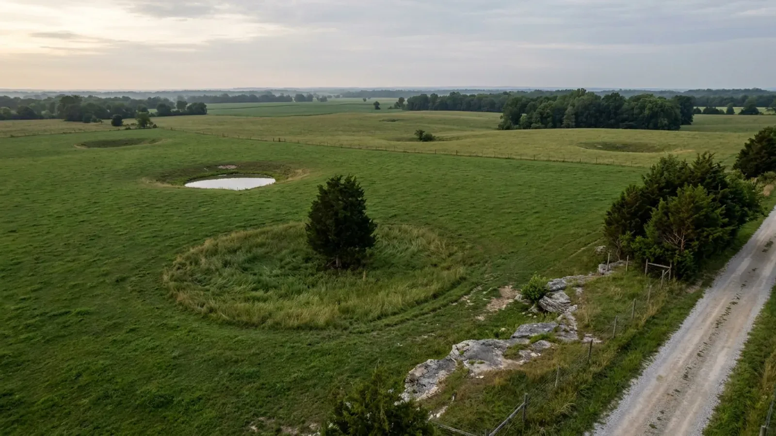
Breckinridge County is Hardinsburg, Irvington, Cloverport, Harned, Custer, Union Star and Stephensport — 570 square miles of north-western Kentucky with the Ohio River along the whole north-west boundary and the Rough River and Rough River Lake along the south. About 20,400 people live in it, roughly 36 to the square mile, and USDA's 2022 Census of Agriculture counts 1,249 farms across 244,558 acres, which is about two-thirds of every acre in the county. The regulatory picture is an unusual combination and it is the first thing to get straight. The county's own government publishes, in plain words on its ordinance page, that Breckinridge County does not have planning and zoning, and that Cloverport, Hardinsburg and Irvington do — so outside those three city limits there is no zoning district, no minimum lot size, no setback schedule and no cap on how big a shop may be. The same page, in the same breath, names a county building inspector and tells you to call him about building permits and codes. That pairing is rarer than it sounds, and it means the permit question here is a phone call rather than an assumption. The ground splits the county in two as sharply as the ordinance does. The Kentucky Geological Survey puts only the eastern edge of Breckinridge on the karst limestone plain — sinkholes, streamless valleys and underground drainage, at 580 to 630 feet — with a conspicuous escarpment rising 200 to 250 feet immediately west of it onto a dissected sandstone plateau that carries the rest of the county. So a blanket assumption that this is sinkhole country is wrong for most of Breckinridge, and right for the part of it nearest the eastern county line, which it shares with Hardin and Meade. Between that line, the Ohio River floodplain, a brand-new set of flood maps effective 8 May 2024 and a standalone county health department that wants a backhoe on site before it will evaluate a septic field, the real constraints here are about ground and water rather than paperwork.
Breckinridge County at a glance
- County
- Breckinridge
- Population
- 20,432
- ZIP codes
- 40143, 40146, 40111, 40144, 40145, 40140, 40170, 40171, 40176, 40115, 40152, 40178, 40119
- Site visits
- Same week
Building conditions in Breckinridge County
The building code is the same in every Kentucky county, and no local government may adopt or enforce a different one on a house — the Kentucky Residential Code says so in its own text. The design criteria are settled by the state too: the code prints a filled-in table covering all 120 counties, so your county's ground snow load, frost depth and seismic design category are published figures rather than something a local office decides. Ultimate design wind speed is 115 mph for every county in the state.
What changes from one county to the next is whether anyone checks. Kentucky makes permits, inspections and certificates of occupancy optional for a single-family home unless the local government has passed an ordinance requiring them, and it forbids the state from stepping in where none has. Twenty-five counties tell the state outright that they have no local building inspector, and in much of the rest the answer depends on an ordinance the county either passed or never did. Zoning is a separate, equally local choice — most Kentucky counties have never adopted any. What is below covers this county specifically: who issues the permit if anyone does, what the state's tables assign it, and what the ground does to a slab.
https://breckinridgeky.com/ordinances/ (Breckinridge County Government's own ordinance index and its planning-and-zoning note, read from the raw page HTML rather than a fetch summary, 8 Sep 2026 — the page also carries the three city hall numbers and names Fiscal Court Clerk Kathina Bell for ordinances not listed) · https://breckinridgeky.com/fiscal-court/ (Judge/Executive Maurice Lucas and the six magisterial districts) · https://breckinridgeky.com/directory/ (county departments; the list names Circuit Court Clerk, Coroner, County Attorney, County Clerk, Jailer, PVA, Sheriff, tourism and six magistrates, and no planning commission, zoning office or building department) · https://apps.legislature.ky.gov/law/statutes/statute.aspx?id=52659 (KRS 198B.060)
https://www.uky.edu/KGS/water/library/gwatlas/Breckinridge/Topography.htm (KGS Groundwater Resources of Breckinridge County, Topography of the County, quoting McGrain and Currens 1978 — the sinkhole plain, the escarpment, the relief figures and the full town elevation list; read from the page HTML 8 Sep 2026) · https://www.uky.edu/KGS/water/library/gwatlas/Breckinridge/Geology.htm (St. Louis Limestone as the oldest surface rock; Mississippian limestones as the most common rock type) · https://www.uky.edu/KGS/water/library/gwatlas/wprkarst.html (KGS's five named karst regions and the description of the Western Pennyroyal; KGS publishes no county roster for them, and Breckinridge is named in none of them) · https://kgs.uky.edu/kgsmap/helpfiles/karst_help.shtm and https://kgs.uky.edu/kygeode/geomap?gkarst=true (Karst Potential Index classes and the pannable viewer) · https://apps.legislature.ky.gov/law/kar/titles/902/010/085/
https://dhbc.ky.gov/Documents/2018%20Kentucky%20Residential%20Code%203d%20Ed.pdf — Table R301.2(1) Design Snow, Climatic and Geometric Design Criteria for Kentucky Counties; Table R403.1.4 Minimum Frost Protection Depth for Kentucky; Table R301.2.2.1 Seismic Design Categories–Site Class D; Table R401.4.1. The PDF was downloaded and extracted with pdftotext in BOTH -raw and -layout, 8 Sep 2026. The snow row (Breckinridge 15) reconciles in both passes. The seismic table does NOT: in -layout the first column's county names print at double line-density, Breckinridge's category cell comes out empty and values slide onto adjacent rows, which is why that pass returns an impossible Bell = D2. The -raw pass emits one county and one category per line in four gap-free alphabetical sequences and returns Breckinridge = C, Bell = B, Boone/Campbell/Kenton = A and every D-category county in far-western Kentucky; -raw is authoritative and is what is published here. The same three county tables are transcribed in research/statewide/design-criteria-and-climate.md, whose §4b records the identical -layout-versus-raw correction for this county
https://www.nass.usda.gov/Publications/AgCensus/2022/Online_Resources/County_Profiles/Kentucky/cp21027.pdf (2022 Census of Agriculture, Breckinridge County profile, FIPS 21027 — downloaded and extracted with pdftotext in both -raw and -layout, 8 Sep 2026, and reconciled value by value against the same row. The -layout pass is misaligned by one row in three places: the overview block hands Land in farms' −11 per cent change to Average size of farm, the farms-by-size table pairs the 1-to-9-acre count with the wrong label, and the livestock inventory shifts cattle's 29,946 onto the second line of the broiler label. Every figure above is from the -raw pass, whose size bands sum to the published 1,249 and whose land-use lines sum to the published 244,558) · land area and internal point from the U.S. Census Bureau 2024 Gazetteer county file, https://www2.census.gov/geo/docs/maps-data/data/gazetteer/2024_Gazetteer/2024_Gaz_counties_national.zip (Breckinridge County KY, GEOID 21027: 569.725 sq mi land, 15.868 sq mi water, internal point 37.777988 / −86.432919) · population and density from research/statewide/geography-and-population.md · Grayson County's comparison figures from research/entries/grayson-county-ky.json, itself sourced to cp21085.pdf
https://breckinridgecountyhealthdept.org/environmental-services (Breckinridge County Health Department environmental services — the site inspection notice, the service list, the named contacts and the full environmental fee schedule, all read from the page's own HTML on 8 Sep 2026 rather than from a fetch summary; the department's 270-756-2462 number and the Hardinsburg address confirm this is the Kentucky county) · https://dhbc.ky.gov/Documents/Breckinridge%20County.pdf (sheet updated 7/17/2025, extracted with pdftotext -raw — the health department address at 220 South Hardin Street, the environmentalist block and John Stamper's Thursday 8:00–9:00 a.m. Central hours at that address; note the state sheet spells the environmentalist Jeremy Hilton where the department's own page spells it Jeremy Hinton) · https://apps.legislature.ky.gov/law/kar/titles/902/010/085/ · https://ltdhd.org/on-site-sewage/ (Lincoln Trail District — cited to establish which counties it does cover, and that Breckinridge is not one of them)
https://www.fema.gov/cis/KY.html (Kentucky Community Status Book, document date 8 Sep 2026; the four Breckinridge County rows were read through a rendering fetch because this host refuses plain automated requests, and the CID numbers, the county column and the participating section were each checked on the row rather than matched on the community name) · FEMA CRS Eligible Communities list, effective 1 April 2026, https://www.fema.gov/sites/default/files/documents/fema_crs_eligible-communities_042026.pdf — the Kentucky block is 42 rows of which 33 hold a class better than 10, and it contains no Breckinridge County entry; read with pdftotext -raw, because the -layout pass shifts the class column by one row and hands every community its neighbour's class · the state floodplain permit is KRS 151.250 with 401 KAR 4:060 §2, cited by section number and indexed at https://apps.legislature.ky.gov/law/statutes/ · https://eec.ky.gov/Environmental-Protection/Water/FloodDrought/Pages/default.aspx · https://breckinridgeky.com/ordinances/ (the ordinance index, which contains no flood damage prevention ordinance)
Also worth knowing before you build in Breckinridge County
- Breckinridge is NOT one of the 37 mine subsidence counties — and the boundary runs along its own county line
- This one is counter-intuitive and the geography makes it worth getting exactly right. Kentucky's Mine Subsidence Insurance Fund covers only the counties whose fiscal courts voted the coverage in, and the Department of Insurance's current brochure lists 37 of them: Bell, Boyd, Breathitt, Butler, Carter, Christian, Clay, Daviess, Edmonson, Elliot, Floyd, Greenup, Hancock, Harlan, Henderson, Hopkins, Jackson, Johnson, Knott, Knox, Laurel, Lawrence, Lee, Leslie, Letcher, Martin, McCreary, McLean, Morgan, Muhlenberg, Ohio, Owsley, Perry, Union, Webster, Whitley and Wolfe. Breckinridge is not on it. What makes that specific rather than generic is where the line falls: Hancock and Ohio, both of which Breckinridge borders, ARE on the list, as are Daviess, Butler and Edmonson a little further out — while Meade, Hardin and Grayson, the county's other neighbours, are not. The programme boundary in this corner of Kentucky effectively runs along Breckinridge County's own western and southern lines. The consequence is concrete. In a participating county the mine subsidence endorsement is added automatically to a property policy unless the insured declines it in writing; in Breckinridge County there is no such automatic endorsement, and the ordinary homeowner's earth-movement exclusion stands unrelieved. The geology does not disappear at the county line — the Kentucky Geological Survey records Pennsylvanian sandstone, shale and coal above the Mississippian limestones here, and the Tradewater Formation underlying the dissected uplands and ridgetops — so the sensible response is to check the ground and to put the coverage question to an insurance agent in writing rather than assume a policy covers it. The Kentucky Mine Mapping Information System at minemaps.ky.gov is parcel-checkable, and the cabinet publishes its own limits on it: the mapping is digitised at 1:24,000 with roughly forty feet of horizontal accuracy, it should not be considered complete, and not all voids are shown. One more thing a buyer should know: Kentucky's seller disclosure, KREC Form 402, asks about soil stability, drainage and erosion but carries no question at all about mines, sinkholes, caves or undermining — so a silent form is not an assurance about any of them.
- A well on the Ohio River bottoms and a well on a ridgetop are not the same purchase
- The Kentucky Geological Survey's Groundwater Resources of Breckinridge County splits the county by water as sharply as it splits it by landform, and the difference is large enough to price. Along the Ohio River, the unconsolidated alluvium and valley-train terrace deposits may yield several hundred gallons per minute to a drilled well, and as much as 5,000 gallons per minute to compound horizontal wells; nearly all wells in that material furnish more than 500 gallons per day. Move off the main valley and the answer changes twice over. Alluvium in the stream valleys tributary to the Ohio is fine grained and thin, and most wells in it do not yield enough for domestic use at all. And the Tradewater Formation, which underlies the dissected uplands and ridgetops where the resistant sandstone beds form cliffs, is the material a great many attractive building sites sit on. The water in the alluvium is also described as hard to very hard and may carry objectionable amounts of iron, which is a treatment cost rather than a supply problem but is still a cost. The underlying study is McGrain and Currens (1978), so this is the regional picture rather than a prediction for one parcel — but the instruction it supports is simple and worth following before an offer rather than after: find out whether a rural water district line reaches the property, and if it does not, price a well as a contingency rather than a certainty, and treat a ridgetop tract with no main as a different proposition from a bottomland tract with one.
- What the fiscal court actually does regulate here — solar, data centres, roads and nuisances, but not buildings
- A county with no zoning is not a county with no rules, and reading Breckinridge County's ordinance index tells you exactly which levers the fiscal court has chosen to pull. Two of them are recent and land-use adjacent. Ordinance #2025-0121 governs solar energy systems, and ordinance #2025-1117A imposes a moratorium on AI data centres — both adopted in the last couple of years, which is a fair indication of what has been arriving at the courthouse. Ordinance #2015-0810 sets county road specifications, which matters more than it sounds for a rural build, because the standard a private access has to meet if it is ever to be accepted into the county road system is written there rather than negotiated later. Ordinance #2021-0816B is a nuisance ordinance, which is the instrument a county without zoning typically uses in place of one, and it is worth reading if the plan involves stored equipment, vehicles or materials on the property. The rest of the index is fire dues (#2011-0314, with two superseded versions still published), animal control (#2026-0420), a cannabinoids ordinance (#2012-0312), four generations of alcohol ordinance, a tourist commission (#2026-0216) and a transient room tax (#2026-0216A). What is not there is the point: no building ordinance, no zoning ordinance, no subdivision regulations and no flood damage prevention ordinance. The county also publishes an invitation to ask for anything not listed — Fiscal Court Clerk Kathina Bell at the courthouse, 270-756-2269 — which is the right route if you need to see the text of any of these before you commit to a site plan.
- Even where nobody inspects the frame, one approval reaches every parcel: no certificate, no meter
- It is easy to read a county with no building ordinance as a county where nothing is checked, and that is wrong in a way that costs money. KRS 198B.060(11) provides that no utility may initiate permanent electrical service to a new building until a certified electrical inspector issues a final certificate of approval. That is not a penalty applied after the fact — it is the difference between having power and not having it, and it reaches unincorporated Breckinridge County exactly as it reaches Hardinsburg. The county's own health department names the electrical inspector to call: Greg Carwile, 270-570-8538. The state building directory's Breckinridge sheet also assigns the county a state building inspector (Kelly Meadows), a state manufactured housing inspector (Carl Lee), a state electrical inspector (Pat O'Bryan), an HVAC inspector (Rick Sims), an elevator inspector (Jim Morris), a boiler inspector (Billy Yarbrough) and state plumbing inspector John Stamper, who holds Thursday 8:00 to 9:00 a.m. Central hours at the health department at 220 South Hardin Street in Hardinsburg. The trades are licensed by the Commonwealth regardless of what any county requires — electrical under KRS 227.450 to 227.530, plumbing under KRS Chapter 318, HVAC under KRS Chapter 198B. The health department controls the septic permit independently of anything on the building side. Anything in the base floodplain needs a state Division of Water Individual permit under KRS 151.250 and 401 KAR 4:060 §2 on form DOW 7116. And where a parcel adjoins Rough River Lake, the U.S. Army Corps of Engineers governs the flowage easement and the shoreline independently of every local office. One last thing that matters when comparing builders: Kentucky issues no state licence for residential general contracting, so nobody can hold one. What a buyer can and should ask for instead is a building constructed to the Kentucky Residential Code, because a lender, an appraiser and an insurer will each want to see one whether or not a local inspector ever visits the site.
- A fourth shared contract inspector — the same man, number and email appear on Butler County's sheet too
- This one is about how much weight to put on a state directory row, and it is worth spelling out because on this county the directory and the county's own page happen to agree — which makes it tempting to treat the directory as the evidence when it is not. The Department of Housing, Buildings and Construction publishes one contact sheet per Kentucky county. Breckinridge's, updated 17 July 2025, lists a Local Building Inspector as Troy Mills, statelineinspections1@gmail.com, 270-302-7105, with no scope note beside the name — no city named, no city excluded, no title beyond the row label. The identical name, the identical Gmail address and the identical phone number also appear as Local Building Inspector on the Butler County sheet, updated 18 November 2025, equally unqualified. Butler County is not adjacent to Breckinridge; Grayson and Ohio counties sit between them. Two nearby sheets show the opposite pattern for contrast: Hancock and Ohio counties both print the Local Building Inspector row and leave it blank. So a filled-in row on that directory establishes that a phone number exists and nothing further about what is inspected or where. On this county the finding survives anyway, because Breckinridge County's own government page independently names the same man as the county building inspector and tells you to call him about building permits and codes — a county's own instruction to its own residents, which is a different order of evidence. The reason to record the Butler overlap is that it is the correct way round: establish the answer from the jurisdiction's own published material, and treat the state directory as a phone book that happens to corroborate it.
- The farm exemption is real and it is narrow — do not assume the house rides on it
- In a county where two-thirds of the land is in farms, the agricultural exemption comes up in nearly every early conversation, and it is worth stating precisely because the loose version of it is wrong. Kentucky's building-code exemption is written into the definition of the buildings the code governs, and it can reach a dwelling on a farm — but only on a farm as the statute defines one, which is a tract of at least ten contiguous acres, used for the production of agricultural or horticultural crops or livestock, registered as a farm with the Property Valuation Administrator, and outside the limits of a city. Every one of those conditions travels with the claim; a ten-acre lot that has never been in agricultural use, or a tract split by a road into two parcels neither of which reaches ten acres, or ground inside Hardinsburg, Irvington or Cloverport does not qualify. The Breckinridge County PVA is Dana Bland, 208 South Main Street, Hardinsburg, 270-756-5154, and the PVA record is where that question is actually answered. Three things the exemption does not do, which matter more than what it does. It does not reach zoning — KRS 100.203(4)(c) preserves local authority over the dwelling even where farm buildings are exempt, so inside a city with zoning the house is still zoned. It does not reach the electrical certificate: KRS 198B.060(11) still stops a utility energising the building until a certified inspector signs off, exemption or no exemption. And it does not reach the septic permit, which is issued by the health department under 902 KAR 10:085 on its own terms. Nor, in practice, does it reach a lender, an appraiser or an insurer, all three of whom will want to see a building constructed to the Kentucky Residential Code whether or not anyone was required to inspect it. The honest way to use the exemption is as a fact about who has to sign a form, never as a reason to build to a lower standard.
- Make sure it is the right Hardinsburg — and the right spelling of Breckinridge
- Two name collisions catch people researching this county, and both of them return confident-looking results. The first is Hardinsburg. There is a Hardinsburg in Indiana, about seventy miles north-east across the Ohio River, and a search that does not pin the state will mix the two freely. The second is the spelling. Breckenridge with an E is a town in Colorado, a city in Texas, a city in Minnesota and a city in Missouri, and search engines will silently correct Breckinridge to Breckenridge and hand back results from any of them. Breckinridge with two I's is a county name that exists only in Kentucky. Three tests settle any document you are handed: a 270 area code, an address in Hardinsburg, Irvington, Cloverport, Harned, Custer, Union Star, Stephensport, Webster, Garfield, McDaniels, Westview or Hudson, or an explicit Kentucky reference such as a KRS citation or a .ky.gov domain. The county's own government site is breckinridgeky.com, its courthouse is at 208 South Main Street in Hardinsburg on 270-756-2269, and its ZIP codes run 40111, 40115, 40119, 40140, 40143, 40144, 40145, 40146, 40152, 40170, 40171, 40176 and 40178. The county keeps Central time, which is a quick sanity check on an office-hours listing. If a document names a 606 or 859 number, quotes a statute that is not a KRS section, or gives an address in a state other than Kentucky, it is not about this county — and that is a check worth doing before you rely on a permit answer, a flood determination or a fee schedule.
https://insurance.ky.gov/PPC/Documents/JAN%202025_Revised%20Mine%20Subsidence%20Insurance%20Fund%20080124.pdf (Kentucky Department of Insurance, Mine Subsidence Insurance Fund brochure, rev. 08/24 effective 1/1/25 — the 37-county participating list, the automatic-endorsement rule and the claims process; downloaded and extracted with pdftotext in both -raw and -layout on 8 Sep 2026, and a case-insensitive search of both extractions returns no occurrence of Breckinridge in either) · https://minemaps.ky.gov/ and https://eppcgis.ky.gov/minemapping/ (the cabinet's own accuracy notice) · https://www.uky.edu/KGS/water/library/gwatlas/Breckinridge/Geology.htm and https://www.uky.edu/KGS/water/library/gwatlas/Breckinridge/GWavailability.htm (Pennsylvanian coal-bearing rock above the Mississippian limestones; the Tradewater Formation under the dissected uplands and ridgetops) · the automatic-endorsement rule is KRS 304.44-030, indexed at https://apps.legislature.ky.gov/law/statutes/ — cited by section number rather than by a per-section deep link, because the legislature's statute.aspx?id= links are opaque numeric ids and three of the ones carried over from a neighbouring county entry resolve to the wrong statute when opened · KREC Form 402 as established in research/statewide/soils-karst-and-slopes.md
https://www.uky.edu/KGS/water/library/gwatlas/Breckinridge/GWavailability.htm (KGS Groundwater Resources of Breckinridge County, Groundwater Availability — the Quaternary alluvium and glacial sediment yields, the tributary-alluvium caution and the Tradewater Formation description; read from the page HTML 8 Sep 2026, and the atlas attributes the underlying discussion to McGrain and Currens, 1978) · https://www.uky.edu/KGS/water/library/gwatlas/Breckinridge/Topography.htm · https://kgs.uky.edu/kgsmap/KGSWater/viewer.asp (KGS water wells and springs viewer, pannable to a parcel)
https://breckinridgeky.com/ordinances/ (the full published ordinance index with ordinance numbers, read from the page's raw HTML 8 Sep 2026; the individual documents are published as PDFs from the county's own wp-content/uploads path, e.g. https://breckinridgeky.com/wp-content/uploads/2025/12/Solar-Energy-Systems-Ordinance-2025-0121.pdf, https://breckinridgeky.com/wp-content/uploads/2025/12/AI-Data-Center-Moratorium-Ordinance-2025-1117A.pdf, https://breckinridgeky.com/wp-content/uploads/2023/07/Ordinance-2015-0810-County-Road-Specifications.pdf and https://breckinridgeky.com/wp-content/uploads/2023/07/Ordinance-2021-0816B-Nuisance-Ordinance.pdf, each link taken from the index page's own href list rather than constructed) · https://breckinridgeky.com/directory/ · https://breckinridgeky.com/fiscal-court/
https://dhbc.ky.gov/Documents/Breckinridge%20County.pdf (Breckinridge County sheet, updated 7/17/2025, downloaded and extracted with pdftotext -raw — the full state inspector assignment, the plumbing inspector's Thursday hours and address, and the printed instruction in the Local Electrical Inspector row to contact the County Judge Executive's office or the city office where work is to be performed) · https://breckinridgecountyhealthdept.org/environmental-services (electrical inspector Greg Carwile, 270-570-8538, named on the health department's own contacts block) · https://apps.legislature.ky.gov/law/statutes/statute.aspx?id=52659 (KRS 198B.060, including subsection 11) · research/statewide/contractor-licensing.md and research/statewide/code-regime.md for the licensing and enforcement framework
https://dhbc.ky.gov/Documents/Breckinridge%20County.pdf (updated 7/17/2025) and https://dhbc.ky.gov/Documents/Butler%20County.pdf (updated 11/18/2025) — both downloaded and extracted with pdftotext -raw on 8 Sep 2026 and compared line by line; the Local Building Inspector row on each carries the same name, the same statelineinspections1@gmail.com address and the same 270-302-7105 number, and neither carries a scope note · https://dhbc.ky.gov/Documents/Hancock%20County.pdf and https://dhbc.ky.gov/Documents/Ohio%20County.pdf (both print the row and leave it empty) · https://dhbc.ky.gov/docs_cols.aspx?cat=312 (the directory index) · https://breckinridgeky.com/ordinances/ (the county's own naming of its building inspector, which is the evidence this entry actually rests on)
research/statewide/code-regime.md §5 (the forensic treatment of the exemption — that it lives in the definition of the buildings covered rather than as an exception, the ten-contiguous-acre and PVA-registration gate, the outside-city-limits condition, and the part-farm/part-residence case) · https://apps.legislature.ky.gov/law/statutes/statute.aspx?id=52659 (KRS 198B.060 — this deep link was opened and confirmed to serve the correct section) · KRS 100.203(4)(c), cited by section number and indexed at https://apps.legislature.ky.gov/law/statutes/ · https://breckinridgeky.com/directory/ (Breckinridge County PVA Dana Bland, 208 S Main St, 270-756-5154) · https://apps.legislature.ky.gov/law/kar/titles/902/010/085/
https://breckinridgeky.com/directory/ and https://breckinridgeky.com/ordinances/ (the county's own site, 270 numbers and Hardinsburg address) · https://dhbc.ky.gov/Documents/Breckinridge%20County.pdf (Central time office hours printed on the state sheet) · U.S. Census Bureau 2020 ZCTA-to-county relationship file, https://www2.census.gov/geo/docs/maps-data/data/rel2020/zcta520/tab20_zcta520_county20_natl.txt (every ZCTA intersecting county GEOID 21027, downloaded and filtered on the county code rather than matched on a place name, 8 Sep 2026; the list above is the set whose land area lies substantially inside the county, and 40142, 40157, 40175, 42343 and 42754 are excluded because most of each falls in Meade, Hardin, Ohio or Grayson County) · https://www2.census.gov/geo/docs/maps-data/data/gazetteer/2024_Gazetteer/2024_Gaz_counties_national.zip

The expensive surprises are in the ground, not the building
What moves a Kentucky budget is usually below grade, and more often than not it is what the ground is sitting on rather than the ground itself. The Kentucky Geological Survey says 92 of the state's 120 counties contain karst — limestone that dissolves — across four named areas: the Western Pennyroyal around Bowling Green and Hopkinsville, the Inner Bluegrass around Lexington, the Eastern Pennyroyal through Somerset and Monticello, and Pine Mountain in the south-east. On karst, KGS's own model ordinance for local governments lists the structures that should not be sited in sinkhole areas, and the list is buildings with soil-bearing foundations and buildings that cover thousands of square feet with impermeable surface. A post-frame or steel building on a monolithic slab is both of those at once. KGS is equally clear that nearly all karst parcels still have buildable ground on them — so karst does not stop the build, it removes the option of siting the pad by eye. A filled and graded-over sinkhole is the classic trap, because the pad looks perfect.
In the two coal fields the question is undermining instead, and Kentucky treats it differently from everything else: mine subsidence coverage is added automatically to property policies in the counties whose fiscal court voted the fund in, with a written opt-out — thirty-seven of them — while karst collapse gets no fund at all and falls under the ordinary earth-movement exclusion. On slopes the surprise is geographic: KGS's landslide inventory puts Kenton, Campbell, Boone and Gallatin — the northern Kentucky counties opposite Cincinnati — near the very top, above most Appalachian counties, on Ordovician shale. Three of those four — Boone, Campbell and Kenton — are the only counties in the state with a line of their own in the residential code's bearing table, which raises the presumptive value for two named clay groups there and nowhere else. Everywhere else the table gives clay and silt a single presumptive figure, and a soils investigation becomes mandatory once the building official determines the real capacity is likely to be lower than it.
The same ground then sizes the septic system, and Kentucky does that from soil morphology — a certified inspector reading the profile in a backhoe pit — rather than from a percolation test, at 110 gallons a day per bedroom against an application rate taken from soil texture and structure. On a mound or other alternative design a measured permeability test can still be required. And on karst the septic regulation is blunter than the building code ever gets: it declares the ground within seventy feet of an open sinkhole throat unsuitable outright. The soil that needs a foundation engineer is usually the soil that complicates the drainfield, so the site work, the foundation and the septic get resolved together rather than one at a time. We price the dirt before we price the building.
What we build in Breckinridge County
All seven services are available in Breckinridge County. What a build costs depends far more on the parcel than on square footage, so we price against your land rather than publishing a rate card.
Barndominium Kits
We check barndominium kit packages against the wind, snow, frost and seismic criteria the Kentucky Residential Code publishes for your county.
Pole Barn Homes
Pole barn homes across Kentucky. KRC §R327 covers accessory barns, not houses — so a pole barn home is engineered by the code's own terms.
Custom Barndominium Plans
Barndominium plans drawn to Kentucky's published county design criteria — snow, wind, seismic, frost — with engineering where the code calls for it.
What a build looks like
Three stages every Breckinridge County project passes through, from a raw parcel to a finished home. Site work first, because that is where the budget is decided.

The parcel
Karst and mine maps, the flood question, zoning where the county has any, and utility access — all checked before anything is drawn.
Pad and permit
Clearing, grading and a compacted pad, while the submittal works through whichever office issues the permit — and where no office does, through the approvals that still apply.

Frame to finish
Shell erected and dried in, then systems and interior finish — and the certified electrical inspection your utility needs before it will set a meter.
Those are the rules where you are building in Breckinridge County. Tell us what you want to build and we will draw it to them.
Where we build around Breckinridge County
Breckinridge and the rural land around it. The buildable acreage for a project this size usually sits outside the city limits, and in Kentucky that line frequently decides whether anyone issues a permit at all, not merely who issues it.
Keep reading
The questions that usually come next once you know what Breckinridge County allows.
Barndominium Cost Guide
Why the published spread runs from one end of the scale to the other, and which of it is the building rather than the ground.
Read itIs It Legal in Kentucky?
Whether your county inspects a house at all, what the farm-dwelling exemption really requires, and the approvals that reach you anyway.
Read itWhat a Pole Barn Home Costs
Post-frame against stick-built, and what the prescriptive post-frame section of the state code does and does not cover.
Read itNearby areas we build in
Others we cover nearby. They share the same statewide code and the same state-published design tables — but whether a house is permitted and inspected at all, whether the county zones, what the health department will accept for septic, and what the ground does to a foundation can all differ from one card to the next. Two counties that touch are not two versions of the same answer.
Building in Breckinridge County: common questions
10 questions we get asked most often about building in Breckinridge County. If yours is not on the list, ask it directly.
Do I need a building permit to put up a pole barn or barndominium in Breckinridge County?
Can I build a shop bigger than the house, and can I build it first?
Is this karst country? Where can I actually pour a slab?
Does Breckinridge County need a deeper footing or a stiffer frame than its neighbours?
Who issues the septic permit, what does it cost, and what do I need to have ready?
Is there really buildable land in Breckinridge County?
Should I worry about mine subsidence here?
The flood maps changed recently. What does that mean for my parcel?
It's going to be a barn with living quarters in it. Doesn't the farm exemption cover that?
Am I looking at the right Breckinridge, and the right Hardinsburg?
Building in Breckinridge County?
Start with the plan. Tell us what you want to build and we will draw it, then confirm whether any office permits and inspects a house where your parcel is, what it will let you put there, and which line of the state's snow, frost and seismic tables your county falls on. That conversation costs nothing.