Barndominium Builders in Casey County, KY
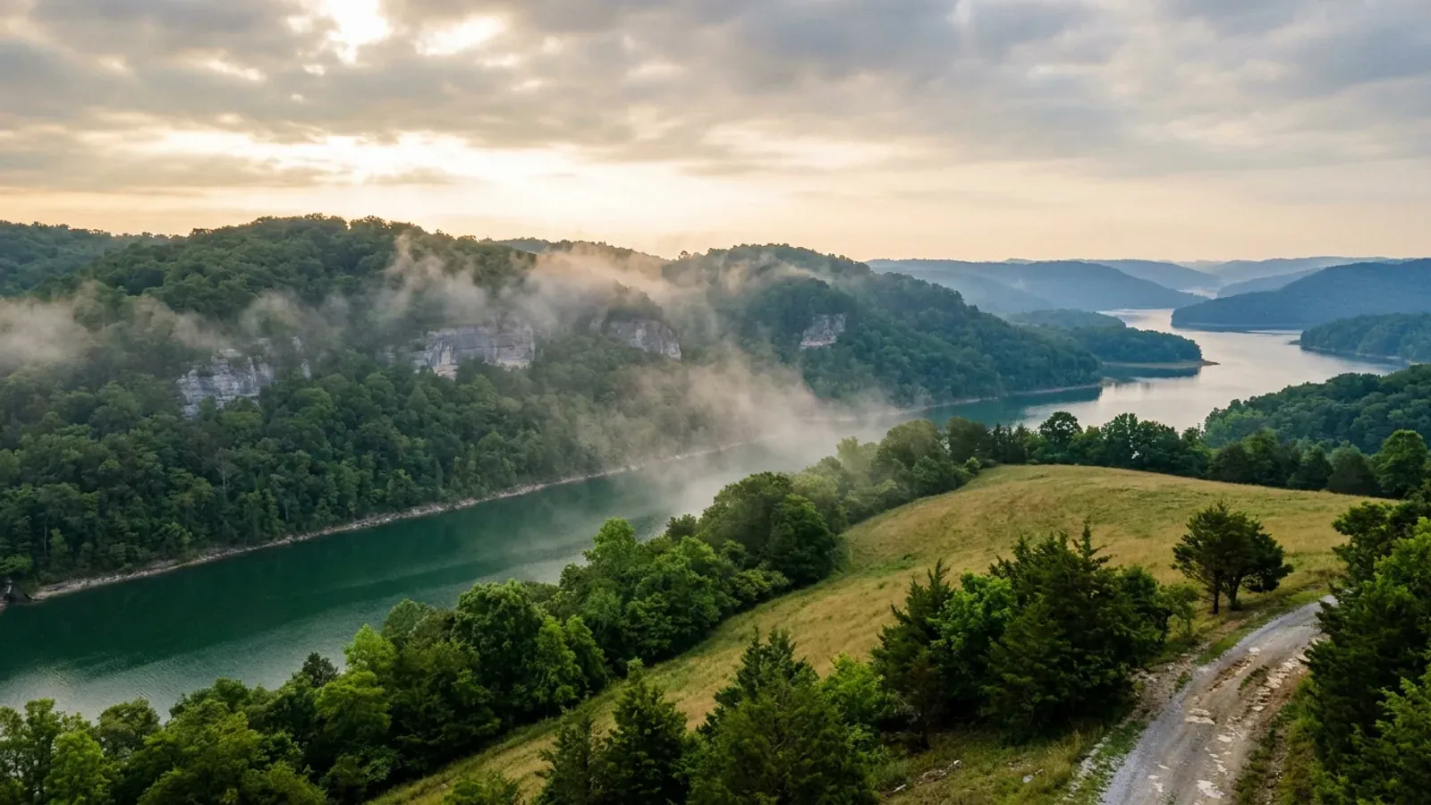
Casey County is 444 square miles of working farmland at 36 people per square mile, sitting where the Knobs come down off the Bluegrass and the Green River starts its run west. Two-thirds of the county — 188,753 acres of 284,000 — is in farms, a far higher share than Pulaski's, and the farms are bigger: 975 of them at an average of 194 acres, with the modal Casey farm a 50-to-179-acre tract and thirty-four holdings above 1,000 acres. It is one of the state's genuine dairy counties, twelfth in Kentucky for milk sales, eighth for hay and other crops, and it supports one of only five produce auctions the University of Kentucky tracks statewide, run at Liberty by the Amish and Old Order Mennonite families who have been farming here since the 1970s. On the regulatory side Casey is about as light as Kentucky gets. No county planning commission or zoning office turned up at any address searched, the county publishes no ordinance index, and the planning-and-zoning contact listed against Casey in the state directories resolves to Liberty City Hall rather than to a county office. The name DHBC prints in Casey's Local Building Inspector row is a contract inspector who appears on at least seven southern Kentucky county sheets and whom Pulaski County's own government titles County Commercial Building Inspector — a contact list entry, not proof that anybody inspects a house here. And Casey is one of only four Kentucky counties whose unincorporated government is not in the National Flood Insurance Program at all, sanctioned since December 1975. Inside the Liberty city limits the picture flips: the city has an adopted code of ordinances, a Planning and Zoning Board, a Zoning Administrator and a Downtown Business District, and it has been an NFIP Regular Program community since 1986. What binds on both sides of that line is the Lake Cumberland District Health Department's septic permit, its 22,000 square foot lot minimum, and the electrical certificate without which no utility may set a meter.
Casey County at a glance
- County
- Casey
- Population
- 15,941
- ZIP codes
- 42539, 42516, 42528, 42541, 42565, 42566
- Site visits
- Same day
Building conditions in Casey County
The building code is the same in every Kentucky county, and no local government may adopt or enforce a different one on a house — the Kentucky Residential Code says so in its own text. The design criteria are settled by the state too: the code prints a filled-in table covering all 120 counties, so your county's ground snow load, frost depth and seismic design category are published figures rather than something a local office decides. Ultimate design wind speed is 115 mph for every county in the state.
What changes from one county to the next is whether anyone checks. Kentucky makes permits, inspections and certificates of occupancy optional for a single-family home unless the local government has passed an ordinance requiring them, and it forbids the state from stepping in where none has. Twenty-five counties tell the state outright that they have no local building inspector, and in much of the rest the answer depends on an ordinance the county either passed or never did. Zoning is a separate, equally local choice — most Kentucky counties have never adopted any. What is below covers this county specifically: who issues the permit if anyone does, what the state's tables assign it, and what the ground does to a slab.
https://dhbc.ky.gov/Documents/Casey%20County.pdf (sheet updated 2/25/2026, text extracted with pdftotext -raw and read 6 Sep 2026; the same extraction run against https://dhbc.ky.gov/Documents/Pulaski%20County.pdf, Wayne, Laurel, Whitley, Knox and Clay County.pdf returned the identical inspector name, e-mail and phone) · https://dhbc.ky.gov/docs_cols.aspx?cat=312 · https://apps.legislature.ky.gov/law/statutes/statute.aspx?id=52659 · https://libertycaseychamber.org/local-government (Casey County Judge/Executive and county government address, read 6 Sep 2026)
https://kaco.org/articles/planning-and-zoning-101-for-counties/ (Kentucky Association of Counties, 58 planning / 40 zoning as of 2025) · https://kadisonline.org/planning-zoning/ (statewide planning-and-zoning contact directory — the CASEY entry reads P.O. BOX 127 / LIBERTY KY 42539 / 606-787-9973, read 6 Sep 2026) · https://libertycaseychamber.org/local-government (same P.O. Box 127 and 606-787-9973 published for the City of Liberty mayor, clerk and operations manager; the county government listed separately at 625 Courthouse Square, 606-787-8311) · https://apps.legislature.ky.gov/law/statutes/chapter.aspx?id=38316
https://www.fema.gov/cis/KY.html (Kentucky Community Status Book, read 6 Sep 2026) · https://www.fema.gov/api/open/v1/NfipCommunityStatusBook?$filter=state%20eq%20%27KY%27%20and%20county%20eq%20%27CASEY%20COUNTY%27 (OpenFEMA machine-readable record retrieved 6 Sep 2026: Casey County participatingInNFIP false, sanction true, sanctionDate 12/13/75; Liberty participatingInNFIP true, regularEmergencyProgramDate 07/03/86 — fema.gov refuses curl on the HTML page but serves the API) · the same query filtered to participatingInNFIP false across Kentucky returns four community names containing COUNTY: Casey, Cumberland, Hickman and Wolfe
https://www.nass.usda.gov/Publications/AgCensus/2022/Online_Resources/County_Profiles/Kentucky/cp21045.pdf (2022 Census of Agriculture, Casey County profile — extracted 6 Sep 2026 both ways, pdftotext -layout and pdftotext -raw, and reconciled: the -layout pass shifts the label column against the value column on both the Farms by Size and the Market Value tables, so all figures here are taken from the -raw pass, which reconciles against the printed totals — the six size bands sum to 975 and their percentages to 100, and the livestock components sum to the printed $25,034,000 livestock total) · https://www2.census.gov/geo/docs/maps-data/data/gazetteer/2024_Gazetteer/2024_Gaz_counties_national.zip (2024 Gazetteer: Casey County FIPS 21045, 444.258 sq mi land, internal point 37.321962 / -84.92822)
https://dhbc.ky.gov/Documents/2018%20Kentucky%20Residential%20Code%203d%20Ed.pdf — Table R301.2(1) for snow, wind, weathering and termite, Table R301.2.2.1 Seismic Design Categories–Site Class D, Table R403.1.4 Minimum Frost Protection Depth for Kentucky, and §R327 for post-frame; all three tables transcribed county-by-county in research/statewide/design-criteria-and-climate.md rather than re-fetched
https://www.lcdhd.org/services/environmental-services/guidelines/new-home-on-site-sewage-disposal/ and https://www.lcdhd.org/services/environmental-services/guidelines/lot-size-regulation-for-private-waste-water-disposal-systems/ — the live LCDHD host refuses automated connections from here behind a Wordfence block, so both were read 6 Sep 2026 from Internet Archive captures at http://web.archive.org/web/20260513060757/https://www.lcdhd.org/services/environmental-services/guidelines/new-home-on-site-sewage-disposal/ and http://web.archive.org/web/20260905124213/https://www.lcdhd.org/services/environmental-services/guidelines/lot-size-regulation-for-private-waste-water-disposal-systems/ · https://www.lcdhd.org/locations/casey-county/ read via http://web.archive.org/web/20260521014432/https://www.lcdhd.org/locations/casey-county/ for the 650 Whipp Avenue address and the July 1982 district-entry date · https://apps.legislature.ky.gov/law/kar/titles/902/010/085/
Also worth knowing before you build in Casey County
- Radon Zone 1 across the county, but no KGS-named karst area — a different ground story from Somerset
- EPA maps Casey as one of only thirty Kentucky counties in radon Zone 1, its highest predicted-average class, alongside Adair, Boyle, Lincoln, Russell and Pulaski. Kentucky's Zone 1 map is very nearly its karst map, and the Kentucky Geological Survey lists radon infiltration into homes among karst's hazards right beside sinkhole flooding and cover collapse. But the karst statement has to be made more carefully here than in Pulaski. KGS names cities to anchor each of its karst areas — Mount Vernon, Somerset and Monticello for the Eastern Pennyroyal — and no Casey County community is among them; KGS publishes no county-by-county karst roster at all, only a polygon map. Casey straddles the Knobs and the Bluegrass margin, and the honest answer for any given parcel is the KGS Karst Potential Index viewer, which classes bedrock as Intense, Prone or Nonkarst and is pannable to a single field. On the radon side nothing in Kentucky requires a response: the Kentucky Residential Code adopts appendices K, R and S and does not adopt Appendix F, Radon Control Methods, so radon-resistant construction is nowhere mandatory in the Commonwealth. A passive sub-slab depressurisation rough-in costs very little while the slab is still open and a great deal afterwards, which makes it a decision worth taking deliberately on a large-footprint slab.
- Casey is not a mine subsidence county, and neither are any of its neighbours
- Kentucky's Mine Subsidence Insurance Fund covers 37 counties whose fiscal courts voted the coverage in, and in those counties KRS 304.44-030 puts the endorsement on every property policy automatically unless the insured waives it in writing. Casey is not one of the 37, and neither are Adair, Boyle, Lincoln, Russell or Pulaski — the fund maps Kentucky's two coal fields, and Casey sits between them on the Knobs. That is worth stating precisely because the two ground hazards get merged in conversation and they are not the same thing: the fund's own statutory definition covers the collapse of underground coal mines and explicitly excludes earthquake, landslide, water seepage, volcanic eruption and storm-drain collapse, and the insurance department adds that blasting and strip-mining effects are outside it too. Kentucky built no equivalent fund, no mandatory endorsement and no seller-disclosure question for karst: the Kentucky Real Estate Commission's Form 402 asks about soil stability, drainage, flooding and erosion and asks nothing about sinkholes, caves or undermining. The standard homeowner's earth-movement exclusion is broad enough to swallow a karst collapse, so cover for it is a written question for an agent rather than an assumption. One thing the fund's definitions do settle for this building type: a structure qualifies only if it was constructed or assembled at its present location on a permanent foundation, and buildings designed to be mobile or portable are excluded regardless of foundation type.
- Liberty runs one of five produce auctions the University of Kentucky tracks statewide
- Casey County has carried plain-Anabaptist farm settlements since the 1970s, and the peer-reviewed county-by-county census of them lists three separate Casey entries: a Midwest Beachy Amish settlement founded in 1974 from Maryland, an Old Order Amish settlement straddling Casey and Adair founded in 1978 from Pennsylvania, and a Swartzentruber Amish settlement at Liberty founded in 2013 from Staples, Minnesota. The same study describes the Casey County plain Anabaptist settlement as also containing Stauffer and Groffdale Old Order Mennonite churches established in 1979 and 1987 plus Holdeman, Remnant and Biblical Mennonite Alliance congregations — so the shorthand of Amish country understates how many distinct groups farm here. Those figures are as of October 2014 and are the most recent systematic count published. What the community means for a builder is visible commercially rather than demographically: the Casey County Produce Auction at 524 South Fork Creek Road in Liberty is one of five Kentucky produce auctions the University of Kentucky's Center for Crop Diversification collects market reports from, running hay and firewood through the winter, plants and flowers in spring and produce from summer into fall. It is also why Casey's road network carries horse-drawn traffic, which is a genuine site-access consideration on a delivery schedule for long steel and trusses.
- No building permit does not mean no approvals — the electric meter is the gate
- KRS 198B.060(11) provides that no utility may initiate permanent electrical service to a new building until a certified electrical inspector has issued a final certificate of approval. That reaches every parcel in Kentucky whatever the county does or does not require on the building side. DHBC's Casey sheet leaves the Local Electrical Inspector row filled not with a name but with an instruction — contact the County Judge/Executive's office or the city office where the work is to be performed — and names a state electrical inspector, Don Cravens, alongside state HVAC, plumbing, manufactured-housing, elevator and boiler inspectors, all at ky.gov addresses. The health department sits in the same chain: the Lake Cumberland district issues the temporary electric sticker once the soil evaluation is written up and the permanent one once the installed system passes, and the plumbing inspector writes the water permit off a copy of the septic permit. So the honest picture on unincorporated Casey acreage is that nobody may sign off on the frame, and four other approvals still stand between a finished shell and a house you can live in. We build to the Kentucky Residential Code regardless, because a lender, an appraiser and an insurer will each ask, and because the alternative is a building nobody will finance.
- The state floodplain permit is the one that reaches unincorporated Casey — and the Green River starts here
- Liberty sits at the head of the Green River, which rises in the hills where Casey, Lincoln and Pulaski meet and runs 384 miles west to the Ohio; Kentucky Fish and Wildlife manages the reach from Liberty down to Green River Lake as its own fishery. Because unincorporated Casey County is not an NFIP participant there is no county floodplain administrator and no local floodplain permit outside the Liberty city limits, which leaves the Commonwealth's permit standing on its own. Under KRS 151.250 and 401 KAR 4:060 §2 the Kentucky Division of Water requires a state floodplain construction permit — form DOW 7116 — for construction, fill, obstruction or a structure in the floodway or the mapped 100-year floodplain of any stream, and that requirement applies whether or not the local government participates in the flood insurance program. Inside Liberty, the city's NFIP participation means a local floodplain permit stacks on top of the state one. Casey's current effective flood map is dated 23 May 2023, which is newer than Liberty's own 7 July 2009 map, so the two jurisdictions are not reading the same sheet — a parcel near the city line is worth checking against both.
- Six ZIP codes are seated in Casey, and several more spill across the county line
- A ZIP code is a mail route and it does not respect a county boundary, which matters here because Casey is surrounded by five counties and the post offices interleave. The six ZIPs seated in Casey County are 42539 Liberty, 42516 Bethelridge, 42528 Dunnville, 42541 Middleburg, 42565 Windsor and 42566 Yosemite. The Census Bureau's 2020 ZIP-code-tabulation-area to county relationship file shows how leaky the edges are: 40437 Hustonville is a Lincoln County post office, and just over half its mapped area lies inside Casey; 40442 Kings Mountain is Lincoln-seated with about 46 percent in Casey; 40464 Moreland, 40328 Gravel Switch and 42733 Elk Horn each put roughly a quarter to a third of their area in Casey. Even 42539 itself is not wholly Casey — about one percent of its area falls outside. The practical point is that a mailing address is not a jurisdiction. Whether a given parcel answers to the City of Liberty's Planning and Zoning Board or to nobody at all, and whether it sits inside or outside an NFIP participating community, is decided by the parcel boundary against the city limit and by the county line, not by the envelope.
https://www.epa.gov/sites/default/files/2014-08/documents/kentucky.pdf (EPA Map of Radon Zones, Kentucky — Casey in Zone 1) · https://www.uky.edu/KGS/water/library/gwatlas/wprkarst.html (KGS karst areas and the cities that anchor them; no Casey community named) · https://kgs.uky.edu/kygeode/geomap?gkarst=true (KGS Karst Potential Index viewer, parcel-checkable) · https://kgs.uky.edu/kgsmap/helpfiles/karst_help.shtm (the three KPI classes) · https://kygs.uky.edu/geology/radon
https://insurance.ky.gov/PPC/Documents/JAN%202025_Revised%20Mine%20Subsidence%20Insurance%20Fund%20080124.pdf (KDOI brochure rev. 08/24 effective 1/1/25, 37-county list; Casey absent) · https://insurance.ky.gov/ppc/Documents/bulletin0904minesubs092109.pdf (Bulletin 2009-04, the fiscal-court gate and the KRS 304.44-010(6) structure definition) · https://krec.ky.gov/Documents/KREC%20Form%20402%20-%20Sellers%20Disclosure%20of%20Property%20Condition.pdf · https://minemaps.ky.gov/
Donnermeyer, Joseph, and Cory Anderson. 2014. "The Growth of Amish and Plain Anabaptists in Kentucky." Journal of Amish and Plain Anabaptist Studies 2(2):215-44 — https://kb.osu.edu/server/api/core/bitstreams/1a83c782-9994-562d-802f-b82108066ccd/content (full text extracted with pdftotext and read 6 Sep 2026; Table 1, Amish Settlements in Kentucky as of October 31, 2014, and the Old Order Mennonite discussion at pp. 577-585 of the extracted text) · https://ccd.uky.edu/pricereports/kypa/casey (University of Kentucky Center for Crop Diversification, Casey County auction prices, read 6 Sep 2026)
https://apps.legislature.ky.gov/law/statutes/statute.aspx?id=52659 (KRS 198B.060) · https://dhbc.ky.gov/Documents/Casey%20County.pdf (sheet updated 2/25/2026, text extracted with pdftotext -raw and read 6 Sep 2026 — the -layout pass scrambles these sheets and only -raw is readable) · https://www.lcdhd.org/services/environmental-services/guidelines/new-home-on-site-sewage-disposal/ read via http://web.archive.org/web/20260513060757/https://www.lcdhd.org/services/environmental-services/guidelines/new-home-on-site-sewage-disposal/
https://www.fema.gov/api/open/v1/NfipCommunityStatusBook?$filter=state%20eq%20%27KY%27%20and%20county%20eq%20%27CASEY%20COUNTY%27 (OpenFEMA, retrieved 6 Sep 2026 — Casey County current effective map date 05/23/23, Liberty 07/07/09) · https://apps.legislature.ky.gov/law/statutes/statute.aspx?id=54097 (KRS 151.250) · https://apps.legislature.ky.gov/law/kar/titles/401/004/060/ · https://eec.ky.gov/Environmental-Protection/Water/FloodDrought/Pages/default.aspx · https://fw.ky.gov/Fish/Pages/Green-River-above-the-Lake.aspx (Kentucky Department of Fish and Wildlife Resources, Green River above the Lake — Liberty to Green River Lake)
https://www2.census.gov/geo/docs/maps-data/data/rel2020/zcta520/tab20_zcta520_county20_natl.txt (2020 ZCTA-to-county relationship file, downloaded and filtered on county GEOID 21045, 6 Sep 2026 — area-part figures give the split percentages quoted) · https://www2.census.gov/geo/docs/maps-data/data/gazetteer/2024_Gazetteer/2024_Gaz_counties_national.zip

The expensive surprises are in the ground, not the building
What moves a Kentucky budget is usually below grade, and more often than not it is what the ground is sitting on rather than the ground itself. The Kentucky Geological Survey says 92 of the state's 120 counties contain karst — limestone that dissolves — across four named areas: the Western Pennyroyal around Bowling Green and Hopkinsville, the Inner Bluegrass around Lexington, the Eastern Pennyroyal through Somerset and Monticello, and Pine Mountain in the south-east. On karst, KGS's own model ordinance for local governments lists the structures that should not be sited in sinkhole areas, and the list is buildings with soil-bearing foundations and buildings that cover thousands of square feet with impermeable surface. A post-frame or steel building on a monolithic slab is both of those at once. KGS is equally clear that nearly all karst parcels still have buildable ground on them — so karst does not stop the build, it removes the option of siting the pad by eye. A filled and graded-over sinkhole is the classic trap, because the pad looks perfect.
In the two coal fields the question is undermining instead, and Kentucky treats it differently from everything else: mine subsidence coverage is added automatically to property policies in the counties whose fiscal court voted the fund in, with a written opt-out — thirty-seven of them — while karst collapse gets no fund at all and falls under the ordinary earth-movement exclusion. On slopes the surprise is geographic: KGS's landslide inventory puts Kenton, Campbell, Boone and Gallatin — the northern Kentucky counties opposite Cincinnati — near the very top, above most Appalachian counties, on Ordovician shale. Three of those four — Boone, Campbell and Kenton — are the only counties in the state with a line of their own in the residential code's bearing table, which raises the presumptive value for two named clay groups there and nowhere else. Everywhere else the table gives clay and silt a single presumptive figure, and a soils investigation becomes mandatory once the building official determines the real capacity is likely to be lower than it.
The same ground then sizes the septic system, and Kentucky does that from soil morphology — a certified inspector reading the profile in a backhoe pit — rather than from a percolation test, at 110 gallons a day per bedroom against an application rate taken from soil texture and structure. On a mound or other alternative design a measured permeability test can still be required. And on karst the septic regulation is blunter than the building code ever gets: it declares the ground within seventy feet of an open sinkhole throat unsuitable outright. The soil that needs a foundation engineer is usually the soil that complicates the drainfield, so the site work, the foundation and the septic get resolved together rather than one at a time. We price the dirt before we price the building.
What we build in Casey County
All seven services are available in Casey County. What a build costs depends far more on the parcel than on square footage, so we price against your land rather than publishing a rate card.
Barndominium Kits
We check barndominium kit packages against the wind, snow, frost and seismic criteria the Kentucky Residential Code publishes for your county.
Pole Barn Homes
Pole barn homes across Kentucky. KRC §R327 covers accessory barns, not houses — so a pole barn home is engineered by the code's own terms.
Custom Barndominium Plans
Barndominium plans drawn to Kentucky's published county design criteria — snow, wind, seismic, frost — with engineering where the code calls for it.
What a build looks like
Three stages every Casey County project passes through, from a raw parcel to a finished home. Site work first, because that is where the budget is decided.

The parcel
Karst and mine maps, the flood question, zoning where the county has any, and utility access — all checked before anything is drawn.
Pad and permit
Clearing, grading and a compacted pad, while the submittal works through whichever office issues the permit — and where no office does, through the approvals that still apply.

Frame to finish
Shell erected and dried in, then systems and interior finish — and the certified electrical inspection your utility needs before it will set a meter.
Those are the rules where you are building in Casey County. Tell us what you want to build and we will draw it to them.
Where we build around Casey County
Casey and the rural land around it. The buildable acreage for a project this size usually sits outside the city limits, and in Kentucky that line frequently decides whether anyone issues a permit at all, not merely who issues it.
Keep reading
The questions that usually come next once you know what Casey County allows.
Barndominium Cost Guide
Why the published spread runs from one end of the scale to the other, and which of it is the building rather than the ground.
Read itIs It Legal in Kentucky?
Whether your county inspects a house at all, what the farm-dwelling exemption really requires, and the approvals that reach you anyway.
Read itWhat a Pole Barn Home Costs
Post-frame against stick-built, and what the prescriptive post-frame section of the state code does and does not cover.
Read itNearby areas we build in
Others we cover nearby. They share the same statewide code and the same state-published design tables — but whether a house is permitted and inspected at all, whether the county zones, what the health department will accept for septic, and what the ground does to a foundation can all differ from one card to the next. Two counties that touch are not two versions of the same answer.
Building in Casey County: common questions
9 questions we get asked most often about building in Casey County. If yours is not on the list, ask it directly.
Do I need a building permit to put up a barndominium in Casey County?
Can I build a shop bigger than the house?
Why does it matter that Casey County is not in the flood insurance program?
Who issues the septic permit, and how much land do I need?
What design figures does a Casey County build have to meet?
Is there really buildable acreage in Casey County?
If nobody inspects the structure, does anything get checked at all?
What about radon and sinkholes in Casey County?
Do I need a contractor's licence to build in Casey County?
Building in Casey County?
Start with the plan. Tell us what you want to build and we will draw it, then confirm whether any office permits and inspects a house where your parcel is, what it will let you put there, and which line of the state's snow, frost and seismic tables your county falls on. That conversation costs nothing.