Barndominium Builders in Lincoln County, KY
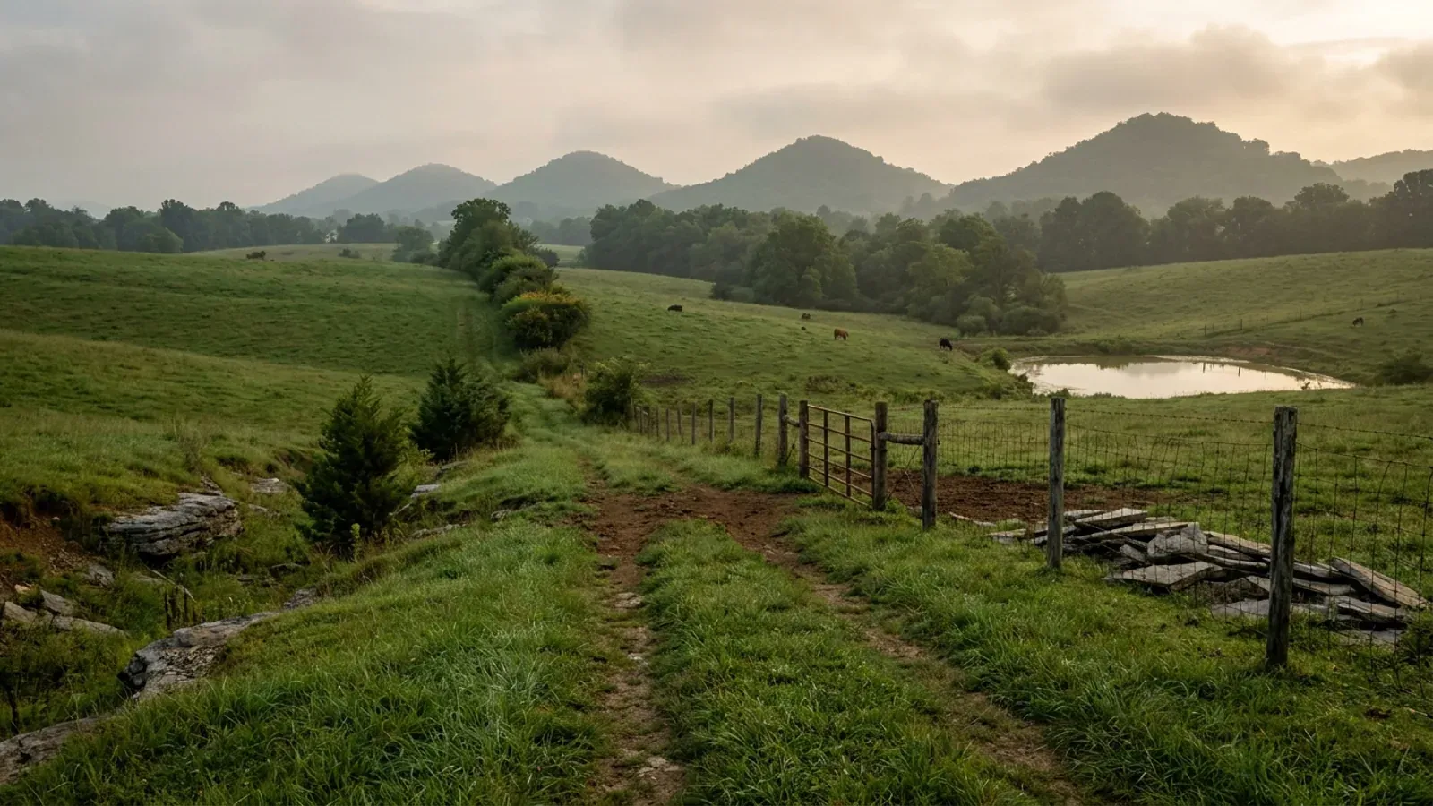
Lincoln County is the most fully regulated of the four counties it touches, and that is the single most useful thing to know before buying ground here. It runs a county building inspection program with a published residential fee schedule and a four-stop inspection sequence ending in a certificate of occupancy, and it is one of the minority of Kentucky counties that also adopted planning and zoning under KRS Chapter 100 - the Lincoln County Zoning Ordinance, administered by the Lincoln County/Cedar Creek Planning Commission from the courthouse basement at 102 East Main Street in Stanford. Directly north-east, Garrard County inspects every house and has no zoning at all. Directly south-east, the state's directory sheet for Rockcastle County names no local building inspector. Casey, to the west, has neither a located zoning office nor a county ordinance index. So the reader crossing into Lincoln is crossing into a place where a plan gets reviewed twice, and the numbers that decide what fits are actually published. In the A-1 agricultural district that covers most of the rural county, a dwelling needs one acre, 125 feet of road frontage, 75 feet of width at the building line, a 60-foot front yard, 25-foot side yards and a 50-foot rear yard - and the maximum building height is printed N/A, so the ordinance sets no ceiling on how tall a shop or a two-storey living end may be. Nor does it cap floor area: Section 830 puts accessory buildings in rear yards only, five feet off other buildings and five feet off the line, and stops there. Around Cedar Creek Lake in the county's south-east the same district doubles to five acres and 200 feet of frontage, which is the one place in Lincoln where a small tract will not work. The land itself is Outer Bluegrass farmland tilting into the Knobs along the southern and eastern edges, drained north by the Dix River and the Hanging Fork toward the Kentucky River and west by the headwaters that become the Green. USDA counts 984 farms across 147,519 acres - about 69 percent of the county's 332.9 square miles - with 361 of those farms in the 50-to-179-acre band that suits this building type best, and Lincoln ranks first in Kentucky for nursery, greenhouse, floriculture and sod sales. At roughly 73 people per square mile it is emptier than Boyle next door and busier than Casey, which is about right for a county whose rules are written down.
Lincoln County at a glance
- County
- Lincoln
- Population
- 24,275
- ZIP codes
- 40484, 40419, 40437, 40489, 40442, 40448
- Site visits
- Site visits across Stanford, Crab Orchard, Hustonville, Waynesburg, Kings Mountain, McKinney and the Cedar Creek Lake shore
Building conditions in Lincoln County
The building code is the same in every Kentucky county, and no local government may adopt or enforce a different one on a house — the Kentucky Residential Code says so in its own text. The design criteria are settled by the state too: the code prints a filled-in table covering all 120 counties, so your county's ground snow load, frost depth and seismic design category are published figures rather than something a local office decides. Ultimate design wind speed is 115 mph for every county in the state.
What changes from one county to the next is whether anyone checks. Kentucky makes permits, inspections and certificates of occupancy optional for a single-family home unless the local government has passed an ordinance requiring them, and it forbids the state from stepping in where none has. Twenty-five counties tell the state outright that they have no local building inspector, and in much of the rest the answer depends on an ordinance the county either passed or never did. Zoning is a separate, equally local choice — most Kentucky counties have never adopted any. What is below covers this county specifically: who issues the permit if anyone does, what the state's tables assign it, and what the ground does to a slab.
https://www.lincolnky.com/departments/building_inspection.php (Lincoln County's own Building page: exempt buildings, applicant checklist, inspection sequence, certificate of occupancy and the full residential and commercial fee schedule; read 6 Sep 2026) · https://www.lincolnky.com/revised%20Lincoln%20County%20Zoning%20Ordinance%20(2).pdf - Lincoln County Zoning Ordinance, Lincoln County/Cedar Creek Planning Commission and Lincoln County Fiscal Court, January 2005 with amendments through 2015, Sections 110, 140 and 310; PDF text extracted and read 6 Sep 2026 · https://www.lincolnky.com/departments/planning_and_zoning.php · https://dhbc.ky.gov/Documents/Lincoln%20County.pdf (sheet updated 2/26/2026, extracted with pdftotext -raw; the -layout pass scrambles these sheets) · https://dhbc.ky.gov/Documents/Garrard%20County.pdf, https://dhbc.ky.gov/Documents/Rockcastle%20County.pdf and https://dhbc.ky.gov/Documents/Boyle%20County.pdf (compared the same way 6 Sep 2026; Rockcastle's Local Building Inspector row reads None)
https://www.lincolnky.com/revised%20Lincoln%20County%20Zoning%20Ordinance%20(2).pdf - Sections 643, 651 (A-1 permitted uses and Development Standards, amended 1st 11-15-2004 and 2nd 12-14-2004) and 850. The Development Standards table was extracted twice, with pdftotext -raw and pdftotext -layout, and reconciled row by row: the -layout pass shifts the label column one row against the value column, printing a 50-foot maximum building height and an N/A for signs, and the -raw pass, which is internally consistent and matches the printed label order, is the one relied on here · https://www.lincolnky.com/revised%20sub%20regs%20(2).pdf - Lincoln County Subdivision Regulations, Section 4.23 Street Rights-of-Way and Grades (arterials 80 ft, collectors 60 ft, local 50 ft); extracted and read 6 Sep 2026 · https://www.lincolnky.com/departments/planning_and_zoning.php
https://www.lincolnky.com/revised%20Lincoln%20County%20Zoning%20Ordinance%20(2).pdf - Section 830 Accessory Buildings, Section 310 Building Permits (exemption c, accessory buildings not attached to a principal building), Section 651 A-1 Development Standards (maximum building height N/A) and Section 850 Exceptions to Height Limitations; extracted and read 6 Sep 2026 · https://www.lincolnky.com/departments/building_inspection.php (the county's own list of exempt buildings: farm buildings, detached garages without living space, unattached decks, non-structural renovations, above-ground pools, sidewalks, retaining walls under 4 ft)
https://dhbc.ky.gov/Documents/2018%20Kentucky%20Residential%20Code%203d%20Ed.pdf - Table R301.2(1) for snow, wind, weathering and termite; Table R301.2.2.1 Seismic Design Categories-Site Class D; Table R403.1.4 Minimum Frost Protection Depth for Kentucky and its backfill and solid-rock provisions; Section R327 for post-frame. All three tables are transcribed county by county in research/statewide/design-criteria-and-climate.md and were read there rather than re-fetched
https://www.nass.usda.gov/Publications/AgCensus/2022/Online_Resources/County_Profiles/Kentucky/cp21137.pdf - 2022 Census of Agriculture, Lincoln County profile. Extracted twice, with pdftotext -raw and pdftotext -layout, and reconciled: the -layout pass shifts the Farms by Size labels one row against their values, so all figures here come from the -raw pass, whose six size bands sum to the printed total of 984 · https://www2.census.gov/geo/docs/maps-data/data/gazetteer/2024_Gazetteer/2024_Gaz_counties_national.zip (2024 Census Gazetteer: Lincoln County GEOID 21137, ALAND_SQMI 332.904, internal point 37.457174 / -84.658335; the file was retrieved and the row read directly 6 Sep 2026) · https://www.lincolnky.com/Lincoln_comp_plan%20(2).pdf (Comprehensive Plan, adopted March 2003 and re-adopted 11 August 2009: total land area approximately 215,000 acres) · research/statewide/geography-and-population.md
https://www.epa.gov/sites/default/files/2014-08/documents/kentucky.pdf and https://radonlevels.org/state/ky (EPA Map of Radon Zones, Kentucky - Lincoln in the 30-county Zone 1 list, Garrard in Zone 2) · https://www.uky.edu/KGS/water/library/gwatlas/wprkarst.html (KGS karst areas, the cities that anchor each, and the 92-of-120 count; no Lincoln County community is named and no county roster is published) · https://kgs.uky.edu/kygeode/geomap?gkarst=true and https://kgs.uky.edu/kgsmap/helpfiles/karst_help.shtm (KGS Karst Potential Index viewer and its three classes) · https://insurance.ky.gov/PPC/Documents/JAN%202025_Revised%20Mine%20Subsidence%20Insurance%20Fund%20080124.pdf (KDOI brochure rev. 08/24 effective 1/1/25; the 37-county list was extracted and read in full 6 Sep 2026 and contains no Lincoln County) · https://www.lincolnky.com/Lincoln_comp_plan%20(2).pdf (Comprehensive Plan residential policy guideline f, slopes greater than 12 percent) · https://www.lincolnky.com/revised%20sub%20regs%20(2).pdf (Sections 4.73 and 4.79 grading permits and exceptions, 4.81 land determined to be unsuitable, and the final-plat requirement to show sinkholes)
Also worth knowing before you build in Lincoln County
- Four flood communities on one map date, none of them in the CRS - and the man who zones the county is also Crab Orchard's floodplain coordinator
- Lincoln County has four National Flood Insurance Program communities and all four participate: unincorporated Lincoln County as CID 210325, the City of Stanford as 210145, the Town of Crab Orchard as 210143 and the City of Hustonville as 210144. All four read the same current effective map dated 17 September 2010, which is unusual and useful - a parcel near a city line is not caught between two vintages of flood map the way it is in some neighbouring counties. Initial identification runs back further: Stanford's first flood hazard boundary map dates to 17 May 1974, Crab Orchard's to 14 June 1974, Hustonville's to 2 August 1974 and the county's to 26 August 1977. None of the four appears on FEMA's Community Rating System eligible list effective 1 April 2026, which carries 42 Kentucky communities of which 33 hold a class better than 10 and therefore earn an actual premium discount. That is worth a number rather than a shrug: Berea, immediately north-east across the Rockcastle line, holds Class 8 and a 10 percent discount and Madison County holds Class 9 and 5 percent, so the same floodplain parcel is cheaper to insure a short drive from here than it is inside Lincoln. Local floodplain administration has one feature that no directory entry makes obvious: Kentucky's Division of Water lists Luther Galloway of the Lincoln County/Cedar Creek Planning Commission, 102 East Main Street, Stanford, 606-365-4507, as the floodplain coordinator for both unincorporated Lincoln County and the Town of Crab Orchard, while Stanford names Scott Maples on 606-879-8755 and Hustonville names Mayor Tim Smith on 606-346-2501. So on a Crab Orchard parcel the flood question and the zoning question go to the same desk in Stanford. The Zoning Ordinance's own Flood Plain District (F) is an overlay superimposed on whatever district is underneath, and it states that no building permits shall be issued within the 100-year floodplain unless the structures are flood proofed and meet all other state and federal flood insurance requirements. On top of any local approval, Kentucky requires a separate state Division of Water floodplain construction permit for construction, fill or obstruction in the floodway or the mapped 100-year floodplain of any stream, under KRS 151.250 and 401 KAR 4:060 Section 2, on form DOW 7116; the state permit stacks on the local one rather than replacing it, and the Dix River, the Hanging Fork and the Green River headwaters are where it most often applies.
- The septic permit comes from a standalone single-county health department, and the environmental office is open 90 minutes a day
- Kentucky mixes multi-county district health departments with standalone single-county ones, and Lincoln is standalone. The Kentucky Cabinet for Health and Family Services lists the Lincoln County Health Department as its own department at 44 Health Way, P.O. Box 165, Stanford KY 40484, 606-365-3106, with its own public health director and its own board of health - it is not part of a district, which matters because the county immediately west, Casey, sits inside the ten-county Lake Cumberland District and works to that district's rules and fee schedule instead. Nor should the name be confused with the Lincoln Trail District Health Department, which is the six-county Elizabethtown district a hundred miles away and has nothing to do with this county. The department publishes its own on-site sewage fees: a site evaluation at $155.00 and a permit at $205.00, alongside a septic installer certification letter, an installer certification chart and an application for an on-site sewage disposal system site evaluation. The timing detail that catches people out is the office hours - environmental services runs Monday to Friday from 8:00 to 9:30 a.m. only, so the window to reach the environmentalist is 90 minutes a day, which is worth planning a soil evaluation around rather than discovering. DHBC's Lincoln County sheet names environmentalist Randal Carrier and prints those same Tuesday morning hours; the county's own Building page names Joe Maciag as the septic contact. The sequence is not optional and both offices state it from their own side: Section 310 of the Zoning Ordinance makes it unlawful to commence excavation until a permit has been issued for a septic system by the County Health Department, and the county Building page lists septic approval from the Lincoln County Health Department second on its checklist of what an applicant must supply the inspector's office. Section 880 of the same ordinance adds that no building or dwelling can be occupied without water supply and sewage disposal facilities approved by the County Health Department.
- Cedar Creek Lake changes the arithmetic: five acres instead of one, and a state stormwater sign-off above five acres
- The planning commission's full name - the Lincoln County/Cedar Creek Planning Commission - is a clue that the lake in the county's south-east is a planning subject in its own right, and the ordinance is titled Lincoln County Zoning Ordinance Including the Cedar Creek Lake Watershed. Inside that watershed the A-1 agricultural district's numbers change across the board: minimum lot area rises from 1 acre to 5, road frontage from 125 feet to 200, width at the building line from 75 feet to 175, the front yard from 60 feet to 80, side yards from 25 to 35 feet and the rear yard from 50 to 60. The ten-acre frontage relaxation that applies elsewhere in the county is written to exclude the watershed explicitly. The Subdivision Regulations add a second layer with real lead time attached: developments involving five acres or more within the Cedar Creek Lake Watershed must submit stormwater plans to the Kentucky Division of Water and file the Division's letter of approval with the Planning Commission alongside the plat approval request, where everything else in the county is reviewed by the Resident Engineer. The ordinance also created a Recreation District (R-R) for high-recreational-value ground, at a 5-acre minimum with 175 feet of frontage, an 80-foot front yard and 75-foot side yards, where every development proposal requires a Development Plan and an Environmental Quality Inventory prepared by professional engineers, planners, architects or landscape architects, and where any land use that would negatively impact the water quality of the Cedar Creek Watershed or Lake is prohibited outright along with oil, gas and coal extraction. None of that makes lake-adjacent building impossible; it makes it a five-acre-minimum, plan-first exercise with a state agency in the loop, which is a different project from a one-acre homesite twenty minutes north-west on the same county's rules.
- Stanford writes its own rules and Crab Orchard writes none - and Crab Orchard's soils are why it has a sewer
- Section 140 limits the county Zoning Ordinance to the unincorporated areas of Lincoln County, so the two towns inside it are separate questions with opposite answers. Stanford runs a full municipal apparatus: a Planning and Zoning Board meeting the last Thursday of each month at 6:00 p.m. in the fire department training room, a Board of Adjustments, an Architectural Review Board, its own zoning ordinance and city map, its own planning and zoning fee schedule and home occupation rules, and a Code Enforcement Officer, Jeff Knouse on 606-879-1002, who takes the city building permit application by e-mail or by post at 403 East Main Street with fees paid online under General Fees. The city's adopted zoning ordinance, dated 15 May 2025, and its fee schedule are both posted as scanned images with no text layer, so their dimensional tables were not read here and are a phone call to the Code Enforcement Officer rather than a download. Crab Orchard is the reverse. Its published ordinance index carries budget, curfew, insurance premium tax, leash law, municipal licence, nuisance, occupational payroll fee, tax rate and yard sale - no zoning ordinance and no building code ordinance - and the city's own contact page lists Lincoln Co Planning and Zoning 606-365-4507 among its helpful numbers, which is the county planning office in Stanford. One physical fact shapes building around Crab Orchard more than any ordinance does. The county's Comprehensive Plan records that the terrain of Crab Orchard is basically flat with tight, low permeability soil types that are unsuitable for septic systems, and that in 1981-82 the city, coping with a chronic septic tank failure rate, took EPA, HUD and FmHA grant and loan support to build sewer lines and a lagoon treatment plant, which now serves all city residents plus six customers outside the limits. Inside those limits sewer solves the problem. Just outside them, on the same soils, the health department's site evaluation is the step that decides whether a parcel works, and it should come before an offer rather than after.
- You can live on the site while you build - but the permit is for a mobile home, it runs one year, and it costs $25
- Lincoln County wrote the temporary-dwelling question into its zoning ordinance rather than into a standalone camper ordinance, and the shape of the permission is different from the one next door. Section 950 allows the Administrative/Enforcement Officer to issue a temporary use permit to an applicant in an A-1 district with a minimum of one acre who is in the process of building a conventional dwelling, to use a mobile home as a temporary dwelling for a maximum of one calendar year during construction. The permit is void after one year or on issuance of the certificate of occupancy, whichever comes first, and the mobile home must be off the property within thirty days of that. It may be renewed for additional six-month periods on a showing of good cause and with permission to do so, and the officer has separate discretion to issue a longer permit for a health or age related circumstance. The temporary unit must have an approved water supply, sewage disposal system and utility connections. The fee is twenty-five dollars, in addition to all other required permits for utilities and sewage disposal. Note what the section does and does not name: it is written around a manufactured or certified mobile home, not a travel trailer. Section 1060 handles recreational equipment separately and it is worded for residential districts - no travel trailer, pick-up camper, motorised dwelling or tent trailer may be used for living, sleeping or housekeeping purposes when parked or stored on a residential lot, or in any location not approved for such use. A-1 is an agricultural district rather than a residential one, so the camper question on farm ground is a question for the planning office at 606-365-4507 and should be asked before the trailer is towed in, not after.
- Two farm exemptions, two different answers - and the ordinance says which one stops at the front door
- The phrase it is a barn, so it is exempt gets used loosely in Kentucky and Lincoln County's own ordinance is unusually explicit about where it stops. The zoning side is Section 710, Special Provisions for Agricultural Areas: land used solely for agricultural, farming, dairying, stock raising or similar purposes shall have no regulations imposed as to height, yard, location or court requirements for agricultural buildings - except that Kentucky Transportation Cabinet setback, sight-distance and drainage requirements still apply for the protection of existing and proposed streets and highways, and except that all buildings or structures in a designated floodway or floodplain, or which tend to increase flood heights or obstruct the flow of flood waters, shall be fully regulated. The section then closes the loophole in one sentence: mobile homes and other dwellings may be permitted as part of an agricultural use of the land but shall have regulations imposed which are applicable, such as zoning, building, and certificates of occupancy. That is the county's own statement of what KRS 100.203(4)(c) does - the exemption reaches the farm's buildings, not the farmhouse. The building-code side is a separate instrument under KRS Chapter 198B and reaches a farm dwelling only on a PVA-registered farm of ten contiguous acres outside city limits, which is a narrow test rather than a general licence. A barndominium is a dwelling with a shop attached, so it is on the regulated side of both lines - while a genuinely separate hay barn or equipment shed on the same tract is on the other side of both, and the county's Building page lists farm buildings among those needing no permit. Two further approvals reach the property no matter which side of that line a structure falls on. KRS 198B.060(11) bars any utility from initiating permanent electrical service to a new building until a certified electrical inspector issues a final certificate of approval. And the Subdivision Regulations exempt accepted agricultural land management practices from the erosion and grading rules while stating that non-agricultural uses permitted in an agricultural zone are not excepted from soil erosion and sediment control.
- Six ZIP codes are seated here and two of them put more of their ground in the next county
- A ZIP code is a mail route and it does not respect a county line, which matters in Lincoln because the county is long, its post offices sit near its edges, and several of them serve more of Casey County than of this one. The six ZIPs seated in Lincoln County are 40484 Stanford, 40419 Crab Orchard, 40437 Hustonville, 40489 Waynesburg, 40442 Kings Mountain and 40448 McKinney. The Census Bureau's 2020 ZIP-code-tabulation-area to county relationship file shows how leaky the western edge is: 40437 Hustonville, a Lincoln County town, has 52 percent of its mapped area inside Casey County and only 48 percent inside Lincoln, and 40442 Kings Mountain splits 54 percent Lincoln to 46 percent Casey. 40489 Waynesburg keeps 86 percent of its area in Lincoln and 40484 Stanford 96 percent, while 40419 Crab Orchard runs 56 percent Lincoln with the balance spilling into Rockcastle and Garrard. In the other direction Lincoln takes slices of five neighbours' ZIPs - 42567 Science Hill, 40422 Danville, 40444 Lancaster, 40409 Brodhead and 40440 Junction City all put some of their area inside this county. The practical consequence is specific and it is worth checking before an offer: whether a parcel answers to the Lincoln County/Cedar Creek Planning Commission or to the City of Stanford's own board, whether the county's building permit or the city's applies, and which floodplain coordinator has jurisdiction, is decided by the parcel boundary against the city limit and the county line, not by the mailing address on the deed.
https://www.fema.gov/api/open/v1/NfipCommunityStatusBook?$filter=state%20eq%20%27KY%27%20and%20county%20eq%20%27LINCOLN%20COUNTY%27 (OpenFEMA machine-readable Community Status Book, retrieved 6 Sep 2026 - all four communities participating, none sanctioned, current effective map 09/17/10 for each) and https://www.fema.gov/cis/KY.html (the same four rows read through the fetch tool, since that host refuses curl) · https://www.fema.gov/sites/default/files/documents/fema_crs_eligible-communities_042026.pdf (CRS Eligible Communities effective 1 April 2026; extracted with pdftotext -raw and all 42 Kentucky rows read and counted directly - 33 hold a class better than 10, Berea 8/10% and Madison County 9/5% - and no Lincoln County, Stanford, Crab Orchard or Hustonville row appears. The list does carry a Lincoln County at CID 290869, which is MISSOURI. Layout-mode extraction of this file misaligns the class column by one row and was not used) · https://eec.ky.gov/Environmental-Protection/Water/FloodDrought/Documents/FloodplainCoordinatorsList.pdf - Kentucky Local Floodplain Coordinators Contact List dated 3 March 2026; the live host returns 404 to both curl and the fetch tool, so it was read 6 Sep 2026 from the Internet Archive capture at http://web.archive.org/web/20260305214953/https://eec.ky.gov/Environmental-Protection/Water/FloodDrought/Documents/FloodplainCoordinatorsList.pdf and the four Lincoln rows were reconciled between -raw and -layout extractions, which agree exactly · https://www.lincolnky.com/revised%20Lincoln%20County%20Zoning%20Ordinance%20(2).pdf (Section 690 Flood Plain District) · https://apps.legislature.ky.gov/law/statutes/statute.aspx?id=54097 · https://apps.legislature.ky.gov/law/kar/titles/401/004/060/
https://www.chfs.ky.gov/agencies/dph/dmch/nsb/Documents/KY%20LHD%20Listing.pdf - Kentucky Local Health Department Listing rev. 3/16/2026; extracted with pdftotext and read 6 Sep 2026, where Lincoln County Health Department appears as its own entry with no local health centres beneath it, between the district listings, and Lincoln Trail District Health Department is a separate six-county entry seated in Elizabethtown · https://lincolncountyhealth.org/environmental/ and https://lincolncountyhealth.org/contact/ (the department's own site: site evaluation $155.00, permit $205.00, environmental hours Monday to Friday 8am-9:30am, 44 Health Way, Stanford KY 40484 - a Kentucky address on a Kentucky-seated department, checked against the several other Lincoln County health departments in other states; read 6 Sep 2026) · https://dhbc.ky.gov/Documents/Lincoln%20County.pdf (health department address and environmentalist, sheet updated 2/26/2026) · https://www.lincolnky.com/departments/building_inspection.php · https://www.lincolnky.com/revised%20Lincoln%20County%20Zoning%20Ordinance%20(2).pdf (Sections 310 and 880) · https://apps.legislature.ky.gov/law/kar/titles/902/010/085/
https://www.lincolnky.com/revised%20Lincoln%20County%20Zoning%20Ordinance%20(2).pdf - title page, Section 651 A-1 Development Standards (both columns, read from the -raw extraction after reconciling against the -layout pass), Section 676 Recreation District (R-R) permitted, conditional and prohibited uses, development plan and Environmental Quality Inventory requirement and development standards; extracted and read 6 Sep 2026 · https://www.lincolnky.com/revised%20sub%20regs%20(2).pdf - Section 4.73(A)(1), stormwater plans for developments of five acres or more within the Cedar Creek Lake Watershed to be submitted to the Kentucky Division of Water; extracted and read 6 Sep 2026
https://stanford.ky.gov/City%20Departments/Pages/Planning-and-Zoning-Board.aspx and https://stanford.ky.gov/City%20Departments/Pages/Code-Enforcement.aspx (City of Stanford, a .ky.gov site: board membership and meeting schedule, Code Enforcement Officer Jeff Knouse 606-879-1002 at 403 E Main Street, city building permit application under the Forms tab; read 6 Sep 2026) · https://stanford.ky.gov/City%20Departments/PublishingImages/Pages/Planning-and-Zoning-Board/05152025_ZONING%20ORDINANCE%20FOR%20THE%20CITY%20OF%20STANFORD.pdf and the city Planning and Zoning Fee Schedule at the same path (both downloaded 6 Sep 2026 and both scans with no extractable text layer, so their contents were not read) · https://craborchard.ky.gov/our-city/Pages/Ordinances.aspx and https://craborchard.ky.gov/our-city/Pages/default.aspx (City of Crab Orchard, a .ky.gov site: the full published ordinance list, and the helpful-numbers page directing planning and zoning to 606-365-4507) · https://www.lincolnky.com/Lincoln_comp_plan%20(2).pdf (Comprehensive Plan, Crab Orchard Sewerage System: flat terrain, tight low-permeability soils unsuitable for septic, the 1981-82 grant-funded system and its 110,000 gallon-per-day lagoon plant) · https://www.lincolnky.com/revised%20Lincoln%20County%20Zoning%20Ordinance%20(2).pdf (Section 140 Jurisdiction) · https://codelibrary.amlegal.com/codes/lincolncountyky/latest/overview and https://codelibrary.amlegal.com/codes/stanfordky/latest/stanford_ky/0-0-0-1 (both of Kentucky.s municipal code publishers refuse automated access and neither copy was read; the jurisdictions' own posted documents were used instead)
https://www.lincolnky.com/revised%20Lincoln%20County%20Zoning%20Ordinance%20(2).pdf - Section 950 Temporary Use of Manufactured or Certified Mobile Homes (circumstances, one-year limit, thirty-day removal, six-month renewals, utility requirements and the $25 fee) and Section 1060 Parking, Storage, Or Use of Major Recreational Equipment; PDF text extracted and both sections read in full 6 Sep 2026 · https://www.lincolnky.com/departments/planning_and_zoning.php
https://www.lincolnky.com/revised%20Lincoln%20County%20Zoning%20Ordinance%20(2).pdf - Section 710 Special Provisions for Agricultural Areas, in full; extracted and read 6 Sep 2026 · https://www.lincolnky.com/revised%20sub%20regs%20(2).pdf - Section 4.73(D)(3), accepted agricultural land management practices and the non-agricultural carve-back · https://www.lincolnky.com/departments/building_inspection.php (farm buildings listed as exempt from the county building permit) · https://apps.legislature.ky.gov/law/statutes/statute.aspx?id=52659 (KRS 198B.060, including subsection (11)) · https://apps.legislature.ky.gov/law/statutes/statute.aspx?id=26719 (KRS 100.203)
https://www2.census.gov/geo/docs/maps-data/data/rel2020/zcta520/tab20_zcta520_county20_natl.txt (2020 ZCTA-to-county relationship file, downloaded and filtered on county GEOID 21137 on 6 Sep 2026; the AREALAND_PART figures against each ZCTA's total land area give the split percentages quoted) · https://www2.census.gov/geo/docs/maps-data/data/gazetteer/2024_Gazetteer/2024_Gaz_counties_national.zip

The expensive surprises are in the ground, not the building
What moves a Kentucky budget is usually below grade, and more often than not it is what the ground is sitting on rather than the ground itself. The Kentucky Geological Survey says 92 of the state's 120 counties contain karst — limestone that dissolves — across four named areas: the Western Pennyroyal around Bowling Green and Hopkinsville, the Inner Bluegrass around Lexington, the Eastern Pennyroyal through Somerset and Monticello, and Pine Mountain in the south-east. On karst, KGS's own model ordinance for local governments lists the structures that should not be sited in sinkhole areas, and the list is buildings with soil-bearing foundations and buildings that cover thousands of square feet with impermeable surface. A post-frame or steel building on a monolithic slab is both of those at once. KGS is equally clear that nearly all karst parcels still have buildable ground on them — so karst does not stop the build, it removes the option of siting the pad by eye. A filled and graded-over sinkhole is the classic trap, because the pad looks perfect.
In the two coal fields the question is undermining instead, and Kentucky treats it differently from everything else: mine subsidence coverage is added automatically to property policies in the counties whose fiscal court voted the fund in, with a written opt-out — thirty-seven of them — while karst collapse gets no fund at all and falls under the ordinary earth-movement exclusion. On slopes the surprise is geographic: KGS's landslide inventory puts Kenton, Campbell, Boone and Gallatin — the northern Kentucky counties opposite Cincinnati — near the very top, above most Appalachian counties, on Ordovician shale. Three of those four — Boone, Campbell and Kenton — are the only counties in the state with a line of their own in the residential code's bearing table, which raises the presumptive value for two named clay groups there and nowhere else. Everywhere else the table gives clay and silt a single presumptive figure, and a soils investigation becomes mandatory once the building official determines the real capacity is likely to be lower than it.
The same ground then sizes the septic system, and Kentucky does that from soil morphology — a certified inspector reading the profile in a backhoe pit — rather than from a percolation test, at 110 gallons a day per bedroom against an application rate taken from soil texture and structure. On a mound or other alternative design a measured permeability test can still be required. And on karst the septic regulation is blunter than the building code ever gets: it declares the ground within seventy feet of an open sinkhole throat unsuitable outright. The soil that needs a foundation engineer is usually the soil that complicates the drainfield, so the site work, the foundation and the septic get resolved together rather than one at a time. We price the dirt before we price the building.
What we build in Lincoln County
All seven services are available in Lincoln County. What a build costs depends far more on the parcel than on square footage, so we price against your land rather than publishing a rate card.
Barndominium Kits
We check barndominium kit packages against the wind, snow, frost and seismic criteria the Kentucky Residential Code publishes for your county.
Pole Barn Homes
Pole barn homes across Kentucky. KRC §R327 covers accessory barns, not houses — so a pole barn home is engineered by the code's own terms.
Custom Barndominium Plans
Barndominium plans drawn to Kentucky's published county design criteria — snow, wind, seismic, frost — with engineering where the code calls for it.
What a build looks like
Three stages every Lincoln County project passes through, from a raw parcel to a finished home. Site work first, because that is where the budget is decided.

The parcel
Karst and mine maps, the flood question, zoning where the county has any, and utility access — all checked before anything is drawn.
Pad and permit
Clearing, grading and a compacted pad, while the submittal works through whichever office issues the permit — and where no office does, through the approvals that still apply.

Frame to finish
Shell erected and dried in, then systems and interior finish — and the certified electrical inspection your utility needs before it will set a meter.
Those are the rules where you are building in Lincoln County. Tell us what you want to build and we will draw it to them.
Where we build around Lincoln County
Lincoln and the rural land around it. The buildable acreage for a project this size usually sits outside the city limits, and in Kentucky that line frequently decides whether anyone issues a permit at all, not merely who issues it.
Keep reading
The questions that usually come next once you know what Lincoln County allows.
Barndominium Cost Guide
Why the published spread runs from one end of the scale to the other, and which of it is the building rather than the ground.
Read itIs It Legal in Kentucky?
Whether your county inspects a house at all, what the farm-dwelling exemption really requires, and the approvals that reach you anyway.
Read itWhat a Pole Barn Home Costs
Post-frame against stick-built, and what the prescriptive post-frame section of the state code does and does not cover.
Read itNearby areas we build in
Others we cover nearby. They share the same statewide code and the same state-published design tables — but whether a house is permitted and inspected at all, whether the county zones, what the health department will accept for septic, and what the ground does to a foundation can all differ from one card to the next. Two counties that touch are not two versions of the same answer.
Building in Lincoln County: common questions
10 questions we get asked most often about building in Lincoln County. If yours is not on the list, ask it directly.
Do I need a building permit for a barndominium in Lincoln County?
Can I build a shop bigger than the house in Lincoln County?
How much land do I need to build here, and is there really acreage in Lincoln County?
What structural design figures does a Lincoln County build have to meet?
Is Lincoln County zoned, and who grants a variance?
Can I live on the property while the build is going up?
Who issues the septic permit and what does it cost?
What about flooding, sinkholes, radon and slopes in Lincoln County?
Does the farm exemption let me skip the permit?
Do I need a contractor's licence to build in Lincoln County?
Building in Lincoln County?
Start with the plan. Tell us what you want to build and we will draw it, then confirm whether any office permits and inspects a house where your parcel is, what it will let you put there, and which line of the state's snow, frost and seismic tables your county falls on. That conversation costs nothing.