Barndominium Builders in Boyle County, KY
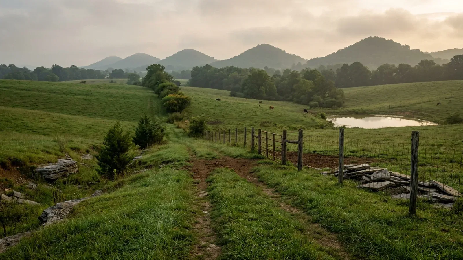
Boyle County is the tidiest regulatory picture in this part of Kentucky, and it is tidy in both directions at once. Every acre of the county is zoned - the Danville-Boyle County Joint Zoning Ordinance states that the Planning and Zoning Commission's area of jurisdiction includes all land within Boyle County, including the cities of Danville, Junction City and Perryville - and every house in that same territory is inspected by one office, the Boyle County Building Inspector at 445 West Main Street in Danville, whose own published construction guide describes itself as a guide for residential construction in Boyle County including all three cities. That is the opposite of the Kentucky default, where roughly eighty of 120 counties have no county zoning at all and where KRS 198B.060(1) makes permits and inspections on a single-family residence discretionary unless the local government adopted an ordinance requiring them. Cross the line into Garrard County to the east and you land in a county that inspects but does not zone; Boyle does both. What that buys a barndominium buyer is a written dimensional table instead of a phone call, and the table is unusually generous in the district that matters. In the Agriculture District the minimum lot is 50,000 square feet whether you are on sewer or septic, the front yard is 50 feet, the side is 10 and the rear is 25, a detached accessory building needs only 25 feet from the front line and 5 from the rear and sides, maximum lot coverage is 25 percent - and the height maximum reads N/A, with no floor-area cap on an accessory building anywhere in the district. Move the same parcel into the Rural Residential district and both of those disappear: the total area of all accessory buildings may not exceed 75 percent of the floor area of the principal building, an accessory building may not exceed the height of the principal structure, and the height maximum is 42 feet. Which of those two districts your ground sits in is therefore the single most consequential thing to establish before you buy. The land underneath is genuinely there. USDA's 2022 Census of Agriculture counts 491 farms across 96,306 acres, which against the county's 180.3 square miles of land area is about 83 percent of Boyle County in farms - the highest farmland share of any county on this axis - and land in farms actually rose 9 percent since 2017 while farm count fell 18 percent, so the average farm grew a third larger to 196 acres. Boyle straddles the Bluegrass and the Mississippian Plateaus: rolling Outer and Inner Bluegrass limestone in the north, the Dix River's limestone-walled valley and Herrington Lake on the east, and the Muldraugh Escarpment rising more than 300 feet across the county from Junction City westward into the Knobs, with Parksville Knob at 1,364 feet the high point.
Boyle County at a glance
- County
- Boyle
- Population
- 31,967
- ZIP codes
- 40422, 40423, 40440, 40468, 40464
- Site visits
- Site visits across Danville, Junction City, Perryville, Parksville, Mitchellsburg, Forkland and the Herrington Lake shore
Building conditions in Boyle County
The building code is the same in every Kentucky county, and no local government may adopt or enforce a different one on a house — the Kentucky Residential Code says so in its own text. The design criteria are settled by the state too: the code prints a filled-in table covering all 120 counties, so your county's ground snow load, frost depth and seismic design category are published figures rather than something a local office decides. Ultimate design wind speed is 115 mph for every county in the state.
What changes from one county to the next is whether anyone checks. Kentucky makes permits, inspections and certificates of occupancy optional for a single-family home unless the local government has passed an ordinance requiring them, and it forbids the state from stepping in where none has. Twenty-five counties tell the state outright that they have no local building inspector, and in much of the rest the answer depends on an ordinance the county either passed or never did. Zoning is a separate, equally local choice — most Kentucky counties have never adopted any. What is below covers this county specifically: who issues the permit if anyone does, what the state's tables assign it, and what the ground does to a slab.
https://www.boyleplanning.org/_files/ugd/a677db_d10e9c9cf62343b8820ad667139324ff.pdf - Danville-Boyle County Joint Zoning Ordinance as amended October 2024, Sections 1.5, 1.12.1.D, 3.2 and 3.4; PDF extracted with pdftotext and read 6 Sep 2026 · https://www.boylecountyky.gov/161/Building-Inspection (permit types, inspector, fee schedule and iWorq portals; read 6 Sep 2026) · https://boylecountyky.gov/DocumentCenter/View/341/Building-Permit-guide--to-the-permit-and-construction-process-2022PDF - Boyle County Building Inspector's Office, Construction Information, revised August 2022; extracted and read in full · https://apps.legislature.ky.gov/law/statutes/statute.aspx?id=52659 (KRS 198B.060)
https://www.boyleplanning.org/_files/ugd/a677db_d10e9c9cf62343b8820ad667139324ff.pdf - Joint Zoning Ordinance as amended October 2024: Section 4.3.5 Agriculture District property development standards and Section 4.3.5.D accessory structures; Section 4.4.4.B general residential development standards table and Section 4.4.4.E accessory structures; Section 4.4.4.C.6 measurement of lot coverage. Both dimensional tables were extracted with pdftotext -raw and pdftotext -layout and reconciled value by value - the layout pass shifts the value column up by one row in each table and was not relied on · https://www.boyleplanning.org/zoning-ordinance
https://www.boyleplanning.org/_files/ugd/a677db_d10e9c9cf62343b8820ad667139324ff.pdf - Section 4.3.5 Agriculture District dimensional table and Section 4.4.4.B and C.5 for lot width and frontage measurement, Joint Zoning Ordinance as amended October 2024 (read 6 Sep 2026; the published file still shows 50,000 sq ft) · https://amnews.com/2025/11/21/boyle-county-holds-public-meeting-on-proposed-zoning-text-amendment/ (The Advocate-Messenger, Boyle County holds public meeting on proposed zoning text amendment) · https://citizenportal.ai/articles/7224832/kentucky/boyle-county/boyle-county-court-sends-proposed-agricultural-lotsize-amendment-back-to-planning-commission-for-more-study (Fiscal Court vote of 25 Nov 2025 returning the amendment to the commission; this is a third-party meeting-coverage service rather than the county's own minutes, and the standing figure should be confirmed with the commission) · https://www.boyleplanning.org/
https://dhbc.ky.gov/Documents/2018%20Kentucky%20Residential%20Code%203d%20Ed.pdf - Table R301.2(1) for snow, wind, weathering and termite; Table R301.2.2.1 Seismic Design Categories-Site Class D; Table R403.1.4 Minimum Frost Protection Depth for Kentucky. Transcribed in research/statewide/design-criteria-and-climate.md and not re-fetched · https://boylecountyky.gov/DocumentCenter/View/341/Building-Permit-guide--to-the-permit-and-construction-process-2022PDF - Boyle County Building Inspector's Office, Construction Information, revised August 2022: the Climatic and Geographic Design Criteria for Boyle County table, the residential construction checklist and the list of adopted codes; PDF extracted and read 6 Sep 2026
https://www.nass.usda.gov/Publications/AgCensus/2022/Online_Resources/County_Profiles/Kentucky/cp21021.pdf - 2022 Census of Agriculture, Boyle County profile. Extracted twice, with pdftotext -raw and pdftotext -layout, and every figure reconciled between the two passes; the layout pass offsets the overview labels and the size-band value column by one row, and the raw pass, whose size bands sum exactly to 491 and whose percentages check against that total, was relied on · https://www2.census.gov/geo/docs/maps-data/data/gazetteer/2024_Gazetteer/2024_Gaz_counties_national.zip (2024 Census Gazetteer: Boyle County GEOID 21021, ALAND_SQMI 180.336, AWATER_SQMI 2.505, internal point 37.618104 / -84.868352; file retrieved and the row read directly) · https://www.nass.usda.gov/Publications/AgCensus/2022/Online_Resources/County_Profiles/Kentucky/cp21079.pdf and cp21113.pdf in the same series for the Garrard and Jessamine size bands · research/statewide/geography-and-population.md (county densities, 2020 Census)
https://www.uky.edu/KGS/water/library/gwatlas/Boyle/Topography.htm - KGS, Groundwater Resources of Boyle County, Topography of the County, after McGrain and Currens (1978): Outer and Inner Bluegrass, 230 ft relief on the Dix River, the Muldraugh Escarpment from Junction City westward, Parksville Knob at 1,364 ft, and the hummocky lower slopes on soft clay shales · https://www.uky.edu/KGS/water/library/gwatlas/Boyle/Geology.htm (High Bridge Group, Lexington Limestone including the Perryville Member, New Albany Shale, Borden Formation, Salem and Warsaw) · https://www.uky.edu/KGS/water/library/gwatlas/Boyle/Karst.htm and https://kgs.uky.edu/kgsweb/download/gwatlas/gwcounty/boyle/boyleK.pdf - the Boyle County Karst Areas map, legend read from the PDF text layer; the map body is a graphic and the class boundaries were not read from it · https://kgs.uky.edu/kgsweb/download/karst/mc15_12.pdf (KGS: four major karst regions in Kentucky) · https://kgs.uky.edu/kygeode/geomap?gkarst=true (KGS Karst Potential Index viewer) · https://www.epa.gov/sites/default/files/2014-08/documents/kentucky.pdf (EPA radon zones; Boyle is on the Zone 1 list) · https://insurance.ky.gov/PPC/Documents/JAN%202025_Revised%20Mine%20Subsidence%20Insurance%20Fund%20080124.pdf (the 37 participating counties; Boyle is not among them) · https://dhbc.ky.gov/Documents/2018%20Kentucky%20Residential%20Code%203d%20Ed.pdf (Table R401.4.1 and footnotes b and c)
Also worth knowing before you build in Boyle County
- Boyle's Flood Plain District bans buildings outright rather than raising them - and there is no CRS discount here
- Most Kentucky flood ordinances let you build in the mapped floodplain if you raise the lowest floor. Boyle's does not. Section 4.8.1.B of the Joint Zoning Ordinance states that no principal or accessory structures shall be permitted within any area designated as part of the Flood Plain District. A structure on a lot only partly in the district is allowed provided it sits outside the district's limits and its first floor and basement floor are at least 1.5 feet above the regulatory flood-protection elevation - a freeboard requirement half a foot above the one-foot minimum most Kentucky communities apply. The floodplain part of the lot may still be counted toward the yard and setback requirements of the adjoining district under single ownership, which is a genuine allowance on a creek-bottom parcel. Permitted uses inside the district are open-space only: general farming, pasture, orchards, ponds, lawns, play areas and gardens, plus public recreation, docks, piers and boat ramps. Removing the designation from the zoning map is not a routine rezoning either - Section 3.14 requires evidence certified by a Kentucky registered professional engineer that the designation is in error, or that the area can be filled to or above the regulatory flood protection elevation without causing on-site or off-site damage and without increasing flood levels during the base flood, plus contiguity and access over land outside the district, and no such amendment takes effect until FEMA or the authorised state agency approves it. On the maps themselves, FEMA's Kentucky Community Status Book lists unincorporated Boyle County as community 210322C with an initial FHBM of 19 August 1977, an initial FIRM of 15 May 1986 and a current effective map dated 16 October 2025 - so the county is working from brand-new panels. Danville is community 210019C on the same 16 October 2025 map date, Perryville is 210020C on 23 May 2023, and Junction City is 210377. None of the four appears on FEMA's Community Rating System eligible list effective 1 April 2026, which carries 42 Kentucky communities of which 33 hold a class better than 10 and therefore earn a real premium discount. The nearest classes that do earn one are Nicholasville at 8, Berea at 8, Richmond at 8 and Madison County at 9; Jessamine County itself sits at class 10, which is a 0 percent discount. On top of any local approval, Kentucky requires a separate state Division of Water floodplain permit for construction in the base floodplain under KRS 151.250 and 401 KAR 4:060 Section 2, applied for on form DOW 7116, and it stacks on the local permit rather than replacing it. Along the Dix River, the Herrington Lake shore, Clarks Run through Danville and North Rolling Fork in the southwest is where it most often applies.
- The septic permit comes from Boyle County's own health department, not from a multi-county district
- Kentucky mixes multi-county district health departments with standalone single-county ones and the difference matters when you are trying to reach the person who will dig your test holes. Boyle is standalone: the Boyle County Health Department at 448 South Third Street in Danville, 859-236-2053, has its own twelve-member Boyle County Board of Health and serves this county alone - unlike, for instance, the WEDCO district north of here that covers three counties from Cynthiana. Its environmental services include the on-site sewage programme, and the environmentalists named on both the county building inspector's contact sheet and DHBC's Boyle County sheet are Jason Stevens and Brittany Elkins. Published office hours run Monday 8:00 a.m. to 5:30 p.m. through Friday 8:00 a.m. to 3:00 p.m. Two scheduling facts are worth knowing before you plan a build. The state plumbing inspector, Mark Long, holds office hours at the health department on Monday and Thursday mornings only, 8:00 to 9:30 a.m., on 859-236-2053 extension 121 or cell 859-582-7273 - so the plumbing plan submission has a narrow window each week. And the county's own construction timeline puts the plumbing plan submission at the same step as the building permit application, before the first footer inspection, so the septic work is upstream of the concrete rather than parallel to it. The department does not publish its fee schedule or its site-evaluation application online, so the fees and the backhoe requirement have to be settled on the phone. The joint zoning ordinance refers to the department in several use standards as the Boyle County District Health Department, which is a naming difference rather than evidence of a multi-county district. Note also that the health department's address is printed with the 40423 ZIP, which is Danville's post-office box range.
- Kentucky certifies no builder - but Boyle County requires a county contractor licence before work starts
- The building inspector's own guide states it plainly: Kentucky does not require contractors or builders to be certified, though plumbers, electricians and HVAC installers must be licensed to legally work on a project. Then it adds a county rule that catches out builders coming in from a neighbouring county. Boyle County has an ordinance requiring workers involved in the construction trade to obtain a contractor's or subcontractor's licence and register with the county occupational tax office, and the guide states that contractors shall provide proof of insurance, a contractor's licence and workers' compensation to the building inspector in order for the start of construction to be approved. The county runs a dedicated contractor licensing portal alongside its permit portal. A list of contractors and subcontractors on the job must be turned in to the building inspector by the framing inspection, and the guide's last page is that form. Occupational tax registration runs through the courthouse at 321 West Main Street, 859-238-1100. Two more procedural details from the same guide are worth carrying. The county expects the code-required certification stickers - an insulation installer's label attesting to the R-values installed, and a sticker inside the electrical panel - because all installers must certify the work they have done. And engineering specification sheets for all trusses, I-joists, laminated veneer lumber and steel beams must be handed to the building inspector, with span limits shown; the guide warns that trusses and engineered members may not be cut, notched, spliced or altered, and that additional loads such as HVAC equipment or a water heater may not be hung from a truss, without the approval of a registered design professional. On a post-frame or steel building with a long clear span and mechanical equipment in the attic, that last line is the one that gets missed.
- One address, three counters - and one Board of Adjustments for the whole county
- 445 West Main Street in Danville holds the Boyle County Building Inspector's Office, the Danville-Boyle County Planning & Zoning Commission and Danville City Hall, which is why a Boyle County build has an unusually short walk between approvals. The commission is open Monday to Friday 8:30 a.m. to 4:00 p.m. on 859-238-1235 or 859-936-6851, and runs a monthly Coffee with a Planner session at The Downtown Hub on the third Thursday at 10 a.m. - an informal question session with the planning director, which is the cheapest way to test a site plan before it costs anything. Variances, conditional use permits, administrative appeals and non-conforming use questions all go to a single Danville-Boyle County Board of Adjustments whose jurisdiction is all land within Boyle County. It has seven citizen members: three appointed by the Boyle County Judge/Executive, three by the Mayor of Danville, and one joint member by the Mayors of Junction City and Perryville. The ordinance permits each city to stand up its own additional board limited to its own boundaries under KRS 100.217, but the county-wide board is the standing route. The planning director serves as the Administrative Official under KRS 100.271, makes written interpretations of the ordinance, reviews building and zoning permits for conformance, may inspect premises to enforce the ordinance, and may issue citations under KRS 100.991. Two structural rules follow from this arrangement. Section 1.8 provides that where the ordinance conflicts with any ordinance of Danville, Junction City or Perryville, or with any private covenant or deed, the most restrictive applies - so a recorded subdivision covenant can forbid the shop the AG district would allow. And a residential build never needs a Zoning Permit: under Section 3.3 those are required in unincorporated Boyle County only for non-residential structures and signs, in Danville only for multi-family, institutional, commercial and industrial work, and not at all inside Junction City or Perryville.
- The ordinance has a temporary construction unit - it does not publish a live-in-a-camper allowance
- Owner-builders regularly ask whether they can park a camper on the land and live in it while the house goes up, and Boyle County's ordinance does not answer that question the way some neighbouring counties do. What Section 5.3.1 provides is a Temporary Construction Unit: it may be located within the districts shown on the Use Table following the issuance of a Building and Zoning Permit for construction on that parcel, and it must be removed within 30 days of occupancy of the building constructed under the permit, or within 30 days after the permit terminates or expires, whichever comes first. That is a construction-office provision by its terms rather than a residency permission. Working in the other direction, the accessory-structure rules in both the Agriculture District and the residential districts require accessory buildings and structures to be permanently affixed to the ground and expressly exclude a mobile home, bus, travel trailer, RV, trailer, cooler, vehicle or freight container - so a camper cannot become an accessory structure on the lot by sitting there. The definitions article separately distinguishes a recreational vehicle from a mobile home. There is no standalone recreational-vehicle ordinance published alongside the zoning ordinance the way there is one county east. The practical consequence is that this is a question to put to the Planning & Zoning Commission on 859-238-1235 in writing before the camper is towed, not after - and to put to the health department at the same time, because temporary sanitation is their side of it. Manufactured and modular homes, by contrast, are squarely permitted residential unit types in both the Agriculture and Rural Residential districts, alongside single-family detached and accessory apartments, so a manufactured home as an interim dwelling is a different and clearer conversation than a camper.
- Two source traps on this county, and a fee schedule that has to be collected on paper
- Three practical notes about working with Boyle County's published record, because two of them cost time. First, the county's 2025 building permit fee schedule is published as a scanned image with no text layer - extracting it returns a single stray fragment and nothing else - so the current permit fees have to be collected from the office at 859-238-1107 or downloaded and read on screen rather than quoted from here. The same is true of several other county forms. Second, the searches that look most obviously right lead to the wrong state. A search for Perryville city permits returns cityofperryville.com, which is Perryville, Missouri; Perryville, Kentucky's city hall is at 216 South Buell Street, 859-332-8361. A search for a Danville flood-insurance class turns up Danville, Borough of, in Pennsylvania on FEMA's Community Rating System list, which is not this Danville and does not give this county a discount. And a domain that reads like the health department, boylecountyhealthdept.com, redirects to an unrelated commercial site; the department is at boylehealth.com. Third, the county publishes two versions of its construction guide in its document centre under different view numbers, and the one to read is the August 2022 revision. On the codes themselves, the guide names the Kentucky Building Code as a mini-maxi code - a statewide uniform mandatory building code that no local government may add to or replace - except that the Kentucky Residential Code governs detached single-family dwellings, two-family dwellings and townhouses. That is why a Boyle County inspection is an inspection against the state's residential book rather than against a locally written one, and why the only genuinely local dimensional rules you have to satisfy are the zoning ones.
https://www.boyleplanning.org/_files/ugd/a677db_d10e9c9cf62343b8820ad667139324ff.pdf - Joint Zoning Ordinance, Section 4.8.1 General Flood Plain District and Section 3.14 Special Procedures in Flood Plain District; extracted and read 6 Sep 2026 · https://www.fema.gov/cis/KY.html (Kentucky Community Status Book: Boyle County 210322C, Danville 210019C, Perryville 210020C, Junction City 210377; this host refuses curl and was read through the fetch tool instead) · https://www.fema.gov/sites/default/files/documents/fema_crs_eligible-communities_042026.pdf (CRS Eligible Communities effective 1 April 2026; the Kentucky block was extracted with pdftotext -raw, all 42 rows read and counted directly, and no Boyle County community appears. Layout-mode extraction of this file misaligns the class column and gives Berea a 9 where the raw pass gives 8, and was not used) · https://apps.legislature.ky.gov/law/statutes/statute.aspx?id=54097 · https://apps.legislature.ky.gov/law/kar/titles/401/004/060/
https://www.boylehealth.com/portfolio/environmental-services/ (Boyle County Health Department environmental services, on-site sewage programme inspections, 448 South Third Street Danville KY 40423, 859-236-2053, published hours; read 6 Sep 2026) · https://www.boylehealth.com/ · https://dhbc.ky.gov/Documents/Boyle%20County.pdf (DHBC Boyle County sheet updated 25 Feb 2026: health department address, environmentalists Jason Stevens and Brittany Elkins, plumbing inspector Mark Long and his Monday/Thursday 8:00-9:30 a.m. office hours) · https://boylecountyky.gov/DocumentCenter/View/341/Building-Permit-guide--to-the-permit-and-construction-process-2022PDF (contact list and construction timeline placing plumbing plan submission with the building permit application) · https://www.boyleplanning.org/_files/ugd/a677db_d10e9c9cf62343b8820ad667139324ff.pdf (the ordinance's Boyle County District Health Department Rules and Regulations references). A separate domain, boylecountyhealthdept.com, redirects to an unrelated commercial site and is not the department
https://boylecountyky.gov/DocumentCenter/View/341/Building-Permit-guide--to-the-permit-and-construction-process-2022PDF - Boyle County Building Inspector's Office, Construction Information, revised August 2022: introduction on contractor certification and the county licence ordinance, the construction timeline, the engineered building materials page and the contractor/subcontractor list; PDF extracted and read in full 6 Sep 2026 · https://www.boylecountyky.gov/161/Building-Inspection (permit portal and contractor licensing portal) · https://www.boylecountyky.gov/101/Departments (Occupational Tax Business Information) · https://www.boylecountyky.gov/168/Occupational-Tax-Business-Information (forms and online registration; rates and fees are not published on the page and should be taken from the office on 859-238-1100)
https://www.boyleplanning.org/_files/ugd/a677db_d10e9c9cf62343b8820ad667139324ff.pdf - Joint Zoning Ordinance as amended October 2024: Sections 1.8, 1.12.1.D, 1.12.2, 1.12.3 and 3.3; extracted and read 6 Sep 2026 · https://www.boyleplanning.org/ (address, phone numbers, hours and the Coffee with a Planner schedule) · https://www.danvilleky.org/236/Ordinances (Danville City Hall, 445 W Main Street, 859-238-1200) · https://www.boylecountyky.gov/161/Building-Inspection (Boyle County Building Inspector's Office at 445 West Main Street, PO Box 670)
https://www.boyleplanning.org/_files/ugd/a677db_d10e9c9cf62343b8820ad667139324ff.pdf - Joint Zoning Ordinance, Section 5.3.1 Temporary Construction Unit, Section 4.3.4 and 4.4.1.B permitted residential unit types, Section 4.3.5.D.1 and 4.4.4.E.7 on permanent affixture and excluded vehicle types, and the Article 2 definitions of Mobile Home, Modular Home and Recreational Vehicle; extracted and read 6 Sep 2026. No separate recreational-vehicle or camper ordinance appears among the county's published documents · https://www.boylecountyky.gov/101/Departments
https://www.boylecountyky.gov/DocumentCenter/View/691/ (2025 Building Permit Fee Schedule; the file was downloaded and pdftotext returned no usable text, so it is a scan without a text layer and its contents are not reproduced here) · https://boylecountyky.gov/DocumentCenter/View/341/Building-Permit-guide--to-the-permit-and-construction-process-2022PDF and https://www.boylecountyky.gov/DocumentCenter/View/118/Building-Permit-Guide-A-guide-to-the-permit-and-construction-process-PDF (two copies of the construction guide in the county document centre; the 2022 revision was the one read) · https://www.fema.gov/sites/default/files/documents/fema_crs_eligible-communities_042026.pdf (the Danville on this list is Danville, Borough of, PA, CID 420714) · https://www.boylehealth.com/ · https://www.boylecountyky.gov/161/Building-Inspection

The expensive surprises are in the ground, not the building
What moves a Kentucky budget is usually below grade, and more often than not it is what the ground is sitting on rather than the ground itself. The Kentucky Geological Survey says 92 of the state's 120 counties contain karst — limestone that dissolves — across four named areas: the Western Pennyroyal around Bowling Green and Hopkinsville, the Inner Bluegrass around Lexington, the Eastern Pennyroyal through Somerset and Monticello, and Pine Mountain in the south-east. On karst, KGS's own model ordinance for local governments lists the structures that should not be sited in sinkhole areas, and the list is buildings with soil-bearing foundations and buildings that cover thousands of square feet with impermeable surface. A post-frame or steel building on a monolithic slab is both of those at once. KGS is equally clear that nearly all karst parcels still have buildable ground on them — so karst does not stop the build, it removes the option of siting the pad by eye. A filled and graded-over sinkhole is the classic trap, because the pad looks perfect.
In the two coal fields the question is undermining instead, and Kentucky treats it differently from everything else: mine subsidence coverage is added automatically to property policies in the counties whose fiscal court voted the fund in, with a written opt-out — thirty-seven of them — while karst collapse gets no fund at all and falls under the ordinary earth-movement exclusion. On slopes the surprise is geographic: KGS's landslide inventory puts Kenton, Campbell, Boone and Gallatin — the northern Kentucky counties opposite Cincinnati — near the very top, above most Appalachian counties, on Ordovician shale. Three of those four — Boone, Campbell and Kenton — are the only counties in the state with a line of their own in the residential code's bearing table, which raises the presumptive value for two named clay groups there and nowhere else. Everywhere else the table gives clay and silt a single presumptive figure, and a soils investigation becomes mandatory once the building official determines the real capacity is likely to be lower than it.
The same ground then sizes the septic system, and Kentucky does that from soil morphology — a certified inspector reading the profile in a backhoe pit — rather than from a percolation test, at 110 gallons a day per bedroom against an application rate taken from soil texture and structure. On a mound or other alternative design a measured permeability test can still be required. And on karst the septic regulation is blunter than the building code ever gets: it declares the ground within seventy feet of an open sinkhole throat unsuitable outright. The soil that needs a foundation engineer is usually the soil that complicates the drainfield, so the site work, the foundation and the septic get resolved together rather than one at a time. We price the dirt before we price the building.
What we build in Boyle County
All seven services are available in Boyle County. What a build costs depends far more on the parcel than on square footage, so we price against your land rather than publishing a rate card.
Barndominium Kits
We check barndominium kit packages against the wind, snow, frost and seismic criteria the Kentucky Residential Code publishes for your county.
Pole Barn Homes
Pole barn homes across Kentucky. KRC §R327 covers accessory barns, not houses — so a pole barn home is engineered by the code's own terms.
Custom Barndominium Plans
Barndominium plans drawn to Kentucky's published county design criteria — snow, wind, seismic, frost — with engineering where the code calls for it.
What a build looks like
Three stages every Boyle County project passes through, from a raw parcel to a finished home. Site work first, because that is where the budget is decided.

The parcel
Karst and mine maps, the flood question, zoning where the county has any, and utility access — all checked before anything is drawn.
Pad and permit
Clearing, grading and a compacted pad, while the submittal works through whichever office issues the permit — and where no office does, through the approvals that still apply.

Frame to finish
Shell erected and dried in, then systems and interior finish — and the certified electrical inspection your utility needs before it will set a meter.
Those are the rules where you are building in Boyle County. Tell us what you want to build and we will draw it to them.
Where we build around Boyle County
Boyle and the rural land around it. The buildable acreage for a project this size usually sits outside the city limits, and in Kentucky that line frequently decides whether anyone issues a permit at all, not merely who issues it.
Keep reading
The questions that usually come next once you know what Boyle County allows.
Barndominium Cost Guide
Why the published spread runs from one end of the scale to the other, and which of it is the building rather than the ground.
Read itIs It Legal in Kentucky?
Whether your county inspects a house at all, what the farm-dwelling exemption really requires, and the approvals that reach you anyway.
Read itWhat a Pole Barn Home Costs
Post-frame against stick-built, and what the prescriptive post-frame section of the state code does and does not cover.
Read itNearby areas we build in
Others we cover nearby. They share the same statewide code and the same state-published design tables — but whether a house is permitted and inspected at all, whether the county zones, what the health department will accept for septic, and what the ground does to a foundation can all differ from one card to the next. Two counties that touch are not two versions of the same answer.
Building in Boyle County: common questions
9 questions we get asked most often about building in Boyle County. If yours is not on the list, ask it directly.
Do I need a building permit for a barndominium in Boyle County?
Can I build a shop bigger than the house in Boyle County?
How much land do I need, and is there really acreage in Boyle County?
What structural design figures does a Boyle County build have to meet?
Is Boyle County zoned, and who grants a variance?
What about flooding, sinkholes and slopes in Boyle County?
Does the farm exemption let me skip the permit or the zoning here?
Who issues the septic permit, and when in the sequence does it happen?
Does Danville or Perryville have its own building department?
Building in Boyle County?
Start with the plan. Tell us what you want to build and we will draw it, then confirm whether any office permits and inspects a house where your parcel is, what it will let you put there, and which line of the state's snow, frost and seismic tables your county falls on. That conversation costs nothing.