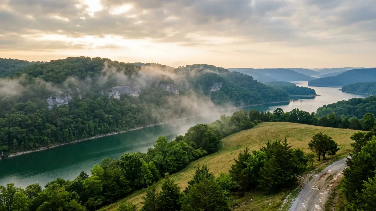
Barndominium Builders in Adair County, KY
Adair County is 405 square miles of Mississippian Plateaus farm country on the divide between the Green and the Cumberland, with Columbia — the county's only incorporated city — sitting at 750 feet at the courthouse, on the Louie B. Nunn Cumberland Parkway. It is genuinely agricultural ground: USDA's 2022 Census of Agriculture counts 1,074 farms across 142,751 acres, about 55 percent of the county, and ranks Adair second in Kentucky for milk sales and ninth for cattle and calves out of 120 counties. The regulatory picture is unusually plain, and it is plain because the county says so itself rather than because nothing could be found. Adair County government publishes an Ordinances and Codes page, and it carries exactly three documents — a district boundaries reapportionment ordinance, an occupational license tax ordinance and a business license ordinance. There is no building code ordinance and no zoning ordinance on it, no planning commission or codes office among the county's departments, and the planning-and-zoning contact published against Adair in the state directory resolves to Columbia City Hall. Inside the Columbia city limits the picture changes: the city employs a Planning and Zoning Administrator and a Code Enforcement Officer, runs a Planning and Zoning Board that hears rezoning cases in city hall, and uses conventional district labels such as C-2 Highway Oriented Commercial. What binds on both sides of that line is the Lake Cumberland District Health Department's septic permit on a 22,000 square foot minimum lot, the state electrical certificate without which no utility may set a meter, and — near Russell Creek, the Green River or Green River Lake — the Commonwealth's own floodplain permit. Two ground conditions here deserve a look before a slab is designed: the Ste. Genevieve and St. Louis limestones that underlie the county's rolling karst, and the Chattanooga Shale, which the Kentucky Geological Survey maps at the surface in Adair and warns about by name a county to the east.
Adair County at a glance
- County
- Adair
- Population
- 18,903
- ZIP codes
- 42728, 42753, 42715, 42741, 42742
- Site visits
- Same day
Building conditions in Adair County
The building code is the same in every Kentucky county, and no local government may adopt or enforce a different one on a house — the Kentucky Residential Code says so in its own text. The design criteria are settled by the state too: the code prints a filled-in table covering all 120 counties, so your county's ground snow load, frost depth and seismic design category are published figures rather than something a local office decides. Ultimate design wind speed is 115 mph for every county in the state.
What changes from one county to the next is whether anyone checks. Kentucky makes permits, inspections and certificates of occupancy optional for a single-family home unless the local government has passed an ordinance requiring them, and it forbids the state from stepping in where none has. Twenty-five counties tell the state outright that they have no local building inspector, and in much of the rest the answer depends on an ordinance the county either passed or never did. Zoning is a separate, equally local choice — most Kentucky counties have never adopted any. What is below covers this county specifically: who issues the permit if anyone does, what the state's tables assign it, and what the ground does to a slab.
https://adaircounty.ky.gov/about/Pages/Ordinances-and-Codes.aspx (the county's own ordinance index, read 6 Sep 2026 — the three linked files are district-boundaires-reapportionment-ordinance.pdf, occupational-license-tax-ordinance.pdf and Business License Ordinance.pdf, the last of which is a five-page image scan with no text layer) · https://adaircounty.ky.gov/departments/Pages/default.aspx · https://adaircounty.ky.gov/elected-officials/Pages/Judge-Executive.aspx · https://apps.legislature.ky.gov/law/statutes/statute.aspx?id=52659
https://dhbc.ky.gov/Documents/Adair%20County.pdf (sheet updated 2/3/2025; text extracted with pdftotext -raw and read 6 Sep 2026 — the -layout pass scrambles these sheets and only -raw is readable) · https://dhbc.ky.gov/docs_cols.aspx?cat=312 (index page; all 119 linked county sheets were downloaded and extracted on 6 Sep 2026 and searched for the same name and number, which returned Adair only — a search for the surname otherwise returns only a state HVAC inspector in four Bluegrass counties) · https://dhbc.ky.gov/Documents/Casey%20County.pdf and https://dhbc.ky.gov/Documents/Russell%20%20County.pdf for the neighbouring comparison
https://kadisonline.org/planning-zoning/ (statewide planning-and-zoning contact directory — the ADAIR entry reads 116 CAMPBELLSVILLE ST / COLUMBIA KY 42728 / 270-384-6183 and links cityofcolumbiaky.com, read 6 Sep 2026) · https://cityofcolumbiaky.com/departments/ (the same 116 Campbellsville Street address, and 270-384-6183 published for Mayor Pamela Hoots) · https://adaircounty.ky.gov/about/Pages/Ordinances-and-Codes.aspx · https://kaco.org/articles/planning-and-zoning-101-for-counties/ (Kentucky Association of Counties, 58 planning / 40 zoning as of 2025) · https://apps.legislature.ky.gov/law/statutes/chapter.aspx?id=38316 · https://www2.census.gov/geo/docs/maps-data/data/gazetteer/2024_Gazetteer/2024_Gaz_place_national.zip (2024 Gazetteer places file, filtered to Kentucky 6 Sep 2026: Columbia city is the only incorporated place among Adair County's named communities, the rest — Knifley, Gradyville, Breeding, Glens Fork, Cane Valley and the others — being unincorporated)
https://kgs.uky.edu/kgsweb/download/gwatlas/gwcounty/adair/ADAIRK.pdf (Kentucky Geological Survey, "Adair County Karst Areas", legend Intense Karst / Karst Prone / Non-karst, source Geologic Map of Kentucky 1:500,000; downloaded and read 6 Sep 2026) · https://www.uky.edu/KGS/water/library/gwatlas/Adair/Topography.htm and .../GWavailability.htm (Carey and Stickney, Groundwater Resources of Adair County, Kentucky, KGS County Report 1, Series XII, 2001 — the topography discussion is quoted there from McGrain and Currens, 1978) · https://www.uky.edu/KGS/water/library/gwatlas/wprkarst.html (KGS karst regions and the cities that anchor them; no Adair community named) · https://kgs.uky.edu/kygeode/geomap?gkarst=true · https://apps.legislature.ky.gov/law/kar/titles/902/010/085/
https://www.uky.edu/KGS/water/library/gwatlas/Adair/Geology.htm and .../GWavailability.htm (Carey and Stickney, Groundwater Resources of Adair County, KGS County Report 1, Series XII, 2001 — the Chattanooga Shale is listed among the county's geologic formations and described under its own heading; read 6 Sep 2026) · https://kgs.uky.edu/kgsweb/download/misc/landuse/RUSSELL/russellissues.htm (KGS land-use issues page for the adjoining county, source of the pyrite-oxidation and gypsum-heave description and of the yellow-weathering tell; KGS publishes no equivalent land-use page for Adair, so the mechanism is attributed to the page that carries it) · https://kgs.uky.edu/kgsweb/olops/pub/kgs/IC25_12.pdf
https://www.nass.usda.gov/Publications/AgCensus/2022/Online_Resources/County_Profiles/Kentucky/cp21001.pdf (2022 Census of Agriculture, Adair County profile, FIPS 21001 — extracted 6 Sep 2026 both ways, pdftotext -layout and pdftotext -raw, and reconciled row by row: the -layout pass shifts the percent-change column up by one row against the label column on the Total and Per Farm Overview table and interleaves the two Farms by Size columns, so every figure here is taken from the -raw pass, which reconciles against the printed totals — the six size bands sum to 1,074 and their percentages to 100, and the four land-use components sum to 142,751 exactly) · https://www2.census.gov/geo/docs/maps-data/data/gazetteer/2024_Gazetteer/2024_Gaz_counties_national.zip (2024 Gazetteer: Adair County GEOID 21001, 405.292 sq mi land, 7.101 sq mi water, internal point 37.105559 / -85.28138) · https://www.nass.usda.gov/Publications/AgCensus/2022/Online_Resources/County_Profiles/Kentucky/cp21207.pdf for the Russell County comparison
Also worth knowing before you build in Adair County
- 15 psf snow, 24 inch frost, seismic category B — the lightest structural case Kentucky publishes
- Three separate Kentucky Residential Code tables answer for Adair, and each figure belongs to the table that publishes it. Table R301.2(1) gives Adair a ground snow load of 15 psf, the statewide floor, against 20 psf on the Ohio River tier and in the named eastern mountain counties. Table R403.1.4, Minimum Frost Protection Depth for Kentucky, places Adair in its All other KY Counties row at 24 inches; the deeper 27, 30 and 33 inch values apply only to named eastern and northern counties. Table R301.2.2.1 assigns Seismic Design Category B, which triggers IRC R301.2.2 Exception 1 and exempts a detached one- or two-family dwelling from the seismic provisions altogether. Statewide values fill in the rest: 115 mph ultimate wind from Table R301.2(1) with the code's own instruction that topographic effects shall be investigated, severe weathering probability for concrete, and moderate to heavy termite probability. That is about as light a design case as the Commonwealth issues, and it means an Adair County shell is sized by wind and its own dead load. Two footnotes that cost money if missed. The 24 inch frost depth is deeper than the turned-down edge on many kit slab details, and the frost-protected shallow foundation alternative is not available for an unheated shop bay. And the Kentucky Residential Code's own prescriptive post-frame section, §R327, sets a 48 inch minimum footing depth — double the county frost depth — but is scoped to single-storey residential accessory structures within stated size limits, so a post-frame home falls outside it and is engineered by the code's own terms.
- The real lot minimum is 22,000 square feet, and Adair has been in the health district since 1982
- With no county zoning there is no county minimum lot size in Adair. The binding floor comes from the Lake Cumberland District Board of Health, a ten-county district — Adair, Casey, Clinton, Cumberland, Green, McCreary, Pulaski, Russell, Taylor and Wayne — which the Adair County Health Department joined in February 1982 after the state cut funding to independent single-county departments. Its lot-size regulation, adopted 14 November 2006 under the authority of KRS 212.230(1)(c) and effective 1 January 2007, provides that a lot created, sectioned or platted off after that date and intended for construction of a home or a building for human habitation shall be a minimum of 22,000 square feet, roughly half an acre; a subdivision lot needs that 22,000 square feet to be suitable or provisionally suitable area as interpreted under 902 KAR 10:085. The sequence surprises people because it runs backwards from what they expect. You apply for an on-site sewage disposal site evaluation with a $227 fee and a floor plan showing bedrooms, laundry, kitchen and baths — the floor plan comes before the septic permit, not after. You dig two to four backhoe pits 42 inches deep and 50 to 100 feet apart in the proposed field area. Once the soil is evaluated the district issues a system write-up and a temporary electric sticker; a certified installer then applies for the septic permit at $271, which releases the plumbing inspector to write a water permit from a copy of it, and the permanent sticker follows the installed system's approval. Two details people miss: no building may have a water meter installed without a plumbing permit issued through a state-authorised plumbing inspector, and the district director or board may grant a hardship variance. One local practicality — the environmentalist keeps office hours at the Adair County Health Department on Tuesday mornings only, 8:00 to 9:30 Central.
- Adair County and Columbia both joined the flood program in 2010, and the 2010 map is still the current one
- FEMA's Community Status Book records two Adair County communities and they tell the same short story. Unincorporated Adair County, CID 210333, and the City of Columbia, CID 210434, both became National Flood Insurance Program participants on 17 December 2010 — and that same date is their initial flood insurance rate map and their currently effective map. There is no earlier flood hazard boundary map on the record for either, and neither map has been revised since. Rank Kentucky's county governments by the date they entered the programme and only eight are later than Adair's, so this is a county that has had a published flood map for about fifteen years rather than fifty. Neither community holds a Community Rating System class, so there is no CRS premium discount here of the kind a Class 8 or 9 community earns. Kentucky's Division of Water names one floodplain coordinator for both jurisdictions — Grant Loy, 107 N High Street, Columbia, 270-384-4760, at the county's emergency management address — so the same person answers for a parcel inside the city limits and one two miles outside. And a local permit is only half of it: under KRS 151.250 and 401 KAR 4:060 section 2 the Commonwealth requires its own floodplain construction permit, form DOW 7116, for construction, fill, obstruction or a structure in the floodway or the mapped 100-year floodplain of any stream — and the state general permit does not cover a new residential structure, so a house in the base floodplain needs an individual state permit on top of anything Adair County asks for. The corridors that matter here are Russell Creek, which drains the county and leaves it at 585 feet, the Green River, and the arm of Green River Lake in the north-west.
- A domestic well is a safe assumption in central Adair and a poor one everywhere else
- This is the most under-appreciated fact about buying rural acreage here, and the Kentucky Geological Survey states it plainly in its Adair county report. About three-quarters of the wells drilled in the uplands of central Adair County yield enough water for a domestic supply, and some that penetrate large solution openings in karst areas yield more than 50 gallons per minute. In the rest of the county, very few wells yield enough water for a domestic supply, except in a few areas bordering streams. Numerous small springs and seeps occur throughout the county, but most discharge less than a gallon a minute. The formation-by-formation detail sharpens it: the New Providence Shale and the Chattanooga Shale yield little or no water to wells at all, the Boyle Dolomite feeds springs but almost no drilled wells, and much of the Fort Payne and Borden country produces from perched water bodies supported by discontinuous shale layers that go dry in late summer and fall. On a parcel without a public water connection the well question deserves settling before the land question, not after, and a neighbour's working well two ridges over is weak evidence where flow follows solution conduits and perched horizons rather than a water table. On quality, KGS records that water from most drilled wells in the county's limestone aquifers is hard, and that common salt and hydrogen sulfide are the two naturally occurring constituents most often found in objectionable amounts.
- No building permit does not mean no approvals — the electric meter is the gate
- KRS 198B.060(11) provides that no utility may initiate permanent electrical service to a new building until a certified electrical inspector has issued a final certificate of approval. That reaches every parcel in Kentucky whatever the county does or does not require on the building side, and it is not a penalty after the fact — it is no meter. DHBC's Adair sheet leaves the Local Electrical Inspector row filled not with a name but with an instruction to contact the County Judge Executive's office or the city office where the work is to be performed, and names a state electrical inspector, Jerry Skinner, alongside a state building inspector, a state HVAC inspector, a plumbing inspector, a manufactured-housing inspector, an elevator inspector and a boiler inspector, all at ky.gov addresses. The health department sits in the same chain: the Lake Cumberland district issues the temporary electric sticker once the soil evaluation is written up and the permanent one once the installed system passes, and the plumbing inspector is released to write the water permit off a copy of the septic permit. So the honest picture on unincorporated Adair acreage is that nobody may sign off on the frame and four other approvals still stand between a finished shell and a house you can live in. We build to the Kentucky Residential Code regardless, because a lender, an appraiser and an insurer will each ask, and because the alternative is a building nobody will finance.
- Radon Zone 1, no mine subsidence fund, and the county line north-east is the time-zone line
- Three ground-and-admin facts that travel together because each one is a yes-or-no a buyer can settle before making an offer. EPA maps Adair as one of only thirty Kentucky counties in radon Zone 1, its highest predicted-average class, alongside Casey, Russell, Green, Taylor, Metcalfe, Cumberland and the rest of the Pennyroyal karst belt — and nothing in Kentucky requires a response, because the Kentucky Residential Code adopts appendices K, R and S and does not adopt Appendix F, Radon Control Methods. A passive sub-slab depressurisation rough-in costs very little while the slab is still open and a great deal to retrofit under a finished floor, so it is worth deciding deliberately rather than by default. Second, Adair is not one of the 37 counties whose fiscal courts voted into the Kentucky Mine Subsidence Insurance Fund, so the automatic endorsement KRS 304.44-030 puts on every property policy in those counties does not reach here; neither Russell, Casey, Green, Taylor nor Cumberland is on the list either, because the fund maps Kentucky's two coal fields and Adair lies between them. Third, and more practical than it sounds: Adair County keeps Central time, and the county lines it shares with Taylor and Casey to the north-east are also the time-zone line — the state's own county sheets publish the Adair, Green, Cumberland, Metcalfe and Russell health-department hours in Central time and the Taylor and Casey hours in Eastern. Every county office in Adair, the fiscal court's fourth-Tuesday 4:30 meeting and the health department's Tuesday morning environmental window are all Central, which is worth knowing before driving over from Campbellsville or Liberty.
- Five ZIP codes are seated in Adair, and 42728 covers three-quarters of the county
- A ZIP code is a mail route and it does not respect a county line, which matters here because Adair touches six counties and the post offices interleave across every boundary. The five ZIP-code tabulation areas seated in Adair County are 42728 Columbia, 42753 Knifley, 42715 Breeding, 42741 Glens Fork and 42742 Gradyville. The Columbia ZIP is enormous — about 308 square miles of it fall inside Adair, three-quarters of the county's 405 square miles of land, and 96 percent of the ZIP's own area is in Adair. Knifley and Gradyville are wholly inside the county and Glens Fork is 98 percent inside; Breeding straddles the southern line with about 62 percent of its area in Adair. Coming the other way, several neighbouring ZIPs spill in: 42528 Dunnville puts about 16 percent of its area in Adair, 42642 Russell Springs about 10 percent, 42129 Edmonton about 5 percent, and 42743 Greensburg, 42733 Elk Horn and 42539 Liberty a few percent each. The practical point is that a mailing address is not a jurisdiction. Whether a given parcel answers to the City of Columbia's Planning and Zoning Board or to no zoning at all is decided by the parcel boundary against the city limit, not by the envelope.
https://dhbc.ky.gov/Documents/2018%20Kentucky%20Residential%20Code%203d%20Ed.pdf — Table R301.2(1) for snow, wind, weathering and termite; Table R301.2.2.1 Seismic Design Categories–Site Class D; Table R403.1.4 Minimum Frost Protection Depth for Kentucky; §R327 for post-frame. All three county tables are transcribed county-by-county in research/statewide/design-criteria-and-climate.md, where the seismic table was re-extracted in raw content-stream order because the layout pass mis-paired county names, rather than re-fetched here
https://www.lcdhd.org/services/environmental-services/guidelines/lot-size-regulation-for-private-waste-water-disposal-systems/ and https://www.lcdhd.org/services/environmental-services/guidelines/new-home-on-site-sewage-disposal/ — the live LCDHD host declines automated connections from here, so the full regulation text and the fee steps were read 6 Sep 2026 from Internet Archive captures at http://web.archive.org/web/20260905124213/https://www.lcdhd.org/services/environmental-services/guidelines/lot-size-regulation-for-private-waste-water-disposal-systems/ and http://web.archive.org/web/20260513060757/https://www.lcdhd.org/services/environmental-services/guidelines/new-home-on-site-sewage-disposal/ · https://www.lcdhd.org/locations/adair-county/ read via http://web.archive.org/web/20260606190838/https://www.lcdhd.org/locations/adair-county/ for the ten-county list, the 801 Wellness Way address and the February 1982 district-entry date · https://dhbc.ky.gov/Documents/Adair%20County.pdf for the environmentalist's Tuesday 8:00–9:30 CST hours · https://apps.legislature.ky.gov/law/kar/titles/902/010/085/
https://www.fema.gov/api/open/v1/NfipCommunityStatusBook?$filter=state eq 'KY' and county eq 'ADAIR COUNTY' (FEMA's own OpenFEMA endpoint, queried 6 Sep 2026, last refreshed 25 Aug 2026 — Adair County CID 210333 and Columbia CID 210434, both participating, both regular-program and initial-FIRM dated 12/17/10, neither carrying a CRS class rating; the same query run for all Kentucky communities and sorted by programme-entry date puts eight county governments later than Adair) · https://www.fema.gov/cis/KY.html · https://eec.ky.gov/Environmental-Protection/Water/FloodDrought/Documents/FloodplainCoordinatorsList.pdf (Kentucky Local Floodplain Coordinators Contact List, 3 March 2026; the live cabinet URL no longer serves the file, so it was read 6 Sep 2026 from the Internet Archive capture at http://web.archive.org/web/20260305214953/https://eec.ky.gov/Environmental-Protection/Water/FloodDrought/Documents/FloodplainCoordinatorsList.pdf and extracted with pdftotext -raw — the -layout pass shifts the county column by two rows and assigns Adair County to Allen County, and must not be used) · https://apps.legislature.ky.gov/law/statutes/statute.aspx?id=54097 · https://apps.legislature.ky.gov/law/kar/titles/401/004/060/ · https://www.uky.edu/KGS/water/library/gwatlas/Adair/Topography.htm for the Russell Creek and Green River Lake elevations
https://www.uky.edu/KGS/water/library/gwatlas/Adair/Overview.htm, .../GWavailability.htm and .../Waterquality.htm (Carey, D.I., and Stickney, J.F., Groundwater Resources of Adair County, Kentucky, Kentucky Geological Survey County Report 1, Series XII, 2001; all three sections read 6 Sep 2026) · https://eec.ky.gov/Environmental-Protection/Water/Pages/default.aspx
https://apps.legislature.ky.gov/law/statutes/statute.aspx?id=52659 (KRS 198B.060, including subsection (11)) · https://dhbc.ky.gov/Documents/Adair%20County.pdf (sheet updated 2/3/2025, text extracted with pdftotext -raw and read 6 Sep 2026) · https://www.lcdhd.org/services/environmental-services/guidelines/new-home-on-site-sewage-disposal/ read via http://web.archive.org/web/20260513060757/https://www.lcdhd.org/services/environmental-services/guidelines/new-home-on-site-sewage-disposal/
https://www.epa.gov/sites/default/files/2014-08/documents/kentucky.pdf (EPA Map of Radon Zones, Kentucky — Adair in Zone 1) · https://insurance.ky.gov/PPC/Documents/JAN%202025_Revised%20Mine%20Subsidence%20Insurance%20Fund%20080124.pdf (Kentucky Department of Insurance brochure rev. 08/24 effective 1/1/25, the 37-county list; Adair absent) · https://insurance.ky.gov/ppc/Documents/bulletin0904minesubs092109.pdf (Bulletin 2009-04, the fiscal-court gate) · https://minemaps.ky.gov/ · https://dhbc.ky.gov/Documents/Adair%20County.pdf, https://dhbc.ky.gov/Documents/Taylor%20County.pdf and https://dhbc.ky.gov/Documents/Casey%20County.pdf (health-department office hours published in CST on the first and EST on the other two; all extracted 6 Sep 2026) · https://adaircounty.ky.gov/elected-officials/Pages/Judge-Executive.aspx
https://www2.census.gov/geo/docs/maps-data/data/rel2020/zcta520/tab20_zcta520_county20_natl.txt (2020 ZCTA-to-county relationship file, downloaded and filtered on county GEOID 21001, 6 Sep 2026 — the area-part figures give every split percentage quoted) · https://www2.census.gov/geo/docs/maps-data/data/gazetteer/2024_Gazetteer/2024_Gaz_counties_national.zip

The expensive surprises are in the ground, not the building
What moves a Kentucky budget is usually below grade, and more often than not it is what the ground is sitting on rather than the ground itself. The Kentucky Geological Survey says 92 of the state's 120 counties contain karst — limestone that dissolves — across four named areas: the Western Pennyroyal around Bowling Green and Hopkinsville, the Inner Bluegrass around Lexington, the Eastern Pennyroyal through Somerset and Monticello, and Pine Mountain in the south-east. On karst, KGS's own model ordinance for local governments lists the structures that should not be sited in sinkhole areas, and the list is buildings with soil-bearing foundations and buildings that cover thousands of square feet with impermeable surface. A post-frame or steel building on a monolithic slab is both of those at once. KGS is equally clear that nearly all karst parcels still have buildable ground on them — so karst does not stop the build, it removes the option of siting the pad by eye. A filled and graded-over sinkhole is the classic trap, because the pad looks perfect.
In the two coal fields the question is undermining instead, and Kentucky treats it differently from everything else: mine subsidence coverage is added automatically to property policies in the counties whose fiscal court voted the fund in, with a written opt-out — thirty-seven of them — while karst collapse gets no fund at all and falls under the ordinary earth-movement exclusion. On slopes the surprise is geographic: KGS's landslide inventory puts Kenton, Campbell, Boone and Gallatin — the northern Kentucky counties opposite Cincinnati — near the very top, above most Appalachian counties, on Ordovician shale. Three of those four — Boone, Campbell and Kenton — are the only counties in the state with a line of their own in the residential code's bearing table, which raises the presumptive value for two named clay groups there and nowhere else. Everywhere else the table gives clay and silt a single presumptive figure, and a soils investigation becomes mandatory once the building official determines the real capacity is likely to be lower than it.
The same ground then sizes the septic system, and Kentucky does that from soil morphology — a certified inspector reading the profile in a backhoe pit — rather than from a percolation test, at 110 gallons a day per bedroom against an application rate taken from soil texture and structure. On a mound or other alternative design a measured permeability test can still be required. And on karst the septic regulation is blunter than the building code ever gets: it declares the ground within seventy feet of an open sinkhole throat unsuitable outright. The soil that needs a foundation engineer is usually the soil that complicates the drainfield, so the site work, the foundation and the septic get resolved together rather than one at a time. We price the dirt before we price the building.
What we build in Adair County
All seven services are available in Adair County. What a build costs depends far more on the parcel than on square footage, so we price against your land rather than publishing a rate card.
Barndominium Kits
We check barndominium kit packages against the wind, snow, frost and seismic criteria the Kentucky Residential Code publishes for your county.
Pole Barn Homes
Pole barn homes across Kentucky. KRC §R327 covers accessory barns, not houses — so a pole barn home is engineered by the code's own terms.
Custom Barndominium Plans
Barndominium plans drawn to Kentucky's published county design criteria — snow, wind, seismic, frost — with engineering where the code calls for it.
What a build looks like
Three stages every Adair County project passes through, from a raw parcel to a finished home. Site work first, because that is where the budget is decided.

The parcel
Karst and mine maps, the flood question, zoning where the county has any, and utility access — all checked before anything is drawn.
Pad and permit
Clearing, grading and a compacted pad, while the submittal works through whichever office issues the permit — and where no office does, through the approvals that still apply.

Frame to finish
Shell erected and dried in, then systems and interior finish — and the certified electrical inspection your utility needs before it will set a meter.
Those are the rules where you are building in Adair County. Tell us what you want to build and we will draw it to them.
Where we build around Adair County
Adair and the rural land around it. The buildable acreage for a project this size usually sits outside the city limits, and in Kentucky that line frequently decides whether anyone issues a permit at all, not merely who issues it.
Keep reading
The questions that usually come next once you know what Adair County allows.
Barndominium Cost Guide
Why the published spread runs from one end of the scale to the other, and which of it is the building rather than the ground.
Read itIs It Legal in Kentucky?
Whether your county inspects a house at all, what the farm-dwelling exemption really requires, and the approvals that reach you anyway.
Read itWhat a Pole Barn Home Costs
Post-frame against stick-built, and what the prescriptive post-frame section of the state code does and does not cover.
Read itNearby areas we build in
Others we cover nearby. They share the same statewide code and the same state-published design tables — but whether a house is permitted and inspected at all, whether the county zones, what the health department will accept for septic, and what the ground does to a foundation can all differ from one card to the next. Two counties that touch are not two versions of the same answer.
Building in Adair County: common questions
10 questions we get asked most often about building in Adair County. If yours is not on the list, ask it directly.
Do I need a building permit to put up a barndominium in Adair County?
Can I build a shop bigger than the house?
Who issues the septic permit, and how much land do I need?
What design figures does an Adair County build have to meet?
Is there really buildable acreage in Adair County?
If nobody inspects the structure, does anything get checked at all?
Is Adair County sinkhole country?
What is this about shale heaving a slab?
Does Adair County have a flood map, and does it matter?
Do I need a contractor's licence to build in Adair County?
Building in Adair County?
Start with the plan. Tell us what you want to build and we will draw it, then confirm whether any office permits and inspects a house where your parcel is, what it will let you put there, and which line of the state's snow, frost and seismic tables your county falls on. That conversation costs nothing.