Barndominium Builders in Allen County, KY
Allen County is Scottsville, Adolphus, Halfway and Holland — 346 square miles of the southern Pennyroyal running from Barren River Lake down to the Tennessee state line, on Central time, on 270 numbers, and inside the Bowling Green metropolitan area with Warren, Butler and Edmonson. Two things decide how a barndominium gets built here, and both are unusually well documented. The first is that permitting splits at the Scottsville city line. The Scottsville-Allen County Planning Commission — one office, two jurisdictions — publishes its residential building permit application under the heading that a permit is required in the city and optional in the county unless the project is multifamily of three or more units, while the commercial application is marked required in both. Inside the city that means a $400 minimum permit, a four-stop inspection sequence and a certificate of occupancy; outside it, no county residential building permit at all. The second is that the commission's subdivision regulations do reach the whole county. Their own scope clause makes them applicable within the unincorporated areas of Allen County and within the corporate limits of Scottsville, and they set the number that actually binds a rural homesite: a new lot on an on-site sewage system must be at least 0.70 of an acre, 30,492 square feet, with 20,000 of those square feet clear of buildings, setback lines, easements and rights-of-way, and the health department has to approve it. A tract of more than ten acres split without a new street skips commission approval entirely. The land itself is farm country and specifically cattle country: the 2022 Census of Agriculture counts 906 farms across 136,286 acres and ranks Allen County first in Kentucky for the market value of cattle and calves sold. The ground is Mississippian limestone, karst in the northwestern part of the county toward Warren, radon Zone 1, and 24-inch frost with a 15 psf snow load. What binds a build here is the septic evaluation, the subdivision plat, the sinkhole map and the federal easement line around the lake — not a county permit counter.
Allen County at a glance
- County
- Allen
- Population
- 20,588
- ZIP codes
- 42164, 42120, 42153
- Site visits
- Same week
Building conditions in Allen County
The building code is the same in every Kentucky county, and no local government may adopt or enforce a different one on a house — the Kentucky Residential Code says so in its own text. The design criteria are settled by the state too: the code prints a filled-in table covering all 120 counties, so your county's ground snow load, frost depth and seismic design category are published figures rather than something a local office decides. Ultimate design wind speed is 115 mph for every county in the state.
What changes from one county to the next is whether anyone checks. Kentucky makes permits, inspections and certificates of occupancy optional for a single-family home unless the local government has passed an ordinance requiring them, and it forbids the state from stepping in where none has. Twenty-five counties tell the state outright that they have no local building inspector, and in much of the rest the answer depends on an ordinance the county either passed or never did. Zoning is a separate, equally local choice — most Kentucky counties have never adopted any. What is below covers this county specifically: who issues the permit if anyone does, what the state's tables assign it, and what the ground does to a slab.
Scottsville-Allen County Planning Commission, Forms + Applications page, https://scottsvilleallencountyplanningandzoning.com/forms-documents/ (headings read from the page's own HTML, 8 Sep 2026) · Scottsville-Allen County Residential Building Permit Application 2025, including the Residential Permit Fee Schedule and the inspection sequence, https://scottsvilleallencountyplanningandzoning.com/wp-content/uploads/2025/07/scottsville-residential-permit-application-2025.pdf (extracted with pdftotext in both -raw and -layout and reconciled line by line, 8 Sep 2026; every fee figure sits on the same row in both passes) · KRS 198B.060, https://apps.legislature.ky.gov/law/statutes/statute.aspx?id=52659
Scottsville-Allen County Planning Commission, Important Information page — the '(City Only)' and '(City and County)' captions are the commission's own, read from the page HTML 8 Sep 2026: https://scottsvilleallencountyplanningandzoning.com/important-information/ · City of Scottsville Zoning Ordinance, effective 17 June 2025, Article I §§4, 5, 11 and 12 and Article IV §§3, 5 and 6: https://scottsvilleallencountyplanningandzoning.com/wp-content/uploads/2025/06/zoning-ordinance-06-2025updatetoc.pdf (extracted with pdftotext -raw and re-extracted with -enc UTF-8 to resolve the fraction glyphs; §11's lettered subparagraphs align identically in both passes) · Scottsville-Allen County Subdivision Regulations §1.4: https://scottsvilleallencountyplanningandzoning.com/wp-content/uploads/2026/02/subdivisionregulationsfinal_10_25.pdf
Scottsville-Allen County Subdivision Regulations, original regulations adopted 15 June 1998 and effective 1 October 1998 with amendments noted through 15 September 2025; §§4.2.1.1, 4.2.1.2, 4.2.8, 4.3.1, 4.3.2, 4.6, 9.2.1 and 9.9.1.3: https://scottsvilleallencountyplanningandzoning.com/wp-content/uploads/2026/02/subdivisionregulationsfinal_10_25.pdf (extracted with pdftotext in both -raw and -layout and reconciled; the 0.70 / 30,492 / 20,000 and 0.25 / 10,890 / 7,700 figures appear on matching rows in both passes) · https://scottsvilleallencountyplanningandzoning.com/important-information/ (the commission's own '(City and County)' caption on this document)
USDA National Agricultural Statistics Service, 2022 Census of Agriculture County Profile, Allen County, Kentucky (FIPS 21003): https://www.nass.usda.gov/Publications/AgCensus/2022/Online_Resources/County_Profiles/Kentucky/cp21003.pdf — extracted with pdftotext in both -raw and -layout and reconciled row by row. The -layout pass MISALIGNS both the overview block and the market-value ranking table by one row, and would have reported the cattle-and-calves state rank as 24 rather than 1, because 24 is the rank sitting on the Livestock, poultry and products line above it. Every figure quoted here is from the -raw pass, whose farms-by-size bands sum to the published 906 total. County land area from research/statewide/geography-and-population.md
U.S. Army Corps of Engineers, Louisville District, Shoreline Management Plan — Barren River Lake, §1.2 Scope, §6.2 Shoreline Allocation, §7.2 Re-evaluation of Limited Development Areas, §8.1 Consequences and §10 Flowage Easements: https://usace.contentdm.oclc.org/utils/getfile/collection/p16021coll7/id/27441 (PDF downloaded fresh, extracted with pdftotext -raw and read 8 Sep 2026; the Louisville District's own lrl.usace.army.mil pages refuse automated requests, so the plan was read from the Corps' own document collection host, and the Barren River Lake office number 270-646-2055 is printed in the plan's contact block) · normal pool elevation and county elevations from the Kentucky Geological Survey, Groundwater Resources of Allen County, Kentucky, Topography: https://www.uky.edu/KGS/water/library/gwatlas/Allen/Topography.htm
Barren River District Health Department, https://www.barrenriverhealth.org/ (the eight-county list is the district's own; read 8 Sep 2026 — Allen County does not appear on it) · Allen County Health Department, https://www.allencountykentucky.com/offices/allen-county-health-department (the Kentucky county's own government site; address, phone and director) · Kentucky Department of Housing, Buildings and Construction, Allen County sheet updated 27 May 2026, https://dhbc.ky.gov/Documents/Allen%20County.pdf (health department address, environmentalist Peyton Donisi and extension; extracted with pdftotext in both -raw and -layout — the -layout pass shifts every label one row against its value on this sheet, so -raw is authoritative) · Scottsville-Allen County Subdivision Regulations §5.3.9 and Appendix A, https://scottsvilleallencountyplanningandzoning.com/wp-content/uploads/2026/02/subdivisionregulationsfinal_10_25.pdf · https://apps.legislature.ky.gov/law/kar/titles/902/010/085/
Also worth knowing before you build in Allen County
- 15 psf snow, 24-inch frost, Seismic Design Category B — each from its own named table, each by exclusion from a named list
- Kentucky is unusual in publishing filled-in design criteria for all 120 counties, so these are lookups rather than estimates — but every one of them is decided by whether the county appears on an exception list, and Allen appears on none of them. Table R301.2(1) of the 2018 Kentucky Residential Code, Third Edition, assigns a ground snow load of 20 psf to eighteen named counties — the Ohio River and Northern Kentucky arc together with five eastern mountain counties — and separately footnotes Bell and Harlan above 2,600 feet and Letcher above 2,500 feet for site-specific study. Allen County is on none of those, so it takes 15 psf, the statewide floor. Table R403.1.4, Minimum Frost Protection Depth for Kentucky, names 33 inches for Floyd, Knott, Letcher, Martin and Pike; 30 inches for Boone, Breathitt, Campbell, Harlan, Johnson, Kenton, Leslie, Magoffin and Perry; and 27 inches for Bell, Clay, Knox, Lawrence and Owsley. Allen is on none of those either, so it falls under the table's 'All other KY Counties' row at 24 inches. Table R301.2.2.1, Seismic Design Categories — Site Class D, names six D2 counties in the Jackson Purchase, three at D1, five at D0, a fourteen-county C band across the western Pennyroyal and coalfield, and three A counties opposite Cincinnati. Allen is on none of those, so it is Category B — and IRC R301.2.2 Exception 1 exempts detached one- and two-family dwellings and their accessory structures in Categories A, B and C from the seismic provisions entirely, so the practical effect on a house is nil. Wind is the one figure the code sets statewide: 115 mph ultimate, with the printed instruction that topographic effects shall be investigated. Section R403.1.4's own text is unusually helpful on this ground: the depth may be achieved by backfilling with non-compacted soil to the required depth plus four inches, footings may be formed on the prepared grade of the cut side where the excavation cut exceeds 28 inches, and where solid rock is exposed during grading the footing may bear on it and is not required to extend below the frost line — which on Mississippian limestone happens often, and which is a karst question and a frost answer at the same time. The related number is Table R401.4.1's presumptive load-bearing values, used in lieu of a complete geotechnical evaluation: 12,000 psf for crystalline bedrock, 4,000 for sedimentary and foliated rock, 3,000 for sandy gravel, 2,000 for sands and silty or clayey gravels, and 1,500 psf for clay, sandy clay, silty clay, clayey silt, silt and sandy silt, with footnote b providing that where the building official determines in-place soils below 1,500 psf are likely, a soils investigation determines the capacity.
- A name on the state building directory is a phone number: the same inspector covers Allen and Barren
- The Department of Housing, Buildings and Construction publishes one contact sheet per Kentucky county, and Allen County's — updated 27 May 2026 — carries a filled-in Local Building Inspector row: Jim Griffin, jimgriffininspector@gmail.com, 270-590-6606, with the sheet's own parenthetical scope note 'includes City of Scottsville'. Pull the Barren County sheet and the same name and the same phone number appear, this time scoped 'includes Cities of Cave City, Glasgow, & Park City', under a different email address at a Glasgow city domain. One contract inspector, two counties, four cities, two different scope notes. That is worth knowing for two reasons. The first is practical: he is the man who will actually come out, and the permit application says he must be given a minimum of 72 hours' notice of an inspection request. The second is evidential, and it is the reason this page does not rest its central finding on the directory. That directory is a contact list, not a register of ordinances — KRS 198B.060(1) turns on whether an ordinance exists, and no statewide register of those ordinances is published anywhere in Kentucky. A name in the row proves a phone number exists and nothing more; several Kentucky sheets scope the role to a city, several say nothing at all, and at least one names a man whose actual title is county commercial building inspector in a county requiring no residential permit. The scope of local building inspection here is established instead from the commission's own residential permit application and the heading it publishes that application under. The rest of the Allen County sheet is the state layer, which is assigned regardless of what any county requires: state building inspector Dale Henderson, manufactured housing inspector Rodney Farrar, state electrical inspector Pat O'Bryan, elevator inspector Ben Pennington, HVAC inspector Brent Lowe, plumbing inspector Kyle Bealmear and boiler inspector John Widelski, all at ky.gov addresses, plus a local electrical inspector, Ricky Sheffield on 270-427-8373. That last one matters more than any of them: under KRS 198B.060(11) no utility may initiate permanent electrical service to a new building until a certified electrical inspector issues a final certificate of approval. No certificate, no meter — in the city and in the county alike.
- Karst in the northwest, radon Zone 1 county-wide, and no code requirement about either
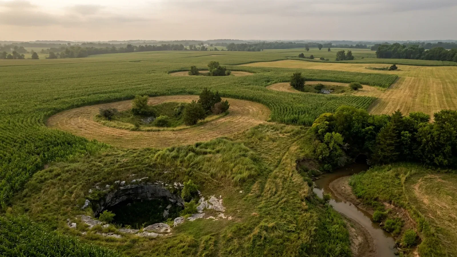
- The Kentucky Geological Survey's groundwater atlas for Allen County is precise about where the karst is: the county sits in the Mississippian Plateaus area of south-central Kentucky, the topography is undulating to rough, reflecting a moderately to deeply dissected plateau, and karst features characterize the topography in the northwestern part of the county — the corner facing Warren County and Bowling Green, which is the densest sinkhole country in the Commonwealth. The rock under it is Mississippian limestone including the Ste. Genevieve and St. Louis Limestones, deposited about 350 million years ago on the floor of a warm shallow sea, and KGS publishes a karst map for this county specifically. Its general warning is the one that costs people money: homes built over filled sinkholes may be damaged as the fill is transported out of the sinkhole and the soil cover collapses, and structures built in sinkholes are often vulnerable to flood damage. A post-frame or steel building on a monolithic slab is the least forgiving thing you can put on that ground, because it is a soil-bearing foundation and thousands of square feet of impermeable surface at once, and it assumes uniform bearing across the whole footprint. The regulatory consequence lands on the septic side first: under 902 KAR 10:085 ground closer than seventy feet to an open sinkhole throat, downslope from the sinkhole sideslope midpoint, or subject to flooding damage is unsuitable for a system. On radon, EPA maps Allen County in Zone 1, the highest of three — a predicted average indoor screening level above 4 picocuries per litre. Only 30 of Kentucky's 120 counties are Zone 1, and the list is essentially the Inner Bluegrass plus the Pennyroyal karst belt, with Allen sitting alongside Warren, Barren, Monroe, Metcalfe and Hart. EPA's own printed cautions travel with the map: it dates from 1993, it should not be used to decide whether an individual home needs testing, and all homes should be tested regardless of zone. The code question has a definitive answer and it is no. The Kentucky Residential Code activates only Appendices K, R and S; Appendix F, Radon Control Methods, is not among them, and radon-resistant construction is required nowhere in the Commonwealth by state code. A passive sub-slab depressurisation rough-in costs very little while the slab is open and a great deal afterwards, and KRS 309.436(9) expressly exempts a building contractor installing vent pipes during the construction of a home from the state radon licensing regime — so on a Zone 1 parcel it is a decision to take deliberately at slab stage. One hazard this county does not have: Allen is not among the 37 Kentucky counties whose fiscal courts voted into the Mine Subsidence Insurance Fund, and it is not a coalfield county — the fund's nearest members in this direction are Butler and Edmonson. Karst and mine subsidence are different problems and should not be merged.
- Two feet of freeboard on a plat here, where the Commonwealth requires none — and no flood-insurance discount either side of it
- Allen County's flood picture has a local rule stricter than the state's and a cost position worse than its neighbours', and both are checkable. FEMA's Community Status Book lists both communities in the county as participating in the National Flood Insurance Program's Regular Program: unincorporated Allen County, CID 210267, with an initial Flood Hazard Boundary Map of 24 June 1977 and an initial FIRM of 1 March 1995; and the City of Scottsville, CID 210001, with an initial FHBM of 25 January 1974 and an initial FIRM of 27 September 1985. Both carry a current effective map dated 4 July 2011, and neither is sanctioned or suspended — federally backed flood insurance is available throughout the county. What is not available is a discount. FEMA's Community Rating System eligible-communities list effective 1 April 2026 carries 42 Kentucky communities, 33 of them holding a class better than 10, and no Allen County community appears on it at all. That is money, and the comparison is right next door: Barren County holds Class 9 for a 5 per cent discount, and Warren County and the City of Bowling Green both hold Class 7 for 15 per cent. The same premium on the same house is cheaper across the county line. The local rule cuts the other way and in the buyer's favour. Section 9.1.2 of the Scottsville-Allen County subdivision regulations requires the Commission to obtain flood elevation information for any subdivision including official flood hazard areas, requires lots partially affected by flooding to have the flooded area clearly delineated with the remaining portion meeting the minimum lot size on its own, and requires the elevation of the first floor intended for living area or commerce to be shown — stating that such elevation will be at least two feet above the 100 year flood elevation. Kentucky's own statewide standard is base flood elevation plus zero, so a plat approved through this office carries two feet of freeboard the Commonwealth does not demand. Section 9.2.5 lets the Commission disapprove lots subject to flooding outright, and §9.2.6 allows approval only where there is sufficient land outside the floodplain equal to the required minimum lot size — which on a 0.70-acre septic lot with 20,000 square feet already required clear is a demanding test. Above all of it sits the state permit almost nobody mentions: a Kentucky Division of Water Individual permit is required for construction in the base floodplain under KRS 151.250 and 401 KAR 4:060 §2, on form DOW 7116, and state jurisdiction reaches the entire base floodplain rather than only the regulatory floodway.
- Allen County, Kentucky — not the Allen County that ranks first for the name, and not the city of Allen in Floyd County
- There are five Allen Counties in the United States and a Kentucky city called Allen, and the collision is live inside the sources a land buyer will actually reach. FEMA's Community Rating System eligible-communities list contains exactly one community named Allen County anywhere in the nation: CID 180302, which is Indiana's Allen County, holding Class 8 for a 10 per cent discount. Kentucky's Allen County is not on that list at all, so anyone matching on the bare county name would hand a flood-insurance discount to the wrong state. Search for an Allen County health department and the first results are allencountypublichealth.org and allencountyhealth.com, neither of which is the Kentucky department. And inside Kentucky itself there is a city of Allen in Floyd County, three hours east in the coalfield, on Eastern time and a 606 area code, with a different code answer in two of the three tables — a 33-inch frost depth and a 20 psf snow load rather than 24 inches and 15 psf. Three tests resolve any document quickly: a 270 area code, a Scottsville address, or an explicit reference to Allen County, Kentucky rather than to a bare county name or to the city of Allen. If the parcel is near Scottsville, Adolphus, Halfway, Holland, Petroleum or Settle, this page is the right one. Geography is the other half of the identity. Allen County covers 346 square miles on Central time; its southern boundary is the Tennessee state line, and it is one of the seven Kentucky counties that touch it. It is one of the four counties of the Bowling Green metropolitan area with Warren, Butler and Edmonson, and it was the second-fastest-growing of them by percentage over the last census decade, at roughly 11.7 per cent against Warren's 13.1 — which is why farmland here is being converted to homesites faster than the raw 2020 population of 20,588 suggests. The Kentucky Geological Survey puts the county's high ground near Scottsville at about 966 feet and its low point at about 445 feet where the Barren River leaves the county, with ridges typically 640 to 880 feet, valley flats 470 to 600, and a maximum local relief of 180 feet along the bluffs of the entrenched river.
- Who to call, in the order you will need them
- Allen County has fewer offices than most counties this size, and the ones it has are unusually easy to reach, so the sequence matters more than the switchboard. First, the Scottsville-Allen County Planning Commission, 201 West Main Street, Suite 202, Scottsville KY 42164, 270-237-4180, clerksacpc@gmail.com, Monday to Friday 8:00 a.m. to 4:30 p.m. Central. That single office handles the building permit inside the city, the subdivision plat everywhere in the county, zoning map amendments, variances and the 911 address. Its six board members are appointed jointly by the Mayor of Scottsville and the County Judge/Executive, which is what makes it a genuinely joint city-county body rather than a city department that answers county calls. The 911 address request form is worth filing early: the commission says an address usually takes five to seven days to assign, and the address is what the utilities, the septic permit and the deed all hang off. Second, the Allen County Health Department, 107 N. Court Street, Scottsville KY 42164, 270-237-4423, environmentalist Peyton Donisi at extension 112 — the site evaluation should be booked before the pad location is settled, and the department's signature is a required element of a minor plat under §5.3.9 of the subdivision regulations. Third, water: the Scottsville Water Department on 270-237-4402 inside the city, the Allen County Water District on 270-237-3040 outside it, and the answer to whether a line reaches a rural tract should be obtained before an offer rather than after, since the alternative is a well and the county's water-bearing rock varies. Fourth, the county itself: Judge/Executive Dennis Harper, PO Box 115, Scottsville KY 42164, 270-237-3631, Monday to Friday 8:00 to 4:30, with six magistrates on the Fiscal Court. The county's own published list of offices runs to the County Attorney, Clerk, Coroner, PVA, Sheriff, Jailer, Treasurer, Animal Control, Fire and Rescue, EMS, the County Water District, the transfer station and the rescue squad — and names no planning, zoning, building, code enforcement or floodplain office, which is consistent with everything else on this page. Fifth, for a lakeside parcel, the U.S. Army Corps of Engineers Barren River Lake office on 270-646-2055, before rather than after the survey. And for the electrical certificate that no build can skip, local electrical inspector Ricky Sheffield on 270-427-8373.
https://dhbc.ky.gov/Documents/2018%20Kentucky%20Residential%20Code%203d%20Ed.pdf — Table R301.2(1) Design Snow, Climatic and Geometric Design Criteria for Kentucky Counties; Table R301.2.2.1 Seismic Design Categories–Site Class D; Table R403.1.4 Minimum Frost Protection Depth for Kentucky, with the §R403.1.4 exception text; and Table R401.4.1 with footnote b. All three county tables are transcribed in research/statewide/design-criteria-and-climate.md from a raw content-stream extraction of the DHBC PDF and were read there rather than re-fetched; the Allen County answer was determined by checking the county name against each published exception list in turn rather than by assuming a default
https://dhbc.ky.gov/Documents/Allen%20County.pdf (sheet updated 5/27/26) and https://dhbc.ky.gov/Documents/Barren%20County.pdf — both downloaded and extracted with pdftotext in -raw and -layout and compared, 8 Sep 2026. On the Allen sheet the -layout pass shifts every label one row against its value, printing the inspector's email beside 'Local Building Inspector:' and his name beside the county name, so -raw is authoritative; both passes agree on the pairing once the offset is accounted for · Scottsville-Allen County Residential Building Permit Application 2025, https://scottsvilleallencountyplanningandzoning.com/wp-content/uploads/2025/07/scottsville-residential-permit-application-2025.pdf (the 72-hour notice requirement and Jim Griffin's number are printed on the form itself) · https://apps.legislature.ky.gov/law/statutes/statute.aspx?id=52659
Kentucky Geological Survey, Groundwater Resources of Allen County, Kentucky (Carey and Stickney, County Report 2, Series XII, 2002) — Topography, https://www.uky.edu/KGS/water/library/gwatlas/Allen/Topography.htm; Geology, https://www.uky.edu/KGS/water/library/gwatlas/Allen/Geology.htm; and Karst, https://www.uky.edu/KGS/water/library/gwatlas/Allen/Karst.htm, which links a county karst map at http://kgs.uky.edu/kgsweb/download/gwatlas/gwcounty/allen/ALLENK.pdf (all read 8 Sep 2026) · KGS Karst Potential Index viewer, https://kgs.uky.edu/kygeode/geomap?gkarst=true · https://www.epa.gov/sites/default/files/2014-08/documents/kentucky.pdf (EPA Map of Radon Zones for Kentucky — zone definitions and EPA's printed cautions). Posture on the county-to-zone assignment: EPA's own sheet is a graphic map whose colour assignments do not extract, so the Zone 1 membership is taken from the 30-county list corroborated across two independent renderings of that map and transcribed in research/statewide/soils-karst-and-slopes.md, rather than from a primary EPA county table · https://kgs.uky.edu/radon (KGS's finer-grained geology-based indoor radon potential map) · https://insurance.ky.gov/PPC/Documents/JAN%202025_Revised%20Mine%20Subsidence%20Insurance%20Fund%20080124.pdf (KDOI brochure rev. 08/24 — the 37-county participating list, which does not include Allen) · https://apps.legislature.ky.gov/law/kar/titles/902/010/085/
https://www.fema.gov/cis/KY.html (Kentucky Community Status Book — the Allen County and Scottsville rows read 8 Sep 2026; this host refuses plain automated requests, so the table was read through a rendering fetch) · FEMA CRS Eligible Communities, effective 1 April 2026: https://www.fema.gov/sites/default/files/documents/fema_crs_eligible-communities_042026.pdf — downloaded fresh and extracted with pdftotext -raw rather than reused from any earlier copy; the Kentucky block is 42 rows, 9 of them at Class 10 and 33 with a better class, and it contains no Allen County or Scottsville entry. Barren County reads Class 9 / 5%, Warren County and Bowling Green Class 7 / 15% · Scottsville-Allen County Subdivision Regulations §§9.1.2, 9.2.5 and 9.2.6: https://scottsvilleallencountyplanningandzoning.com/wp-content/uploads/2026/02/subdivisionregulationsfinal_10_25.pdf · https://apps.legislature.ky.gov/law/statutes/statute.aspx?id=54097 · https://eec.ky.gov/Environmental-Protection/Water/FloodDrought/Pages/default.aspx
FEMA CRS Eligible Communities effective 1 April 2026, https://www.fema.gov/sites/default/files/documents/fema_crs_eligible-communities_042026.pdf — extracted with pdftotext -raw and searched for every row containing 'Allen'; the national list returns exactly two, 'IN 180302 Allen County' and 'PA 420372 Upper Allen, Township of', and no Kentucky entry · https://dhbc.ky.gov/Documents/Allen%20County.pdf (Scottsville address, 270 numbers and Central time office hours, confirming the Kentucky county) · https://www.allencountykentucky.com/fiscal-court and https://www.allencountykentucky.com/offices/allen-county-judge-executive (the Kentucky county's own government site) · Kentucky Geological Survey, Groundwater Resources of Allen County, Kentucky — Topography, https://www.uky.edu/KGS/water/library/gwatlas/Allen/Topography.htm · population, land area, metropolitan-area composition and growth rates from research/statewide/geography-and-population.md, which records the 2020 census figure of 20,588 across 346 square miles and Allen's growth beside Warren's in the Bowling Green area · frost and snow figures for the Floyd County comparison from Tables R403.1.4 and R301.2(1), https://dhbc.ky.gov/Documents/2018%20Kentucky%20Residential%20Code%203d%20Ed.pdf
Scottsville-Allen County Residential Building Permit Application 2025, https://scottsvilleallencountyplanningandzoning.com/wp-content/uploads/2025/07/scottsville-residential-permit-application-2025.pdf (office address, 270-237-4180, and the contact block listing the building inspector, electrical inspector, health department and both water departments; extracted with pdftotext and read 8 Sep 2026) · https://scottsvilleallencountyplanningandzoning.com/ and https://scottsvilleallencountyplanningandzoning.com/forms-documents/ (board membership, hours, clerksacpc@gmail.com, and the 911 address form with its five-to-seven-day turnaround) · https://www.allencountykentucky.com/offices/allen-county-judge-executive and https://www.allencountykentucky.com/fiscal-court (Judge/Executive Dennis Harper, PO Box 115, 270-237-3631, magistrates and the county's published list of offices) · https://www.allencountykentucky.com/offices/allen-county-health-department · Scottsville-Allen County Subdivision Regulations §5.3.9, https://scottsvilleallencountyplanningandzoning.com/wp-content/uploads/2026/02/subdivisionregulationsfinal_10_25.pdf · U.S. Army Corps of Engineers, Louisville District, Shoreline Management Plan — Barren River Lake, contact block, https://usace.contentdm.oclc.org/utils/getfile/collection/p16021coll7/id/27441

The expensive surprises are in the ground, not the building
What moves a Kentucky budget is usually below grade, and more often than not it is what the ground is sitting on rather than the ground itself. The Kentucky Geological Survey says 92 of the state's 120 counties contain karst — limestone that dissolves — across four named areas: the Western Pennyroyal around Bowling Green and Hopkinsville, the Inner Bluegrass around Lexington, the Eastern Pennyroyal through Somerset and Monticello, and Pine Mountain in the south-east. On karst, KGS's own model ordinance for local governments lists the structures that should not be sited in sinkhole areas, and the list is buildings with soil-bearing foundations and buildings that cover thousands of square feet with impermeable surface. A post-frame or steel building on a monolithic slab is both of those at once. KGS is equally clear that nearly all karst parcels still have buildable ground on them — so karst does not stop the build, it removes the option of siting the pad by eye. A filled and graded-over sinkhole is the classic trap, because the pad looks perfect.
In the two coal fields the question is undermining instead, and Kentucky treats it differently from everything else: mine subsidence coverage is added automatically to property policies in the counties whose fiscal court voted the fund in, with a written opt-out — thirty-seven of them — while karst collapse gets no fund at all and falls under the ordinary earth-movement exclusion. On slopes the surprise is geographic: KGS's landslide inventory puts Kenton, Campbell, Boone and Gallatin — the northern Kentucky counties opposite Cincinnati — near the very top, above most Appalachian counties, on Ordovician shale. Three of those four — Boone, Campbell and Kenton — are the only counties in the state with a line of their own in the residential code's bearing table, which raises the presumptive value for two named clay groups there and nowhere else. Everywhere else the table gives clay and silt a single presumptive figure, and a soils investigation becomes mandatory once the building official determines the real capacity is likely to be lower than it.
The same ground then sizes the septic system, and Kentucky does that from soil morphology — a certified inspector reading the profile in a backhoe pit — rather than from a percolation test, at 110 gallons a day per bedroom against an application rate taken from soil texture and structure. On a mound or other alternative design a measured permeability test can still be required. And on karst the septic regulation is blunter than the building code ever gets: it declares the ground within seventy feet of an open sinkhole throat unsuitable outright. The soil that needs a foundation engineer is usually the soil that complicates the drainfield, so the site work, the foundation and the septic get resolved together rather than one at a time. We price the dirt before we price the building.
What we build in Allen County
All seven services are available in Allen County. What a build costs depends far more on the parcel than on square footage, so we price against your land rather than publishing a rate card.
Barndominium Kits
We check barndominium kit packages against the wind, snow, frost and seismic criteria the Kentucky Residential Code publishes for your county.
Pole Barn Homes
Pole barn homes across Kentucky. KRC §R327 covers accessory barns, not houses — so a pole barn home is engineered by the code's own terms.
Custom Barndominium Plans
Barndominium plans drawn to Kentucky's published county design criteria — snow, wind, seismic, frost — with engineering where the code calls for it.
What a build looks like
Three stages every Allen County project passes through, from a raw parcel to a finished home. Site work first, because that is where the budget is decided.

The parcel
Karst and mine maps, the flood question, zoning where the county has any, and utility access — all checked before anything is drawn.
Pad and permit
Clearing, grading and a compacted pad, while the submittal works through whichever office issues the permit — and where no office does, through the approvals that still apply.

Frame to finish
Shell erected and dried in, then systems and interior finish — and the certified electrical inspection your utility needs before it will set a meter.
Those are the rules where you are building in Allen County. Tell us what you want to build and we will draw it to them.
Where we build around Allen County
Allen and the rural land around it. The buildable acreage for a project this size usually sits outside the city limits, and in Kentucky that line frequently decides whether anyone issues a permit at all, not merely who issues it.
Keep reading
The questions that usually come next once you know what Allen County allows.
Barndominium Cost Guide
Why the published spread runs from one end of the scale to the other, and which of it is the building rather than the ground.
Read itIs It Legal in Kentucky?
Whether your county inspects a house at all, what the farm-dwelling exemption really requires, and the approvals that reach you anyway.
Read itWhat a Pole Barn Home Costs
Post-frame against stick-built, and what the prescriptive post-frame section of the state code does and does not cover.
Read itNearby areas we build in
Others we cover nearby. They share the same statewide code and the same state-published design tables — but whether a house is permitted and inspected at all, whether the county zones, what the health department will accept for septic, and what the ground does to a foundation can all differ from one card to the next. Two counties that touch are not two versions of the same answer.
Building in Allen County: common questions
10 questions we get asked most often about building in Allen County. If yours is not on the list, ask it directly.
Do I need a building permit for a barndominium in Allen County?
Can I build a shop bigger than the house, and can I build it first?
I want to split ten or twenty acres off a family farm to build on. What does that take here?
Does Allen County need a deeper footing or a stiffer frame than its neighbours?
Is there really buildable land in Allen County, and what is the ground like?
What about sinkholes — should I be worried?
Is this the Allen County in Kentucky, or the one I keep finding online?
I am looking at a parcel on Barren River Lake. What should I check before I make an offer?
Who issues the septic permit, and is Allen County in the Barren River health district?
Nobody has to inspect my frame outside Scottsville. Does anything actually get checked?
Building in Allen County?
Start with the plan. Tell us what you want to build and we will draw it, then confirm whether any office permits and inspects a house where your parcel is, what it will let you put there, and which line of the state's snow, frost and seismic tables your county falls on. That conversation costs nothing.