Barndominium Builders in Shelby County, KY
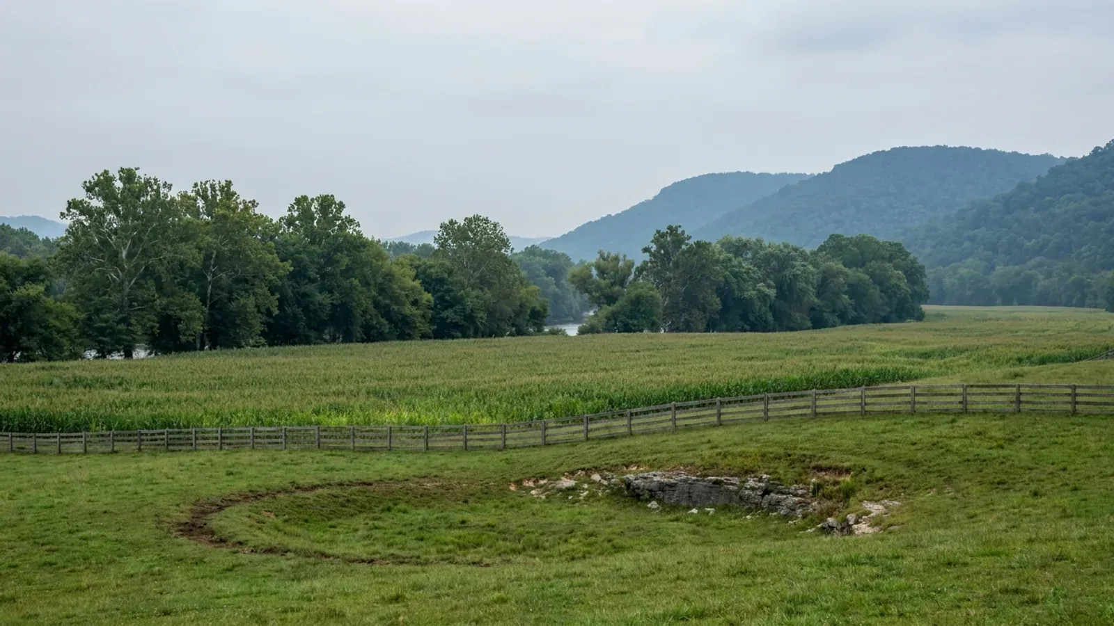
Shelby County is the land answer on the eastern side of the Louisville ring, and it is one of the Kentucky counties that inspects. Under KRS 198B.060(1) permits, inspections and certificates of occupancy are not mandatory on a single-family residence unless the local government adopted an ordinance requiring them, and roughly eighty of Kentucky's 120 counties have never adopted county zoning at all. Shelby did both. Its own code, at Chapter 150 of the Land Usage title, adopts the Kentucky Building Code and states that a building inspection program is established in Shelby County for application to all buildings including single-family dwellings — and the county's Building Inspection office publishes the fee schedule, the inspection list and the permit steps that follow from it. Zoning runs through the Triple S Planning Commission, a single joint commission for Shelby County, Shelbyville and Simpsonville, which is why the county and both of its cities share one set of zoning articles and one office at 419 Washington Street. On unincorporated land the Agricultural district takes a five-acre minimum lot, 250 feet of road frontage on a tract under fifteen acres, a hundred-foot front yard, twenty-five feet at the sides and rear, and a thirty-six-foot height limit. What the county's accessory-building section does not contain is a floor-area cap — nothing in it measures a detached shop against the house the way Hardin County's ordinance does. What it does contain is a placement rule and a use rule: accessory buildings go in the rear yard, five feet off any other building and five feet off the line, and a residential accessory building may not be used for or involved with the conduct of any business, trade or industry. The ground is Outer Bluegrass on Ordovician and Silurian limestones, dolomites and shales, rolling to hilly with about a hundred feet of local relief, and it carries one feature no other Kentucky county has: Jeptha Knob, a cryptoexplosion structure roughly 14,000 feet across sitting just north of I-64, whose central uplift and ring of annular and radial faults put Shelby's highest point at 1,188 feet. USDA counts 1,350 farms here — fourth-most of any Kentucky county — on 160,081 acres, with 608 of them in the ten-to-forty-nine-acre band. Land in farms is down twenty percent since the 2017 census, which is what sitting between Louisville and Frankfort on an interstate does to farmland.
Shelby County at a glance
- County
- Shelby
- Population
- 52,004
- ZIP codes
- 40065, 40066, 40067, 40076, 40003, 40022
- Site visits
- Site visits out I-64 into Shelbyville, Simpsonville, Waddy, Bagdad and Finchville
Building conditions in Shelby County
The building code is the same in every Kentucky county, and no local government may adopt or enforce a different one on a house — the Kentucky Residential Code says so in its own text. The design criteria are settled by the state too: the code prints a filled-in table covering all 120 counties, so your county's ground snow load, frost depth and seismic design category are published figures rather than something a local office decides. Ultimate design wind speed is 115 mph for every county in the state.
What changes from one county to the next is whether anyone checks. Kentucky makes permits, inspections and certificates of occupancy optional for a single-family home unless the local government has passed an ordinance requiring them, and it forbids the state from stepping in where none has. Twenty-five counties tell the state outright that they have no local building inspector, and in much of the rest the answer depends on an ordinance the county either passed or never did. Zoning is a separate, equally local choice — most Kentucky counties have never adopted any. What is below covers this county specifically: who issues the permit if anyone does, what the state's tables assign it, and what the ground does to a slab.
Shelby County Code of Ordinances, Title XV Land Usage, Chapter 150 Building Regulations §§ 150.01–150.05 — https://shelbycounty.ky.gov/Land%20Usage/150%20-%20Building%20Regulations.pdf (PDF text extracted and read 6 Sep 2026; the county's Azure host refuses plain curl requests with an HTTP block page, so the file was retrieved through a rendering fetch and then text-extracted locally) · https://shelbycounty.ky.gov/departments/building-inspector/Pages/Permit-Requirements.aspx · https://apps.legislature.ky.gov/law/statutes/statute.aspx?id=52659
Shelby County Zoning Regulations, Article VIII General Zone Regulations for Lots and Yards (2015) §§ 810(6), 830 and 840 — https://img1.wsimg.com/blobby/go/a9104a77-9bdf-470b-a9af-47949c795004/downloads/Article%20VIII%20GENERAL%20ZONE%20REGULATIONS%20SC.pdf · Article II Terms and Definitions, entries 22(b) Accessory Building, 23 Building Height and 71 Home Occupation, Agricultural — https://img1.wsimg.com/blobby/go/a9104a77-9bdf-470b-a9af-47949c795004/downloads/Article%20II%20TERMS%20AND%20DEFINITIONS.pdf (both PDFs text-extracted and read 6 Sep 2026) · https://shelbypz.com/zoning-regulations
Shelby County Zoning Regulations, Article VI Establishment of Zones (2020) § 652 Agricultural District (A), development standards — https://img1.wsimg.com/blobby/go/a9104a77-9bdf-470b-a9af-47949c795004/downloads/Article%20VI%20ESTABLISHMENT%20OF%20ZONES.pdf (PDF text extracted and read 6 Sep 2026) · https://apps.legislature.ky.gov/law/statutes/statute.aspx?id=46635 · https://shelbypz.com/zoning-map
https://dhbc.ky.gov/Documents/2018%20Kentucky%20Residential%20Code%203d%20Ed.pdf — Table R301.2(1) (snow, wind, weathering, termite), Table R301.2.2.1 Seismic Design Categories–Site Class D, Table R403.1.4 Minimum Frost Protection Depth for Kentucky with § R403.1.4, and Table R401.4.1 with footnotes b and c; the county rows are transcribed in research/statewide/design-criteria-and-climate.md from a local text extraction of that PDF · https://shelbycounty.ky.gov/departments/building-inspector/Pages/Permit-Requirements.aspx (the county naming the 2018 Kentucky Building Code and 2018 Kentucky Residential Code as the codes it enforces)
https://www.uky.edu/KGS/water/library/gwatlas/Shelby/Topography.htm and https://www.uky.edu/KGS/water/library/gwatlas/Shelby/Geology.htm and https://www.uky.edu/KGS/water/library/gwatlas/Shelby/Karst.htm (KGS Groundwater Resources of Shelby County; the karst page's text is KGS's statewide karst chapter with a link to a Shelby County karst map, and it names no karst region for this county — read 6 Sep 2026) · https://kgs.uky.edu/kygeode/geomap?gkarst=true (KGS Karst Potential Index viewer) · https://pubs.usgs.gov/publication/pp1151B (Surface geology of the Jeptha Knob cryptoexplosion structure, Shelby County, Kentucky, USGS Professional Paper 1151-B) · https://www.uky.edu/KGS/rocksmineral/meteorite-hitky.php
https://www.nass.usda.gov/Publications/AgCensus/2022/Online_Resources/County_Profiles/Kentucky/cp21211.pdf (2022 Census of Agriculture, Shelby County profile, FIPS 21211 — PDF text extracted twice, with -layout and with -raw, and the two reconciled before transcription because the layout pass offsets the size-distribution labels by one row; read 6 Sep 2026) · research/statewide/geography-and-population.md (52,004 at the 2020 census, +8.2 percent; 384 sq mi at 125 people per sq mi; Shelby 4th in Kentucky by farm count; Oldham at 358 per sq mi)
Also worth knowing before you build in Shelby County
- The zoning permit and the building permit are two different offices, and the zoning one comes first
- Shelby County splits what many jurisdictions combine, and the sequence is published. Article III § 310 of the zoning regulations states that no building or other structure shall be erected, moved, added to or structurally altered without a zoning permit issued by the Administrative Official, and § 320 sets out what has to accompany the application: plans drawn to scale showing the actual dimensions and shape of the lot, the exact sizes and locations of existing buildings and the location and outside dimensions of the proposed building; the governing health official's certificate approving proposed water and sewage facilities under § 880; and an entrance or encroachment permit from the Shelby County road engineer, the State Highway Department or the City of Shelbyville Engineer for the driveway. The Administrative Official must act within two weeks. A zoning permit expires if work has not begun within one year, and again if the work is not substantially completed within two years. Then a separate building permit issues from the building inspector's office, and separate electric, septic, plumbing and HVAC approvals from four more contacts. The county publishes the whole chain on one sheet, and it opens with a requirement that trips people on raw land: a physical address is required to obtain a Shelby County building or electric permit, and lot numbers are not accepted — addressing is done by Triple S Planning and Zoning on 502-633-1718. Article III § 315 also carries the one exception worth knowing on a farm: no zoning permit is required for construction or alteration of agricultural structures when they are three hundred feet or more from the nearest property line or road. That is a distance test, not a use test, and it does not reach a dwelling.
- The county prices a house at 16 cents a square foot of everything under roof — which is how a shop-house gets measured
- Shelby County Building Inspection publishes its fee schedule, and for this building type the definition matters more than the rate. New home construction is charged at $0.16 per square foot with a minimum of $250, and the schedule's own note says the residential square-footage fee is derived from measuring total floor space including the enclosing walls, outside dimensions, and any porches — including unfinished basement, attached garage, first floor, second floor and bonus rooms. In short, in the schedule's own words, all areas under roof. A barndominium whose shop and dwelling share one roofline is therefore priced on the whole envelope, not on the finished living area, and that is a number worth running before the permit conversation rather than after. Residential additions are the same rate at a $125 minimum; a deck without a roof is $50; a plans or application revision is $50; moving a structure is $100. Starting a project without a permit doubles the permit fee. The published inspection types are footing, foundation wall, slab, framing, insulation and final, with the first inspection of each type and one follow-up included in the permit fee, a second follow-up at $50 and each subsequent one at twice the last fee imposed. Two thresholds need checking against each other on the day: the fee schedule states that one-storey detached accessory structures of 200 square feet and less do not require a building permit, while the county's permit-requirements page lists storage sheds and similar structures under 120 square feet among its exemptions — the two figures come from the residential and the building code respectively, so ask the office which applies to your structure. A land disturbance permit — essentially a grading permit with erosion and sediment control — applies only on projects disturbing an acre or more of soil. And the schedule states plainly that where the state issues a permit, a local building permit is always required in addition to it.
- The Emergency Management Director is the Floodplain Administrator, and the ordinance adds no freeboard
- Shelby County's Flood Damage Prevention ordinance is Chapter 153 of its Land Usage title, Ord. 08-04-13, passed 4 August 2009, and § 153.25 appoints the Emergency Management Director — not the county engineer, not a GIS officer — to administer, implement and enforce it by granting or denying development permits, as the Floodplain Administrator. A development permit is required before any construction or other development begins within a special flood hazard area, and § 153.26(B) states that endorsement of the local administrator is required before a state floodplain construction permit can be processed. The residential elevation standard in § 153.41(A) is the lowest floor, including basement, mechanical equipment and ductwork, elevated no lower than at or above the base flood elevation — that is BFE plus zero, matching the state minimum in 401 KAR 4:060 rather than adding the extra foot some Kentucky communities do, so the margin has to be a design decision instead of an ordinance requirement. Section 153.45 is the provision a shop owner needs: an accessory structure in any zone beginning with the letter A must be non-habitable, anchored against flotation, vented with at least two openings on opposite walls at one square inch per square foot of floor area no more than a foot above grade, built of flood-resistant materials, with utilities elevated, may only be used for storage or parking, and cannot be modified for a different use after permitting. A shop in the floodplain therefore cannot later be finished into living space. Separately, the zoning regulations' Floodplain/Conservation (F/C) district has no principal permitted uses at all and states that the erection of any structure for residential purposes is prohibited. On top of any of this, Kentucky requires a state Division of Water Individual permit for construction in the base floodplain under KRS 151.250 and 401 KAR 4:060 § 2, on form DOW 7116, and state jurisdiction reaches the whole base floodplain rather than only the regulatory floodway. Clear Creek and the Salt River headwaters, plus Brashears and Guist Creeks, are where that bites.
- All three communities were remapped on 16 October 2025, and none of them is a CRS community
- FEMA's Kentucky Community Status Book lists three Shelby County communities and all three participate in the National Flood Insurance Program: unincorporated Shelby County (CID 210209, initial FIRM 1 September 2001), the City of Shelbyville (210376, initial FIRM 2 September 2009) and the City of Simpsonville (210431, initial FIRM 2 September 2009). Two things stand out. First, all three carry the same current effective map date of 16 October 2025, which means the county was remapped — a flood determination on a Shelby parcel that predates that date is answering from a superseded map, and this is the same effective date the Hardin County communities carry, so it is part of a wider Kentucky map revision rather than a Shelby-only event. Second, none of the three appears in the Community Rating System columns. Kentucky has only 33 CRS communities in the whole book and Shelby County has none of them, so there is no CRS premium discount on a flood policy here and no CRS-driven floodplain standard above the NFIP minimum — which is consistent with the county ordinance setting the lowest floor at base flood elevation with no added freeboard. Note also how late the mapping is: Shelbyville and Simpsonville did not get an initial Flood Insurance Rate Map until September 2009, and the county's own initial FIRM is dated 2001. A long-tenured landowner here may never have had a mapped flood answer for the parcel before this century, which is a reason to get a current determination rather than to rely on what the ground has historically done.
- Septic runs through a single-county health department, and the Agricultural district sets its own two-acre floor
- Most Kentucky counties are served by a multi-county district health department — Hardin by Lincoln Trail across six counties, for instance. Shelby is not: the Shelby County Health Department at 615 11th Street in Shelbyville, 502-633-1231, serves this county alone, with Amy Tingle as the environmentalist on 502-633-9377 and DHBC listing the same address and number on its county sheet. The county's building-permit sheet gives the practical detail: septic hours are Monday to Friday 8:00 to 10:00 a.m., messages may be left any other time, and a set of house plans is required to start. Inside the city sewer service areas the answer changes — Shelbyville Water and Sewer at 1059 Washington Street, 502-633-2840, and the Simpsonville Sewer Commission at 108 Old Veechdale Road, 502-722-8110, are the alternatives named on the same sheet, and Simpsonville's own 2024 zoning ordinance requires municipal water and sewer even in its A1 Agricultural district. On unincorporated land two floors stack. The zoning regulations set a minimum lot on septic tank in the agricultural district of two acres, and Article VIII § 880 states that no building or dwelling can be constructed without a safe drinking water supply and sewage disposal facilities approved by the governing health official, with a certificate showing that approval required to accompany the zoning permit application. Then 902 KAR 10:085, the state on-site sewage regulation, requires room for the system plus a full replacement area, makes ground closer than seventy feet to an open sinkhole throat or downslope from a sinkhole sideslope midpoint unsuitable, and limits who may install. The site evaluation should therefore come before the pad is sited, not after.
- One planning commission, three jurisdictions — and Simpsonville is the one that broke ranks
- Zoning in Shelby County is administered by the Triple S Planning Commission, a single joint commission covering Shelby County, Shelbyville and Simpsonville from one office at 419 Washington Street, 502-633-1718. Historically that meant three parallel sets of the same nineteen zoning articles, one adopted by each legislative body — which is why the county's Article VI is dated 2020, its Article VIII 2015 and its Article III 1994, each amended on its own schedule. Simpsonville then adopted a wholly new, consolidated zoning ordinance on 7 October 2024, and the differences matter to this building type. Simpsonville's A1 Agricultural district takes a 5-acre minimum, 36 feet of structure height, 30 percent maximum lot coverage, 25-foot side and rear yards, a front yard tiered the same way as the county's by parcel size — and it requires municipal water and sewer. Its residential districts cap accessory structures at 20 feet of height and add the rule that accessory structures cannot exceed the height of the principal structure, which is exactly the constraint the county's own Article VIII § 830 does not impose. Simpsonville's ordinance also reproduces the KRS 100.203 agricultural exemption in its own § 6.5-B: land used solely for agricultural purposes has no regulations imposed as to zoning permits, height, yard or location requirements for agricultural buildings, except that setback lines are still required to protect streets and highways and anything in a designated floodway or floodplain may be fully regulated. So the answer to what may be built here is genuinely three answers, and the city line is where it changes.
- No conservation-subdivision or purchase-of-development-rights track was found in the adopted documents
- An equine and row-crop county between two cities is exactly where a conservation-subdivision option or an agricultural-preservation programme would be expected, so it is worth saying what the adopted documents actually contain. The Triple S subdivision regulations are organised into nine articles — legal status and general provisions, procedures for major plats, contents and format of documents, general requirements and minimum design standards, improvements required for final approval, waivers and enforcement, definitions, effective date and certifications — and none of them is a conservation, cluster or open-space subdivision article. The zoning regulations' Article XIX Special Districts, adopted 2014, establishes exactly one special district, the BEQ Building Exterior Quality Design Overlay, aimed at commercial corridors. The Recreational/Open Space (ROS) zone is a parks-and-recreation designation, and the Floodplain/Conservation (F/C) zone is a flood-hazard district that permits no principal use. Article II does define residential cluster and planned unit development, and Article XII carries the PUD procedure, so a clustered layout is available through the planned-development route rather than as a by-right rural option. What actually preserves rural character in unincorporated Shelby County, then, is the ordinary A district arithmetic: a five-acre minimum lot, 250 feet of width at the building line, tiered road frontage that makes narrow flag-shaped splits difficult, and a 100-foot front yard. Anyone told a parcel qualifies for a conservation-subdivision density bonus here should ask the Triple S office to name the ordinance section, because none was found in the published articles.
Shelby County Zoning Regulations, Article III Administration and Enforcement (1994) §§ 310, 315, 320 and 330 — https://img1.wsimg.com/blobby/go/a9104a77-9bdf-470b-a9af-47949c795004/downloads/Article%20III%20ADMINISTRATION%20AND%20ENFORCEMENT.pdf and Article VIII § 880 — https://img1.wsimg.com/blobby/go/a9104a77-9bdf-470b-a9af-47949c795004/downloads/Article%20VIII%20GENERAL%20ZONE%20REGULATIONS%20SC.pdf (PDFs text-extracted and read 6 Sep 2026) · https://shelbycounty.ky.gov/departments/building%20inspector/the%20steps%20to%20obtain%20a%20building%20permit.pdf (Obtaining a Building Permit, the county's seven-step contact sheet; retrieved through a rendering fetch because the county's host blocks plain automated requests, then text-extracted locally) · https://shelbycounty.ky.gov/departments/Pages/planning-and-zoning.aspx
https://shelbycounty.ky.gov/departments/Building%20Inspector/Permit%20Fee%20Schedule.pdf (Shelby County Building Inspection fee schedule with its Building Cost / Fee Schedule and its numbered definitions 1 through 17; retrieved through a rendering fetch because the county's Azure host returns an HTTP block page to plain curl, then text-extracted locally and read 6 Sep 2026) · https://shelbycounty.ky.gov/departments/building-inspector/Pages/Permit-Requirements.aspx
Shelby County Code of Ordinances, Chapter 153 Flood Damage Prevention §§ 153.25, 153.26, 153.41 and 153.45 (Ord. 08-04-13, passed 8-4-2009) — https://shelbycounty.ky.gov/Land%20Usage/153%20-%20Flood%20Damage%20Prevention.pdf (retrieved through a rendering fetch because the county's host blocks plain automated requests, then text-extracted locally and read 6 Sep 2026) · Shelby County Zoning Regulations Article VI § 690 Floodplain/Conservation District — https://img1.wsimg.com/blobby/go/a9104a77-9bdf-470b-a9af-47949c795004/downloads/Article%20VI%20ESTABLISHMENT%20OF%20ZONES.pdf · https://apps.legislature.ky.gov/law/statutes/statute.aspx?id=54097 · https://apps.legislature.ky.gov/law/kar/titles/401/004/060/
https://www.fema.gov/cis/KY.html (Kentucky Community Status Book, Shelby County rows read 6 Sep 2026 — the host refuses plain automated requests, so the table was read through a rendering fetch rather than copied from source) · research/entries/hardin-county-ky.json (the matching 16 October 2025 effective date on the Hardin communities) · research/statewide/land-water-and-septic.md (Kentucky's 33 CRS communities)
https://dhbc.ky.gov/Documents/Shelby%20County.pdf (DHBC Shelby County sheet, updated 5 Aug 2026 — PDF text extracted and read 6 Sep 2026; health department address and environmentalist contact) · https://shelbycounty.ky.gov/departments/building%20inspector/the%20steps%20to%20obtain%20a%20building%20permit.pdf (septic, sewer and hours) · Shelby County Zoning Regulations Article VI § 652 and Article VIII § 880 · https://apps.legislature.ky.gov/law/kar/titles/902/010/085/ · ⚠️ do not confuse this department with shelbycountyhealth.com, which is Shelby County, Missouri and cites Missouri statutes
https://shelbypz.com/zoning-regulations (the Triple S Planning Commission publishing separate Shelby County, Shelbyville and Simpsonville article sets) · https://img1.wsimg.com/blobby/go/a9104a77-9bdf-470b-a9af-47949c795004/downloads/9d87ce63-96db-4493-ba8c-31c70dacc297/Simpsonville_Zoning_Ordinance_Adopted_10.7.24.pdf (Simpsonville Zoning Ordinance adopted 7 Oct 2024, Article 6.5 A1 and Articles 6.6–6.7 residential development standards; PDF text extracted and read 6 Sep 2026) · https://shelbyvillekentucky.com/176/Triple-S-Planning-Commission · https://shelbycounty.ky.gov/departments/Pages/planning-and-zoning.aspx
https://shelbypz.com/subdivision-regulations (Triple S subdivision regulations, article structure as published) · Shelby County Zoning Regulations Article XIX Special Districts (2014) — https://img1.wsimg.com/blobby/go/a9104a77-9bdf-470b-a9af-47949c795004/downloads/Article%20XIX%20SPECIAL%20DISTRICTS.pdf and Article VI §§ 654 and 690 — https://img1.wsimg.com/blobby/go/a9104a77-9bdf-470b-a9af-47949c795004/downloads/Article%20VI%20ESTABLISHMENT%20OF%20ZONES.pdf (PDFs text-extracted and read 6 Sep 2026) · https://shelbypz.com/zoning-regulations

The expensive surprises are in the ground, not the building
What moves a Kentucky budget is usually below grade, and more often than not it is what the ground is sitting on rather than the ground itself. The Kentucky Geological Survey says 92 of the state's 120 counties contain karst — limestone that dissolves — across four named areas: the Western Pennyroyal around Bowling Green and Hopkinsville, the Inner Bluegrass around Lexington, the Eastern Pennyroyal through Somerset and Monticello, and Pine Mountain in the south-east. On karst, KGS's own model ordinance for local governments lists the structures that should not be sited in sinkhole areas, and the list is buildings with soil-bearing foundations and buildings that cover thousands of square feet with impermeable surface. A post-frame or steel building on a monolithic slab is both of those at once. KGS is equally clear that nearly all karst parcels still have buildable ground on them — so karst does not stop the build, it removes the option of siting the pad by eye. A filled and graded-over sinkhole is the classic trap, because the pad looks perfect.
In the two coal fields the question is undermining instead, and Kentucky treats it differently from everything else: mine subsidence coverage is added automatically to property policies in the counties whose fiscal court voted the fund in, with a written opt-out — thirty-seven of them — while karst collapse gets no fund at all and falls under the ordinary earth-movement exclusion. On slopes the surprise is geographic: KGS's landslide inventory puts Kenton, Campbell, Boone and Gallatin — the northern Kentucky counties opposite Cincinnati — near the very top, above most Appalachian counties, on Ordovician shale. Three of those four — Boone, Campbell and Kenton — are the only counties in the state with a line of their own in the residential code's bearing table, which raises the presumptive value for two named clay groups there and nowhere else. Everywhere else the table gives clay and silt a single presumptive figure, and a soils investigation becomes mandatory once the building official determines the real capacity is likely to be lower than it.
The same ground then sizes the septic system, and Kentucky does that from soil morphology — a certified inspector reading the profile in a backhoe pit — rather than from a percolation test, at 110 gallons a day per bedroom against an application rate taken from soil texture and structure. On a mound or other alternative design a measured permeability test can still be required. And on karst the septic regulation is blunter than the building code ever gets: it declares the ground within seventy feet of an open sinkhole throat unsuitable outright. The soil that needs a foundation engineer is usually the soil that complicates the drainfield, so the site work, the foundation and the septic get resolved together rather than one at a time. We price the dirt before we price the building.
What we build in Shelby County
All seven services are available in Shelby County. What a build costs depends far more on the parcel than on square footage, so we price against your land rather than publishing a rate card.
Barndominium Kits
We check barndominium kit packages against the wind, snow, frost and seismic criteria the Kentucky Residential Code publishes for your county.
Pole Barn Homes
Pole barn homes across Kentucky. KRC §R327 covers accessory barns, not houses — so a pole barn home is engineered by the code's own terms.
Custom Barndominium Plans
Barndominium plans drawn to Kentucky's published county design criteria — snow, wind, seismic, frost — with engineering where the code calls for it.
What a build looks like
Three stages every Shelby County project passes through, from a raw parcel to a finished home. Site work first, because that is where the budget is decided.

The parcel
Karst and mine maps, the flood question, zoning where the county has any, and utility access — all checked before anything is drawn.
Pad and permit
Clearing, grading and a compacted pad, while the submittal works through whichever office issues the permit — and where no office does, through the approvals that still apply.

Frame to finish
Shell erected and dried in, then systems and interior finish — and the certified electrical inspection your utility needs before it will set a meter.
Those are the rules where you are building in Shelby County. Tell us what you want to build and we will draw it to them.
Where we build around Shelby County
Shelby and the rural land around it. The buildable acreage for a project this size usually sits outside the city limits, and in Kentucky that line frequently decides whether anyone issues a permit at all, not merely who issues it.
Keep reading
The questions that usually come next once you know what Shelby County allows.
Barndominium Cost Guide
Why the published spread runs from one end of the scale to the other, and which of it is the building rather than the ground.
Read itIs It Legal in Kentucky?
Whether your county inspects a house at all, what the farm-dwelling exemption really requires, and the approvals that reach you anyway.
Read itWhat a Pole Barn Home Costs
Post-frame against stick-built, and what the prescriptive post-frame section of the state code does and does not cover.
Read itNearby areas we build in
Others we cover nearby. They share the same statewide code and the same state-published design tables — but whether a house is permitted and inspected at all, whether the county zones, what the health department will accept for septic, and what the ground does to a foundation can all differ from one card to the next. Two counties that touch are not two versions of the same answer.
Building in Shelby County: common questions
10 questions we get asked most often about building in Shelby County. If yours is not on the list, ask it directly.
Do I need a building permit for a barndominium in Shelby County?
Can I build a shop bigger than the house in Shelby County?
How much land do I need in Shelby County?
What structural design figures does a Shelby County build have to meet?
What is the ground like here — is Shelby County karst?
Is Shelby County a realistic place to find acreage on the Louisville side?
Who issues the septic permit, and when in the process?
My parcel touches a creek — what does that change?
Do I need a contractor's licence to build in Shelby County?
Does the farm exemption let me skip any of this?
Building in Shelby County?
Start with the plan. Tell us what you want to build and we will draw it, then confirm whether any office permits and inspects a house where your parcel is, what it will let you put there, and which line of the state's snow, frost and seismic tables your county falls on. That conversation costs nothing.