Barndominium Builders in Oldham County, KY
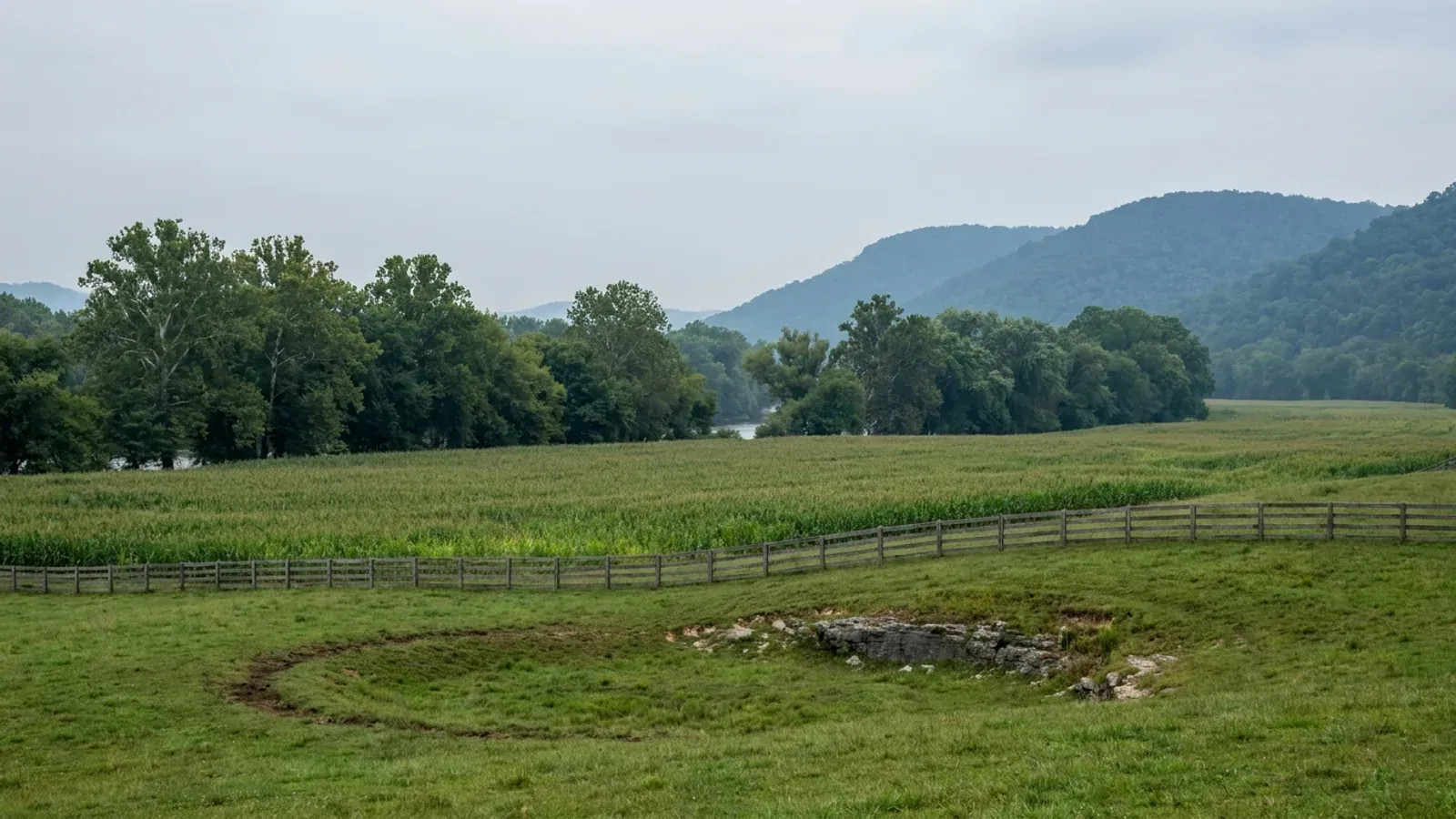
Oldham County is where a barndominium search in the north-east Louisville ring either resolves in one afternoon or has to move counties, and the number that decides it is 5.01 acres. Oldham does not do what Fayette does — its AG-1 Agricultural/Residential minimum lot area is 43,560 square feet, one acre, which is generous by Kentucky county-zoning standards. The restriction is somewhere else entirely. Section 250-030 of the Oldham County Comprehensive Zoning Ordinance publishes a graduated cap on accessory structures that applies in every district: 800 square feet on a lot of 20,000 square feet or less, 1,200 square feet up to an acre, 1,800 square feet from one to 2.99 acres, 2,700 square feet from three to five acres, and no size restriction at all at 5.01 acres or larger. Two accessory structures, three only by conditional use permit and never on a parcel under five acres. A shop bigger than the house is the whole point of this building type, and in Oldham the parcel has to clear five acres before the ordinance stops writing the shop's floor area for you. Genuine agricultural structures come out from under the table under paragraph A, but that is an agricultural-use test, not a box to tick. Under that sits the harder constraint. Oldham County's own comprehensive plan, working from the USDA Soil Conservation Service's Soil Survey of Oldham County, publishes a soil table in which 15.8 percent of the county's land area has only slight limitations for septic tank absorption fields, 9.4 percent moderate, and 74.8 percent severe — and the plan says in its own words that approximately 75 percent of the county's land area is soils with severe limitations. Where there is no sanitary sewer the future land use plan holds development to no more than one dwelling unit per acre. Where there is sewer, it is MSD or La Grange Utilities, and it is not out in the AG-1 country. Add the karst: KIPDA's regional hazard mitigation inventory counts 3,664 sinkholes in Oldham County, against 644 in Shelby and 1,952 in Bullitt, which makes this the most sinkhole-dense county in the Louisville region. Oldham is worth building in, and it is well run — Planning and Development Services issues the building permit at fifteen cents a square foot with a $100 minimum, the county inspects to the Kentucky Residential Code, and the county engineer is the floodplain administrator. But be straight about the land. USDA's 2022 Census of Agriculture counts 410 farms across 55,910 acres in Oldham, and only 130 of those farms are 50 acres or more, on a county of 189 square miles at 358 people per square mile with a median household income of $121,491. Shelby County next door has 1,350 farms across 160,081 acres, 397 of them in the 50-to-179-acre band against Oldham's 90, at 125 people per square mile. If the requirement is a specific Oldham parcel — family ground, a Harrods Creek view, the school district — this page is for that. If the requirement is five-plus acres at a price that leaves budget for the building, the honest answer is Shelby County first and Franklin County second, and Bullitt County is not the answer despite the map, because only 16 percent of Bullitt's land area is in farms at all.
Oldham County at a glance
- County
- Oldham
- Population
- 67,607
- ZIP codes
- 40031, 40014, 40056, 40026, 40010, 40059, 40055
- Site visits
- Same day
Building conditions in Oldham County
The building code is the same in every Kentucky county, and no local government may adopt or enforce a different one on a house — the Kentucky Residential Code says so in its own text. The design criteria are settled by the state too: the code prints a filled-in table covering all 120 counties, so your county's ground snow load, frost depth and seismic design category are published figures rather than something a local office decides. Ultimate design wind speed is 115 mph for every county in the state.
What changes from one county to the next is whether anyone checks. Kentucky makes permits, inspections and certificates of occupancy optional for a single-family home unless the local government has passed an ordinance requiring them, and it forbids the state from stepping in where none has. Twenty-five counties tell the state outright that they have no local building inspector, and in much of the rest the answer depends on an ordinance the county either passed or never did. Zoning is a separate, equally local choice — most Kentucky counties have never adopted any. What is below covers this county specifically: who issues the permit if anyone does, what the state's tables assign it, and what the ground does to a slab.
https://irp.cdn-website.com/fd0fc3bd/files/uploaded/Zoning_Ordinance_Final_December_2019_0.pdf — Oldham County Comprehensive Zoning Ordinance, Sec. 250-030 Accessory Uses and Structures (without dwelling units), paragraphs A, B, C, E, G and H; PDF text extracted with pdftotext and read 6 Sep 2026. This is the file the county's own Planning and Development Services page links as the current ordinance · https://www.oldhamcountyky.gov/planningdevelopment · the separately published amendment file https://irp.cdn-website.com/fd0fc3bd/files/uploaded/Added+Sections+of+Zoning+Ordinances+9.2025.pdf was also extracted and searched — its added sections cover solar energy systems, fences and driving ranges and do not amend Sec. 250-030
https://irp.cdn-website.com/fd0fc3bd/files/uploaded/FINAL+DRAFT+1+8+2026+WEB+VERSION.pdf — Oldham County Comprehensive Plan, Section 5 Physical Environment, Soils, Table 5.1 and the wastewater treatment section; PDF text extracted with pdftotext and read 6 Sep 2026. The plan cites USDA Soil Conservation Service, 1977 Soil Survey of Oldham County, Kentucky as the table's source, so the mapping is old and a parcel should be checked against the current data · https://websoilsurvey.nrcs.usda.gov/app/ · https://www.oldhamcountyky.gov/planningdevelopment (the page that links the plan)
https://www.kipda.org/community-economic-development/regional-hazard-mitigation/hazards/karst-sinkhole/ (per-county sinkhole counts and the topo/LiDAR split, read 6 Sep 2026) · https://www.uky.edu/KGS/water/library/gwatlas/Oldham/Geology.htm (the Drakes, Silurian and Devonian section; the Kope Formation does not appear in it) · https://www.uky.edu/KGS/water/library/gwatlas/Oldham/Karst.htm (KGS's Oldham karst page points at a county karst map rather than publishing a density figure, which is why the KIPDA inventory is cited for the number) · https://irp.cdn-website.com/fd0fc3bd/files/uploaded/FINAL+DRAFT+1+8+2026+WEB+VERSION.pdf (comprehensive plan, Topography and karst discussion) · https://kgs.uky.edu/kygeode/geomap?gkarst=true (the parcel-level Karst Potential Index viewer) · research/statewide/soils-karst-and-slopes.md §6 for Table R401.4.1
https://www.oldhamcountyky.gov/buildingsandinspections and https://www.oldhamcountyky.gov/BuildingInfo (read 6 Sep 2026) · https://irp.cdn-website.com/fd0fc3bd/files/uploaded/OC_Building_Fee_List_2022.pdf (fee schedule, effective 1 November 2022 — PDF text extracted and read) · https://dhbc.ky.gov/Documents/Oldham%20County.pdf (DHBC county sheet, updated 8/29/2025, extracted and read; treat it as a contact list rather than a register of ordinances, which is why the county's own fee schedule and permit pages are the load-bearing evidence here) · https://apps.legislature.ky.gov/law/statutes/statute.aspx?id=52659 · note that the county's residential building permit application at https://irp.cdn-website.com/fd0fc3bd/files/uploaded/Residential_Building_Permit.pdf and its pole barn cross-section at https://irp.cdn-website.com/fd0fc3bd/files/uploaded/Pole_Barn_Cross_Section.pdf are scanned images with no text layer, so their contents are not asserted here — ask the inspections office for the current checklist
https://irp.cdn-website.com/fd0fc3bd/files/uploaded/Zoning_Ordinance_Final_December_2019_0.pdf — Oldham County Comprehensive Zoning Ordinance, Sec. 020-010 and 020-020 (AG-1 intent and development regulations), Sec. 025-020 (AG-2), Sec. 030-010 and 030-020 (CO-1), Sec. 020-030 and 020-040 (AG-1 permitted and conditional uses), Sec. 250-040 (accessory dwelling units); extracted with pdftotext and read 6 Sep 2026 · https://www.oldhamcountyky.gov/planning-commission · ⚠️ Oldham County's general code of ordinances is published on codelibrary.amlegal.com, which refuses automated access and must not be worked around; nothing in this entry comes from it, and anything outside the zoning ordinance itself should be confirmed with the planning office on 502-222-1476
https://www.nass.usda.gov/Publications/AgCensus/2022/Online_Resources/County_Profiles/Kentucky/cp21185.pdf (Oldham, FIPS 21185) · cp21211.pdf (Shelby), cp21073.pdf (Franklin), cp21029.pdf (Bullitt) and cp21103.pdf (Henry) at the same path — all five extracted with pdftotext -raw and read 6 Sep 2026, with the farm-count, acreage and average-size figures cross-checked against each other for internal consistency · https://irp.cdn-website.com/fd0fc3bd/files/uploaded/FINAL+DRAFT+1+8+2026+WEB+VERSION.pdf (Oldham County Comprehensive Plan, median household income $121,491 for 2019–2023 against Jefferson County's $67,849 and Kentucky's $62,417) · research/statewide/geography-and-population.md for county land areas and 2020 densities
Also worth knowing before you build in Oldham County
- 15 psf of snow — and Trimble and Henry, right next door, carry 20
- Oldham fronts the Ohio River, and the instinct is to assume it inherits the Ohio River tier's heavier snow case. It does not, and the county line is where the number changes. The Kentucky Residential Code's Table R301.2(1) names 18 counties at a 20 psf ground snow load and puts every other Kentucky county at 15 psf. The 20 psf list runs along the river through Boone, Gallatin, Carroll and Trimble, and inland through Grant and Henry — and then stops. Oldham is not on it, and neither is Jefferson. So a build in the north-east corner of Oldham designs for 15 psf while a build a few miles up the river in Trimble County designs for 20, and the same step exists across the Henry County line to the east. Two more figures come from two more tables and they do not travel together. Table R403.1.4, Minimum Frost Protection Depth for Kentucky, names 33-inch, 30-inch and 27-inch exception counties and puts everything else — Oldham included — at 24 inches, the default that covers roughly 100 counties; the Northern Kentucky river counties at 30 inches are Boone, Campbell and Kenton, and that group does not extend downstream to Oldham either. Table R301.2.2.1 assigns Oldham Seismic Design Category B, so IRC R301.2.2 Exception 1 exempts a detached one- or two-family dwelling from the seismic provisions. Wind is 115 mph ultimate statewide from Table R301.2(1), with the code's own instruction that topographic effects shall be investigated — which is not boilerplate on an Ohio River bluff or on the 30-percent-plus slopes the county's comprehensive plan maps. Section R403.1.4 also carries a genuinely useful rule for this ground: if solid rock is exposed during preparation of the finished site grade, footings may bear on it and are not required to extend below the frost line — though on karst, bearing on rock has its own questions.
- In Goshen you need two building permits, and a committee reviews how the building looks
- Oldham County's zoning is a joint ordinance, and Section 010-140 names the Oldham County Planning Unit as four bodies: the Fiscal Court, the La Grange City Council, the Pewee Valley City Council and the Crestwood City Council. The Board of Adjustments that hears conditional use permits and dimensional variances is shared by Oldham County, La Grange and Pewee Valley. Cities outside that unit can still bind. Goshen, incorporated in 1990 out of the Harmony Lake subdivision, adopts the Oldham County Zoning Ordinance as amended from time to time by its own Section 152.01 — so the county's dimensional standards and the Section 250-030 accessory-structure table apply there — and then adds a layer of its own. Under Goshen Section 150.02, no building, outbuilding, driveway, grading, sloping, elevation, wall, fence, deck or treehouse may be erected, placed or altered on any lot until the construction plans, specifications and a location plan have been filed and approved in writing by the Architectural Control Committee as to quality of workmanship and material, harmony of external design with existing structures, and location with respect to topography and finished grade elevation — and until a city building permit has been obtained. Section 150.03 lets the committee require the county building permit, blueprints, a plot plan and a typed description of building materials as conditions of approval. Section 150.05 requires both the county permit and the city permit posted at the site throughout construction. Section 150.06 gives new home or garage construction 180 days from the committee's approval to finish, with extensions requested in writing at least 14 days ahead. The committee has 45 days to act, after which approval is not required. For a metal or post-frame building the phrase to plan around is harmony of external design with existing structures — that is a design-review test, and it is worth engaging with before drawings are finished rather than after. Note also that the county's 2020 population divides 46,905 in unincorporated Oldham against 20,702 across La Grange (10,067), Crestwood (6,183), Pewee Valley (1,588), Orchard Grass Hills (1,536), Goshen (892) and River Bluff (436), so roughly seven in ten Oldham residents live outside any city.
- School capacity can stop a subdivision here, and can ration building permits per year
- Oldham County runs a Capacity Standards system that very few Kentucky counties have, and Division 270 of the zoning ordinance sets it out: the legislative bodies establish the system to ensure adequate water supply, wastewater disposal, public schools and roads are available at the time developments are occupied, and a permit for a proposed development shall not be granted unless the appropriate legislative body has determined that the public facilities will be adequate. The school half has teeth. Section 270-050 says available school capacity shall be considered as part of the consideration to subdivide land, and that capacity inadequate to accommodate the students a project generates may be considered grounds for denial of a subdivision plat. Capacity and students-generated-per-dwelling are quantified from Oldham County Board of Education data reviewed at least annually, and the ordinance names the mitigation mechanism explicitly: the Board of Education has adopted a Campus Capacity Worksheet that averages the capacity of the elementary, middle and high school serving the development and applies a multiplier to generate the number of building permits allowed per calendar year for that development. Two things follow. First, this is the real supply constraint in a county whose schools are the reason many people move here — new lots are throttled, which is a large part of why the acreage market is what it is. Second, it does not reach a single house: Section 270-020 exempts single-family dwellings on a lot of record, along with developments approved before the regulations and alterations that create no additional impact. So buying an existing platted lot and building on it is outside the system entirely, while creating new lots is inside it. The same division sets fire-protection standards that do reach an individual build — buildings on private roads or shared access easements must be accessible by full-size fire apparatus, with bridges rated for it, and single-family detached development on lots of an acre or more with buildings including accessory buildings set back at least 30 feet from any property line needs 500 GPM of fire flow at a residual pressure of no less than 20 PSI, against 750 GPM for everything else.
- $600 to the health department before the county will look at a building permit
- Kentucky issues on-site sewage permits locally, under 902 KAR 10:085 for site evaluation and 902 KAR 10:110 for permit issuance, which places issuance with a certified inspector at the health department having jurisdiction. Oldham is served by the Oldham County Health Department — an independent county department rather than one of Kentucky's multi-county districts — at 1786 Commerce Parkway, La Grange KY 40031, 502-222-3516, with environmental services open Monday to Thursday 8am to 4:30pm and Friday mornings. Its published checklist for obtaining a building permit runs in a fixed order and prices each step: a site and soil evaluation application with a $300 fee, allowing 10 to 14 days for the fieldwork, which needs a backhoe on site and has to be complete before anything else moves; then a $300 on-site sewage construction permit, applied for by a certified installer unless the homeowner is installing, with a drawing of the proposed system required for issuance. An alteration permit is $300 and a repair permit $150, on fees adjusted 25 March 2022. The checklist then states the sequencing point that matters: once those requirements are met a certificate is issued for submission to planning and zoning for obtaining a building permit. So on an unsewered Oldham parcel — which is most of the county outside La Grange, Crestwood and the MSD footprint — $600 and the soil pits come before the building permit, and the proposed lateral field has to be protected from regrading and heavy equipment from that point on. Given that roughly 75 percent of the county's land area rates severe for absorption fields, this step is where an Oldham project most often changes shape.
- The Ohio River, a brand-new flood map, and the state permit that stacks on the local one
- Oldham fronts the Ohio for its whole northern boundary, from Prospect round past Goshen and Westport, and the county's comprehensive plan names the Ohio River as the county's only severe flood potential corridor while listing 26 internal creeks at moderate potential — Harrods Creek, Floyds Fork and its east and north forks, Currys Fork and its north and south forks, Cedar Creek, Eighteen Mile Creek, Brush Creek, Darby Creek, Hite Creek, Sinking Fork and the rest. FEMA's Kentucky Community Status Book lists unincorporated Oldham County as CID 210185 and the City of Crestwood as 210027, both participating in the National Flood Insurance Program on a current effective map dated 16 October 2025 — a remap barely a year old, which is the single best reason not to rely on what an owner remembers about a parcel's flood zone. Goshen (210397) and Orchard Grass Hills (210398) are listed participating on a 23 March 2021 map, with Goshen carried as NSFHA, all zones C and X. No Community Rating System class appears for any Oldham community in that listing, so no CRS premium discount should be assumed; only 33 Kentucky communities carry one. Locally, the Oldham County Engineer serves as Floodplain Administrator, and Goshen maintains its own floodplain management chapter. On top of whatever the local administrator requires, Kentucky requires a separate state Division of Water floodplain construction permit for work in the base floodplain, under KRS 151.250 and 401 KAR 4:060 §2, on form DOW 7116 — the state permit stacks on the local one rather than replacing it. And carry the county's own karst warning alongside the maps: flooding around karst features does not show up on FEMA flood maps, which in the county with 3,664 inventoried sinkholes is not a footnote.
- No mine subsidence endorsement, no Zone 1 radon, no contractor licence — and no sinkhole cover either
- Three Kentucky hazard programmes stop short of Oldham County, and one gap is worth acting on. Oldham is not among the 37 counties whose fiscal courts voted into the Kentucky Mine Subsidence Insurance Fund, so the automatic-with-written-waiver endorsement that KRS 304.44-030 attaches to policies in coal counties does not attach here — which is correct, because Oldham is in neither coal field. Oldham is also not on the 30-county EPA Zone 1 radon list, which in Kentucky is essentially the karst map, and which does include neighbouring Jefferson and Bullitt; that placement comes from third-party renderings of EPA's map rather than an EPA county table, and EPA's own caption says the Map of Radon Zones should not be used to determine whether an individual home needs testing. Test regardless — the Devonian New Albany Shale sits in the Oldham section, and black shale is one of the two rock types KGS names as high radon potential in Kentucky. The Kentucky Residential Code adopts appendices K, R and S and not Appendix F, so radon-resistant construction is nowhere required in Kentucky, and a passive sub-slab rough-in is cheap while the slab is open. The gap that matters most in this particular county is the insurance one: Kentucky built a statutory reinsurance fund for underground coal-mine collapse and nothing comparable for karst, and the Department of Insurance's own brochure states that a typical homeowners policy does not cover damage originating from earth movement, settling, shrinking, bulging or expansion of soil. In the county with 3,664 inventoried sinkholes, that exclusion is a written question for an agent before closing, not after. And on credentials: Kentucky issues no state contractor licence for residential general contracting, and nothing in Oldham County's published permit material adds a county contractor registration — the trades are licensed by the Commonwealth, with DHBC assigning named state electrical, plumbing and HVAC inspectors to Oldham, and KRS 198B.060(11) meaning no utility may energise a new building until a certified electrical inspector issues a final certificate.
https://dhbc.ky.gov/Documents/2018%20Kentucky%20Residential%20Code%203d%20Ed.pdf — Table R301.2(1) ground snow load and wind design row, Table R403.1.4 Minimum Frost Protection Depth for Kentucky and §R403.1.4 text, Table R301.2.2.1 Seismic Design Categories–Site Class D; all transcribed per county in research/statewide/design-criteria-and-climate.md §2, §3, §4 and §5, which is the source read for this entry rather than a re-fetch of the code
https://www.cityofgoshen.com/uploads/1/1/9/6/119686881/goshen_20merged.pdf — City of Goshen, Kentucky Code of Ordinances, 2019 S-1 supplement, §§ 150.02, 150.03, 150.04, 150.05, 150.06 and 152.01; PDF text extracted with pdftotext and read 6 Sep 2026 · https://www.cityofgoshen.com/city-ordinances-goshen-ky.html · https://irp.cdn-website.com/fd0fc3bd/files/uploaded/Zoning_Ordinance_Final_December_2019_0.pdf Sec. 010-140 Joint Planning Units and Sec. 010-040(D) Board of Adjustments · https://irp.cdn-website.com/fd0fc3bd/files/uploaded/FINAL+DRAFT+1+8+2026+WEB+VERSION.pdf Table 2.3, Oldham County Incorporated Cities Populations
https://irp.cdn-website.com/fd0fc3bd/files/uploaded/Zoning_Ordinance_Final_December_2019_0.pdf — Oldham County Comprehensive Zoning Ordinance, Sec. 270-010 Establishment of Capacity Standards, Sec. 270-020 Exemptions, Sec. 270-040 Road Capacity Standards, Sec. 270-050 School Capacity Standards Parts 1 to 5, Sec. 270-060 Fire Protection Standards Parts 3 to 6; extracted with pdftotext and read 6 Sep 2026
https://oldhamcountyhealthdepartment.org/wp-content/uploads/2022/08/On-Site-Process-Fee-Schedule.pdf — Oldham County Health Department, Checklist for Obtaining a Building Permit, with the fee adjustment effective 25 March 2022; PDF text extracted with pdftotext and read 6 Sep 2026 · https://oldhamcountyhealthdepartment.org/environmental/onsite-sewage/ · https://apps.legislature.ky.gov/law/kar/titles/902/010/085/ · https://apps.legislature.ky.gov/law/kar/titles/902/010/110/ · https://dhbc.ky.gov/Documents/Oldham%20County.pdf (which independently names the Oldham County Health Department and the Commerce Parkway address in its Health Dept. Environmentalist row)
https://www.fema.gov/cis/KY.html (Kentucky Community Status Book — the Oldham County, Crestwood, Goshen and Orchard Grass Hills rows with CIDs, participation status and current effective map dates, read through the fetch service 6 Sep 2026; the host refuses direct automated requests. No La Grange or Pewee Valley row was returned in that read, so their status should be confirmed with FEMA rather than inferred) · https://irp.cdn-website.com/fd0fc3bd/files/uploaded/FINAL+DRAFT+1+8+2026+WEB+VERSION.pdf (Comprehensive Plan Table 5.2 Oldham County Flood Prone Areas, citing FEMA's 2006 Flood Insurance Study of Oldham County; and the karst discussion) · https://www.oldhamcountyky.gov/buildingsandinspections (the County Engineer as Floodplain Administrator) · https://apps.legislature.ky.gov/law/statutes/statute.aspx?id=54097 · https://eec.ky.gov/Environmental-Protection/Water/FloodDrought/Pages/UnderstandYourFloodHazards.aspx
https://insurance.ky.gov/PPC/Documents/JAN%202025_Revised%20Mine%20Subsidence%20Insurance%20Fund%20080124.pdf (the 37-county participating list, rev. 08/24 effective 1/1/25 — Oldham is not on it; and the earth-movement exclusion language) · https://www.epa.gov/sites/default/files/2014-08/documents/kentucky.pdf and https://radonlevels.org/state/ky (the EPA map is a graphic whose county colour assignments do not extract; the 30-county Zone 1 list is corroborated across two third-party renderings and Oldham is absent from it, so re-check against EPA before relying on it) · https://kygs.uky.edu/geology/radon (black shale and phosphatic limestone as Kentucky's high-radon rock types) · https://www.uky.edu/KGS/water/library/gwatlas/Oldham/Geology.htm (New Albany Shale in the Oldham section) · https://dhbc.ky.gov/Documents/Oldham%20County.pdf · research/statewide/soils-karst-and-slopes.md §3, §4 and §7 and research/statewide/contractor-licensing.md

The expensive surprises are in the ground, not the building
What moves a Kentucky budget is usually below grade, and more often than not it is what the ground is sitting on rather than the ground itself. The Kentucky Geological Survey says 92 of the state's 120 counties contain karst — limestone that dissolves — across four named areas: the Western Pennyroyal around Bowling Green and Hopkinsville, the Inner Bluegrass around Lexington, the Eastern Pennyroyal through Somerset and Monticello, and Pine Mountain in the south-east. On karst, KGS's own model ordinance for local governments lists the structures that should not be sited in sinkhole areas, and the list is buildings with soil-bearing foundations and buildings that cover thousands of square feet with impermeable surface. A post-frame or steel building on a monolithic slab is both of those at once. KGS is equally clear that nearly all karst parcels still have buildable ground on them — so karst does not stop the build, it removes the option of siting the pad by eye. A filled and graded-over sinkhole is the classic trap, because the pad looks perfect.
In the two coal fields the question is undermining instead, and Kentucky treats it differently from everything else: mine subsidence coverage is added automatically to property policies in the counties whose fiscal court voted the fund in, with a written opt-out — thirty-seven of them — while karst collapse gets no fund at all and falls under the ordinary earth-movement exclusion. On slopes the surprise is geographic: KGS's landslide inventory puts Kenton, Campbell, Boone and Gallatin — the northern Kentucky counties opposite Cincinnati — near the very top, above most Appalachian counties, on Ordovician shale. Three of those four — Boone, Campbell and Kenton — are the only counties in the state with a line of their own in the residential code's bearing table, which raises the presumptive value for two named clay groups there and nowhere else. Everywhere else the table gives clay and silt a single presumptive figure, and a soils investigation becomes mandatory once the building official determines the real capacity is likely to be lower than it.
The same ground then sizes the septic system, and Kentucky does that from soil morphology — a certified inspector reading the profile in a backhoe pit — rather than from a percolation test, at 110 gallons a day per bedroom against an application rate taken from soil texture and structure. On a mound or other alternative design a measured permeability test can still be required. And on karst the septic regulation is blunter than the building code ever gets: it declares the ground within seventy feet of an open sinkhole throat unsuitable outright. The soil that needs a foundation engineer is usually the soil that complicates the drainfield, so the site work, the foundation and the septic get resolved together rather than one at a time. We price the dirt before we price the building.
What we build in Oldham County
All seven services are available in Oldham County. What a build costs depends far more on the parcel than on square footage, so we price against your land rather than publishing a rate card.
Barndominium Kits
We check barndominium kit packages against the wind, snow, frost and seismic criteria the Kentucky Residential Code publishes for your county.
Pole Barn Homes
Pole barn homes across Kentucky. KRC §R327 covers accessory barns, not houses — so a pole barn home is engineered by the code's own terms.
Custom Barndominium Plans
Barndominium plans drawn to Kentucky's published county design criteria — snow, wind, seismic, frost — with engineering where the code calls for it.
What a build looks like
Three stages every Oldham County project passes through, from a raw parcel to a finished home. Site work first, because that is where the budget is decided.

The parcel
Karst and mine maps, the flood question, zoning where the county has any, and utility access — all checked before anything is drawn.
Pad and permit
Clearing, grading and a compacted pad, while the submittal works through whichever office issues the permit — and where no office does, through the approvals that still apply.

Frame to finish
Shell erected and dried in, then systems and interior finish — and the certified electrical inspection your utility needs before it will set a meter.
Those are the rules where you are building in Oldham County. Tell us what you want to build and we will draw it to them.
Where we build around Oldham County
Oldham and the rural land around it. The buildable acreage for a project this size usually sits outside the city limits, and in Kentucky that line frequently decides whether anyone issues a permit at all, not merely who issues it.
Keep reading
The questions that usually come next once you know what Oldham County allows.
Barndominium Cost Guide
Why the published spread runs from one end of the scale to the other, and which of it is the building rather than the ground.
Read itIs It Legal in Kentucky?
Whether your county inspects a house at all, what the farm-dwelling exemption really requires, and the approvals that reach you anyway.
Read itWhat a Pole Barn Home Costs
Post-frame against stick-built, and what the prescriptive post-frame section of the state code does and does not cover.
Read itNearby areas we build in
Others we cover nearby. They share the same statewide code and the same state-published design tables — but whether a house is permitted and inspected at all, whether the county zones, what the health department will accept for septic, and what the ground does to a foundation can all differ from one card to the next. Two counties that touch are not two versions of the same answer.
Building in Oldham County: common questions
8 questions we get asked most often about building in Oldham County. If yours is not on the list, ask it directly.
Can I build a shop bigger than the house in Oldham County?
Do I need a building permit here, and what does it cost?
Is there really land to buy in Oldham County?
What design figures does an Oldham County build have to meet?
How bad is the sinkhole problem, and does insurance cover it?
Who issues the septic permit, and where does it sit in the order of operations?
Does the county permit reach inside the cities?
I'm leaving the Louisville metro to find land. Where should I actually be looking?
Building in Oldham County?
Start with the plan. Tell us what you want to build and we will draw it, then confirm whether any office permits and inspects a house where your parcel is, what it will let you put there, and which line of the state's snow, frost and seismic tables your county falls on. That conversation costs nothing.