Barndominium Builders in Russell County, KY
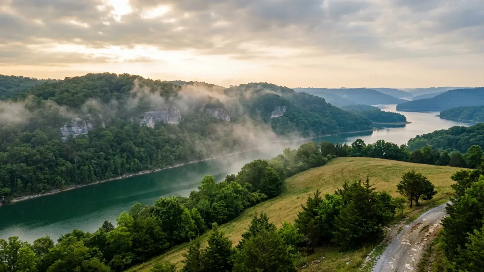
Russell County is Lake Cumberland's north shore, and the lake is not a backdrop here — it is a tenth of the county. The 2024 Census Gazetteer gives Russell 253.26 square miles of land and 29.615 square miles of water, which makes 10.5 percent of its surface water and puts it fourth among all 120 Kentucky counties on that measure, behind only Lyon, Marshall and Fulton. Wolf Creek Dam, which impounds the whole lake, stands about ten miles southwest of Jamestown. For a barndominium buyer that geography sets the agenda. The regulatory picture is unusually open: the Department of Housing, Buildings and Construction's Russell County sheet carries no Local Building Inspector row at all, the county's own website lists no building, planning or zoning office among its departments, services or boards, and no county ordinance index is published. Zoning exists only inside the Russell Springs city limits, where a city commission administers it. What binds everywhere is the Lake Cumberland District Health Department's septic permit on a 22,000 square foot minimum lot, the state electrical certificate before any meter is set, and — for lake-adjacent ground — the Corps of Engineers, whose 2024 Shoreline Management Plan authorises no new private docks at all. Two Russell-specific ground conditions deserve a geotechnical look before a slab is designed: the Kentucky Geological Survey's own county page describes cover-collapse sinkholes and warns that pyrite in the Chattanooga Shale can heave a foundation and the slab resting on it.
Russell County at a glance
- County
- Russell
- Population
- 17,991
- ZIP codes
- 42629, 42642
- Site visits
- Same day
Building conditions in Russell County
The building code is the same in every Kentucky county, and no local government may adopt or enforce a different one on a house — the Kentucky Residential Code says so in its own text. The design criteria are settled by the state too: the code prints a filled-in table covering all 120 counties, so your county's ground snow load, frost depth and seismic design category are published figures rather than something a local office decides. Ultimate design wind speed is 115 mph for every county in the state.
What changes from one county to the next is whether anyone checks. Kentucky makes permits, inspections and certificates of occupancy optional for a single-family home unless the local government has passed an ordinance requiring them, and it forbids the state from stepping in where none has. Twenty-five counties tell the state outright that they have no local building inspector, and in much of the rest the answer depends on an ordinance the county either passed or never did. Zoning is a separate, equally local choice — most Kentucky counties have never adopted any. What is below covers this county specifically: who issues the permit if anyone does, what the state's tables assign it, and what the ground does to a slab.
https://dhbc.ky.gov/Documents/Russell%20%20County.pdf (note the doubled space in the filename as DHBC publishes it; sheet updated 4/7/2026, text extracted with pdftotext -raw and read 6 Sep 2026 — the -layout pass scrambles these sheets) · https://dhbc.ky.gov/docs_cols.aspx?cat=312 · https://russellcountyky.gov/ · https://russellcountyky.gov/services/ · https://russellcountyky.gov/county-boards/ · https://apps.legislature.ky.gov/law/statutes/statute.aspx?id=52659
https://russellcountyky.gov/county-boards/ · https://russellcountyky.gov/services/ · https://russellcountyky.gov/documents/ (all read 6 Sep 2026) · https://russellsprings.net/rs-planning-zoning-commission/ · https://russellsprings.net/wp-content/uploads/2017/07/Zoning-Regulation-Part-1.pdf and .../Zoning-Regulation-Part-2.pdf (both downloaded 6 Sep 2026 at 10.6 MB and 12.0 MB; pdftotext returns only page breaks, so these are scans without a text layer and no OCR tool is available here) · KRS Chapter 100, https://apps.legislature.ky.gov/law/statutes/chapter.aspx?id=38316
https://www.fema.gov/api/open/v1/NfipCommunityStatusBook?$filter=state eq 'KY' and county eq 'RUSSELL COUNTY' (FEMA's own OpenFEMA endpoint, queried 6 Sep 2026, last refreshed 25 Aug 2026 — used because the HTML Community Status Book at https://www.fema.gov/cis/KY.html refuses curl with (refuses automated requests)and returned a misaligned row through the fetcher, giving a wrong CID and a wrong county for Russell Springs) · https://eec.ky.gov/Environmental-Protection/Water/FloodDrought/Documents/FloodplainCoordinatorsList.pdf (the live URL now returns a SharePoint 404; read 6 Sep 2026 from the Internet Archive capture at http://web.archive.org/web/20260305214953/https://eec.ky.gov/Environmental-Protection/Water/FloodDrought/Documents/FloodplainCoordinatorsList.pdf, extracted with pdftotext -raw — the -layout pass on that file assigns Jamestown to Shelby County and Russell County to Simpson County and must not be used) · https://apps.legislature.ky.gov/law/statutes/statute.aspx?id=54097
https://www.dvidshub.net/news/466704/updated-lake-cumberland-shoreline-management-plan-released (Nashville District release, 20 March 2024, retrieved with curl and read 6 Sep 2026) · https://usace.contentdm.oclc.org/digital/collection/p16021coll7/id/25294/ (the 2024 plan in the Corps digital library) · https://usace.contentdm.oclc.org/digital/api/collection/p16021coll7/id/2163/download (the preceding Lake Cumberland Shoreline Management Plan, text extracted and read 6 Sep 2026 — source of the lake description and the boundary-encroachment and sanitary-facility paragraphs) · Lake Cumberland Resource Management Office, 855 Boat Dock Road, Somerset KY, 606-679-6337
https://kgs.uky.edu/kgsweb/download/misc/landuse/RUSSELL/russellissues.htm (Kentucky Geological Survey, Russell County land-use issues; retrieved with curl and the full page text read 6 Sep 2026) · https://kgs.uky.edu/kygeode/geomap?gkarst=true (KGS Karst Potential Index viewer, checkable parcel by parcel) · https://kgs.uky.edu/kgsweb/olops/pub/kgs/IC25_12.pdf (KGS model karst ordinance IC-25)
https://www.nass.usda.gov/Publications/AgCensus/2022/Online_Resources/County_Profiles/Kentucky/cp21207.pdf (2022 Census of Agriculture, Russell County profile, FIPS 21207; extracted 6 Sep 2026 both ways and reconciled — the -layout pass shifts the Farms by Size column up by one row and must not be used, while the -raw pass sums to 639 farms and to 99,006 acres exactly, and its percentage-change column is internally consistent with the 155-acre average) · https://www2.census.gov/geo/docs/maps-data/data/gazetteer/2024_Gazetteer/2024_Gaz_counties_national.zip
Also worth knowing before you build in Russell County
- 15 psf snow, 24 inch frost, seismic category B — the lightest structural case Kentucky publishes
- Three separate Kentucky Residential Code tables answer for Russell County, and each figure belongs to the table that publishes it. Table R301.2(1) gives Russell a ground snow load of 15 psf, the statewide floor, against 20 psf on the Ohio River tier and in the eastern mountain counties. Table R403.1.4, Minimum Frost Protection Depth for Kentucky, places Russell in its All other KY Counties row at 24 inches; the deeper 27, 30 and 33 inch values apply only to named eastern and northern counties. Table R301.2.2.1 assigns Seismic Design Category B, which triggers IRC R301.2.2 Exception 1 and exempts a detached one- or two-family dwelling from the seismic provisions altogether. Statewide values fill in the rest: 115 mph ultimate wind from Table R301.2(1), severe weathering for concrete, and moderate to heavy termite probability. That is about as light a design case as the Commonwealth issues, and it means a Russell County shell is sized by wind and its own dead load. The 24 inch frost depth is still deeper than the turned-down edge on many kit slab details, and the frost-protected shallow foundation alternative is not available for an unheated shop bay, so the footing detail deserves checking against the county number rather than the catalogue.
- The septic permit is the real gate: 22,000 square feet, $227 to evaluate, $271 to permit
- Russell County sits in the ten-county Lake Cumberland District Health Department, with its local office at 211 Fruit of the Loom Drive in Jamestown on 270-343-2181. The district board of health adopted a lot-size regulation on 14 November 2006, effective 1 January 2007, under the authority of KRS 212.230(1)(c), and it applies across the whole district: a lot created, sectioned or platted after 1 January 2007 and intended for a home or a building for human habitation must be a minimum of 22,000 square feet, roughly half an acre, and a subdivision lot needs that 22,000 square feet to be suitable or provisionally suitable area as interpreted under 902 KAR 10:085. The district publishes its process in four steps. Apply for the site evaluation with a $227 fee and submit a floor plan showing bedrooms, laundry, kitchen and baths. Dig two to four backhoe pits 42 inches deep and 50 to 100 feet apart in the proposed field; once the soil is evaluated the district issues the system write-up and a temporary electric sticker. A certified installer then applies for the septic permit at $271, which releases the plumbing inspector to write the water permit. After installation and inspection the permanent electric sticker follows. The regulation also carries a detail people miss: no building may have a water meter installed without a plumbing permit issued through a state-authorised plumbing inspector. A hardship variance is available from the district board or director.
- Over most of the county a domestic well is not a safe assumption
- This is the single most under-appreciated fact about buying rural acreage in Russell County, and the Kentucky Geological Survey states it flatly on the county's own page. In the north-western third of the county about three-quarters of drilled wells yield enough water for domestic use. Throughout the rest of the county only a few wells yield enough for a domestic supply — the exception being ground close to the Cumberland River at the southern end, where most wells are adequate, especially those that penetrate small solution openings in the limestone. So the county divides into roughly three water situations, and two of them are difficult. On a parcel without a public water connection, the well question deserves settling before the land question, not after, and a neighbour's working well two ridges over is weak evidence in karst where flow follows solution conduits rather than the water table. KGS also notes that ponds here need a compacted clay or artificial liner to stop water seeping into limestone solution channels, that a pond dam should be built of compacted clayey soils at slopes flatter than 3 horizontal to 1 vertical, and that a dam over 25 feet high or a pond over 50 acre-feet needs a Division of Water permit.
- A tenth of Russell County is water — fourth highest of Kentucky's 120 counties
- The Census Bureau's 2024 Gazetteer gives Russell County 253.26 square miles of land and 29.615 square miles of water, so 10.47 percent of the county's surface is water. Ranking all 120 Kentucky counties on that measure puts Russell fourth, behind Lyon at 16.7 percent, Marshall at 11.2 and Fulton at 10.7 — and it is the only one of the four outside the Kentucky and Barkley lakes country and the Mississippi River bottoms. For comparison, Pulaski County next door, which has far more Lake Cumberland frontage in absolute terms, is only 2.8 percent water because it is two and a half times larger on land. The practical consequence for a buyer is that lake influence in Russell County is not a niche — coves, embayments and the steep ground above them are ordinary conditions here rather than a special case, and the county's 2020 population of 17,991 across 253 square miles of land works out at about 71 people per square mile. The flip side of steep, water-cut terrain is that a deed acreage figure and a buildable acreage figure can differ sharply, so walk the ground and look for the flat before you commit to the parcel.
- Central time, and no county business licence fee
- Two small administrative facts that catch people coming from Somerset. First, Russell County keeps Central time while Pulaski County next door keeps Eastern, so the county line on the Cumberland Parkway is also the time-zone line. The county's own offices publish Central hours, and the DHBC county sheet gives the health department environmentalist's hours as Monday and Thursday, 8 to 9.30 a.m. CST — an hour and a half a week, in a different time zone from the Somerset office, which is worth knowing before driving over for a septic conversation. Second, Kentucky issues no state licence for residential general contracting, and Russell County adds nothing on top: its Occupational Tax Office states that there is no business licence fee to register within Russell County, though a business operating in the county does register with that office at 410 Monument Square Suite 209, 270-343-1404, open 8 to 4 Central. That is a real contrast with the City of Somerset an hour east, which charges a contractor $150 local or $200 non-local and requires each subcontractor to buy their own. Russell Springs and Jamestown set their own city requirements, so ask the city if the parcel is inside either.
https://dhbc.ky.gov/Documents/2018%20Kentucky%20Residential%20Code%203d%20Ed.pdf — Table R301.2(1) for snow, wind, weathering and termite; Table R301.2.2.1 Seismic Design Categories–Site Class D; Table R403.1.4 Minimum Frost Protection Depth for Kentucky. Transcribed in research/statewide/design-criteria-and-climate.md, where the seismic table was re-extracted in raw content-stream order because the layout pass mis-paired county names
https://www.lcdhd.org/services/environmental-services/guidelines/lot-size-regulation-for-private-waste-water-disposal-systems/ and https://www.lcdhd.org/services/environmental-services/guidelines/new-home-on-site-sewage-disposal/ — the live LCDHD host does not accept connections from here (curl times out on port 443 after 21 seconds on every path tried), so both regulation and fee texts were read 6 Sep 2026 from the Internet Archive captures at http://web.archive.org/web/20260905124213/https://www.lcdhd.org/services/environmental-services/guidelines/lot-size-regulation-for-private-waste-water-disposal-systems/ and http://web.archive.org/web/20260513060757/https://www.lcdhd.org/services/environmental-services/guidelines/new-home-on-site-sewage-disposal/ · https://www.lcdhd.org/locations/russell-county/ via http://web.archive.org/web/20260606202520/https://www.lcdhd.org/locations/russell-county/ · https://apps.legislature.ky.gov/law/kar/titles/902/010/085/
https://kgs.uky.edu/kgsweb/download/misc/landuse/RUSSELL/russellissues.htm (Kentucky Geological Survey, Russell County land-use issues, read 6 Sep 2026; the groundwater section cites Carey and Stickney, 2004) · https://eec.ky.gov/Environmental-Protection/Water/Pages/default.aspx
https://www2.census.gov/geo/docs/maps-data/data/gazetteer/2024_Gazetteer/2024_Gaz_counties_national.zip (2024 Gazetteer counties file, downloaded and the Kentucky rows ranked 6 Sep 2026; Russell County GEOID 21207, ALAND 655,941,463 m2, AWATER 76,703,032 m2) · 2020 decennial population as transcribed in research/statewide/geography-and-population.md
https://russellcountyky.gov/occupational-tax-office/ (read 6 Sep 2026) · https://dhbc.ky.gov/Documents/Russell%20%20County.pdf (office hours stated in CST on the county sheet updated 4/7/2026) · https://russellcountyky.gov/county-judge-executive/ · https://en.wikipedia.org/wiki/Russell_County,_Kentucky (time zone, secondary)

The expensive surprises are in the ground, not the building
What moves a Kentucky budget is usually below grade, and more often than not it is what the ground is sitting on rather than the ground itself. The Kentucky Geological Survey says 92 of the state's 120 counties contain karst — limestone that dissolves — across four named areas: the Western Pennyroyal around Bowling Green and Hopkinsville, the Inner Bluegrass around Lexington, the Eastern Pennyroyal through Somerset and Monticello, and Pine Mountain in the south-east. On karst, KGS's own model ordinance for local governments lists the structures that should not be sited in sinkhole areas, and the list is buildings with soil-bearing foundations and buildings that cover thousands of square feet with impermeable surface. A post-frame or steel building on a monolithic slab is both of those at once. KGS is equally clear that nearly all karst parcels still have buildable ground on them — so karst does not stop the build, it removes the option of siting the pad by eye. A filled and graded-over sinkhole is the classic trap, because the pad looks perfect.
In the two coal fields the question is undermining instead, and Kentucky treats it differently from everything else: mine subsidence coverage is added automatically to property policies in the counties whose fiscal court voted the fund in, with a written opt-out — thirty-seven of them — while karst collapse gets no fund at all and falls under the ordinary earth-movement exclusion. On slopes the surprise is geographic: KGS's landslide inventory puts Kenton, Campbell, Boone and Gallatin — the northern Kentucky counties opposite Cincinnati — near the very top, above most Appalachian counties, on Ordovician shale. Three of those four — Boone, Campbell and Kenton — are the only counties in the state with a line of their own in the residential code's bearing table, which raises the presumptive value for two named clay groups there and nowhere else. Everywhere else the table gives clay and silt a single presumptive figure, and a soils investigation becomes mandatory once the building official determines the real capacity is likely to be lower than it.
The same ground then sizes the septic system, and Kentucky does that from soil morphology — a certified inspector reading the profile in a backhoe pit — rather than from a percolation test, at 110 gallons a day per bedroom against an application rate taken from soil texture and structure. On a mound or other alternative design a measured permeability test can still be required. And on karst the septic regulation is blunter than the building code ever gets: it declares the ground within seventy feet of an open sinkhole throat unsuitable outright. The soil that needs a foundation engineer is usually the soil that complicates the drainfield, so the site work, the foundation and the septic get resolved together rather than one at a time. We price the dirt before we price the building.
What we build in Russell County
All seven services are available in Russell County. What a build costs depends far more on the parcel than on square footage, so we price against your land rather than publishing a rate card.
Barndominium Kits
We check barndominium kit packages against the wind, snow, frost and seismic criteria the Kentucky Residential Code publishes for your county.
Pole Barn Homes
Pole barn homes across Kentucky. KRC §R327 covers accessory barns, not houses — so a pole barn home is engineered by the code's own terms.
Custom Barndominium Plans
Barndominium plans drawn to Kentucky's published county design criteria — snow, wind, seismic, frost — with engineering where the code calls for it.
What a build looks like
Three stages every Russell County project passes through, from a raw parcel to a finished home. Site work first, because that is where the budget is decided.

The parcel
Karst and mine maps, the flood question, zoning where the county has any, and utility access — all checked before anything is drawn.
Pad and permit
Clearing, grading and a compacted pad, while the submittal works through whichever office issues the permit — and where no office does, through the approvals that still apply.

Frame to finish
Shell erected and dried in, then systems and interior finish — and the certified electrical inspection your utility needs before it will set a meter.
Those are the rules where you are building in Russell County. Tell us what you want to build and we will draw it to them.
Where we build around Russell County
Russell and the rural land around it. The buildable acreage for a project this size usually sits outside the city limits, and in Kentucky that line frequently decides whether anyone issues a permit at all, not merely who issues it.
Keep reading
The questions that usually come next once you know what Russell County allows.
Barndominium Cost Guide
Why the published spread runs from one end of the scale to the other, and which of it is the building rather than the ground.
Read itIs It Legal in Kentucky?
Whether your county inspects a house at all, what the farm-dwelling exemption really requires, and the approvals that reach you anyway.
Read itWhat a Pole Barn Home Costs
Post-frame against stick-built, and what the prescriptive post-frame section of the state code does and does not cover.
Read itNearby areas we build in
Others we cover nearby. They share the same statewide code and the same state-published design tables — but whether a house is permitted and inspected at all, whether the county zones, what the health department will accept for septic, and what the ground does to a foundation can all differ from one card to the next. Two counties that touch are not two versions of the same answer.
Building in Russell County: common questions
8 questions we get asked most often about building in Russell County. If yours is not on the list, ask it directly.
Do I need a building permit to put up a barndominium in Russell County?
If nobody inspects the structure, does anything actually get checked?
Can I build a shop bigger than the house?
Who issues the septic permit, and how much land do I need?
What should I know before buying land on Lake Cumberland?
What design figures does a Russell County build have to meet?
Is there buildable acreage in Russell County, or should I look next door?
What about sinkholes, shale heave and radon here?
Building in Russell County?
Start with the plan. Tell us what you want to build and we will draw it, then confirm whether any office permits and inspects a house where your parcel is, what it will let you put there, and which line of the state's snow, frost and seismic tables your county falls on. That conversation costs nothing.