Barndominium Builders in Kenton County, KY
Kenton County is the one Kentucky county where a single joint agency does the planning and permitting for nearly twenty separate governments. Planning and Development Services of Kenton County — PDS — was established in 1961, describes itself as a public agency serving Kenton County and its 19 cities, and works out of 1840 Simon Kenton Way in Covington. It is not a county department and it is not a city department; it is the shared front door for both, and Boone County next door is outside it entirely. Four places are carved out of PDS's building-inspection role and run their own — Erlanger, Bromley, Independence and Fairview — so the honest answer to who inspects a Kenton County house is a two-step answer: PDS for unincorporated Kenton and for Covington, Edgewood, Fort Mitchell, Fort Wright, Taylor Mill, Ludlow, Villa Hills, Crescent Springs, Crestview Hills, Elsmere, Park Hills, Lakeside Park, Kenton Vale and Ryland Heights, and the city itself for the other four. Technically Kenton is one of only three Kentucky counties in Seismic Design Category A, one of only three carrying the code's 2,000 psf clay bearing permission, and — the part almost nobody expects — the second-ranked county in the Kentucky Geological Survey's landslide inventory, ahead of Pike, Floyd, Harlan and Letcher. Kenton is also the only one of the three Northern Kentucky counties whose zoning ordinance answers that with a hard rule: Section 9.24 Hillside Development Controls makes any slope of 20 percent or greater a permit condition, with test borings and a geological analysis, and gives the county power to deny. On the other side of the ledger the zoning is unusually permissive for a county this dense — A-1 and A-2 ask for one acre, not five, and the ordinance writes no floor-area cap on an accessory building at all. Land is the constraint. At 1,037 people per square mile over 163 square miles Kenton is the densest Kentucky county outside Jefferson and Fayette, USDA counts 453 farms over 28,810 acres, and land in farms fell 22 percent between 2017 and 2022. The buildable acreage is in the southern half, around Piner, Morning View, Nicholson and Visalia. If the requirement is volume acreage rather than a particular southern Kenton parcel, Grant County straight down I-75 is the honest answer, with Boone County to the west as the other option.
Kenton County at a glance
- County
- Kenton
- Population
- 177,117
- ZIP codes
- 41011, 41014, 41015, 41016, 41017, 41018, 41051, 41063
- Site visits
- Same day
Building conditions in Kenton County
The building code is the same in every Kentucky county, and no local government may adopt or enforce a different one on a house — the Kentucky Residential Code says so in its own text. The design criteria are settled by the state too: the code prints a filled-in table covering all 120 counties, so your county's ground snow load, frost depth and seismic design category are published figures rather than something a local office decides. Ultimate design wind speed is 115 mph for every county in the state.
What changes from one county to the next is whether anyone checks. Kentucky makes permits, inspections and certificates of occupancy optional for a single-family home unless the local government has passed an ordinance requiring them, and it forbids the state from stepping in where none has. Twenty-five counties tell the state outright that they have no local building inspector, and in much of the rest the answer depends on an ordinance the county either passed or never did. Zoning is a separate, equally local choice — most Kentucky counties have never adopted any. What is below covers this county specifically: who issues the permit if anyone does, what the state's tables assign it, and what the ground does to a slab.
https://www.pdskc.org/about/ (PDS's own account of what it is, when it was formed and who it serves — read 6 Sep 2026; the site serves normally to a browser user-agent, though other PDS endpoints have refused automated access to this project in the past, so nothing here rests on a search extract) · https://dhbc.ky.gov/Documents/Kenton%20County.pdf (DHBC county sheet, updated 8/5/2026, text extracted and read 6 Sep 2026; a contact list rather than a register of ordinances, which is why the jurisdictions' own documents below carry the weight) · https://www.cityofindependence.org/209/Permits (Independence's own Building and Zoning page)
https://dhbc.ky.gov/Documents/2018%20Kentucky%20Residential%20Code%203d%20Ed.pdf — Table R301.2.2.1 Seismic Design Categories–Site Class D, Table R301.2(1) ground snow load, Table R403.1.4 Minimum Frost Protection Depth for Kentucky, and Table R401.4.1 Presumptive Load-Bearing Values footnotes b and c; all four transcribed per county in research/statewide/design-criteria-and-climate.md §§4–5 and research/statewide/soils-karst-and-slopes.md §6 · https://websoilsurvey.nrcs.usda.gov/app/ (the engineering-properties report is where a parcel's USCS symbol comes from)
http://online.encodeplus.com/regs/kentoncounty-ky/doc-view.aspx?secid=5 — Zoning Ordinance, Kenton County, KY, SECTION 9.24 Hillside Development Controls, read 6 Sep 2026 from the ordinance's own enCodePlus service; the archive dialog on the same service lists version 930.6 dated 17 March 2026 as the current ordinance · https://kgs.uky.edu/kgsweb/olops/pub/kgs/ic31_12.pdf (KGS IC-31, Crawford 2014, Figure 11 county ranking; the per-county counts other than Perry's peak are not legible from the extracted figure, so no number is given per county here) · https://www.pdskc.org/Portals/pdskc/Documents/applications_forms/checklists/Checklist_Acc%20Struc-PB_Fillable.pdf (the PDS Accessory Structures / Pole Barn checklist site-plan list)
http://online.encodeplus.com/regs/kentoncounty-ky/doc-view.aspx?secid=5 — Zoning Ordinance, Kenton County, KY: SECTION 10.1 A-1 (Agricultural-One) Zone paragraphs A and D, SECTION 10.29 A-2 (Agricultural-Two) Zone paragraph D, SECTION 9.10 Application of Zoning Regulations; read in full 6 Sep 2026, current version 930.6 dated 17 March 2026 per the service's archive dialog. The absence of an accessory-structure floor-area cap is a searched negative across the whole ordinance text, not an omission · http://online.encodeplus.com/regs/kentoncounty-z21/doc-view.aspx?secid=5 (the Z21 Blueprint, whose Articles 1.04, 1.11 and 1.12 retain unfilled square brackets — read the same day so the two documents would not be confused) · https://www.pdskc.org/services/regulations/
https://www.pdskc.org/Portals/pdskc/Documents/applications_forms/checklists/Checklist_Ag%20Exempt.pdf (PDS Agricultural / Farm Exemptions checklist, text extracted and read 6 Sep 2026) · http://online.encodeplus.com/regs/kentoncounty-ky/doc-view.aspx?secid=5 — SECTION 16.1 Zoning Permits, SECTION 16.2 Building Permits, SECTION 9.28 Land Used for Agricultural Purposes · https://apps.legislature.ky.gov/law/statutes/statute.aspx?id=26719 (KRS 100.203, the agricultural-use limit on zoning and its carve-out for the dwelling)
https://www.nass.usda.gov/Publications/AgCensus/2022/Online_Resources/County_Profiles/Kentucky/cp21117.pdf (2022 Census of Agriculture, Kenton County profile, FIPS 21117 — text extracted and read 6 Sep 2026) · https://www.nass.usda.gov/Publications/AgCensus/2022/Online_Resources/County_Profiles/Kentucky/cp21081.pdf (Grant County) · https://www.nass.usda.gov/Publications/AgCensus/2022/Online_Resources/County_Profiles/Kentucky/cp21015.pdf (Boone County) · https://www.uky.edu/KGS/water/library/gwatlas/Kenton/Overview.htm and https://www.uky.edu/KGS/water/library/gwatlas/Kenton/Topography.htm (the 60 percent upland well-yield finding and the terrain description) · research/statewide/geography-and-population.md for county land areas, densities and the 2020 counts
Also worth knowing before you build in Kenton County
- The Kope Formation, four Ordovician units, and why Northern Kentucky outranks the coalfield for landslides
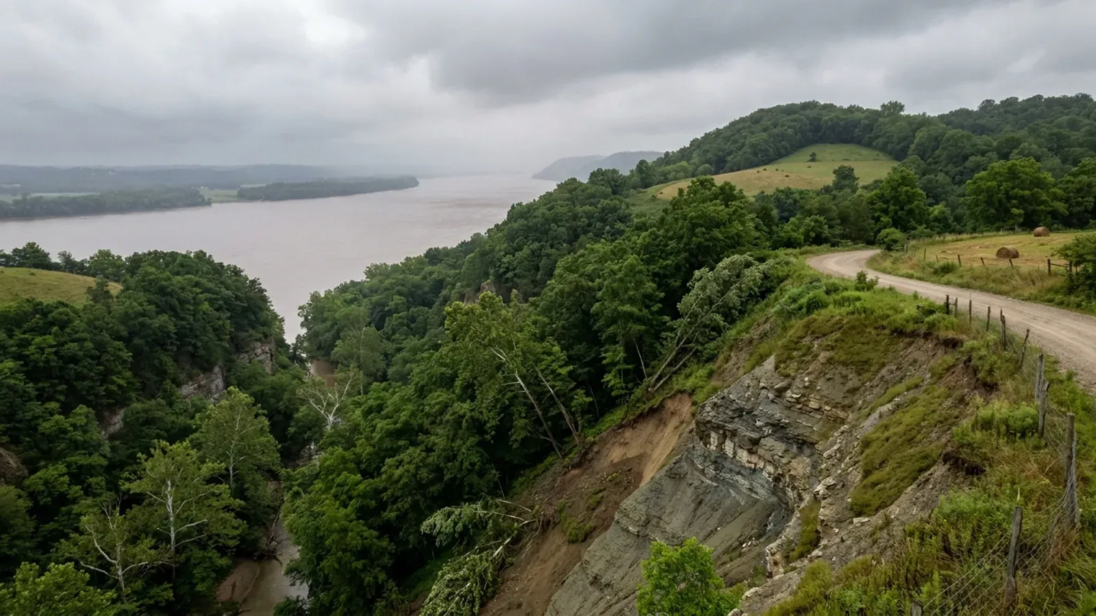
- The mechanism behind Kenton's landslide ranking is in the bedrock, and KGS's Kenton County groundwater atlas names it directly: the oldest rocks found at the surface in Kenton County are the Kope Formation, deposited in shallow Ordovician seas, with the amount of mud — shale — in the sediments recording how shallow those seas became. The atlas lists four bedrock units at the surface across the county, and every one of them is interbedded shale and limestone: the Kope Formation, the Grant Lake Limestone and Fairview Formation, the Bull Fork Formation, and the Cumberland Formation, Leipers Limestone and Catheys Formation, with Quaternary alluvium and glacial sediments along the larger streams. IC-31's formation table puts the Kope second in the state at 334 inventoried landslides, behind only eastern Kentucky's Pikeville Formation, with Fairview, Clays Ferry and Bull Fork adding more. Shale holds water and carries the clay content to fail; the Licking and Ohio valleys give it more than 400 feet of relief to fail into. KGS's own causes list describes precisely what a level building pad does to a hillside — it adds fill and building weight at the top of the slope, removes soil at the toe through an engineered cut, and concentrates runoff — and artificial fill appears in the inventory as a landslide-hosting material in its own right. Two limits belong with this. KGS publishes a landslide susceptibility layer, but it covers 13 eastern Kentucky counties — Breathitt, Floyd, Johnson, Knott, Lee, Leslie, Letcher, Magoffin, Martin, Owsley, Perry, Pike and Wolfe — and Kenton is not among them; and KGS states in its own metadata that the layer is not intended for site-specific slope stability decisions even in the counties it does cover. There is no statewide Kentucky slope threshold that triggers anything. In Kenton the trigger is local, and it is Section 9.24.
- Two feet of freeboard above the base flood, and a state permit that stacks on the county's
- Kenton County's floodplain rules sit inside the zoning ordinance itself, as Section 9.25 Flood Protection Development Controls, adopted under the authority KRS 151.230 delegates to local governments. Its scope clause reaches Special Flood Hazard Areas, areas applicable to KRS 151.250, and any area the Floodplain Administrator or another qualified community official determines from technical studies, historical information and other reliable sources may be subject to periodic inundation — a Community Flood Hazard Area, which explicitly includes ground downstream from dams and can extend beyond the mapped SFHA. The elevation standard is stricter than the NFIP minimum. New construction and substantial improvement of any residential structure must have the lowest floor, including basement, mechanical equipment and ductwork, elevated no lower than two feet above the base flood elevation; fully enclosed areas below the lowest floor that are used solely for parking, access or storage must be built of flood-resistant materials to two feet above BFE and must have openings that automatically equalise hydrostatic pressure; and accessory structures in A zones — a category the ordinance's own definitions list as detached garages, carports, storage sheds, pole barns and hay sheds — must be built of flood-resistant materials and have utilities elevated to the same two feet above BFE. FEMA's Community Status Book lists Kenton County, Covington, Independence, Erlanger, Ludlow, Taylor Mill, Bromley, Crescent Springs, Crestview Hills, Edgewood and Villa Hills as participating in the National Flood Insurance Program, all on a current effective map dated 16 May 2013, and no Kenton County community is shown carrying a Community Rating System class — Kentucky has only a handful of CRS communities statewide, and none of them is here. Whatever the local answer, Kentucky adds a state one: a Division of Water floodplain construction permit is required for work in the base floodplain under KRS 151.250 and 401 KAR 4:060 §2, on form DOW 7116. The state permit stacks on the local permit rather than replacing it, and the ordinance separately requires the Floodplain Administrator to notify the Kentucky Division of Water before any alteration or relocation of a watercourse.
- The septic evaluation comes first, and the approved area must not be driven on
- Kentucky's on-site sewage permits are issued locally by a certified inspector at the health department having jurisdiction under 902 KAR 10:110, with the state cabinet writing 902 KAR 10:085 and certifying the inspectors and installers. For Kenton County that department is the Northern Kentucky Health Department, which states plainly that it provides septic system inspections in Boone, Campbell, Grant and Kenton counties. The published sequence is an application for a site evaluation with a $300 fee paid at submission, then soil testing; if the result shows a usable area, the inspector marks that area on the ground — and the department's own instruction is that the marked area is not to be disturbed by grading, heavy equipment traffic, placement of building materials or any related action, because compaction and soil structure damage can void the site evaluation. Normal mowing or bush hogging is allowed. Only after a suitable overall rating may a certified installer apply for the installation permit, and the installer must request an inspection before any of the work is covered. That do-not-disturb rule is a live construction-sequencing constraint on a barndominium site, where the natural instinct is to stage steel, trusses and gravel wherever the ground is open. The department also notes that local building code offices require it to inspect an existing septic system before a building or remodeling permit issues — which is how the health department reaches a project that is not itself new construction. On the Kenton side, PDS's Agricultural / Farm Exemptions checklist lists the health department permit or the site evaluation for an existing system among the items to be uploaded with the zoning permit application, so on a parcel with no sewer the soil work has to be finished before the zoning permit, and the zoning permit has to issue before the building permit.
- Sanitation District No. 1 is a fourth approval, and it starts at one acre
- Northern Kentucky runs a regional wastewater and stormwater utility, Sanitation District No. 1, serving more than thirty communities across Boone, Campbell and Kenton counties, and on a rural Kenton build it is an approval most people do not see coming. PDS's own checklists name it: the Agricultural / Farm Exemptions checklist lists a Land Disturbance Permit from Sanitation District No. 1 for areas larger than one acre among the items required with the application. SD1 has combined its Clearing Permit, Grading Permit and Land Disturbance Permit applications into a single stormwater permit application, and its rules exist because construction that disturbs an acre or more is the threshold at which Kentucky's construction stormwater regime bites. An acre is not much ground on a project that includes a house, a shop, a drive and a septic field, so on a sloping site the land disturbance permit and the Section 9.24 hillside submission tend to arrive together. PDS reinforces the same theme in its ordinary site-plan requirements, which ask for provisions for erosion control, hillside slippage and sedimentation, naming the temporary and permanent control practices to be implemented during all phases of clearing, grading and construction, plus water drainage and grading lines and existing and proposed topography at contour intervals not exceeding five feet. The zoning ordinance's Section 16.1 asks for the same drainage plan, spot elevations of the proposed finished grade and erosion and sedimentation control provisions with the zoning permit itself.
- PDS asks for engineered drawings on a pole barn — and reprints the code section that limits one
- PDS publishes a building checklist headed Accessory Structures / Pole Barn, and it is unusually explicit for a Kentucky permit office. It opens by stating that construction of a pole barn, detached garage, storage shed, fence, sign or any other type of accessory structure requires a permit obtained before any construction is performed. It then names three things for which engineered drawings are required: a pre-engineered metal building, a pole barn, and a retaining wall. Below that it lists the accessory structures that need a zoning-only permit rather than a building permit — a face change, structures of 200 square feet or less, and fences of seven feet or less unless there is an in-ground pool. The rest of the checklist is a full construction-document list: foundation plan with footings, girder and pier spacing; framing plan and wall section with sizes, spacing and spans; floor plans labelling rooms, egress doors, windows and smoke detectors; the UL design of any fire separation wall required because the structure sits within five feet of a property line; elevations; window and door schedules; and energy calculations. The checklist then reprints the Kentucky Residential Code's Section R327, Post and Frame Structures, with its figure and its eight structural limits: residential accessory structures, single storey, metal roof on purlins and metal wall panels on girts with bracing or solid exterior structural sheathing, no attic storage, maximum building width 48 feet including overhang, maximum wall height 16 feet, maximum mean roof height 20 feet and maximum post spacing 8 feet — and the line that anything exceeding those limits must be designed by a Kentucky registered design professional. Two consequences follow for a barndominium. R327 is written for residential accessory structures, so the prescriptive post-frame path does not carry the dwelling itself; and a shop wider than 48 feet or taller than 16 feet at the wall leaves the prescriptive path and needs an engineer regardless of what the salesperson's brochure says. PDS also notes that electrical and HVAC work are applied for by the licensed contractor on separate permits.
- The permit fee is charged by the square foot — and a house plus a shop is two fees
- PDS publishes a Building Codes Administration Program Fee Schedule for residential permits, effective 1 July 2023, and it is one of the few Kentucky jurisdictions on this axis to publish rates rather than say fees are set by the legislative body. A single-family detached dwelling is charged at $0.272 per square foot with $200 due with the application and the balance due prior to the permit; the same square-foot rate applies to a two-family dwelling, multi-family, townhome, an addition and an alteration or remodel. The schedule defines how that area is measured: total floor space at the subfloor level including the enclosing walls, taking in basement area, first floor, second floor, garage, bonus room and covered deck, and excluding uncovered porches and uncovered decks. So a barndominium's attached garage and shop area are inside the fee base, not outside it. Detached accessory buildings are charged as flat fees instead, and the schedule draws its line at 400 square feet: a small accessory structure is defined as a structure of between 200 and 400 square feet used for storage, a large accessory structure as one greater than 400 square feet, and a detached garage as an accessory structure used primarily for motor vehicle storage. The note that costs people money is the one on calculating fees: a separate fee is required for each construction type specified in the schedule even if the individual activities are part of the same project on the same site. A house and a detached shop on one parcel are two permits and two fees, not one. Two more worth knowing: commencing work covered by a required building permit without that permit is charged at 1.5 times the fee, and all fees collected at application are non-refundable, as are all fees once a permit issues.
- No contractor competency licence — an occupational licence and a workers' comp affidavit instead
- Kentucky issues no state licence for residential general contracting, and Kenton County does not add a competency exam or a bond on top of it. What PDS does require appears on every one of its building checklists in the same two lines: a Kenton County occupational licence, for the city or county where the work is being performed, and proof of Kentucky workers' compensation coverage or an affidavit of assurances, cited to KRS 198B.060(10). That statute is the hook — it ties the building permit to workers' compensation coverage rather than to any test of skill. The affidavit route exists for a genuinely exempt contractor, and the City of Independence publishes its own Affidavit of Assurances form for the same purpose. The occupational licence is a revenue instrument, not a credential, and note the wording: it is the city or county where the work is performed, so a job inside Covington and a job in unincorporated Kenton are not necessarily the same filing. The trades remain licensed by the Commonwealth regardless of any of this — electrical under KRS 227.450 to 227.530, plumbing under KRS Chapter 318, HVAC under KRS Chapter 198B — and DHBC assigns Kenton County a state building inspector, a state electrical inspector, a state HVAC inspector and a plumbing inspector by name. KRS 198B.060(11) is the one approval that reaches every Kentucky address without exception: no utility may energise a new building until a certified electrical inspector issues a final certificate.
- No named karst area, no mine subsidence fund, Radon Zone 2 — and glacial ground on the river
- Kenton County's ground hazards are not the ones most of Kentucky worries about, and it is worth saying which ones do not apply. KGS's groundwater atlas names five principal karst regions in Kentucky — the Western Pennyroyal, the Inner Bluegrass, the Eastern Pennyroyal, Carter Caves and the crest of Pine Mountain — and Northern Kentucky is in none of them. The atlas's own Kenton County geology page lists the surface units as the Kope, the Grant Lake Limestone and Fairview, the Bull Fork, and the Cumberland, Leipers and Catheys, all interbedded shale and limestone rather than the thick soluble carbonate that makes sinkhole country, plus Quaternary alluvium and glacial sediments along the larger streams — Kenton sits at the edge of the glaciated ground, which is why the atlas records the Ohio River alluvium as the best aquifer in the county, with many properly constructed drilled wells producing several hundred gallons a minute. Kenton is not among the 37 counties whose fiscal courts voted into the Kentucky Mine Subsidence Insurance Fund, so the automatic endorsement under KRS 304.44-030 does not attach to a Kenton policy; that fund tracks the two coal fields and Northern Kentucky is in neither. On EPA's Map of Radon Zones, Kenton falls outside the 30-county Zone 1 list — the Inner Bluegrass and the Pennyroyal karst belt — and lands in Zone 2, moderate potential, while neighbouring Pendleton County is Zone 1. EPA's own caveat is that the map should not be used to decide whether an individual home needs testing, and Kentucky adopts appendices K, R and S of the residential code but not Appendix F, so radon-resistant construction is nowhere required here and a passive sub-slab rough-in is a cheap decision while the slab is still open. What Kenton has instead of karst is slope, and the county wrote Section 9.24 for it.
https://www.uky.edu/KGS/water/library/gwatlas/Kenton/Geology.htm (the four surface units and the Kope at the surface in Kenton County, read 6 Sep 2026) · https://kgs.uky.edu/kgsweb/olops/pub/kgs/ic31_12.pdf (KGS IC-31, Crawford 2014 — Figure 11 county ranking and Table 5 formation counts) · https://kgs.uky.edu/arcgis/rest/services/Hazards/LandslideSusceptibility/MapServer/info/iteminfo (the 13-county coverage and KGS's own caveat) · https://www.uky.edu/KGS/water/library/gwatlas/Kenton/Topography.htm (relief along the Licking River)
http://online.encodeplus.com/regs/kentoncounty-ky/doc-view.aspx?secid=5 — Zoning Ordinance, Kenton County, KY, SECTION 9.25 Flood Protection Development Controls: statutory authorization, scope, definitions of Accessory Structure and Community Flood Hazard Area, and the residential and accessory-structure elevation standards; read 6 Sep 2026 · https://www.fema.gov/cis/KY.html (Kentucky Community Status Book — fema.gov refuses direct automated requests with a 403 status, so the Kenton County rows were read through the fetch service; treat the individual city rows as a pointer and confirm a specific community and its CRS status with FEMA before relying on it) · https://apps.legislature.ky.gov/law/statutes/statute.aspx?id=54097 · https://eec.ky.gov/Environmental-Protection/Water/FloodDrought/Pages/UnderstandYourFloodHazards.aspx
https://nkyhealth.org/septic/ (Northern Kentucky Health Department — counties served, the $300 site evaluation fee, the marked-area disturbance rule and the permit sequence; read 6 Sep 2026) · https://www.pdskc.org/Portals/pdskc/Documents/applications_forms/checklists/Checklist_Ag%20Exempt.pdf · https://apps.legislature.ky.gov/law/kar/titles/902/010/085/ · https://apps.legislature.ky.gov/law/kar/titles/902/010/110/
https://www.pdskc.org/Portals/pdskc/Documents/applications_forms/checklists/Checklist_Ag%20Exempt.pdf (item 6, the SD1 land disturbance permit for areas larger than one acre) · https://www.sd1.org/213/Permitting-Other-Requirements (SD1's own permitting page, which states the clearing, grading and land disturbance applications have been combined into one at https://forms.sd1.org/forms/StormWaterPermit; read 6 Sep 2026) · https://www.sd1.org/DocumentCenter/View/73/Stormwater-Rules-and-Regulations-PDF · http://online.encodeplus.com/regs/kentoncounty-ky/doc-view.aspx?secid=5 — SECTION 16.1 Zoning Permits, plot plan requirements
https://www.pdskc.org/Portals/pdskc/Documents/applications_forms/checklists/Checklist_Acc%20Struc-PB_Fillable.pdf (PDS Accessory Structures / Pole Barn checklist, text extracted and read 6 Sep 2026) · https://www.pdskc.org/services/one-stop-shop/building-permits/ (the checklist index, which also carries Res 1-2 Family, Res Additions, Shell, Site Foundation, Decks, Basement Finish, Demolition and Ice Barrier checklists) · https://dhbc.ky.gov/Documents/2018%20Kentucky%20Residential%20Code%203d%20Ed.pdf — SECTION R327 Post and Frame Structures; see also research/statewide/design-criteria-and-climate.md §6 on R327's exclusion of dwellings
https://www.pdskc.org/Portals/pdskc/Documents/OSS/FY24ResFeesNotes.pdf (PDS Building Codes Administration Program Fee Schedule, Residential Building Permit Fees, effective 01 July 2023 — text extracted and read 6 Sep 2026. The square-footage rate, the $200 application deposit and the numbered notes extract cleanly; the flat-fee column for the accessory-structure and other fixed-fee rows does not align reliably in extraction, so no flat-fee figure is quoted here — ask PDS Building Permits on 859-957-2408 for the current figure) · https://www.pdskc.org/Portals/pdskc/Documents/OSS/FY24CommFeesNotes.pdf (the commercial companion schedule) · http://online.encodeplus.com/regs/kentoncounty-ky/doc-view.aspx?secid=5 — SECTION 19.0, which states only that fees shall be as provided by the legislative body
https://www.pdskc.org/Portals/pdskc/Documents/applications_forms/checklists/Checklist_Acc%20Struc-PB_Fillable.pdf and https://www.pdskc.org/Portals/pdskc/Documents/applications_forms/checklists/Checklist_Ag%20Exempt.pdf (both PDS checklists carry the identical contractor requirement, citing KRS 198B.060(10) — read 6 Sep 2026; this supersedes the search-extract-only posture recorded at research/statewide/contractor-licensing.md §3.5, which noted a 404 on the PDS building-codes FAQ and a 403 from the pdskc.govbuilt.com licensed-contractors portal) · https://www.cityofindependence.org/209/Permits (Independence's own Affidavit of Assurances and checklists) · https://apps.legislature.ky.gov/law/statutes/statute.aspx?id=52659 · https://dhbc.ky.gov/Documents/Kenton%20County.pdf
https://www.uky.edu/KGS/water/library/gwatlas/Kenton/Karst.htm (the five named karst regions, none of which is Northern Kentucky) · https://www.uky.edu/KGS/water/library/gwatlas/Kenton/Geology.htm and https://www.uky.edu/KGS/water/library/gwatlas/Kenton/Overview.htm (surface units, glacial sediments and the Ohio River alluvium) · https://insurance.ky.gov/PPC/Documents/JAN%202025_Revised%20Mine%20Subsidence%20Insurance%20Fund%20080124.pdf (the 37-county list; Kenton is not on it — and the list has changed over time, so check the current KDOI page rather than a copy) · https://www.epa.gov/sites/default/files/2014-08/documents/kentucky.pdf together with https://radonlevels.org/state/ky (the EPA document is a graphic map whose county colour assignments do not extract, so Kenton's Zone 2 placement is taken from a third-party rendering of that map corroborated across two such renderings, and should be re-checked against EPA before anyone relies on it) · research/statewide/soils-karst-and-slopes.md §§1, 4, 7

The expensive surprises are in the ground, not the building
What moves a Kentucky budget is usually below grade, and more often than not it is what the ground is sitting on rather than the ground itself. The Kentucky Geological Survey says 92 of the state's 120 counties contain karst — limestone that dissolves — across four named areas: the Western Pennyroyal around Bowling Green and Hopkinsville, the Inner Bluegrass around Lexington, the Eastern Pennyroyal through Somerset and Monticello, and Pine Mountain in the south-east. On karst, KGS's own model ordinance for local governments lists the structures that should not be sited in sinkhole areas, and the list is buildings with soil-bearing foundations and buildings that cover thousands of square feet with impermeable surface. A post-frame or steel building on a monolithic slab is both of those at once. KGS is equally clear that nearly all karst parcels still have buildable ground on them — so karst does not stop the build, it removes the option of siting the pad by eye. A filled and graded-over sinkhole is the classic trap, because the pad looks perfect.
In the two coal fields the question is undermining instead, and Kentucky treats it differently from everything else: mine subsidence coverage is added automatically to property policies in the counties whose fiscal court voted the fund in, with a written opt-out — thirty-seven of them — while karst collapse gets no fund at all and falls under the ordinary earth-movement exclusion. On slopes the surprise is geographic: KGS's landslide inventory puts Kenton, Campbell, Boone and Gallatin — the northern Kentucky counties opposite Cincinnati — near the very top, above most Appalachian counties, on Ordovician shale. Three of those four — Boone, Campbell and Kenton — are the only counties in the state with a line of their own in the residential code's bearing table, which raises the presumptive value for two named clay groups there and nowhere else. Everywhere else the table gives clay and silt a single presumptive figure, and a soils investigation becomes mandatory once the building official determines the real capacity is likely to be lower than it.
The same ground then sizes the septic system, and Kentucky does that from soil morphology — a certified inspector reading the profile in a backhoe pit — rather than from a percolation test, at 110 gallons a day per bedroom against an application rate taken from soil texture and structure. On a mound or other alternative design a measured permeability test can still be required. And on karst the septic regulation is blunter than the building code ever gets: it declares the ground within seventy feet of an open sinkhole throat unsuitable outright. The soil that needs a foundation engineer is usually the soil that complicates the drainfield, so the site work, the foundation and the septic get resolved together rather than one at a time. We price the dirt before we price the building.
What we build in Kenton County
All seven services are available in Kenton County. What a build costs depends far more on the parcel than on square footage, so we price against your land rather than publishing a rate card.
Barndominium Kits
We check barndominium kit packages against the wind, snow, frost and seismic criteria the Kentucky Residential Code publishes for your county.
Pole Barn Homes
Pole barn homes across Kentucky. KRC §R327 covers accessory barns, not houses — so a pole barn home is engineered by the code's own terms.
Custom Barndominium Plans
Barndominium plans drawn to Kentucky's published county design criteria — snow, wind, seismic, frost — with engineering where the code calls for it.
What a build looks like
Three stages every Kenton County project passes through, from a raw parcel to a finished home. Site work first, because that is where the budget is decided.

The parcel
Karst and mine maps, the flood question, zoning where the county has any, and utility access — all checked before anything is drawn.
Pad and permit
Clearing, grading and a compacted pad, while the submittal works through whichever office issues the permit — and where no office does, through the approvals that still apply.

Frame to finish
Shell erected and dried in, then systems and interior finish — and the certified electrical inspection your utility needs before it will set a meter.
Those are the rules where you are building in Kenton County. Tell us what you want to build and we will draw it to them.
Where we build around Kenton County
Kenton and the rural land around it. The buildable acreage for a project this size usually sits outside the city limits, and in Kentucky that line frequently decides whether anyone issues a permit at all, not merely who issues it.
Keep reading
The questions that usually come next once you know what Kenton County allows.
Barndominium Cost Guide
Why the published spread runs from one end of the scale to the other, and which of it is the building rather than the ground.
Read itIs It Legal in Kentucky?
Whether your county inspects a house at all, what the farm-dwelling exemption really requires, and the approvals that reach you anyway.
Read itWhat a Pole Barn Home Costs
Post-frame against stick-built, and what the prescriptive post-frame section of the state code does and does not cover.
Read itNearby areas we build in
Others we cover nearby. They share the same statewide code and the same state-published design tables — but whether a house is permitted and inspected at all, whether the county zones, what the health department will accept for septic, and what the ground does to a foundation can all differ from one card to the next. Two counties that touch are not two versions of the same answer.
Building in Kenton County: common questions
9 questions we get asked most often about building in Kenton County. If yours is not on the list, ask it directly.
Who issues the building permit for a barndominium in Kenton County?
Can I build a shop bigger than the house in Kenton County?
How much land do I need, and how much is actually left in Kenton County?
Northern Kentucky has a landslide problem? I thought that was eastern Kentucky.
What happens if my site is on a slope?
Does the farm exemption get me out of permits in Kenton County?
What design figures does a Kenton County build have to meet?
Is a Kenton County parcel likely to be in a flood zone, and what does that add?
Do I need a contractor's licence to build in Kenton County?
Building in Kenton County?
Start with the plan. Tell us what you want to build and we will draw it, then confirm whether any office permits and inspects a house where your parcel is, what it will let you put there, and which line of the state's snow, frost and seismic tables your county falls on. That conversation costs nothing.