Barndominium Builders in Grant County, KY
Grant County is where Northern Kentucky goes to find acreage, and the numbers behind that are worth stating plainly. USDA's 2022 Census of Agriculture counts 787 farms across 84,737 acres here, averaging 108 acres, over 258 square miles carrying 24,941 people — about 97 to the square mile. In the 50-to-179-acre band, the size most people actually want for a house, a shop and some ground around them, Grant has 362 farms against Boone County's 214 and Kenton County's 151, and 97 more in the 180-to-499 band. That is why both of those counties end up pointing down I-75 and I-71. Administratively Grant is simpler than either of them: the Grant County Building Inspector issues all building permits in the county and performs three separate inspections on a new house, and the Grant County Planning Commission at the old courthouse on North Main Street in Williamstown handles zoning for the county and, under an inter-local agreement, for the City of Williamstown as well. Grant is not inside Planning and Development Services of Kenton County; there is one office, not nineteen. Technically it is the interesting case on the northern criteria. Grant shares the 20 psf ground snow load with Boone, Kenton and Campbell and shares nothing else with them: it drops to the 24-inch frost depth that covers about a hundred Kentucky counties rather than their 30 inches, it sits in Seismic Design Category B rather than their Category A, and it is not named in the code's only county-specific bearing amendment. On a Boone lot and a Grant lot forty minutes apart, the footing schedule is genuinely different. Two things a buyer should know before choosing a parcel. Groundwater is poor: KGS records that in the uplands, about 80 percent of the county, most drilled wells will not produce a dependable domestic supply. And every incorporated city in Grant County — Williamstown, Dry Ridge, Crittenden and Corinth — is listed by FEMA as not in the National Flood Insurance Program. Only unincorporated Grant County participates.
Grant County at a glance
- County
- Grant
- Population
- 24,941
- ZIP codes
- 41010, 41030, 41035, 41052, 41054, 41097
- Site visits
- Same day
Building conditions in Grant County
The building code is the same in every Kentucky county, and no local government may adopt or enforce a different one on a house — the Kentucky Residential Code says so in its own text. The design criteria are settled by the state too: the code prints a filled-in table covering all 120 counties, so your county's ground snow load, frost depth and seismic design category are published figures rather than something a local office decides. Ultimate design wind speed is 115 mph for every county in the state.
What changes from one county to the next is whether anyone checks. Kentucky makes permits, inspections and certificates of occupancy optional for a single-family home unless the local government has passed an ordinance requiring them, and it forbids the state from stepping in where none has. Twenty-five counties tell the state outright that they have no local building inspector, and in much of the rest the answer depends on an ordinance the county either passed or never did. Zoning is a separate, equally local choice — most Kentucky counties have never adopted any. What is below covers this county specifically: who issues the permit if anyone does, what the state's tables assign it, and what the ground does to a slab.
https://grantcounty.ky.gov/wp-content/uploads/2026/04/Permit-Application-Form-Updated.pdf (Grant County Application for Building & Site Permit, Rev 4/2/2026 — text extracted with pdftotext and read 6 Sep 2026; the load-bearing document, because DHBC's directory is a contact list and not a register of ordinances) · https://grantcounty.ky.gov/building-inspector/ · https://grantcounty.ky.gov/departments-and-agencies/ · https://dhbc.ky.gov/Documents/Grant%20County.pdf (DHBC county sheet, updated 8/5/2026, read the same day; extracted with pdftotext -raw because -layout scrambles these sheets) · https://apps.legislature.ky.gov/law/statutes/statute.aspx?id=52659
https://www.nass.usda.gov/Publications/AgCensus/2022/Online_Resources/County_Profiles/Kentucky/cp21081.pdf (2022 Census of Agriculture, Grant County profile, FIPS 21081 — extracted both ways and reconciled 6 Sep 2026. Note for anyone re-checking: pdftotext -layout misaligns the Farms by Size column on this sheet, pairing 97 with the 500-to-999 row; the -raw extraction is the correct one and is what the figures above come from) · https://www.nass.usda.gov/Publications/AgCensus/2022/Online_Resources/County_Profiles/Kentucky/cp21015.pdf (Boone) · https://www.nass.usda.gov/Publications/AgCensus/2022/Online_Resources/County_Profiles/Kentucky/cp21117.pdf (Kenton) · research/statewide/geography-and-population.md for the 2020 county counts, and the 2024 Census Gazetteer county file for Grant's 257.976 square miles of land area
https://dhbc.ky.gov/Documents/2018%20Kentucky%20Residential%20Code%203d%20Ed.pdf — Table R301.2(1) ground snow load (Grant listed in the 20 psf group), Table R403.1.4 Minimum Frost Protection Depth for Kentucky (Grant falls under 'All other KY Counties' at 24 in), Table R301.2.2.1 Seismic Design Categories–Site Class D (Grant = B), Table R401.4.1 Presumptive Load-Bearing Values footnote c (Boone, Campbell and Kenton only); all four transcribed per county in research/statewide/design-criteria-and-climate.md §§2, 4 and 5 and research/statewide/soils-karst-and-slopes.md §6 · https://websoilsurvey.nrcs.usda.gov/app/ (the engineering-properties report is where a parcel's USCS symbol comes from)
https://cdrky.org/wp-content/uploads/Grant-County-Map-Amendment-Application2016.pdf (Grant County Planning Commission's own application form, giving the office address, phone, administrator email and the KRS 100.213(1) findings — hosted on the City of Dry Ridge's site; read 6 Sep 2026) · https://cms5.revize.com/revize/williamstown/Document_Center/Government/Zoning/zoning-ordinance.pdf (City of Williamstown Official Zoning Ordinance, prepared by the Northern Kentucky Area Development District from the Northern Kentucky Area Planning Commission model, SECTION 10 A-1 paragraphs D, E, G and H; text extracted and read 6 Sep 2026) · https://wtownky.org/government/zoning/index.php (the inter-local agreement statement) · https://cdrky.org/wp-content/uploads/Dry-Ridge-Zoning-Ordinance-final-adopted-4-17-06-rev-9-12-2016-1.pdf (Dry Ridge Zoning Ordinance, SECTION 10.0 A-1 paragraph D) · https://grantcounty.ky.gov/ordinances/ and https://grantcounty.ky.gov/planning-zoning/ (the county's own pages, searched for the zoning regulations text without success — ask the Planning Commission)
https://cdrky.org/wp-content/uploads/Dry-Ridge-Zoning-Ordinance-final-adopted-4-17-06-rev-9-12-2016-1.pdf — City of Dry Ridge Zoning Ordinance, SECTION 9.25 Hillside Development Controls (15 percent trigger) and SECTION 10.0 A-1; the absence of an accessory-structure floor-area cap is a searched negative across the full extracted text, not an omission · https://cms5.revize.com/revize/williamstown/Document_Center/Government/Zoning/zoning-ordinance.pdf — City of Williamstown Official Zoning Ordinance, SECTION 9.24 Hillside Development Controls (20 percent trigger), searched the same way · http://online.encodeplus.com/regs/kentoncounty-ky/doc-view.aspx?secid=5 (Kenton County SECTION 9.24, the 20 percent comparison) · https://online.encodeplus.com/regs/boonecounty-ky/doc-view.aspx?secid=2480 (Boone County SECTION 3153, the accessory-structure cap that Grant's ordinances do not have)
https://www.fema.gov/cis/KY.html (Kentucky Community Status Book — fema.gov refuses direct automated requests, so the rows were read through the fetch service and then cross-checked line by line against the saved page: Grant County appears in the participating table under the Reg-Emer Date / CRS Entry Date header, while Corinth, Crittenden, Dry Ridge and Williamstown appear under the header 'Communities Not in the National Flood Program' with its Sanction Date column. Confirm a specific community with FEMA before relying on it) · https://www.fema.gov/sites/default/files/documents/fema_crs_eligible-communities_042026.pdf (CRS Eligible Communities, 1 April 2026 effective date — extracted with pdftotext -raw; note that -layout shifts the class and discount columns by one row on this document and must not be used. No Grant County community appears in the 42-row Kentucky block) · https://apps.legislature.ky.gov/law/statutes/statute.aspx?id=54097 · https://eec.ky.gov/Environmental-Protection/Water/FloodDrought/Pages/UnderstandYourFloodHazards.aspx
Also worth knowing before you build in Grant County
- In 80 percent of Grant County, a drilled well will not give you a dependable domestic supply
- Groundwater is the quiet constraint on a Grant County parcel and it is worse here than in the counties to the north. The Kentucky Geological Survey's Grant County groundwater atlas states that groundwater resources in Grant County are limited; that in the valley bottoms wells will produce enough water for a domestic supply except during dry weather; and that in the upland areas, which it puts at about 80 percent of the county, most drilled wells will not produce enough water for a dependable domestic supply unless they are drilled along drainage lines. It adds that throughout the county the groundwater is hard or very hard and may contain salt or hydrogen sulfide, especially below 100 feet. For comparison, KGS gives the same finding for roughly 60 percent of Kenton County. The practical reading is simple, and it should shape which parcel gets bought rather than how the building gets designed: on Grant County ground, the water question is a public-water question. Confirm where the main runs before the offer, not after — a ridgetop site with a view and no main is a cistern or a haul, and the ridgetops are where the buildable ground is. KGS puts the county in the highly dissected Outer Bluegrass, with ridgetop elevations in excess of 900 feet common, Williamstown at 974 feet and Corinth at 980, and local relief along the principal drainage lines generally over 150 feet and in places almost 300. Eagle Creek is the largest stream in the county, with valley widths of half a mile or more.
- The Northern Kentucky Health Department does reach Grant — and the marked septic area must not be driven on
- Kentucky's on-site sewage permits are issued locally by a certified inspector at the health department having jurisdiction under 902 KAR 10:110, with the state cabinet writing 902 KAR 10:085 and certifying the inspectors and installers. Several counties on this axis turn out to run their own standalone health departments, so it is worth confirming rather than assuming: Grant County is inside the Northern Kentucky Health Department, which states that it provides septic system services in Boone, Campbell, Grant and Kenton counties, from 8001 Veterans Memorial Drive in Florence, 859-341-4264, with a Grant County clinic at 234 Barnes Road in Williamstown. DHBC's Grant County sheet corroborates it independently by listing the environmentalist for Grant County, Ted Tally, at that same Florence address on 859-363-2027. The published sequence is an application for a site evaluation with a $300 fee paid at submission, then soil testing; if a usable area is found the inspector marks it on the ground, and the department's own instruction is that the marked area is not to be disturbed by grading, heavy equipment traffic, placement of building materials or any related action, because compaction and soil-structure damage can void the site evaluation. Normal mowing or bush hogging is allowed. Only after a suitable or provisionally suitable overall rating may a certified installer apply for the installation permit, and the installer must request an inspection before any work is covered. That do-not-disturb rule is a live sequencing constraint on a pole-barn or post-frame site, where the instinct is to stage steel, trusses and gravel wherever the ground is open — on a Grant County ridge parcel the open ground and the septic area are frequently the same ground.
- The Kope Formation does reach Grant County — but Grant sits well down Kentucky's landslide list, not near the top
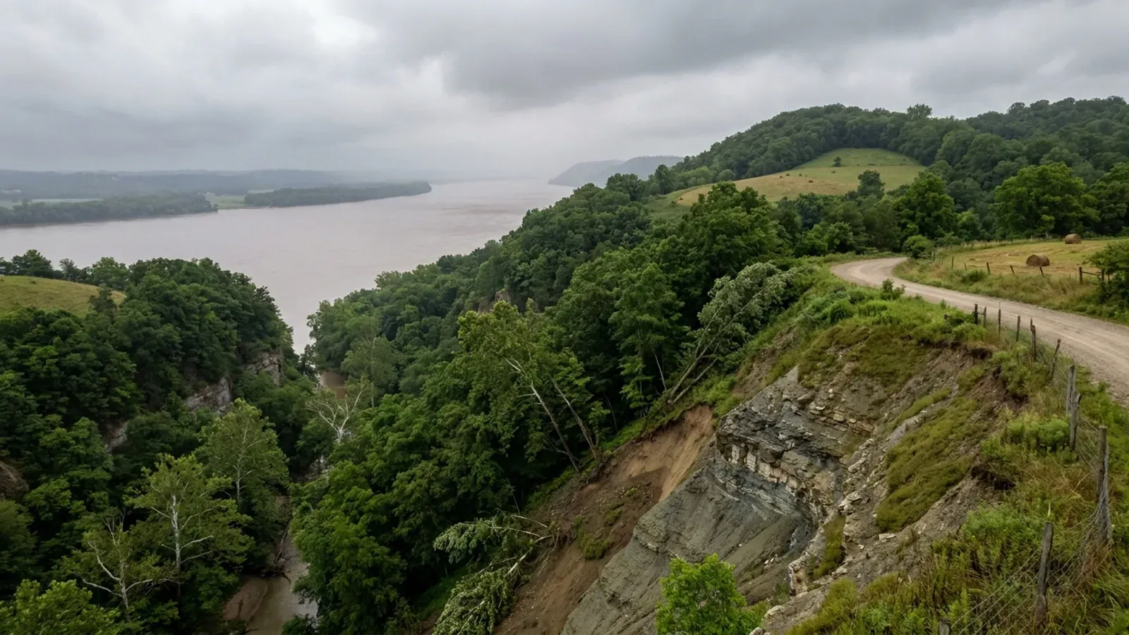
- Northern Kentucky's landslide ranking is the region's most counter-intuitive fact, and it is worth getting the Grant County version right rather than importing the Kenton County version. The Kentucky Geological Survey's Information Circular 31 plots the counties with ten or more inventoried landslides, and Grant County is on it — but its position in the plotted order is roughly twenty-second, well behind Kenton and Campbell in second and third place, behind Perry at the top, and behind Boone and Gallatin too. The mechanism does reach here: KGS's Grant County groundwater atlas lists the Kope Formation among the bedrock units at the surface in the county, alongside the Clays Ferry Formation with its Point Pleasant Tongue, the Grant Lake Limestone and Fairview Formation, the Bull Fork Formation and, as the oldest unit exposed here, the Lexington Limestone — all Ordovician, all interbedded limestone and shale. IC-31's formation table puts the Kope second in the state at 334 inventoried landslides behind only eastern Kentucky's Pikeville Formation, with the Grant Lake Limestone adding 11 and a combined Kope-and-Clays-Ferry category adding 16. And Grant County has at least one documented case in the record: IC-31 cites a 2013 Kentucky Transportation Cabinet geotechnical landslide recommendation for Grant County, KY 22 at approximately milepost 8.1. Two limits travel with all of this. KGS publishes a landslide susceptibility layer, but it covers 13 eastern Kentucky counties — Breathitt, Floyd, Johnson, Knott, Lee, Leslie, Letcher, Magoffin, Martin, Owsley, Perry, Pike and Wolfe — and Grant is not among them, and KGS states in its own metadata that the layer is not intended for site-specific slope stability decisions even where it does apply. There is no statewide Kentucky slope threshold that triggers anything; the trigger here is local, and in Dry Ridge it is 15 percent. KGS's causes list describes exactly what a level building pad does to a hillside — it adds fill and building weight at the top, cuts the toe, and concentrates runoff — with artificial fill appearing in the inventory as a landslide-hosting material in its own right.
- No named karst area, no mine subsidence fund, Radon Zone 2
- It is worth saying which of Kentucky's standard ground hazards do not apply in Grant County, because three of the four do not. KGS names five principal karst regions in its groundwater atlas — the Western Pennyroyal, the Inner Bluegrass, the Eastern Pennyroyal, Carter Caves and the crest of Pine Mountain — and Northern Kentucky is in none of them; KGS does publish a karst-features map sheet for Grant County, so the county is not karst-free, but it is not inside a named karst region and the surface bedrock here is interbedded Ordovician limestone and shale rather than the thick soluble carbonate that makes sinkhole country. Grant is not among the 37 counties whose fiscal courts voted into the Kentucky Mine Subsidence Insurance Fund, so the automatic endorsement under KRS 304.44-030 does not attach to a Grant County policy — that fund tracks the two coal fields and Northern Kentucky is in neither. On EPA's Map of Radon Zones, Grant falls outside the 30-county Zone 1 list, which is essentially the Inner Bluegrass plus the Pennyroyal karst belt, and lands in Zone 2, moderate potential — while neighbouring Pendleton County is Zone 1. EPA's own caveat, printed on the map, is that it should not be used to determine whether individual homes need testing and that all homes should be tested regardless of zone; the map dates from 1993. Kentucky adopts appendices K, R and S of the residential code but not Appendix F, Radon Control Methods, so radon-resistant construction is nowhere required in the Commonwealth and a passive sub-slab rough-in is a cheap decision while the slab is still open. The hazard Grant actually has is slope, and the local answer to it is the Hillside Development Controls section.
- Grant is not inside PDS — one office rather than nineteen governments
- Anyone comparing parcels across the Kenton County line will run into Planning and Development Services of Kenton County, and it is worth knowing that it stops at that line. PDS describes itself as a public agency serving Kenton County and its 19 cities, established in 1961 to give those communities a unified approach to planning and development; DHBC's Kenton County sheet then splits the inspection answer four ways, because Erlanger, Bromley, Independence and Fairview each run their own programme and PDS covers the rest. Boone County is outside PDS too and runs its own building department and planning commission. Grant County's arrangement is the simplest of the three: DHBC's Grant County sheet names one Local Building Inspector for the county with no city exclusions and no separate city contacts, the Fiscal Court's own page says the Building Inspector issues all building permits in the county, and the Grant County Planning Commission administers zoning for the county and, by inter-local agreement, for the City of Williamstown. Dry Ridge keeps its own Planning and Zoning Board and its own zoning ordinance, so the zoning text that governs a Dry Ridge parcel is the city's rather than the county's — but the building permit question does not fork the way it does in Kenton. For a buyer working across the three counties that is a genuine practical difference: in Grant the answer to who permits this is one office regardless of address, in Boone it is one office too, and in Kenton it depends which side of a municipal boundary the parcel falls on.
- No contractor licence to get — but no utility connects until the electrical certificate issues
- Kentucky issues no state licence for residential general contracting, and Grant County adds no registration, competency exam or bond of its own. What the county does run is a revenue side: the Fiscal Court publishes a Grant County Occupational Tax Ordinance and a Grant County Business License Ordinance in its ordinance index, and the Building Inspector's permit form asks for the contractor's name, address, phone and email alongside the applicant's and the property owner's. The trades stay licensed by the Commonwealth regardless of any of that — electrical under KRS 227.450 to 227.530, plumbing under KRS Chapter 318, HVAC under KRS Chapter 198B — and DHBC assigns Grant County a state building inspector, a state electrical inspector, a state HVAC inspector, a state manufactured housing inspector, a boiler inspector and a plumbing inspector by name, with the plumbing inspector holding a Monday morning office hour at the Grant County Health Department on Barnes Road in Williamstown. One approval reaches every Kentucky address without exception and it is the one that decides the move-in date: KRS 198B.060(11) bars any utility from energising a new building until a certified electrical inspector issues a final certificate. On the local electrical inspector specifically, DHBC's Grant sheet prints the same instruction it prints on every county sheet — contact the County Judge/Executive's office, 859-823-7561, or the city office where the work is to be performed.
https://www.uky.edu/KGS/water/library/gwatlas/Grant/Overview.htm (KGS Groundwater Resources of Grant County — the 80 percent upland well-yield finding and the water-quality statement, read 6 Sep 2026) · https://www.uky.edu/KGS/water/library/gwatlas/Grant/Topography.htm (Outer Bluegrass, elevations, relief and Eagle Creek) · https://www.uky.edu/KGS/water/library/gwatlas/Kenton/Overview.htm (the 60 percent Kenton comparison)
https://nkyhealth.org/septic/ (Northern Kentucky Health Department — the four counties served, the $300 site evaluation fee, the marked-area disturbance rule and the permit sequence; read 6 Sep 2026) · https://dhbc.ky.gov/Documents/Grant%20County.pdf (DHBC Grant County sheet, which lists the environmentalist for Grant County at the Northern Kentucky Health Department's Florence address — independent corroboration that Grant is not standalone) · https://apps.legislature.ky.gov/law/kar/titles/902/010/085/ · https://apps.legislature.ky.gov/law/kar/titles/902/010/110/
https://kgs.uky.edu/kgsweb/olops/pub/kgs/ic31_12.pdf (KGS Information Circular 31, Crawford 2014 — Figure 11, Distribution of landslides by county (10 or more landslides), in which Grant appears about twenty-second in the plotted order; Table 5 formation counts; and the Beckham 2013 KYTC reference for Grant County, KY 22. The per-county bar values other than Perry's peak are not legible from the extracted figure, so a position in the plotted order is given rather than a count) · https://www.uky.edu/KGS/water/library/gwatlas/Grant/Geology.htm (the surface bedrock units in Grant County, including the Kope) · https://kgs.uky.edu/arcgis/rest/services/Hazards/LandslideSusceptibility/MapServer/info/iteminfo (the 13-county coverage and KGS's own caveat) · research/statewide/soils-karst-and-slopes.md §5
https://www.uky.edu/KGS/water/library/gwatlas/Grant/Karst.htm (the five named karst regions, none of which is Northern Kentucky, plus KGS's Grant County karst map sheet) · https://kgs.uky.edu/kygeode/geomap?gkarst=true (the KGS Karst Potential Index viewer, the parcel-level check) · https://insurance.ky.gov/PPC/Documents/JAN%202025_Revised%20Mine%20Subsidence%20Insurance%20Fund%20080124.pdf (the 37-county list; Grant is not on it, and the list has changed over time, so check the current KDOI page rather than a copy) · https://www.epa.gov/sites/default/files/2014-08/documents/kentucky.pdf together with https://radonlevels.org/state/ky (the EPA document is a graphic map whose county colour assignments do not extract, so Grant's Zone 2 placement rests on third-party renderings of that map corroborated across two of them, and should be re-checked against EPA before anyone relies on it) · research/statewide/soils-karst-and-slopes.md §§1, 4, 7
https://www.pdskc.org/about/ (PDS's own statement that it serves Kenton County and its 19 cities) · https://dhbc.ky.gov/Documents/Grant%20County.pdf (the Grant sheet, which names one local inspector and no excluded cities) · https://dhbc.ky.gov/Documents/Kenton%20County.pdf (the Kenton sheet, for the contrast) · https://grantcounty.ky.gov/departments-and-agencies/ · https://wtownky.org/government/zoning/index.php (the Williamstown inter-local agreement) · https://cdrky.org/goverment/special-boards-commissions/planning-zoning-board/ (Dry Ridge's own board)
https://grantcounty.ky.gov/ordinances/ (the county's ordinance index, carrying the Grant County Occupational Tax Ordinance and the Grant County Business License Ordinance; no contractor registration ordinance appears in it) · https://grantcounty.ky.gov/wp-content/uploads/2026/04/Permit-Application-Form-Updated.pdf (the contractor row on the permit form) · https://dhbc.ky.gov/Documents/Grant%20County.pdf (the named state inspectors and the Judge/Executive instruction) · https://apps.legislature.ky.gov/law/statutes/statute.aspx?id=52659 · research/statewide/contractor-licensing.md

The expensive surprises are in the ground, not the building
What moves a Kentucky budget is usually below grade, and more often than not it is what the ground is sitting on rather than the ground itself. The Kentucky Geological Survey says 92 of the state's 120 counties contain karst — limestone that dissolves — across four named areas: the Western Pennyroyal around Bowling Green and Hopkinsville, the Inner Bluegrass around Lexington, the Eastern Pennyroyal through Somerset and Monticello, and Pine Mountain in the south-east. On karst, KGS's own model ordinance for local governments lists the structures that should not be sited in sinkhole areas, and the list is buildings with soil-bearing foundations and buildings that cover thousands of square feet with impermeable surface. A post-frame or steel building on a monolithic slab is both of those at once. KGS is equally clear that nearly all karst parcels still have buildable ground on them — so karst does not stop the build, it removes the option of siting the pad by eye. A filled and graded-over sinkhole is the classic trap, because the pad looks perfect.
In the two coal fields the question is undermining instead, and Kentucky treats it differently from everything else: mine subsidence coverage is added automatically to property policies in the counties whose fiscal court voted the fund in, with a written opt-out — thirty-seven of them — while karst collapse gets no fund at all and falls under the ordinary earth-movement exclusion. On slopes the surprise is geographic: KGS's landslide inventory puts Kenton, Campbell, Boone and Gallatin — the northern Kentucky counties opposite Cincinnati — near the very top, above most Appalachian counties, on Ordovician shale. Three of those four — Boone, Campbell and Kenton — are the only counties in the state with a line of their own in the residential code's bearing table, which raises the presumptive value for two named clay groups there and nowhere else. Everywhere else the table gives clay and silt a single presumptive figure, and a soils investigation becomes mandatory once the building official determines the real capacity is likely to be lower than it.
The same ground then sizes the septic system, and Kentucky does that from soil morphology — a certified inspector reading the profile in a backhoe pit — rather than from a percolation test, at 110 gallons a day per bedroom against an application rate taken from soil texture and structure. On a mound or other alternative design a measured permeability test can still be required. And on karst the septic regulation is blunter than the building code ever gets: it declares the ground within seventy feet of an open sinkhole throat unsuitable outright. The soil that needs a foundation engineer is usually the soil that complicates the drainfield, so the site work, the foundation and the septic get resolved together rather than one at a time. We price the dirt before we price the building.
What we build in Grant County
All seven services are available in Grant County. What a build costs depends far more on the parcel than on square footage, so we price against your land rather than publishing a rate card.
Barndominium Kits
We check barndominium kit packages against the wind, snow, frost and seismic criteria the Kentucky Residential Code publishes for your county.
Pole Barn Homes
Pole barn homes across Kentucky. KRC §R327 covers accessory barns, not houses — so a pole barn home is engineered by the code's own terms.
Custom Barndominium Plans
Barndominium plans drawn to Kentucky's published county design criteria — snow, wind, seismic, frost — with engineering where the code calls for it.
What a build looks like
Three stages every Grant County project passes through, from a raw parcel to a finished home. Site work first, because that is where the budget is decided.

The parcel
Karst and mine maps, the flood question, zoning where the county has any, and utility access — all checked before anything is drawn.
Pad and permit
Clearing, grading and a compacted pad, while the submittal works through whichever office issues the permit — and where no office does, through the approvals that still apply.

Frame to finish
Shell erected and dried in, then systems and interior finish — and the certified electrical inspection your utility needs before it will set a meter.
Those are the rules where you are building in Grant County. Tell us what you want to build and we will draw it to them.
Where we build around Grant County
Grant and the rural land around it. The buildable acreage for a project this size usually sits outside the city limits, and in Kentucky that line frequently decides whether anyone issues a permit at all, not merely who issues it.
Keep reading
The questions that usually come next once you know what Grant County allows.
Barndominium Cost Guide
Why the published spread runs from one end of the scale to the other, and which of it is the building rather than the ground.
Read itIs It Legal in Kentucky?
Whether your county inspects a house at all, what the farm-dwelling exemption really requires, and the approvals that reach you anyway.
Read itWhat a Pole Barn Home Costs
Post-frame against stick-built, and what the prescriptive post-frame section of the state code does and does not cover.
Read itNearby areas we build in
Others we cover nearby. They share the same statewide code and the same state-published design tables — but whether a house is permitted and inspected at all, whether the county zones, what the health department will accept for septic, and what the ground does to a foundation can all differ from one card to the next. Two counties that touch are not two versions of the same answer.
Building in Grant County: common questions
9 questions we get asked most often about building in Grant County. If yours is not on the list, ask it directly.
Do I need a building permit for a barndominium or pole barn in Grant County?
Can I build a shop bigger than the house in Grant County?
Is there really more land here than in Boone or Kenton County?
What design figures does a Grant County build have to meet, and how do they differ from Boone or Kenton?
What happens if my site is on a slope?
I have heard Northern Kentucky has a landslide problem. Does that reach Grant County?
Who issues the septic permit, and what should I not do to the site?
What about flood zones — is Grant County safe on that front?
Do I need a contractor's licence to build in Grant County?
Building in Grant County?
Start with the plan. Tell us what you want to build and we will draw it, then confirm whether any office permits and inspects a house where your parcel is, what it will let you put there, and which line of the state's snow, frost and seismic tables your county falls on. That conversation costs nothing.