Barndominium Builders in Jessamine County, KY
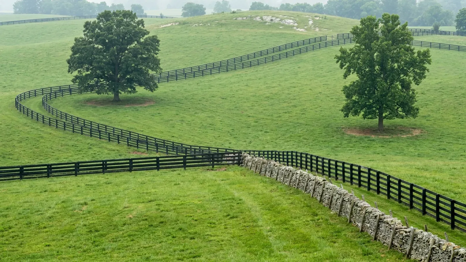
Jessamine County is the land answer Lexington cannot give you. It is the closest county to Fayette, it shares the same Inner Bluegrass limestone and the same climate zone, and its rural zone takes a five-acre minimum lot where Fayette's Agricultural Rural zone takes forty. That single difference is why a buyer who wants a shop and a house on their own ground drives twenty minutes south. Sixty-five percent of the county's land area is still in farms, 619 of them, and 165 of those sit in the fifty-to-179-acre band that suits this building type. What Jessamine is not is cheap or empty: it is the second-densest of Lexington's four land counties, more than half its people live inside Nicholasville, and the county has grown 9.4 percent in a decade. Two things shape a parcel here more than the zoning does. The first is karst. KGS names Nicholasville as one of the cities defining the Inner Bluegrass karst area, and the county's own comprehensive plan says sinkholes are common throughout the county except in the corner southeast of the Hickman Creek fault line. The second is the Kentucky River Palisades, an eight-hundred-foot limestone gorge that forms well over half the county boundary and that the Fiscal Court has zoned into a Conservation-Preservation District of 14,837 acres. And unlike most of Kentucky, somebody inspects the house wherever you build: the Jessamine County-City of Wilmore Joint Planning Commission covers Wilmore and the unincorporated county, and the City of Nicholasville runs its own building department inside its limits.
Jessamine County at a glance
- County
- Jessamine
- Population
- 57,978
- ZIP codes
- 40356, 40390, 40339, 40340
- Site visits
- Site visits across the A-1 farmland between Nicholasville, Wilmore, Keene and the Palisades rim
Building conditions in Jessamine County
The building code is the same in every Kentucky county, and no local government may adopt or enforce a different one on a house — the Kentucky Residential Code says so in its own text. The design criteria are settled by the state too: the code prints a filled-in table covering all 120 counties, so your county's ground snow load, frost depth and seismic design category are published figures rather than something a local office decides. Ultimate design wind speed is 115 mph for every county in the state.
What changes from one county to the next is whether anyone checks. Kentucky makes permits, inspections and certificates of occupancy optional for a single-family home unless the local government has passed an ordinance requiring them, and it forbids the state from stepping in where none has. Twenty-five counties tell the state outright that they have no local building inspector, and in much of the rest the answer depends on an ordinance the county either passed or never did. Zoning is a separate, equally local choice — most Kentucky counties have never adopted any. What is below covers this county specifically: who issues the permit if anyone does, what the state's tables assign it, and what the ground does to a slab.
The Zoning Ordinance of Jessamine County, Section 3.22 Central Agriculture Zone A-1 and Section 3.224 Development Standards. Current official text is published through the county's EncodePlus viewer, http://online.encodeplus.com/regs/jessaminecounty-ky/index.aspx , which serves an application shell rather than readable text to automated retrieval; the dimensional table was read from a complete PDF copy of the ordinance current to December 2015 hosted on a third-party mirror, https://www.tranzon.com/otherdocs/jessamine_county_zoning_ordinance_15288.pdf , and the five-acre density independently corroborated against the county's own 2017 Comprehensive Plan, p. 125, https://jessamineky.gov/wp-content/uploads/2024/12/Comprehensive-Plan.pdf . Confirm the current table with the Joint Planning office on (859) 885-6415.
https://jessamineky.gov/jc-department/planning-zoning/ ; https://jessamineky.gov/planning-zoning/forms-and-applications/ ; https://nicholasville.org/planning-and-zoning/ ; https://dhbc.ky.gov/Documents/Jessamine%20County.pdf (sheet updated 21 November 2024, read with pdftotext -raw) ; KRS 198B.060, https://apps.legislature.ky.gov/law/statutes/statute.aspx?id=52659
The Zoning Ordinance of Jessamine County, Sections 3.211 (Uses Permitted, all zones) and 3.222 (Accessory Uses, Central Agriculture A-1). Official current text at http://online.encodeplus.com/regs/jessaminecounty-ky/index.aspx , which does not serve readable text to automated retrieval; sections read from the complete December 2015 ordinance PDF on a third-party mirror, https://www.tranzon.com/otherdocs/jessamine_county_zoning_ordinance_15288.pdf . Verify with the Joint Planning office, (859) 885-6415, https://jessamineky.gov/jc-department/planning-zoning/
https://www.uky.edu/KGS/water/library/gwatlas/wprkarst.html ; 2017 Jessamine County Comprehensive Plan, Environment chapter, pp. 104-107, https://jessamineky.gov/wp-content/uploads/2024/12/Comprehensive-Plan.pdf ; KGS Karst Potential Index viewer, https://kgs.uky.edu/kygeode/geomap?gkarst=true , classes defined at https://kgs.uky.edu/kgsmap/helpfiles/karst_help.shtm ; 902 KAR 10:085, https://apps.legislature.ky.gov/law/kar/titles/902/010/085/
2017 Jessamine County Comprehensive Plan, Environment and Land Use chapters, pp. 106-107 and p. 126, https://jessamineky.gov/wp-content/uploads/2024/12/Comprehensive-Plan.pdf ; https://jessamineky.gov/planning-zoning/ordinances-plans-and-maps/
FEMA, National Flood Insurance Program Community Rating System Eligible Communities, effective 1 April 2026, Kentucky section: Jessamine County CID 210125 Class 10 / 0%, Nicholasville City CID 210126 Class 8 / 10%, Wilmore City CID 210311 Class 10 / 0%. https://www.fema.gov/sites/default/files/documents/fema_crs_eligible-communities_042026.pdf . fema.gov refuses curl, so the file was retrieved with WebFetch and extracted locally; the table was read both ways and only the -raw pass gives correct rows, the -layout pass shifting every class up one line. ; 2017 Jessamine County Comprehensive Plan p. 106, https://jessamineky.gov/wp-content/uploads/2024/12/Comprehensive-Plan.pdf
Also worth knowing before you build in Jessamine County
- Septic is a standalone county health department, and it wants to see the lot before you buy it
- Most of Kentucky is covered by multi-county district health departments. Jessamine is one of the exceptions: the Jessamine County Health Department at 215 E. Maple Street, Nicholasville is a standalone single-county department and it issues the on-site sewage permit for the whole county. Its published guidance sets the order plainly, and the first step is the one buyers skip. Before buying a lot, contact the health department for a soil evaluation; submit an application with a set of floor plans for the house; have a backhoe on site; flag the house location on the lot. The site evaluation then determines whether the soil will take a system, and if no suitable area exists the environmentalist reports what modifications might upgrade the lot. The sewage permit must be issued before the plumbing permit is. Environmentalists are on (859) 885-2310 and the plumbing inspector keeps hours in the environmental section on (859) 881-3471. On karst ground this sequence is not a formality: 902 KAR 10:085 makes any area within seventy feet of an open sinkhole throat, or downslope of the sinkhole sideslope midpoint, unsuitable outright.
- Sixty-five percent of the county is still in farms, and 165 of them are in the size band that suits this build
- The 2022 Census of Agriculture counts 619 farms in Jessamine County on 71,771 acres. The 2024 Census Gazetteer puts the county's land area at 172.113 square miles, about 110,150 acres, so roughly sixty-five percent of Jessamine is land in farms. Average farm size is 116 acres, up 2 percent since 2017 even as farm numbers fell 8 percent and acreage fell 6. The band that matters for a house-and-shop build is 50 to 179 acres, and Jessamine has 165 farms in it, 27 percent of the total, with another 257 farms between 10 and 49 acres. Sales are 85 percent livestock, poultry and products against 15 percent crops, with horses and ponies the largest single livestock inventory at 3,246 head. For scale against the neighbours a buyer will also be shown: Garrard County has 647 farms on 108,923 acres with 255 in the 50-to-179 band, Boyle 491 farms on 96,306 acres, and Madison 1,164 farms on 191,746 acres. Jessamine has real farmland and a five-acre minimum lot; what it does not have is quantity or a low price per acre.
- Cluster development is the one route to a one-acre lot
- If a five-acre minimum is more land than you want to mow, the Jessamine ordinance offers one alternative and it is a real one. Cluster development in the agricultural zone permits a maximum density of one single-family unit for every five acres of the parent tract, with individual building lots as small as one acre so long as four acres are set aside for each lot and total residual farmland is not less than 80 percent of the parent tract. The individual cluster lot standards are a 100-foot minimum lot width at the building line, a 50-foot front yard, a 50-foot rear yard, a 12-foot side yard, 100 feet of road frontage, a 45-foot maximum building height and 40 feet of road frontage on a cul-de-sac lot. No more than twenty cluster lots may share a common lot line. One single-family dwelling unit is reserved for the residual farmland itself. The Joint Planning Commission has moved in recent years to revoke planned unit developments as an option, but the county's own comprehensive plan says cluster development remains a viable alternative in agricultural land use areas.
- The county publishes an Agricultural Exemption Form, and it is narrower than people hope
- Form 1.1 on the Joint Planning department's forms page is an Agricultural Exemption Form, which is a useful sign that the county administers the state farm exemption formally rather than by conversation. Be careful what it covers. The Kentucky Building Code's exemption reaches a farm dwelling only where the land is a PVA-registered farm of ten contiguous acres outside city limits, and even where it applies, zoning still reaches the house under KRS 100.203(4)(c) — and Jessamine is comprehensively zoned. The electrical gate is untouched either way: KRS 198B.060(11) bars any utility from energising a new building until a certified electrical inspector issues a final certificate of approval, and the county publishes its own contractor and homeowner electrical permit applications, forms 2.1 and 2.2. One more administrative point that catches people out: from 5 November 2025 the county requires a Business Certificate with every permit application, and the forms page states that incomplete applications will not be accepted.
- Radon Zone 1, and no mine subsidence question to answer
- Jessamine is one of 30 Kentucky counties in EPA's Zone 1, the highest radon potential band, predicting an average indoor screening level above 4 pCi/L. That list is essentially Kentucky's karst map — the Inner Bluegrass plus the Pennyroyal belt — and Jessamine sits squarely in the first. EPA's own map notes it was developed in 1993, should not be used to decide whether an individual home needs testing, and that all homes should be tested regardless of zone. Passive sub-slab depressurisation is cheap to rough in under a new slab and expensive to retrofit under a finished one. What Jessamine does not have is the other Kentucky ground hazard: it is not among the 37 counties whose fiscal courts voted into the Kentucky Mine Subsidence Insurance Fund, so there is no automatic mine-subsidence endorsement to accept or waive on a policy here. That is not the same as saying the ground is covered. Kentucky created a statutory fund for coal-mine collapse and nothing equivalent for karst, and the standard homeowners earth-movement exclusion is broad enough to swallow sinkhole collapse. Ask an agent in writing.
- The four design numbers, and which table publishes each
- Jessamine's ground snow load is 15 psf, the statewide floor, from DHBC's Table R301.2(1) in the 2018 Kentucky Residential Code, 3rd Edition; eighteen Ohio River and eastern coalfield counties carry 20 psf and Jessamine is not among them. Minimum frost protection depth is 24 inches, DHBC's default in Table R403.1.4, measured from proposed finished grade to the bottom of the footing, against an exception list that runs to 33 inches in the far east. Seismic design category is B, from Table R301.2.2.1, well below the D1 and D2 assigned to the Jackson Purchase counties near New Madrid. Ultimate design wind speed is 115 mph, and that one figure is statewide rather than particular to Jessamine — though the same table's instruction to investigate topographic effects earns its keep on a ridge above the Palisades. Energy is climate zone 4A, Mixed-Humid, which the 2009 IECC assigns to all 120 Kentucky counties on a single line. All four are identical to Fayette's, which is the point: crossing the county line changes the land rules, not the building.
- Nicholasville holds more than half the county, and the growth is real
- Jessamine County had 57,978 people at the 2020 census, up 9.4 percent on 2010, one of the fastest-growing counties in the Bluegrass alongside Scott. Nicholasville alone held 31,093 of them, more than half the county, which is why the countywide density figure of about 337 people per square mile of land area overstates how built-up the rural county actually feels. Wilmore, the other incorporated city, is a small college town on the western side. Jessamine is the smallest of Lexington's four land counties at 172.113 square miles of land, and it is also the closest, which is exactly the trade: the shortest commute from south Lexington, the least land available, and the highest price per acre of the four. Buyers who want more acres for less money have three counties in easy reach — Garrard directly south across the Palisades, Boyle beyond it around Danville, and Madison to the southeast around Richmond and Berea.
Jessamine County Health Department, Guidelines For Sewage, Plumbing and Building Permits, https://www.jessaminehealth.org/wp-content/uploads/2019/02/guidelines_for_permits.pdf ; https://www.jessaminehealth.org/ ; department named as the county's health authority on the state sheet, https://dhbc.ky.gov/Documents/Jessamine%20County.pdf ; 902 KAR 10:085, https://apps.legislature.ky.gov/law/kar/titles/902/010/085/
2022 Census of Agriculture, USDA NASS, Jessamine County Kentucky profile, https://www.nass.usda.gov/Publications/AgCensus/2022/Online_Resources/County_Profiles/Kentucky/cp21113.pdf , extracted with both pdftotext -layout and -raw and reconciled row by row; the -layout pass misaligns the percent-change column and the -raw pass is the correct one. Neighbour figures from cp21079 (Garrard), cp21021 (Boyle) and cp21151 (Madison) in the same series. Land area from the 2024 US Census Gazetteer counties file, https://www2.census.gov/geo/docs/maps-data/data/gazetteer/2024_Gazetteer/2024_Gaz_counties_national.zip
The Zoning Ordinance of Jessamine County, Section 3.224 Development Standards for Cluster Developments; read from the December 2015 complete PDF on a third-party mirror, https://www.tranzon.com/otherdocs/jessamine_county_zoning_ordinance_15288.pdf , the official current text being at http://online.encodeplus.com/regs/jessaminecounty-ky/index.aspx . Continued viability stated at 2017 Jessamine County Comprehensive Plan p. 125, https://jessamineky.gov/wp-content/uploads/2024/12/Comprehensive-Plan.pdf
https://jessamineky.gov/planning-zoning/forms-and-applications/ ; KRS 198B.060 and KRS 100.203, https://apps.legislature.ky.gov/law/statutes/statute.aspx?id=52659
EPA Map of Radon Zones, Kentucky, https://www.epa.gov/sites/default/files/2014-08/documents/kentucky.pdf ; Kentucky Department of Insurance, Mine Subsidence Insurance Fund brochure rev. 08/24 effective 1/1/25, 37-county participating list, https://insurance.ky.gov/PPC/Documents/JAN%202025_Revised%20Mine%20Subsidence%20Insurance%20Fund%20080124.pdf ; KRS 304.44-030
2018 Kentucky Residential Code, 3rd Edition, Tables R301.2(1), R301.2.2.1 and R403.1.4, https://dhbc.ky.gov/Documents/2018%20Kentucky%20Residential%20Code%203d%20Ed.pdf ; 2009 IECC Table 301.1
2020 Decennial Census population counts; land area 172.113 sq mi from the 2024 US Census Gazetteer counties file, https://www2.census.gov/geo/docs/maps-data/data/gazetteer/2024_Gazetteer/2024_Gaz_counties_national.zip ; city population from the 2020 census as tabulated in this project's statewide geography file; https://jessamineky.gov/

The expensive surprises are in the ground, not the building
What moves a Kentucky budget is usually below grade, and more often than not it is what the ground is sitting on rather than the ground itself. The Kentucky Geological Survey says 92 of the state's 120 counties contain karst — limestone that dissolves — across four named areas: the Western Pennyroyal around Bowling Green and Hopkinsville, the Inner Bluegrass around Lexington, the Eastern Pennyroyal through Somerset and Monticello, and Pine Mountain in the south-east. On karst, KGS's own model ordinance for local governments lists the structures that should not be sited in sinkhole areas, and the list is buildings with soil-bearing foundations and buildings that cover thousands of square feet with impermeable surface. A post-frame or steel building on a monolithic slab is both of those at once. KGS is equally clear that nearly all karst parcels still have buildable ground on them — so karst does not stop the build, it removes the option of siting the pad by eye. A filled and graded-over sinkhole is the classic trap, because the pad looks perfect.
In the two coal fields the question is undermining instead, and Kentucky treats it differently from everything else: mine subsidence coverage is added automatically to property policies in the counties whose fiscal court voted the fund in, with a written opt-out — thirty-seven of them — while karst collapse gets no fund at all and falls under the ordinary earth-movement exclusion. On slopes the surprise is geographic: KGS's landslide inventory puts Kenton, Campbell, Boone and Gallatin — the northern Kentucky counties opposite Cincinnati — near the very top, above most Appalachian counties, on Ordovician shale. Three of those four — Boone, Campbell and Kenton — are the only counties in the state with a line of their own in the residential code's bearing table, which raises the presumptive value for two named clay groups there and nowhere else. Everywhere else the table gives clay and silt a single presumptive figure, and a soils investigation becomes mandatory once the building official determines the real capacity is likely to be lower than it.
The same ground then sizes the septic system, and Kentucky does that from soil morphology — a certified inspector reading the profile in a backhoe pit — rather than from a percolation test, at 110 gallons a day per bedroom against an application rate taken from soil texture and structure. On a mound or other alternative design a measured permeability test can still be required. And on karst the septic regulation is blunter than the building code ever gets: it declares the ground within seventy feet of an open sinkhole throat unsuitable outright. The soil that needs a foundation engineer is usually the soil that complicates the drainfield, so the site work, the foundation and the septic get resolved together rather than one at a time. We price the dirt before we price the building.
What we build in Jessamine County
All seven services are available in Jessamine County. What a build costs depends far more on the parcel than on square footage, so we price against your land rather than publishing a rate card.
Barndominium Kits
We check barndominium kit packages against the wind, snow, frost and seismic criteria the Kentucky Residential Code publishes for your county.
Pole Barn Homes
Pole barn homes across Kentucky. KRC §R327 covers accessory barns, not houses — so a pole barn home is engineered by the code's own terms.
Custom Barndominium Plans
Barndominium plans drawn to Kentucky's published county design criteria — snow, wind, seismic, frost — with engineering where the code calls for it.
What a build looks like
Three stages every Jessamine County project passes through, from a raw parcel to a finished home. Site work first, because that is where the budget is decided.

The parcel
Karst and mine maps, the flood question, zoning where the county has any, and utility access — all checked before anything is drawn.
Pad and permit
Clearing, grading and a compacted pad, while the submittal works through whichever office issues the permit — and where no office does, through the approvals that still apply.

Frame to finish
Shell erected and dried in, then systems and interior finish — and the certified electrical inspection your utility needs before it will set a meter.
Those are the rules where you are building in Jessamine County. Tell us what you want to build and we will draw it to them.
Where we build around Jessamine County
Jessamine and the rural land around it. The buildable acreage for a project this size usually sits outside the city limits, and in Kentucky that line frequently decides whether anyone issues a permit at all, not merely who issues it.
Keep reading
The questions that usually come next once you know what Jessamine County allows.
Barndominium Cost Guide
Why the published spread runs from one end of the scale to the other, and which of it is the building rather than the ground.
Read itIs It Legal in Kentucky?
Whether your county inspects a house at all, what the farm-dwelling exemption really requires, and the approvals that reach you anyway.
Read itWhat a Pole Barn Home Costs
Post-frame against stick-built, and what the prescriptive post-frame section of the state code does and does not cover.
Read itNearby areas we build in
Others we cover nearby. They share the same statewide code and the same state-published design tables — but whether a house is permitted and inspected at all, whether the county zones, what the health department will accept for septic, and what the ground does to a foundation can all differ from one card to the next. Two counties that touch are not two versions of the same answer.
Building in Jessamine County: common questions
8 questions we get asked most often about building in Jessamine County. If yours is not on the list, ask it directly.
Lexington told me to look at Jessamine for land. Is there actually any?
Who issues the building permit, and does anyone inspect the house out on acreage?
How big can the shop be, and can I build it before the house?
Nicholasville sits on limestone. What does that mean for a slab and a septic field?
The land I like overlooks the Kentucky River. Is there a rule about that?
Is flood insurance an issue, and is the county in the Community Rating System?
Can I get a smaller lot than five acres anywhere in agricultural Jessamine?
What will the jurisdiction charge me in permit fees?
Building in Jessamine County?
Start with the plan. Tell us what you want to build and we will draw it, then confirm whether any office permits and inspects a house where your parcel is, what it will let you put there, and which line of the state's snow, frost and seismic tables your county falls on. That conversation costs nothing.