Barndominium Builders in Rowan County, KY
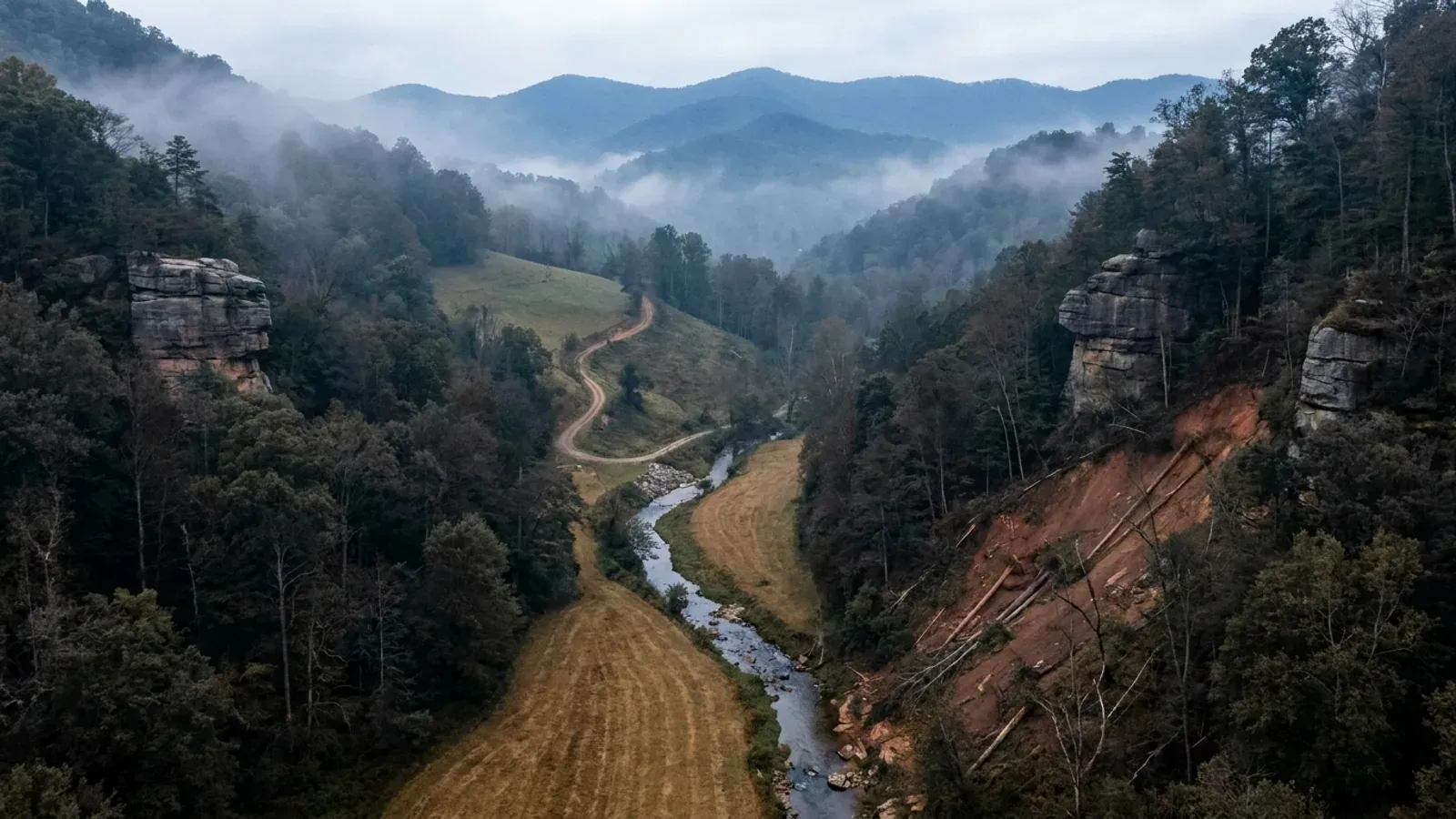
Rowan County is Morehead, Clearfield, Farmers and Elliottville — 280 square miles of eastern Kentucky wrapped around the head of the Licking River, with Cave Run Lake on its southern edge and the Daniel Boone National Forest covering about a third of the ground. It is unusual in this state in a way that matters more than anything else on this page: Rowan County runs its own building inspection program, county-wide, out of the Rowan County Services Building on American Legion Way in Morehead. Most Kentucky counties do not. Under KRS 198B.060(1) permits, inspections and certificates of occupancy are a local option on a single-family residence, and roughly a quarter of Kentucky counties name no local building inspector at all — so a reader who has been told that eastern Kentucky is a place where nobody looks at the frame has been told something that is not true here. The Fiscal Court voted to hire a county building inspector in July 2023, the county's published permit process runs six steps and ends in a Certificate of Occupancy, and Title XV of the Rowan County Code of Ordinances carries a Chapter 154 headed Building and Residential Codes. Plan for a permit and an inspector, and budget the time. The land story is the second half, and it is the harder one. USDA's 2022 Census of Agriculture counts 277 farms across 35,111 acres here — about a fifth of the county — against 63,162 acres of national forest, and land in farms fell eleven per cent between 2017 and 2022. The Kentucky Geological Survey's own description of the county is blunt: most of it is hilly to mountainous, and outside the bedrock terraces in the west and the valleys of the principal streams, little flat land can be found. This is not an open-acreage county the way Grayson or Pulaski are. Between the national forest boundary, the Corps of Engineers reservoir, the fifteen-per-cent slope threshold the county's own subdivision regulations treat as environmentally sensitive, and a health department septic evaluation that has to be dug before it can be judged, the work here is finding the pad — not finding the permit counter.
Rowan County at a glance
- County
- Rowan
- Population
- 24,662
- ZIP codes
- 40351, 40313
- Site visits
- Same week
Building conditions in Rowan County
The building code is the same in every Kentucky county, and no local government may adopt or enforce a different one on a house — the Kentucky Residential Code says so in its own text. The design criteria are settled by the state too: the code prints a filled-in table covering all 120 counties, so your county's ground snow load, frost depth and seismic design category are published figures rather than something a local office decides. Ultimate design wind speed is 115 mph for every county in the state.
What changes from one county to the next is whether anyone checks. Kentucky makes permits, inspections and certificates of occupancy optional for a single-family home unless the local government has passed an ordinance requiring them, and it forbids the state from stepping in where none has. Twenty-five counties tell the state outright that they have no local building inspector, and in much of the rest the answer depends on an ordinance the county either passed or never did. Zoning is a separate, equally local choice — most Kentucky counties have never adopted any. What is below covers this county specifically: who issues the permit if anyone does, what the state's tables assign it, and what the ground does to a slab.
https://www.rcky.us/building-inspection-program (Rowan County, Kentucky — the county's own Building Inspector page; page title reads Rowan County Building Inspector — Rowan County, Kentucky, and the address, 606 area code and rcky.us domain confirm the Kentucky county rather than the Rowan County in North Carolina; HTML read directly rather than through a summary, 8 Sep 2026) · https://www.rcky.us/news/rowan-county-hires-justin-caudill-as-building-inspector-rodney-perkins-for-maintenance (Fiscal Court hiring item, dated 30 August 2023, read 8 Sep 2026) · https://www.rcky.us/code-of-ordinances (Rowan County, Kentucky Code of Ordinances table of contents — Title XV Land Usage, Chapter 154 Building and Residential Codes; the chapter PDF at https://www.rcky.us/s/TITLE15CH154-BUILDING-AND-RESIDENTIAL-CODES.pdf is a two-page image scan that yields no text under pdftotext in either -raw or -layout, so it is cited here for its existence and heading, not for its wording) · https://apps.legislature.ky.gov/law/statutes/statute.aspx?id=52659 (KRS 198B.060)
https://dhbc.ky.gov/Documents/Rowan%20County.pdf (Department of Housing, Buildings and Construction county sheet, footer stamped Updated 11/14/2025; extracted with pdftotext in both -raw and -layout and compared, 8 Sep 2026 — the -raw pass is the readable one, as it is on every DHBC sheet) · https://dhbc.ky.gov/docs_cols.aspx?cat=312 (the county sheet index) · https://www.rcky.us/building-inspection-program · https://apps.legislature.ky.gov/law/statutes/statute.aspx?id=52659 (KRS 198B.060, including subsection (11) on the electrical certificate)
https://dhbc.ky.gov/Documents/2018%20Kentucky%20Residential%20Code%203d%20Ed.pdf — Table R301.2(1) Design Snow, Climatic and Geometric Design Criteria for Kentucky Counties; Table R301.2.2.1 Seismic Design Categories–Site Class D; Table R403.1.4 Minimum Frost Protection Depth for Kentucky and the §R403.1.4 exception text; Table R401.4.1 and its footnote. All three county tables are transcribed in research/statewide/design-criteria-and-climate.md from a raw content-stream extraction of the DHBC PDF, and the Rowan row was checked against each published exception list individually rather than inferred from the region · https://www.uky.edu/KGS/water/library/gwatlas/Rowan/Topography.htm (Kentucky Geological Survey, elevations and relief, read 8 Sep 2026)
USDA Forest Service, Land Areas of the National Forest System, 2023 Land Areas Report, Table 6 — NFS Acreage by State, Congressional District and County, refresh date 10/14/2023: https://www.fs.usda.gov/land/staff/lar/LA2023/LARTable6.pdf. That address now returns an error page from the Forest Service and the report has moved to a document-hosting folder linked from https://www.fs.usda.gov/managing-land/lands-minerals-geology/land-area-reports, so the table was read from the Internet Archive capture of the original at https://web.archive.org/web/20260207012520/https://www.fs.usda.gov/land/staff/lar/LA2023/LARTable6.pdf, pulled with curl and extracted with pdftotext in both -raw and -layout, 8 Sep 2026. ROW ALIGNMENT PROVEN: the -layout pass strips the acreage column away from its county rows entirely and is unusable, while in the -raw pass the twenty-two unit rows of the Kentucky 5th congressional district block sum to exactly the printed 5th Totals of 689,196, so each value is confirmed to sit on its own row · land area and internal point from the U.S. Census Bureau 2024 Gazetteer county file, https://www2.census.gov/geo/docs/maps-data/data/gazetteer/2024_Gazetteer/2024_Gaz_counties_national.zip (KY 21205 Rowan County: 279.881 sq mi land, 6.385 sq mi water) · https://www.fs.usda.gov/r08/danielboone/recreation/cave-run-lake (Cumberland Ranger District)
https://www.fs.usda.gov/r08/danielboone/recreation/cave-run-lake (USDA Forest Service, Daniel Boone National Forest — Cave Run Lake; the 8,270-acre figure, the Forest Service and Corps roles, the Cumberland Ranger District and the lower Licking River valley all read from the page HTML directly, 8 Sep 2026) · https://www.uky.edu/KGS/water/library/gwatlas/Rowan/Topography.htm (Kentucky Geological Survey, Groundwater Resources of Rowan County, quoting McGrain and Currens 1978 — normal pool 730 feet, maximum flood pool 765 feet, flood-control structure upstream from Farmers; read 8 Sep 2026) · the U.S. Army Corps of Engineers Louisville District site at www.lrl.usace.army.mil could not be read: the host presents a TLS certificate that does not match its own hostname, which fails validation in both a plain client and a fetch, so the Corps material above is cited from the Forest Service and the Kentucky Geological Survey instead
https://www.nass.usda.gov/Publications/AgCensus/2022/Online_Resources/County_Profiles/Kentucky/cp21205.pdf (2022 Census of Agriculture county profile, Rowan County, FIPS 21205 — extracted with pdftotext in both -raw and -layout and reconciled row by row. The -layout pass is WRONG here in the way this project has now seen five times: it prints 35,111 on the Number of farms row and shifts the farms-by-size bands down by one, pairing 114 with the 1-to-9-acre row. The figures above are from the -raw pass, whose size bands sum to exactly the published 277 and whose land-use rows sum to exactly the published 35,111) · https://www.uky.edu/KGS/water/library/gwatlas/Rowan/Topography.htm (KGS Groundwater Resources of Rowan County, Topography, quoting McGrain and Currens 1978; read 8 Sep 2026) · land area from the U.S. Census Bureau 2024 Gazetteer county file, https://www2.census.gov/geo/docs/maps-data/data/gazetteer/2024_Gazetteer/2024_Gaz_counties_national.zip · population from research/statewide/geography-and-population.md (2020 decennial) · neighbouring-county comparison from the same USDA series: Carter County FIPS 21043 at 681 farms across 82,568 acres and Montgomery County FIPS 21173 at 528 farms across 67,199 acres, as established in research/entries/carter-county-ky.json and research/entries/montgomery-county-ky.json
Also worth knowing before you build in Rowan County
- A joint planning commission, no county zoning — and a five-acre line that decides which rules apply
- Rowan County has planning without zoning, and knowing which of the two you are dealing with saves a lot of wasted calls. The Morehead-Rowan County-Lakeview Heights Joint Planning Commission is a nine-member board established by agreement between the City of Morehead, Rowan County and the City of Lakeview Heights: three members appointed by the Mayor of Morehead, three by the Rowan County Judge/Executive and three by the Mayor of Lakeview Heights, four-year terms, a maximum of two consecutive. What it administers in the unincorporated county is Chapter 151, the Rowan County Subdivision Regulations, adopted under KRS Chapters 67, 82 and 100, with a Rowan County Subdivision Coordinator as staff administrator running a Planning and Codes Office — Joe Curd, (606) 548-4456, joe.curd@rcky.us, County Auxiliary Services Center, 200 American Legion Way, Morehead. Those are subdivision regulations, not zoning: outside Morehead and Lakeview Heights there is no zoning district, no use table, no lot-coverage ceiling and no accessory-structure floor-area cap. The five-acre line under §151.011A is the one most rural buyers meet. Where land in unincorporated Rowan County, outside the Morehead and Lakeview Heights limits, is divided into tracts of five acres or more for sale or transfer to an individual for agricultural or residential purposes, and no new public road or road improvement is required, the division is exempt from the subdivision regulations — but the owner must still submit a plat of survey to the Coordinator showing the abutting public right-of-way, with additional right-of-way up to 40 feet possibly required, and any private road names approved through the county E-911 Board Coordinator, before the plat is recorded and tracts conveyed. Three parallel exemptions cover gifts to immediate family (§151.011B, with the relationship recited in the deed), three or more parcels each with at least 100 feet of frontage on an existing public road (§151.011C), and three or more parcels of one acre or more (§151.011D). Below that line, inside a platted subdivision, the dimensions bite: §151.029B1 requires any lot not served by public sewer to be at least half an acre, 21,780 square feet, and allows the county Health or Environmental Officer to require more where drainage or soil conditions could cause a health hazard; §151.029C sets the building setback at not less than half the width of the street right-of-way and never less than 30 feet from it; and §151.029E imports the yard requirements of the Morehead Zoning Ordinance R-1 district for residential subdivisions in the unincorporated county — a genuinely unusual arrangement, where the city's dimensional standards reach rural lots by reference. Two more sections are worth reading before you buy sloping ground. Section 151.043 defines environmentally sensitive areas to include steep slope over fifteen per cent, floodplains, sinkholes, poor soils, improper fill, wetlands, cliff areas, significant tree stands and aquifer recharge areas, requires them to be identified on the preliminary plat with a statement of how they will be handled, and lets the Coordinator or Commission delay a decision for up to sixty days and require a targeted environmental assessment by a qualified professional. And §151.044 sets fill standards that read like a specification for a hillside pad: no organic material, no irreducible rock over twelve inches without the County Engineer's approval, benching into sound bedrock where slopes are five horizontal to one vertical or steeper, compaction to ninety-five per cent of maximum density under ASTM 99 where structures are to be supported by the fill, no exposed fill slope steeper than 2:1, no fill at all on natural slopes steeper than 2:1 without a stability analysis approved by the Planning Commission, and layered placement compacted in lifts not exceeding one foot.
- Inside Morehead: five acres in the Agricultural district, and a 12-foot cap on an accessory building that is not a garage
- If your parcel is inside the Morehead city limits, a second and much more detailed rulebook applies, and one row of one table decides whether the shop you want is legal. The City of Morehead Zoning Code is Chapter 154 of the city code, adopted 20 June 2019, with ten districts: AG, RS, R-1, R-2, R-3, B-1, B-2, B-3, I-1 and P-1. Table 162-1, Residential Dimensional Standards, sets minimum lot area at 5 acres — 217,800 square feet — in Agricultural, 2 acres or 87,120 square feet in Rural Settlement, 10,000 square feet in Low Density Residential R-1, 6,500 in R-2 and 5,800 for single and two-family dwellings in R-3. Footnote A adds a rule that catches a lot of rural-edge lots: for properties not served by sewer, the minimum lot size shall be 43,560 square feet, one acre. Maximum height is 30 feet in AG, RS, R-1 and R-2. Front setbacks are 50 feet in AG and RS and 30 feet in R-1; side setbacks 20, 20 and 15 feet; rear setbacks 50, 50 and 25 feet. Accessory building setbacks are 25 feet from the side or rear lot line in AG and RS and 10 feet in R-1, R-2 and R-3. Now the row that matters. Accessory buildings maximum height is 20 feet in AG and in RS — but in R-1, R-2 and R-3 it is 12 feet for accessory structures and 20 feet for garages or carports. A 12-foot ceiling is below the eave height of most steel or post-frame shop packages, so inside the city's residential districts the building has to qualify as a garage or carport to reach 20 feet, and the design conversation should start there rather than end there. What the ordinance does not do is cap floor area: there is no accessory-building square-footage limit anywhere in Chapter 154, and no provision addressing shipping containers, Quonset huts or storage pods. Section 154.152A.1 adds the placement rules — accessory buildings and structures are permitted only in the rear or side yard, take the principal structure's setback on a corner lot, and take the principal structure's setbacks entirely if connected to it. Permits are city-issued: §154.131 requires an application to the City Planner before constructing, enlarging, altering, repairing, moving, demolishing or changing the occupancy of a building or structure, with plans in duplicate drawn to scale showing lot shape and dimensions, existing buildings, the lines within which the proposed structure will be erected, the proposed height and the intended use; and §154.132 provides that no one may use a structure created, erected, changed, converted, enlarged or moved until the City Planner issues a certificate of occupancy, with a temporary certificate available for up to six months during alterations or partial occupancy. Check the city limit against your deed before assuming any of this applies — and check it before assuming it does not, because Morehead's limits reach further out along the highway corridors than the town centre suggests.
- Septic is a five-county health district, and the total is $320 — but you dig the pit
- Rowan County does not run its own health department for on-site sewage, which is the opposite of the arrangement in Carter County next door. The Gateway District Health Department serves five counties — Bath, Elliott, Menifee, Morgan and Rowan — from 42 Treadway Dr, Owingsville KY 40360, (606) 674-6396, with a health centre in each; the Rowan County Health Center is at 730 West Main Street, Morehead KY 40351, 606-784-8954, fax 606-783-1443. Note that the Commonwealth's building directory still prints an older address, 105 East Main St., for the Rowan County Health Department; the district's own contact page gives 730 West Main Street. The district publishes one Septic System/Building Process sheet for all five counties, and its numbers are simple: a total fee of $320, made up of a $150 site evaluation and a $170 permit, payable by check or money order only, made out to GDHD. The four steps have real scheduling consequences. Step one, the site evaluation: the county's health environmentalist comes to the property and evaluates the proposed area, and to do it the applicant must have a pit dug — by backhoe or by hand — four feet deep and at least two feet wide where the system is to go. That is the applicant's job, not the department's, and it is the step most people are surprised by. Temporary electric is released to stick-built and stone-built homes at that point, and expressly not to mobile or camper homes. Step two, the installer: a certified installer is recommended and the environmentalist keeps a per-county list, but a homeowner may install their own system after passing the certified installer's exam with 70 per cent, and there is no fee for the exam. Step three, the permit: a pre-permit drawing showing the tank, distribution box, leach lines and grade shots, based on the site evaluation, must be approved before the permit issues — after which the plumbing permit and the water meter can be obtained. Step four, the final inspection: the system must stay completely uncovered until it has been inspected and approved unless the environmentalist grants otherwise, and permanent electric is released then. All permanent electric releases follow the final inspection; mobile homes and RVs get theirs at the same point. The application is state form DFS-319. The district publishes no lot-size minimum of its own — the half-acre floor for an unsewered lot comes from §151.029B1 of the county's subdivision regulations, and §151.042 requires every subdivision to have a sewage disposal system approved by the health department, permits septic tanks for residential lots of half an acre or more where public sewer is not immediately available, and lets the Subdivision Coordinator postpone action in areas of questionable suitability until percolation tests are approved. Sequence the evaluation before the pad is fixed, not after: on ground this steep the usable septic area very often decides where the building can sit.
- Three participating flood communities, a Class 10 rating, and a $5 electrical permit that turns the power on
- Rowan County has a named floodplain administrator with a published remit, which is worth saying because it is not true everywhere in Kentucky. Tyler Brown, Solid Waste and Floodplain Coordinator, (606) 784-6345, fax (606) 784-3535, tyler.brown@rcky.us, 325 Triplett St., Morehead KY 40351, Monday to Friday 8:00 a.m. to 4:00 p.m. The county states the job directly: people must be aware before purchasing or starting to build on property located in a floodplain; the office performs floodplain assessments to determine what zone a property is in, permits any work being done in a floodplain, and states plainly that nothing can be done in a floodway. The same office handles electrical permitting, and the county's own statement is the operative one for anyone building here: an electrical permit is required in order to get electric turned on for new home construction, service upgrades, mobile homes and commercial buildings. The county sells that permit for $5. FEMA's Community Status Book lists three participating communities in Rowan County, all in the Regular Program and all on a common current effective map dated 18 April 2011: unincorporated Rowan County, CID 210203, initial FIRM 19 January 1983; the City of Morehead, CID 210204, initial FIRM 5 July 1982; and the City of Lakeview Heights, CID 210472, whose initial and current maps are both 18 April 2011. Rowan County holds a Community Rating System class of 10 — which means participation without a premium discount, since Class 10 is the zero-per-cent class. That is worth knowing precisely because a neighbouring county does better: Bath County and the City of Salt Lick, on the other side of Cave Run Lake, both hold Class 8, a ten-per-cent discount. Flood insurance is measurably cheaper there than here on comparable exposure. On top of any county permit, Kentucky adds a state one: a Division of Water Individual permit is required for construction in the base floodplain under KRS 151.250 and 401 KAR 4:060 §2, on form DOW 7116, and state jurisdiction reaches the whole base floodplain rather than only the regulatory floodway. The county's subdivision regulations add a third layer for platted ground: §151.045 provides that land subject to flooding as defined by FEMA shall not be developed for residential use or any use that increases danger to health, life or property, requires any construction along a stream to be permitted by the Division of Water, and forbids approval of subdivision streets subject to inundation so that no part of a subdivision becomes isolated by floods; §151.029F sets the minimum finished floor of the lowest floor at one foot above the 100-year floodplain. The county publishes its Chapter 150 Flood Damage Prevention ordinance as a 38-page image scan with no text layer, so its section numbering and any freeboard beyond that one foot should be confirmed with the coordinator rather than assumed.
- Rowan is a hole in Kentucky's mine subsidence map — three of its neighbours are in the fund and it is not
- This is a small fact with real money attached, and it changes at the county line in a way almost nobody expects. Kentucky's Mine Subsidence Insurance Fund covers only the counties whose fiscal courts voted the coverage in — 37 of them, per the Department of Insurance's own brochure revised August 2024 and effective 1 January 2025. In a participating county the mine subsidence endorsement is added automatically to property insurance policies. Rowan County is not on the list. Carter, Elliott and Morgan — three of the four counties Rowan touches — are, along with Boyd, Greenup, Lawrence, Johnson, Breathitt and Wolfe further out; Bath and Menifee, like Rowan, are not. So the fund's boundary runs right around this county, and a buyer who was told by a friend one county over that the coverage comes automatically will be wrong here. That matters because the exclusion it would have relieved is still in force: the Department of Insurance quotes the standard homeowner's earth-movement exclusion in the same brochure, covering damage originating from earth movement, settling, shrinking, bulging or expansion of soil, including cracking of foundations, walls and floors. It is also worth knowing what the fund would and would not have covered even in a participating county: the statutory definition is the collapse of underground coal mines resulting in direct damage to a structure, and it expressly excludes earthquake, landslide, water seepage or leakage and collapse of storm and sewer drains, and the department adds that it does not cover blasting or the effects of strip mining. The geology behind the question is genuinely present — the Kentucky Geological Survey places Rowan on the western edge of the Eastern Kentucky Coal Field and maps the Breathitt Group and the Grundy Formation, both coal-bearing, across the county, with coal supplying water to a few wells. So the practical steps are the ordinary ones done properly: check the parcel on the Kentucky Mine Mapping Information System at minemaps.ky.gov before you buy, remembering the cabinet's own published caveat that the mapping is accurate to about forty feet and should not be considered complete, and put the coverage question to your insurance agent in writing rather than assuming. Two related ground facts round it out. Rowan is not among the thirteen eastern Kentucky counties in the Kentucky Geological Survey's landslide susceptibility layer — Breathitt, Floyd, Johnson, Knott, Lee, Leslie, Letcher, Magoffin, Martin, Owsley, Perry, Pike and Wolfe — which means no modelled susceptibility class is published for a parcel here, not that the hazard is absent; the Survey's stated mechanism, that most Kentucky landslides occur in colluvial soils or along the soil-bedrock contact and that these soils are susceptible when disturbed or loaded, describes a cut-and-fill hillside pad exactly. And Kentucky's seller disclosure, KREC Form 402, asks about soil stability, drainage and erosion but carries no question at all about mines, sinkholes, caves or undermining, so a silent form is not an assurance on any of this.
- Where the water is: half the wells in the valley bottoms, very little on the hillsides and ridgetops
- On a county where most parcels are slope, the well question is not a detail. The Kentucky Geological Survey's Groundwater Resources of Rowan County breaks the answer down by the rock under the parcel, and the pattern is consistent enough to plan around. The Breathitt Group, the Pikeville Formation rock that underlies much of the county, yields more than 500 gallons per day to almost half the wells in valley bottoms and very little to wells on hillsides and hilltops; the aquifers are sandstone and shale, with coal supplying water to a few wells, and most of the yield comes from near-vertical joints and openings along bedding planes. The Survey adds a warning worth pricing: wells may contain salty water at depths less than 100 feet below the principal valley bottoms, and water chemistry in the Breathitt is highly variable. The Grundy Formation, which forms ridgetops in southern Rowan County and dissected uplands in the south-east and contains Lee-type sandstone, does better on the broad ridges — more than 500 gallons per day to most wells in broad valley bottoms and 100 to 500 gallons per day on some wide ridges, where water may be semi-perched in sandstone above a fire clay that impedes downward percolation. Alluvium along the streams yields almost no water to drilled wells, though small quantities to dug wells, and the high-level fluvial deposits on uplands and hilltops yield only small amounts. The underlying study is McGrain and Currens (1978), so this is the regional picture rather than a prediction for one parcel. The instruction it supports is simple: before you commit to a ridge or hillside tract with no public water main at the road, establish whether a water district line reaches the property, and if it does not, treat a well as a contingency to be priced rather than a certainty. Rowan County's own subdivision regulations reinforce the point from another direction — §151.023 governs utilities in platted subdivisions, and §151.013 sets special conditions for subdivisions involving private roads and no public utilities.
Rowan County Subdivision Regulations, Chapter 151, RCSR revisions final document dated 9/9/22 — https://www.rcky.us/s/RCSR-Revisions-FINAL-DOCUMENT-9922.pdf (extracted with pdftotext in both -raw and -layout and compared; §151.004 authority and jurisdiction, §151.009 administration and the Joint Planning Commission's composition, §151.011A–D exemptions, §151.029 lots and setbacks, §151.043 environmentally sensitive areas and §151.044 fill standards all read from the -raw pass and checked against -layout, 8 Sep 2026) · https://www.rcky.us/subdivision-and-manufactured-home-park-regulations (Rowan County Subdivision Coordinator's page, contact details and the Manufactured Home Park Regulations at https://www.rcky.us/s/Rowan-County-Manufactured-Home-Park-Regulations.pdf) · https://apps.legislature.ky.gov/law/statutes/chapter.aspx?id=37543 (KRS Chapter 100)
City of Morehead, Kentucky, Chapter 154: Zoning Code, adoption date June 20, 2019 — the full 114-page code as published on the Commonwealth's Energy and Environment Cabinet document server at https://eec.ky.gov/Energy/Documents/Rowan%20County%20-%20City%20of%20Morehead%20Solar%20Ordinance.pdf (the filename reflects the cabinet's solar-ordinance collection; the file is the complete city zoning code). Extracted with pdftotext in both -raw and -layout and reconciled: the -layout pass scrambles the label column of Table 162-1 so that labels no longer sit beside their values, while the -raw pass emits each label immediately above its five district values, so the -raw pass is authoritative here and every value above was confirmed to appear in the same row order in both. NOTE ON THE DOWNLOAD: a first attempt returned 916,129 of the file's 1,604,512 bytes and produced a PDF whose cross-reference table would not read; the figures above come from a complete second download whose end-of-file marker is present. Read 8 Sep 2026 · the same code is separately available through a municipal code publisher, which refuses automated access; the city's own text as hosted by the Commonwealth was used instead
https://gdhd.org/wp-content/uploads/2024/03/2023-Septic-Sys-Building-Process.pdf (Gateway District Health Department, Septic System/Building Process — extracted with pdftotext in both -raw and -layout, which agree line for line; read 8 Sep 2026. The same file at the department's .com domain refuses automated requests; the .org copy served normally) · https://gdhd.org/ and https://gdhd.org/contact/ (the district's own statement that it serves Bath, Elliott, Menifee, Morgan and Rowan counties, the Owingsville district address and the Rowan County Health Center at 730 West Main Street, Morehead) · https://gdhd.org/environmental/ (septic, food service and radon programme pages, including the DFS-319 application and the certified installer list) · https://dhbc.ky.gov/Documents/Rowan%20County.pdf (health department environmentalist Brianna Fannin and the older 105 East Main St. address) · Rowan County Subdivision Regulations §§151.029B1 and 151.042, https://www.rcky.us/s/RCSR-Revisions-FINAL-DOCUMENT-9922.pdf
https://www.rcky.us/solid-waste-and-flood-plain (Rowan County Solid Waste and Floodplain Coordinator page — contact details, the floodplain and electrical permitting statements, and the link to the county's Chapter 150 ordinance PDF at https://www.rcky.us/s/Rowan-County-Floodplain-Ordinances.pdf, which yields no text under pdftotext in either mode and is therefore an image scan) · https://www.rcky.us/electrical-permit ($5 electrical permit) · https://www.fema.gov/cis/KY.html (FEMA Community Status Book for Kentucky — the Rowan County, Morehead and Lakeview Heights rows and the CRS class; this host refuses plain automated requests, so the table was read through a rendering fetch, 8 Sep 2026) · https://apps.legislature.ky.gov/law/statutes/statute.aspx?id=54097 (KRS 151.250) · Rowan County Subdivision Regulations §§151.029F and 151.045, https://www.rcky.us/s/RCSR-Revisions-FINAL-DOCUMENT-9922.pdf
https://insurance.ky.gov/PPC/Documents/JAN%202025_Revised%20Mine%20Subsidence%20Insurance%20Fund%20080124.pdf (Kentucky Department of Insurance, Mine Subsidence Insurance Fund brochure, revised 08/24, effective 1/1/25 — the 37-county participating list, the statutory definition and the earth-movement exclusion; extracted with pdftotext in -raw and -layout and read directly, 8 Sep 2026. Rowan does not appear in the list; Carter, Elliott and Morgan do) · https://www.uky.edu/KGS/water/library/gwatlas/Rowan/GWavailability.htm and https://www.uky.edu/KGS/water/library/gwatlas/Rowan/Topography.htm (KGS on the Breathitt Group, the Grundy Formation and the western edge of the Eastern Kentucky Coal Field) · https://minemaps.ky.gov/ · https://kgs.uky.edu/arcgis/rest/services/Hazards/LandslideSusceptibility/MapServer/info/iteminfo (the 13-county landslide susceptibility layer, which does not include Rowan) · KREC Form 402 as established in research/statewide/soils-karst-and-slopes.md
Kentucky Geological Survey, Groundwater Resources of Rowan County, Kentucky — Groundwater Availability: https://www.uky.edu/KGS/water/library/gwatlas/Rowan/GWavailability.htm and Topography: https://www.uky.edu/KGS/water/library/gwatlas/Rowan/Topography.htm (both read 8 Sep 2026; the atlas attributes the underlying discussion to McGrain and Currens, 1978) · https://kgs.uky.edu/kgsmap/KGSWater/viewer.asp (KGS water well and spring viewer) · Rowan County Subdivision Regulations §§151.013 and 151.023, https://www.rcky.us/s/RCSR-Revisions-FINAL-DOCUMENT-9922.pdf

The expensive surprises are in the ground, not the building
What moves a Kentucky budget is usually below grade, and more often than not it is what the ground is sitting on rather than the ground itself. The Kentucky Geological Survey says 92 of the state's 120 counties contain karst — limestone that dissolves — across four named areas: the Western Pennyroyal around Bowling Green and Hopkinsville, the Inner Bluegrass around Lexington, the Eastern Pennyroyal through Somerset and Monticello, and Pine Mountain in the south-east. On karst, KGS's own model ordinance for local governments lists the structures that should not be sited in sinkhole areas, and the list is buildings with soil-bearing foundations and buildings that cover thousands of square feet with impermeable surface. A post-frame or steel building on a monolithic slab is both of those at once. KGS is equally clear that nearly all karst parcels still have buildable ground on them — so karst does not stop the build, it removes the option of siting the pad by eye. A filled and graded-over sinkhole is the classic trap, because the pad looks perfect.
In the two coal fields the question is undermining instead, and Kentucky treats it differently from everything else: mine subsidence coverage is added automatically to property policies in the counties whose fiscal court voted the fund in, with a written opt-out — thirty-seven of them — while karst collapse gets no fund at all and falls under the ordinary earth-movement exclusion. On slopes the surprise is geographic: KGS's landslide inventory puts Kenton, Campbell, Boone and Gallatin — the northern Kentucky counties opposite Cincinnati — near the very top, above most Appalachian counties, on Ordovician shale. Three of those four — Boone, Campbell and Kenton — are the only counties in the state with a line of their own in the residential code's bearing table, which raises the presumptive value for two named clay groups there and nowhere else. Everywhere else the table gives clay and silt a single presumptive figure, and a soils investigation becomes mandatory once the building official determines the real capacity is likely to be lower than it.
The same ground then sizes the septic system, and Kentucky does that from soil morphology — a certified inspector reading the profile in a backhoe pit — rather than from a percolation test, at 110 gallons a day per bedroom against an application rate taken from soil texture and structure. On a mound or other alternative design a measured permeability test can still be required. And on karst the septic regulation is blunter than the building code ever gets: it declares the ground within seventy feet of an open sinkhole throat unsuitable outright. The soil that needs a foundation engineer is usually the soil that complicates the drainfield, so the site work, the foundation and the septic get resolved together rather than one at a time. We price the dirt before we price the building.
What we build in Rowan County
All seven services are available in Rowan County. What a build costs depends far more on the parcel than on square footage, so we price against your land rather than publishing a rate card.
Barndominium Kits
We check barndominium kit packages against the wind, snow, frost and seismic criteria the Kentucky Residential Code publishes for your county.
Pole Barn Homes
Pole barn homes across Kentucky. KRC §R327 covers accessory barns, not houses — so a pole barn home is engineered by the code's own terms.
Custom Barndominium Plans
Barndominium plans drawn to Kentucky's published county design criteria — snow, wind, seismic, frost — with engineering where the code calls for it.
What a build looks like
Three stages every Rowan County project passes through, from a raw parcel to a finished home. Site work first, because that is where the budget is decided.

The parcel
Karst and mine maps, the flood question, zoning where the county has any, and utility access — all checked before anything is drawn.
Pad and permit
Clearing, grading and a compacted pad, while the submittal works through whichever office issues the permit — and where no office does, through the approvals that still apply.

Frame to finish
Shell erected and dried in, then systems and interior finish — and the certified electrical inspection your utility needs before it will set a meter.
Those are the rules where you are building in Rowan County. Tell us what you want to build and we will draw it to them.
Where we build around Rowan County
Rowan and the rural land around it. The buildable acreage for a project this size usually sits outside the city limits, and in Kentucky that line frequently decides whether anyone issues a permit at all, not merely who issues it.
Keep reading
The questions that usually come next once you know what Rowan County allows.
Barndominium Cost Guide
Why the published spread runs from one end of the scale to the other, and which of it is the building rather than the ground.
Read itIs It Legal in Kentucky?
Whether your county inspects a house at all, what the farm-dwelling exemption really requires, and the approvals that reach you anyway.
Read itWhat a Pole Barn Home Costs
Post-frame against stick-built, and what the prescriptive post-frame section of the state code does and does not cover.
Read itNearby areas we build in
Others we cover nearby. They share the same statewide code and the same state-published design tables — but whether a house is permitted and inspected at all, whether the county zones, what the health department will accept for septic, and what the ground does to a foundation can all differ from one card to the next. Two counties that touch are not two versions of the same answer.
Building in Rowan County: common questions
9 questions we get asked most often about building in Rowan County. If yours is not on the list, ask it directly.
Do I need a building permit to put up a barndominium in Rowan County?
Why do some sources say Rowan County only has a City of Morehead inspector?
Is there really buildable land in Rowan County, or should I be looking somewhere else?
Can I build a shop bigger than the house, and can I build it first?
It's an agricultural building on farmland — isn't it exempt?
How deep do the footings go, and does eastern Kentucky mean a heavier snow load?
What should I know about a parcel near Cave Run Lake?
Who issues the septic permit and what does it cost to get started?
The ground here is steep. What rules actually govern a hillside pad?
Building in Rowan County?
Start with the plan. Tell us what you want to build and we will draw it, then confirm whether any office permits and inspects a house where your parcel is, what it will let you put there, and which line of the state's snow, frost and seismic tables your county falls on. That conversation costs nothing.