Barndominium Builders in Carter County, KY
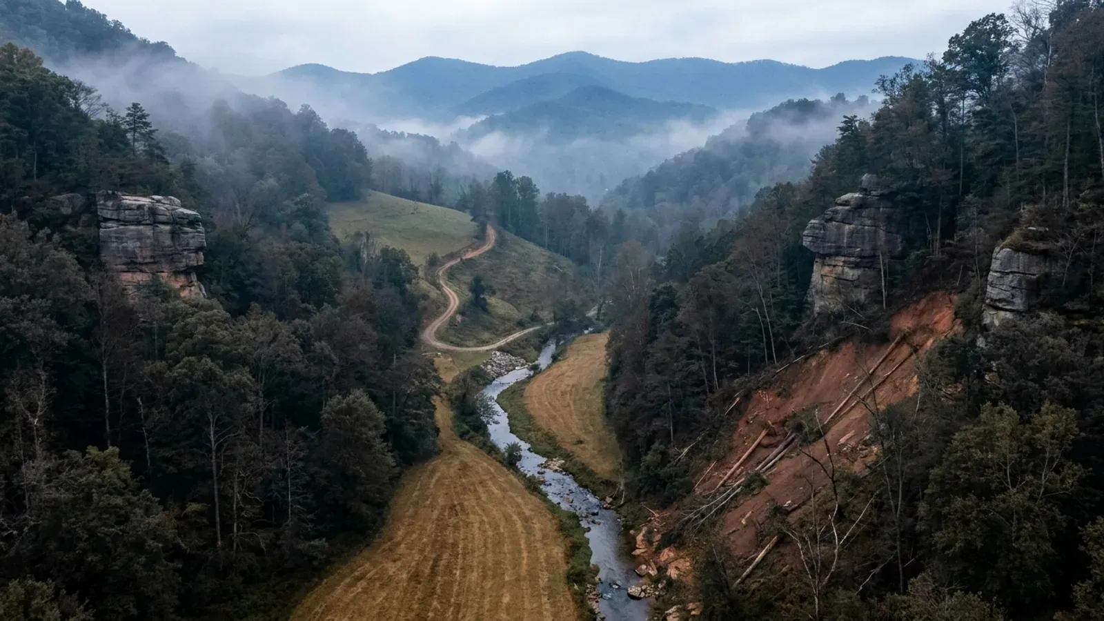
Carter County is 411 square miles of northeastern Kentucky at 65 people per square mile, sitting on the western edge of the Eastern Kentucky Coal Field and inside the Charleston–Huntington, West Virginia television market. There is real land here — USDA counts 681 farms across 82,568 acres, averaging 121, and woodland at 33,127 acres is the single largest land use, ahead of cropland. What constrains a build is not paperwork; it is ground. The Kentucky Geological Survey's own county study puts it plainly: the county is well dissected, flat areas are uncommon except along the Little Sandy River, the Little Fork and parts of Tygarts Creek, steep slopes are common in most parts of the county, and local relief of 300 feet or more is ordinary along the Rowan and Lewis county divides. On the regulatory side the county itself publishes no planning commission, no zoning office and no building department in its own department and services listings, so a house on unincorporated Carter land falls under the KRS 198B.060(1) default. Cross into the city of Grayson — the county seat, in Carter County, and nothing to do with Grayson County 150 miles west — and a twenty-article zoning ordinance, a planning commission, a building permit and a certificate of occupancy all apply. Olive Hill is a third answer again: the Commonwealth's own directory writes it out of the county inspector's scope by name. Two facts bind everywhere: the septic permit from the Carter County Health Department, and the electrical certificate without which no utility may set a meter.
Carter County at a glance
- County
- Carter
- Population
- 26,103
- ZIP codes
- 41143, 41164, 41132, 41146, 41128, 41142, 41173, 41181
- Site visits
- Same week
Building conditions in Carter County
The building code is the same in every Kentucky county, and no local government may adopt or enforce a different one on a house — the Kentucky Residential Code says so in its own text. The design criteria are settled by the state too: the code prints a filled-in table covering all 120 counties, so your county's ground snow load, frost depth and seismic design category are published figures rather than something a local office decides. Ultimate design wind speed is 115 mph for every county in the state.
What changes from one county to the next is whether anyone checks. Kentucky makes permits, inspections and certificates of occupancy optional for a single-family home unless the local government has passed an ordinance requiring them, and it forbids the state from stepping in where none has. Twenty-five counties tell the state outright that they have no local building inspector, and in much of the rest the answer depends on an ordinance the county either passed or never did. Zoning is a separate, equally local choice — most Kentucky counties have never adopted any. What is below covers this county specifically: who issues the permit if anyone does, what the state's tables assign it, and what the ground does to a slab.
https://dhbc.ky.gov/Documents/Carter%20County.pdf (sheet updated 6/12/26, text extracted with pdftotext and read 6 Sep 2026) · https://www.graysonky.org/code-enforcement · https://www.cartercountyky.com/departments_and_services/departments_and_agencies.php · https://www.cartercountyky.com/departments_and_services/services.php · Kentucky Local Floodplain Coordinators Contact List, https://eec.ky.gov/Environmental-Protection/Water/FloodDrought/Documents/FloodplainCoordinatorsList.pdf — the live copy now returns (link no longer resolves)to automated requests, so the Carter, Grayson and Olive Hill rows were extracted 6 Sep 2026 from the Internet Archive capture at http://web.archive.org/web/20260305214953/https://eec.ky.gov/Environmental-Protection/Water/FloodDrought/Documents/FloodplainCoordinatorsList.pdf · https://apps.legislature.ky.gov/law/statutes/statute.aspx?id=52659
https://dhbc.ky.gov/Documents/2018%20Kentucky%20Residential%20Code%203d%20Ed.pdf — Table R403.1.4 Minimum Frost Protection Depth for Kentucky, Table R301.2(1) Design Snow, Climatic and Geometric Design Criteria for Kentucky Counties, Table R301.2.2.1 Seismic Design Categories–Site Class D, and §R403.1.4 exception text; all three county tables transcribed in research/statewide/design-criteria-and-climate.md and read there rather than re-fetched
https://dhbc.ky.gov/Documents/Carter%20County.pdf and https://dhbc.ky.gov/Documents/Grayson%20County.pdf (both sheets extracted with pdftotext and compared 6 Sep 2026) · https://www.uky.edu/KGS/water/library/gwatlas/Carter/Topography.htm (Grayson, the county seat, 608 feet) · https://www.graysonky.org/zoning
City of Grayson (Carter County) Planning and Zoning Regulations, published article by article at https://www.graysonky.org/zoning — Article 3 General Zone and District Regulations, https://www.graysonky.org/_files/ugd/b20b56_4290de58b08b493d95073a52b9c8cdab.pdf ; Article 8 Agricultural Zone, https://www.graysonky.org/_files/ugd/b20b56_fd3550b71dba426fbaa5665fff1a4a13.pdf ; Article 9 Residential Zones, https://www.graysonky.org/_files/ugd/b20b56_9b3e44265c874d1bb5785830d9301af6.pdf ; Article 5 Administration and Enforcement, https://www.graysonky.org/_files/ugd/b20b56_03a3af1ccf784589829d0250566aa7cb.pdf — all four extracted with pdftotext and read 6 Sep 2026
https://www.nass.usda.gov/Publications/AgCensus/2022/Online_Resources/County_Profiles/Kentucky/cp21043.pdf (2022 Census of Agriculture, Carter County profile, FIPS 21043 — extracted with pdftotext and read 6 Sep 2026) · Kentucky Geological Survey, Groundwater Resources of Carter County, Kentucky, Topography of the County, quoting McGrain and Currens (1978): https://www.uky.edu/KGS/water/library/gwatlas/Carter/Topography.htm
https://insurance.ky.gov/PPC/Documents/JAN%202025_Revised%20Mine%20Subsidence%20Insurance%20Fund%20080124.pdf (KDOI brochure rev. 08/24, eff. 1/1/25 — participating-county list, statutory definition and limits extracted with pdftotext and read 6 Sep 2026; note KDOI spells Elliott as Elliot) · https://www.uky.edu/KGS/minerals/im_clay.php (KGS industrial minerals — Olive Hill Clay Bed and Hitchins Clay) · https://minemaps.ky.gov/ and https://eppcgis.ky.gov/minemapping/ (Kentucky Mine Mapping Information System, parcel-checkable)
Also worth knowing before you build in Carter County
- Carter Caves is a named KGS karst area — in a region nobody expects karst
- The Kentucky Geological Survey's groundwater atlas names the Carter Caves region, east-northeast of Winchester, as the fourth of Kentucky's major karst areas, noting it is sometimes treated as part of the Eastern Pennyroyal, and adds that although no large communities are located on this karst, Carter Caves State Park is located here. That is genuinely useful phrasing to hold onto: it is real karst, and it is not under the towns. The limestone is Mississippian — the Newman Limestone, with the Carter Caves Sandstone intertonguing into its upper part — so soluble rock and resistant sandstone bluff sit side by side within a few hundred feet of elevation along Tygarts Creek. KGS's county karst page describes the local sinkhole mechanics, including that dissolution sinkholes rather than dramatic roof collapses are the common form, that a sinkhole throat may be roofed by soil and broken rock and invisible, and that swallow holes carry surface flow straight into conduits without filtration. For a build, that last point is the septic point: Kentucky's on-site sewage regulation 902 KAR 10:085 rules an area unsuitable within seventy feet of an open sinkhole throat and anywhere downslope of the sinkhole sideslope midpoint. Check the parcel against KGS's Karst Potential Index viewer before committing, and let the health department's site evaluation settle it.
- A well is not a given here — KGS says less than half of valley-bottom wells produce a domestic supply in much of the county
- This is the fact most likely to change what a buyer offers on a Carter County tract, and it is published by the state survey rather than inferred. KGS's Groundwater Resources of Carter County reports that in the eastern half of the county most wells in valley bottoms produce enough water for domestic use, but in the rest of the county groundwater becomes more scarce, with less than half of the wells drilled in valley bottoms able to produce enough for a domestic supply. Throughout the county, wells on hillsides and ridges become progressively less productive away from valley bottoms — which is precisely where the view is and where people want the house. It adds that most water from drilled wells is very to extremely hard and contains noticeable amounts of iron, that salty water is commonly found in wells drilled less than 100 feet below the level of the principal valley bottoms, and that almost all springs yield under 5 gallons per minute. The underlying study is McGrain and Currens (1978), so treat it as the regional picture rather than a parcel prediction; but on a ridge parcel with no public water main, the cost and the risk of the water supply belong in the offer, not in a later surprise. Check the availability of a rural water district connection before you assume a well.
- All three Carter County communities are in the flood program, and one person administers all three
- FEMA's Community Status Book for Kentucky lists unincorporated Carter County (CID 210050), the City of Grayson (CID 210051) and the City of Olive Hill (CID 210052) as participating in the National Flood Insurance Program, all three on a current effective map dated 2 June 2011 — Carter County with an initial FIRM identified 15 February 1984 and both cities from 16 August 1982. Grayson additionally carries a Community Rating System entry. The Kentucky Division of Water's local floodplain coordinators list names the same coordinator for all three, Taylor Duncan at the Fiscal Court address in Grayson, with the county's NFIP entry dated 13 December 1974 and both cities 1 February 1974. The water is not incidental here: the Little Sandy River runs through Grayson and is impounded south of town as Grayson Lake at a normal pool of 645 feet, Tygarts Creek drains the Carter Caves side of the county, and KGS records oxbow lakes and abandoned meanders in the valley north of Grayson — abandoned channel is exactly the flat, cheap, tempting ground a barndominium pad wants. On top of any local floodplain permit, Kentucky requires a separate state Division of Water floodplain permit for construction in the base floodplain under KRS 151.250 and 401 KAR 4:060 §2, applied for on form DOW 7116. Article 13 of the city of Grayson's zoning regulations establishes a Floodplain District over the same ground.
- Septic is a standalone county health department here, not a district — and every environmental permit is $200
- Most Kentucky counties are served by a multi-county district health department. Carter is not: the Carter County Health Department is its own agency at 105 Robert & Mary Ave., Grayson KY 41143, 606-474-5109, with environmental director Jeff Barker. Its published environmental services fee schedule prices each item at a flat $200 — site evaluation application, commonly called the perk test; permit to install a septic system; existing septic system inspection; septic system repair permit; and septic system dye test — payable by cash or check only. DHBC's Carter County sheet gives the environmentalist's office hours as Friday only, 8:00 to 9:30 a.m. Eastern, at 606-474-6685, which is a ninety-minute window once a week and worth building into a schedule rather than discovering. Kentucky's on-site sewage regulation, 902 KAR 10:085, governs what the soil evaluation is allowed to approve; on the county's steep ground the usable field area, and the required replacement area beside it, will often decide where the building sits before any other consideration does. No county-wide minimum lot size for a septic lot is published by this health department, which is a different posture from the districts to the south that publish one.
- EPA radon Zone 2, and Kentucky's code requires nothing about it
- EPA maps Carter County in radon Zone 2, moderate potential, defined on EPA's own Kentucky sheet as a predicted average indoor screening level of at least 2 and not more than 4 picocuries per litre. That is the middle of Kentucky's three-zone spread — the state has 30 Zone 1 counties, 82 in Zone 2 and 8 in Zone 3 — so Carter is neither the karst-belt worst case nor the Jackson Purchase best case. EPA prints its own caution on the same sheet: the Map of Radon Zones should not be used to decide whether an individual home needs testing. What matters for a new build is that the Kentucky Residential Code adopts appendices K, R and S and does not adopt Appendix F, Radon Control Methods, and the word radon does not appear in the Kentucky amendment document at all. Radon-resistant construction is nowhere required in Kentucky. A passive sub-slab depressurisation rough-in costs very little while the slab is still open and a great deal to retrofit, and KRS 309.436(9) expressly exempts a building contractor installing vent pipes during construction of a home from the state radon licensing regime — so it is a decision to make deliberately at slab stage. KGS also publishes a geology-based indoor radon potential map covering all 120 counties, which is finer-grained than the EPA county zone.
- Landslides: Carter sits outside KGS's mapped susceptibility layer, so the screening tool people cite does not cover it
- KGS's landslide susceptibility layer — the five-class regional model built on slope angle, aspect, elevation, roughness and curvature — currently covers thirteen eastern Kentucky counties: Breathitt, Floyd, Johnson, Knott, Lee, Leslie, Letcher, Magoffin, Martin, Owsley, Perry, Pike and Wolfe. Carter is not among them, so a reader who goes looking for a susceptibility class for a Carter parcel will not find one, and its absence means nothing about the ground. What does cover Carter is the statewide KGS Landslide Inventory of documented slides, viewable in the KGS landslide map, and KGS's published mechanism, which describes a barndominium hillside pad almost exactly: most Kentucky landslides occur in colluvial soils or along the soil-bedrock contact; shale holds water and is the problem bedrock; and the triggers are increasing weight at the top of a slope by adding fill or building on it, removing soil or rock at the toe by engineered cuts or stream erosion, and raising pore pressure with concentrated water. Artificial fill appears in the inventory as a landslide-hosting material in its own right. Kentucky publishes no statewide slope percentage that triggers anything, and KGS states in its own metadata that the susceptibility mapping is not intended for site-specific slope stability decisions. On a cut-and-fill pad on Carter County's common steep slopes, that means a geotechnical opinion and a drainage plan, not a map class.
- Olive Hill runs its own book, and the state directory says so
- Olive Hill, the county's second city at about 760 feet on the upland flats where resistant sandstone caps the ridges, is the one place in Carter County the Commonwealth's own building directory writes out by name: the scope note beside the local building inspector on DHBC's Carter County sheet excludes Olive Hill. The city maintains its own code of ordinances containing a Title 15, Buildings and Construction, and a Title 17, Zoning. That code is published through a municipal code library that refuses automated requests and whose deep links are refused in a browser too, so the dimensional standards inside Title 17 should be obtained from the city itself rather than from any third-party mirror. City Hall is at 225 Roger Patton Drive, Olive Hill KY 41164, 606-286-5532. Olive Hill is separately in the National Flood Insurance Program as CID 210052 and shares Carter County's floodplain coordinator. The practical instruction is short: if your parcel is inside the Olive Hill city limits, the county answer does not apply to you and neither does the Grayson answer — call City Hall first.
https://www.uky.edu/KGS/water/library/gwatlas/wprkarst.html (KGS statewide karst regions — the Carter Caves region text read directly 6 Sep 2026) · https://www.uky.edu/KGS/water/library/gwatlas/Carter/Karst.htm · https://kgs.uky.edu/kygeode/geomap?gkarst=true (KGS Karst Potential Index viewer) · https://kgs.uky.edu/kgsmap/helpfiles/karst_help.shtm · https://apps.legislature.ky.gov/law/kar/titles/902/010/085/
Kentucky Geological Survey, Groundwater Resources of Carter County, Kentucky — Overview: https://www.uky.edu/KGS/water/library/gwatlas/Carter/Overview.htm (read 6 Sep 2026; the atlas attributes the underlying discussion to McGrain and Currens, 1978) · https://www.uky.edu/KGS/water/library/gwatlas/Carter/GWavailability.htm · https://kgs.uky.edu/kgsmap/KGSWater/viewer.asp
https://www.fema.gov/cis/KY.html (Kentucky Community Status Book, read 6 Sep 2026) · Kentucky Local Floodplain Coordinators Contact List — live copy at https://eec.ky.gov/Environmental-Protection/Water/FloodDrought/Documents/FloodplainCoordinatorsList.pdf now returns (link no longer resolves)to automated requests, so the Carter, Grayson and Olive Hill rows were extracted 6 Sep 2026 from http://web.archive.org/web/20260305214953/https://eec.ky.gov/Environmental-Protection/Water/FloodDrought/Documents/FloodplainCoordinatorsList.pdf · https://www.uky.edu/KGS/water/library/gwatlas/Carter/Topography.htm · https://apps.legislature.ky.gov/law/statutes/statute.aspx?id=54097 · https://eec.ky.gov/Environmental-Protection/Water/FloodDrought/Pages/default.aspx
https://carterhealth.org/environmental-services/ (fee schedule and contacts, read 6 Sep 2026) · https://carterhealth.org/ · https://dhbc.ky.gov/Documents/Carter%20County.pdf (health department environmentalist block — Friday 8:00–9:30 a.m. EST, 606-474-6685, Jeff Barker) · https://apps.legislature.ky.gov/law/kar/titles/902/010/085/
https://www.epa.gov/sites/default/files/2014-08/documents/kentucky.pdf (EPA Map of Radon Zones for Kentucky — zone definitions and caution) · https://radonlevels.org/state/ky (county-to-zone assignment for Carter, read 6 Sep 2026; posture: this is a third-party rendering of the EPA map, corroborated against the statewide distribution transcribed in research/statewide/soils-karst-and-slopes.md, not a primary EPA county table) · https://kygs.uky.edu/geology/radon · https://kgs.uky.edu/radon
https://kgs.uky.edu/arcgis/rest/services/Hazards/LandslideSusceptibility/MapServer/info/iteminfo (13-county coverage, five classes, method and KGS's own caveats) · https://kygs.uky.edu/research/landslides · https://kgs.uky.edu/kygeode/geomap/?layoutid=25 (KGS Landslide Information Map) · Crawford, M.M., 2014, KGS Information Circular 31, https://kgs.uky.edu/kgsweb/olops/pub/kgs/ic31_12.pdf — all as transcribed and attributed in research/statewide/soils-karst-and-slopes.md §5
https://dhbc.ky.gov/Documents/Carter%20County.pdf (scope note excluding Olive Hill) · https://olivehill.ky.gov/ · https://codelibrary.amlegal.com/codes/olivehillky/latest/olivehill_ky/0-0-0-96 (Olive Hill code of ordinances — the publisher refuses automated access with (refuses automated requests), so only the title structure surfaced through search was established, not the text) · https://www.fema.gov/cis/KY.html · https://www.uky.edu/KGS/water/library/gwatlas/Carter/Topography.htm

The expensive surprises are in the ground, not the building
What moves a Kentucky budget is usually below grade, and more often than not it is what the ground is sitting on rather than the ground itself. The Kentucky Geological Survey says 92 of the state's 120 counties contain karst — limestone that dissolves — across four named areas: the Western Pennyroyal around Bowling Green and Hopkinsville, the Inner Bluegrass around Lexington, the Eastern Pennyroyal through Somerset and Monticello, and Pine Mountain in the south-east. On karst, KGS's own model ordinance for local governments lists the structures that should not be sited in sinkhole areas, and the list is buildings with soil-bearing foundations and buildings that cover thousands of square feet with impermeable surface. A post-frame or steel building on a monolithic slab is both of those at once. KGS is equally clear that nearly all karst parcels still have buildable ground on them — so karst does not stop the build, it removes the option of siting the pad by eye. A filled and graded-over sinkhole is the classic trap, because the pad looks perfect.
In the two coal fields the question is undermining instead, and Kentucky treats it differently from everything else: mine subsidence coverage is added automatically to property policies in the counties whose fiscal court voted the fund in, with a written opt-out — thirty-seven of them — while karst collapse gets no fund at all and falls under the ordinary earth-movement exclusion. On slopes the surprise is geographic: KGS's landslide inventory puts Kenton, Campbell, Boone and Gallatin — the northern Kentucky counties opposite Cincinnati — near the very top, above most Appalachian counties, on Ordovician shale. Three of those four — Boone, Campbell and Kenton — are the only counties in the state with a line of their own in the residential code's bearing table, which raises the presumptive value for two named clay groups there and nowhere else. Everywhere else the table gives clay and silt a single presumptive figure, and a soils investigation becomes mandatory once the building official determines the real capacity is likely to be lower than it.
The same ground then sizes the septic system, and Kentucky does that from soil morphology — a certified inspector reading the profile in a backhoe pit — rather than from a percolation test, at 110 gallons a day per bedroom against an application rate taken from soil texture and structure. On a mound or other alternative design a measured permeability test can still be required. And on karst the septic regulation is blunter than the building code ever gets: it declares the ground within seventy feet of an open sinkhole throat unsuitable outright. The soil that needs a foundation engineer is usually the soil that complicates the drainfield, so the site work, the foundation and the septic get resolved together rather than one at a time. We price the dirt before we price the building.
What we build in Carter County
All seven services are available in Carter County. What a build costs depends far more on the parcel than on square footage, so we price against your land rather than publishing a rate card.
Barndominium Kits
We check barndominium kit packages against the wind, snow, frost and seismic criteria the Kentucky Residential Code publishes for your county.
Pole Barn Homes
Pole barn homes across Kentucky. KRC §R327 covers accessory barns, not houses — so a pole barn home is engineered by the code's own terms.
Custom Barndominium Plans
Barndominium plans drawn to Kentucky's published county design criteria — snow, wind, seismic, frost — with engineering where the code calls for it.
What a build looks like
Three stages every Carter County project passes through, from a raw parcel to a finished home. Site work first, because that is where the budget is decided.

The parcel
Karst and mine maps, the flood question, zoning where the county has any, and utility access — all checked before anything is drawn.
Pad and permit
Clearing, grading and a compacted pad, while the submittal works through whichever office issues the permit — and where no office does, through the approvals that still apply.

Frame to finish
Shell erected and dried in, then systems and interior finish — and the certified electrical inspection your utility needs before it will set a meter.
Those are the rules where you are building in Carter County. Tell us what you want to build and we will draw it to them.
Where we build around Carter County
Carter and the rural land around it. The buildable acreage for a project this size usually sits outside the city limits, and in Kentucky that line frequently decides whether anyone issues a permit at all, not merely who issues it.
Keep reading
The questions that usually come next once you know what Carter County allows.
Barndominium Cost Guide
Why the published spread runs from one end of the scale to the other, and which of it is the building rather than the ground.
Read itIs It Legal in Kentucky?
Whether your county inspects a house at all, what the farm-dwelling exemption really requires, and the approvals that reach you anyway.
Read itWhat a Pole Barn Home Costs
Post-frame against stick-built, and what the prescriptive post-frame section of the state code does and does not cover.
Read itNearby areas we build in
Others we cover nearby. They share the same statewide code and the same state-published design tables — but whether a house is permitted and inspected at all, whether the county zones, what the health department will accept for septic, and what the ground does to a foundation can all differ from one card to the next. Two counties that touch are not two versions of the same answer.
Building in Carter County: common questions
9 questions we get asked most often about building in Carter County. If yours is not on the list, ask it directly.
Do I need a building permit to put up a barndominium in Carter County?
Does eastern Kentucky mean a deeper footing here?
Is the Grayson I keep finding online the same Grayson as here?
Can I build a shop bigger than the house?
Who issues the septic permit, and what does it cost?
Is there really buildable land in Carter County?
What about the mine subsidence coverage I keep hearing about?
Will I get a well on a ridge lot here?
Nobody may inspect the frame — so does anything actually get checked?
Building in Carter County?
Start with the plan. Tell us what you want to build and we will draw it, then confirm whether any office permits and inspects a house where your parcel is, what it will let you put there, and which line of the state's snow, frost and seismic tables your county falls on. That conversation costs nothing.