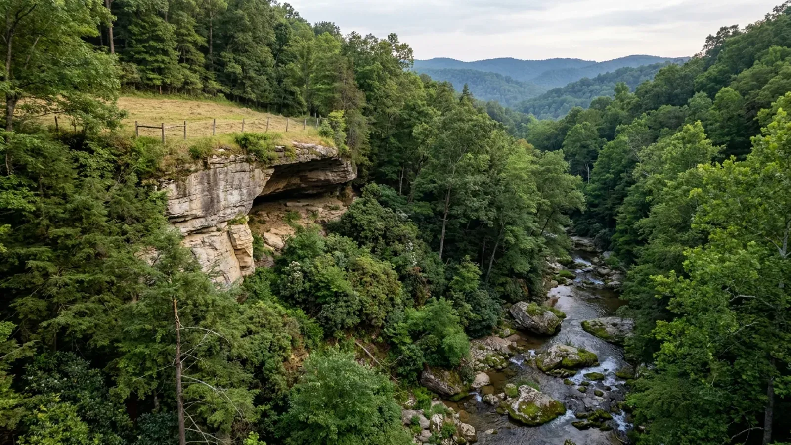
Barndominium Builders in Laurel County, KY
Laurel County is the I-75 south market, and it is not a second Pulaski. The two counties border each other and answer almost every question differently. Pulaski has no zoning and no planning commission of any kind; Laurel has the London-Laurel County Planning Commission, whose subdivision regulations claim jurisdiction and control over the subdivision of all land within Laurel County, including the corporate limits of London. That commission has never adopted county zoning outside the city — its own regulations repeatedly describe a situation where zoning is not in effect — so there is no rural district, no setback schedule for a lone parcel and no accessory-structure cap on unincorporated land. What the commission does set, and what most buyers here never hear until late, is a minimum residential lot of 21,780 square feet where no public sewer is available, a set of subdivision yard requirements, and a foundation plat by a licensed surveyor filed with the codes enforcement officer at the time the footers are poured. On the building side the split is sharp. The City of London runs its own Division of Building Code Enforcement and issues residential building permits under a named city ordinance. Outside the city, DHBC's Laurel County sheet lists one inspector explicitly scoped to the city of London and a second name with no scope stated at all — and that second name appears on four other DHBC county sheets in this corridor. Laurel is also mined ground in a way Pulaski is not: it is one of the 37 counties in the Kentucky Mine Subsidence Insurance Fund, and Pulaski and Rockcastle are not. The land itself is tighter here too. USDA counts 871 farms on 79,761 acres, about 29 percent of the county, against 47 percent in Pulaski, because the Daniel Boone National Forest holds a large share of the east side.
Laurel County at a glance
- County
- Laurel
- Population
- 64,248
- ZIP codes
- 40724, 40729, 40737, 40740, 40741, 40742, 40743, 40744, 40745, 40755
- Site visits
- Same day
Building conditions in Laurel County
The building code is the same in every Kentucky county, and no local government may adopt or enforce a different one on a house — the Kentucky Residential Code says so in its own text. The design criteria are settled by the state too: the code prints a filled-in table covering all 120 counties, so your county's ground snow load, frost depth and seismic design category are published figures rather than something a local office decides. Ultimate design wind speed is 115 mph for every county in the state.
What changes from one county to the next is whether anyone checks. Kentucky makes permits, inspections and certificates of occupancy optional for a single-family home unless the local government has passed an ordinance requiring them, and it forbids the state from stepping in where none has. Twenty-five counties tell the state outright that they have no local building inspector, and in much of the rest the answer depends on an ordinance the county either passed or never did. Zoning is a separate, equally local choice — most Kentucky counties have never adopted any. What is below covers this county specifically: who issues the permit if anyone does, what the state's tables assign it, and what the ground does to a slab.
https://dhbc.ky.gov/Documents/Laurel%20County.pdf (sheet updated 11/14/2025; downloaded and text-extracted in raw content-stream order 6 Sep 2026, which is what disambiguates the doubled inspector row) · https://dhbc.ky.gov/Documents/Whitley%20County.pdf · https://dhbc.ky.gov/Documents/Knox%20County.pdf · https://dhbc.ky.gov/Documents/Clay%20County.pdf · https://londonky.gov/wp-content/uploads/2022/11/Building-Permit-Application-2020-08.pdf (extracted 6 Sep 2026 — the ordinance number is printed on the form) · https://www.londonky.gov/building-inspector/ · https://apps.legislature.ky.gov/law/statutes/statute.aspx?id=52659
https://www.londonky.gov/wp-content/uploads/2025/03/subdivision_regs.pdf (Subdivision Regulations, London and Laurel County, effective 1 January 2005 — downloaded and text-extracted 6 Sep 2026; Article V section 500 for authority and area jurisdiction, section 504.5 for lot development) · https://www.londonky.gov/planning-zoning/ · KRS Chapter 100, https://apps.legislature.ky.gov/law/statutes/chapter.aspx?id=38316
https://www.londonky.gov/wp-content/uploads/2025/03/subdivision_regs.pdf sections 504.5.1, 504.5.2 and 504.5.3 (text-extracted and read 6 Sep 2026) · https://www.laurelcohealthdept.org/permits (the Laurel County Health Department publishes a site-evaluation process and fee but no lot-size minimum of its own)
https://dhbc.ky.gov/Documents/2018%20Kentucky%20Residential%20Code%203d%20Ed.pdf — Table R301.2(1) for snow, wind, weathering and termite; Table R403.1.4 Minimum Frost Protection Depth for Kentucky and section R403.1.4 for the backfill alternative; Table R301.2.2.1 Seismic Design Categories–Site Class D. All three transcribed in research/statewide/design-criteria-and-climate.md rather than re-fetched
https://insurance.ky.gov/PPC/Documents/JAN%202025_Revised%20Mine%20Subsidence%20Insurance%20Fund%20080124.pdf (37-county list, statutory definition and exclusions, brochure rev. 08/24 effective 1/1/25; read from extracted text) · https://insurance.ky.gov/ppc/Documents/bulletin0904minesubs092109.pdf · https://minemaps.ky.gov/ (Kentucky Mine Mapping Information System — mined-out area polygons, parcel-checkable) · https://krec.ky.gov/Documents/KREC%20Form%20402%20-%20Sellers%20Disclosure%20of%20Property%20Condition.pdf
https://www.nass.usda.gov/Publications/AgCensus/2022/Online_Resources/County_Profiles/Kentucky/cp21125.pdf (2022 Census of Agriculture, Laurel County profile, FIPS 21125 — downloaded and text-extracted 6 Sep 2026; the farms-by-size figures sum to the 871 total, which is the internal check) · https://www.fs.usda.gov/r08/danielboone/offices/london-ranger-district-office · county area and density from research/statewide/geography-and-population.md
Also worth knowing before you build in Laurel County
- Three different acreage tests apply here, and none of them is the one you are thinking of
- A Laurel County buyer splitting a homesite off a farm runs into three separate acreage thresholds from three separate bodies of law, and they do not line up. First, the subdivision regulations limit partial outconveyances to two tracts or parcels of less than five acres per calendar year; a third in the same year requires a subdivision plan. Outconveyances of tracts of five acres or more are unlimited if they are for agricultural use, and the regulations define agricultural use as a tract of at least five contiguous acres in crops, livestock, hay, pasture, timber, orchard fruit, vegetables or ornamentals, including dwellings for the people engaged in that use. Second, and separately, there is a family exemption: dividing an estate among immediate family — children, siblings, parents or grandparents — where the division is not intended for future development requires no subdivision plan at all. Third, the Kentucky building code's farm exemption is a different statute with a different number: it can reach a farm dwelling, but only on a PVA-registered farm of ten contiguous acres outside city limits, and zoning still reaches the house under KRS 100.203(4)(c). Five acres for the plat, ten for the code, and a family exemption that ignores acreage entirely.
- The septic permit comes from an independent county health department, not a district — and it costs $240 to start
- Kentucky's health departments are mostly organised into multi-county districts, and the neighbouring Lake Cumberland District Health Department covers Pulaski, Wayne, Russell, Casey, Adair and five more. Laurel is not in it. The Laurel County Health Department is an independent county health department, established in 1931, at 525 Whitley Street in London, and it issues the on-site sewage permit for the whole county. The sequence it publishes is worth knowing before you buy: you pick the building location, your installer gets form DFS-319 from the health center, you supply the bedroom count and say whether there will be a garbage disposal and a basement, you pay a $240 site evaluation fee to the Laurel County Health Department, and the department evaluates the site with backhoe pits. If the soil is suitable the installer gets the permit, builds the system, and a certified inspector verifies it before anything is covered. Two things catch people. First, once an area is approved it cannot be disturbed by grading, heavy equipment or stockpiled material — doing so voids the evaluation, and on a barndominium job the approved field is exactly where a crew wants to park and stage steel. Second, the department states that Kentucky law and the local electrical ordinance require its final approval before permanent electric hookup can be made, so the septic sign-off sits directly in front of the meter.
- All three Laurel communities are in the flood program — and the state permit still stacks on top
- FEMA's Community Status Book for Kentucky lists unincorporated Laurel County as CID 210134B, participating, initial FIRM identified 2 November 1990; the City of London as CID 210396B, participating, initial FIRM 2 August 2006; and the City of Corbin as CID 210227D, participating, initial FIRM 18 December 1986. All three sit on the same current effective map dated 16 March 2015, and none of them appears among the communities not in the flood program — which is a cleaner picture than Pulaski next door, where the City of Burnside sits outside the program. Participation means each has a flood damage prevention ordinance and a local floodplain administrator, and the county's own is reached through the Judge/Executive's office. The water here is the Rockcastle River along the northwestern boundary, the Laurel River, and Laurel River Lake, a roughly 5,600-acre impoundment shared with Whitley County inside the Daniel Boone National Forest. The point almost no competitor page makes is what sits on top of the local permit: for construction in the base floodplain Kentucky requires a separate state Division of Water permit under KRS 151.250 and 401 KAR 4:060 section 2, applied for on form DOW 7116, and the state's streamlined Floodplain General Permit expressly excludes new residential, non-residential and appurtenant structures. A barndominium in a Laurel County floodplain cannot ride the general permit; it needs the individual permit, with public notice, in addition to whatever the county or city asks for.
- Not karst country, not radon Zone 1 — the Plateau trades one set of ground problems for another
- Laurel sits on the western edge of the Cumberland Plateau, and the ground story changes as you cross the escarpment. The Kentucky Geological Survey names five karst areas, and the cities it lists for the nearest one, the Eastern Pennyroyal, are Mount Vernon, Somerset and Monticello — all west of here. Laurel is not inside a named KGS karst area, and it is not one of the 30 Kentucky counties EPA maps as radon Zone 1; the corroborated rendering of EPA's 1993 map places Laurel in Zone 2, moderate potential, predicted average between 2 and 4 pCi/L, where Pulaski next door is Zone 1. EPA's own caption still says every home should be tested regardless of zone, and the Kentucky Residential Code adopts appendices K, R and S but not Appendix F, so radon-resistant construction is nowhere required in Kentucky and a passive sub-slab rough-in is a cheap choice while the slab is open. What replaces sinkholes here is slope. KGS says the majority of Kentucky landslides occur in colluvial soils or along the soil-bedrock contact, and its inventory records slides in the Corbin Sandstone Member — the caprock unit named for the town on Laurel County's southern edge — as well as 17 in artificial fill. Laurel is not one of the 13 eastern counties KGS has mapped for landslide susceptibility, so the statewide landslide inventory viewer is the screen available. And note the code's own trigger: Table R401.4.1 footnote b makes a soils investigation mandatory where the building official determines that in-place soils below 1,500 psf are likely — which on unincorporated Laurel land raises a fair question about who the building official is, and is a good argument for commissioning the geotechnical work yourself on a cut-and-fill hillside pad.
- Corbin straddles three counties, and the footing depth changes as you cross it
- Corbin is one city sitting across Whitley, Knox and a sliver of Laurel, and for a buyer looking at ground on the south end of the county that is not trivia. The Kentucky Residential Code's Table R403.1.4 names Knox County at 27 inches of minimum frost protection depth. Laurel and Whitley are not on the named exception list and take the 24-inch default. So the same house design, moved a short distance across a line that runs through a single town, needs a footing three inches deeper on the Knox side — and the code measures from proposed finished grade to the bottom of the footing, so it is a real excavation change rather than a paper one. The county line moves other things with it too: which fiscal court's floodplain ordinance applies, which planning commission has subdivision jurisdiction, and whether the London-Laurel County subdivision regulations reach the parcel at all, since they claim all land within Laurel County and no further. Corbin itself participates in the NFIP under CID 210227D and FEMA's community listing notes it as located on the Whitley and Knox county lines. The practical instruction is to establish the county of the parcel from the deed and the PVA record before designing anything, not from the mailing address.
- No building permit does not mean no approvals — the meter is the gate everywhere in Kentucky
- Whatever the answer turns out to be on the county side, KRS 198B.060(11) provides that no utility may initiate permanent electrical service to a new building until a certified electrical inspector issues a final certificate of approval. That reaches every parcel in the Commonwealth. DHBC's Laurel sheet backs it with a full state roster — state building inspector Dillon Fields, state manufactured housing Mark Pruitt, state electrical inspector Anisa Ross, HVAC inspector Joey Pratt and plumbing inspector Mike Doolin, all at ky.gov addresses — and for the local electrical inspector it prints an instruction rather than a name: contact the County Judge Executive's office or the city office where the work is to be performed. The Laurel County Health Department adds its own link in the same chain, stating that Kentucky law and the local electrical ordinance require its final approval before permanent electric hookup, which tells you a local electrical ordinance exists here even though no county building ordinance surfaced. Stack those with the planning commission's foundation plat and the picture on unincorporated Laurel land is not an unregulated one: nobody may be signing off on the frame, and the septic approval, the electrical certificate, the surveyor's plat and any floodplain permit all still stand between the pad and permanent power.
https://www.londonky.gov/wp-content/uploads/2025/03/subdivision_regs.pdf — Article V definitions, Definition Clarification Statement items 1 to 3, Family Exemption and Agricultural Use (text-extracted 6 Sep 2026) · https://apps.legislature.ky.gov/law/statutes/statute.aspx?id=52659 · KRS 100.203, https://apps.legislature.ky.gov/law/statutes/chapter.aspx?id=38316
https://www.laurelcohealthdept.org/permits (process, form DFS-319, the $240 evaluation fee, the disturbance rule and the electric hookup condition, read 6 Sep 2026) · https://www.laurelcohealthdept.org/whoweare · https://www.laurelcohealthdept.org/contact-us · https://dhbc.ky.gov/Documents/Laurel%20County.pdf (Health Dept. row: Laurel County Health Department, 525 Whitley Street, London KY 40741, environmental office 606-878-0499) · https://apps.legislature.ky.gov/law/kar/titles/902/010/085/
https://www.fema.gov/cis/KY.html (Kentucky Community Status Book — CIDs, initial FIRM dates and 3/16/2015 current effective map date read 6 Sep 2026; direct automated retrieval of this host returned a stub, so the rows were read through a rendering fetch rather than raw HTML) · https://apps.legislature.ky.gov/law/statutes/statute.aspx?id=54097 · https://eec.ky.gov/Environmental-Protection/Water/FloodDrought/Pages/UnderstandYourFloodHazards.aspx · https://eec.ky.gov/Environmental-Protection/Forms%20Library/WRFloodplain_instructions1.pdf · https://fs.usda.gov/r08/danielboone/recreation/laurel-river-lake
https://www.uky.edu/KGS/water/library/gwatlas/wprkarst.html (KGS five karst areas and the cities named for each) · https://kgs.uky.edu/kygeode/geomap?gkarst=true (KGS Karst Potential Index viewer, parcel-checkable) · https://www.epa.gov/sites/default/files/2014-08/documents/kentucky.pdf (EPA Map of Radon Zones for Kentucky, 1993, with its own test-every-home caption) · https://radonlevels.org/state/ky (county zone membership, corroborated rendering of the EPA map rather than a primary EPA county table) · https://kgs.uky.edu/kgsweb/olops/pub/kgs/ic31_12.pdf (KGS Information Circular 31, landslide inventory; Table 5 formations) · https://kgs.uky.edu/kygeode/geomap/?layoutid=25 · https://dhbc.ky.gov/Documents/2018%20Kentucky%20Residential%20Code%203d%20Ed.pdf Table R401.4.1 footnote b
https://dhbc.ky.gov/Documents/2018%20Kentucky%20Residential%20Code%203d%20Ed.pdf Table R403.1.4, Minimum Frost Protection Depth for Kentucky (27-inch row: Bell, Clay, Knox, Lawrence, Owsley; Laurel and Whitley in the All other KY Counties default) · https://www.fema.gov/cis/KY.html · https://www.londonky.gov/wp-content/uploads/2025/03/subdivision_regs.pdf (area jurisdiction: all land within Laurel County) · https://laurelpva.com/real-property/
https://apps.legislature.ky.gov/law/statutes/statute.aspx?id=52659 (KRS 198B.060, subsections (1), (4)(b) and (11)) · https://dhbc.ky.gov/Documents/Laurel%20County.pdf (state inspector roster and the Local Electrical Inspector instruction, sheet updated 11/14/2025) · https://www.laurelcohealthdept.org/permits · https://www.londonky.gov/wp-content/uploads/2025/03/subdivision_regs.pdf section 504.5.3

The expensive surprises are in the ground, not the building
What moves a Kentucky budget is usually below grade, and more often than not it is what the ground is sitting on rather than the ground itself. The Kentucky Geological Survey says 92 of the state's 120 counties contain karst — limestone that dissolves — across four named areas: the Western Pennyroyal around Bowling Green and Hopkinsville, the Inner Bluegrass around Lexington, the Eastern Pennyroyal through Somerset and Monticello, and Pine Mountain in the south-east. On karst, KGS's own model ordinance for local governments lists the structures that should not be sited in sinkhole areas, and the list is buildings with soil-bearing foundations and buildings that cover thousands of square feet with impermeable surface. A post-frame or steel building on a monolithic slab is both of those at once. KGS is equally clear that nearly all karst parcels still have buildable ground on them — so karst does not stop the build, it removes the option of siting the pad by eye. A filled and graded-over sinkhole is the classic trap, because the pad looks perfect.
In the two coal fields the question is undermining instead, and Kentucky treats it differently from everything else: mine subsidence coverage is added automatically to property policies in the counties whose fiscal court voted the fund in, with a written opt-out — thirty-seven of them — while karst collapse gets no fund at all and falls under the ordinary earth-movement exclusion. On slopes the surprise is geographic: KGS's landslide inventory puts Kenton, Campbell, Boone and Gallatin — the northern Kentucky counties opposite Cincinnati — near the very top, above most Appalachian counties, on Ordovician shale. Three of those four — Boone, Campbell and Kenton — are the only counties in the state with a line of their own in the residential code's bearing table, which raises the presumptive value for two named clay groups there and nowhere else. Everywhere else the table gives clay and silt a single presumptive figure, and a soils investigation becomes mandatory once the building official determines the real capacity is likely to be lower than it.
The same ground then sizes the septic system, and Kentucky does that from soil morphology — a certified inspector reading the profile in a backhoe pit — rather than from a percolation test, at 110 gallons a day per bedroom against an application rate taken from soil texture and structure. On a mound or other alternative design a measured permeability test can still be required. And on karst the septic regulation is blunter than the building code ever gets: it declares the ground within seventy feet of an open sinkhole throat unsuitable outright. The soil that needs a foundation engineer is usually the soil that complicates the drainfield, so the site work, the foundation and the septic get resolved together rather than one at a time. We price the dirt before we price the building.
What we build in Laurel County
All seven services are available in Laurel County. What a build costs depends far more on the parcel than on square footage, so we price against your land rather than publishing a rate card.
Barndominium Kits
We check barndominium kit packages against the wind, snow, frost and seismic criteria the Kentucky Residential Code publishes for your county.
Pole Barn Homes
Pole barn homes across Kentucky. KRC §R327 covers accessory barns, not houses — so a pole barn home is engineered by the code's own terms.
Custom Barndominium Plans
Barndominium plans drawn to Kentucky's published county design criteria — snow, wind, seismic, frost — with engineering where the code calls for it.
What a build looks like
Three stages every Laurel County project passes through, from a raw parcel to a finished home. Site work first, because that is where the budget is decided.

The parcel
Karst and mine maps, the flood question, zoning where the county has any, and utility access — all checked before anything is drawn.
Pad and permit
Clearing, grading and a compacted pad, while the submittal works through whichever office issues the permit — and where no office does, through the approvals that still apply.

Frame to finish
Shell erected and dried in, then systems and interior finish — and the certified electrical inspection your utility needs before it will set a meter.
Those are the rules where you are building in Laurel County. Tell us what you want to build and we will draw it to them.
Where we build around Laurel County
Laurel and the rural land around it. The buildable acreage for a project this size usually sits outside the city limits, and in Kentucky that line frequently decides whether anyone issues a permit at all, not merely who issues it.
Keep reading
The questions that usually come next once you know what Laurel County allows.
Barndominium Cost Guide
Why the published spread runs from one end of the scale to the other, and which of it is the building rather than the ground.
Read itIs It Legal in Kentucky?
Whether your county inspects a house at all, what the farm-dwelling exemption really requires, and the approvals that reach you anyway.
Read itWhat a Pole Barn Home Costs
Post-frame against stick-built, and what the prescriptive post-frame section of the state code does and does not cover.
Read itNearby areas we build in
Others we cover nearby. They share the same statewide code and the same state-published design tables — but whether a house is permitted and inspected at all, whether the county zones, what the health department will accept for septic, and what the ground does to a foundation can all differ from one card to the next. Two counties that touch are not two versions of the same answer.
Building in Laurel County: common questions
8 questions we get asked most often about building in Laurel County. If yours is not on the list, ask it directly.
Do I need a building permit to put up a barndominium in Laurel County?
I am pricing a kit or a pole barn package. What will actually catch me in Laurel County?
Can I build a shop bigger than the house?
Can I just split a lot off the family farm?
Who issues the septic permit here, and what does it cost?
What design figures does a Laurel County build have to meet?
Is the ground here a problem — mines, sinkholes or slopes?
Is there actually acreage to buy in Laurel County?
Building in Laurel County?
Start with the plan. Tell us what you want to build and we will draw it, then confirm whether any office permits and inspects a house where your parcel is, what it will let you put there, and which line of the state's snow, frost and seismic tables your county falls on. That conversation costs nothing.